Category:Mairie de Vieux-Rouen-sur-Bresle
Jump to navigation
Jump to search
| Object location | | View all coordinates using: OpenStreetMap |
|---|
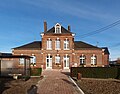
town hall located in Seine-Maritime department, France  | |||||
| Upload media | |||||
| Instance of |
| ||||
|---|---|---|---|---|---|
| Location | Vieux-Rouen-sur-Bresle, canton of Aumale | ||||
| Street address |
| ||||
| Has use | |||||
| Owned by | |||||
| Operator | |||||
 | |||||
Media in category "Mairie de Vieux-Rouen-sur-Bresle"
The following 13 files are in this category, out of 13 total.
-
 Vieux-Rouen-sur-Bresle-FR-76-mairie-a1.jpg 3,648 × 2,736; 3.11 MB
-
 Vieux-Rouen-sur-Bresle-FR-76-mairie-a2.jpg 3,123 × 2,442; 2.91 MB
-
 Vieux-Rouen-sur-Bresle-FR-76-mairie-a3.jpg 2,809 × 2,277; 3.29 MB
-
 Vieux-Rouen-sur-Bresle-FR-76-mairie-a4.jpg 3,648 × 2,736; 3.09 MB
-
 Vieux-Rouen-sur-Bresle-FR-76-mairie-a5.jpg 3,648 × 2,736; 3.24 MB
-
 Vieux-Rouen-sur-Bresle-FR-76-mairie-a6.jpg 2,736 × 3,648; 3.02 MB
-
 Vieux-Rouen-sur-Bresle-FR-76-mairie-a7.jpg 2,736 × 3,648; 2.8 MB
-
 Vieux-Rouen-sur-Bresle-FR-76-mairie-a8.jpg 3,648 × 2,736; 3.13 MB
-
 Vieux-Rouen-sur-Bresle-mairie-1.jpg 4,032 × 3,024; 2.73 MB
-
 Vieux-Rouen-sur-Bresle-mairie-15.JPG 3,648 × 2,736; 923 KB
-
 Vieux-Rouen-sur-Bresle-mairie-16.JPG 3,648 × 2,736; 747 KB
-
 Vieux-Rouen-sur-Bresle-mairie-2.jpg 4,032 × 3,024; 3.01 MB
-
 Vieux-Rouen-sur-Bresle-mairie-3.jpg 4,032 × 3,024; 2.91 MB


