Category:Maidenhead Bridge
Jump to navigation
Jump to search
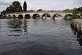
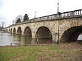
English: Maidenhead Bridge is a Grade I listed bridge carrying the A4 road over the River Thames between Maidenhead, Berkshire and Taplow, Buckinghamshire, England. It crosses the Thames on the reach above Bray Lock, about half a mile below Boulter's Lock.
Grade I listed bridge in South Bucks, United Kingdom .jpg) | |||||
| Upload media | |||||
| Instance of | |||||
|---|---|---|---|---|---|
| Location |
| ||||
| Crosses | |||||
| Carries | |||||
| Heritage designation |
| ||||
| Inception |
| ||||
| Date of official opening |
| ||||
| Next crossing upstream |
| ||||
| Next crossing downstream | |||||
 | |||||
Media in category "Maidenhead Bridge"
The following 38 files are in this category, out of 38 total.
-
 Maidenhead Bridge - geograph.org.uk - 689746.jpg 640 × 427; 81 KB
-
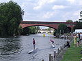 PuntChamps.JPG 2,048 × 1,536; 1.33 MB
-
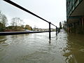 2014 Thames Flood, West of Maidenhead Bridge.JPG 2,560 × 1,920; 2.82 MB
-
 River Thames (34519507176).jpg 4,032 × 3,024; 6.31 MB
-
 Bridge over the River Thames - geograph.org.uk - 5582542.jpg 640 × 283; 37 KB
-

-
 History Plaque on Maidenhead Bridge - geograph.org.uk - 6428168.jpg 1,600 × 1,200; 504 KB
-
 Maidenhead Bridge (1).jpg 2,560 × 1,920; 2.28 MB
-
 Maidenhead Bridge (17434443976).jpg 4,608 × 2,592; 2.3 MB
-
 Maidenhead Bridge (2).jpg 2,560 × 1,920; 2.32 MB
-
 Maidenhead Bridge (28281661909).jpg 3,776 × 2,520; 2.79 MB
-
 Maidenhead Bridge (28771253888).jpg 4,032 × 3,024; 3.01 MB
-
 Maidenhead Bridge (28771255318).jpg 4,032 × 3,024; 2.93 MB
-
 Maidenhead Bridge (33493359973).jpg 4,032 × 3,024; 4.98 MB
-
 Maidenhead Bridge (73412531).jpeg 2,048 × 1,360; 2.36 MB
-
 Maidenhead Bridge - geograph.org.uk - 205279.jpg 640 × 480; 110 KB
-
 Maidenhead Bridge - geograph.org.uk - 2545934.jpg 1,024 × 680; 150 KB
-
 Maidenhead Bridge - geograph.org.uk - 2545938.jpg 1,024 × 680; 142 KB
-
 Maidenhead Bridge - geograph.org.uk - 2878508.jpg 4,288 × 3,216; 3.72 MB
-
 Maidenhead Bridge - geograph.org.uk - 2878535.jpg 3,216 × 4,288; 3.44 MB
-
 Maidenhead Bridge - geograph.org.uk - 752723.jpg 640 × 480; 72 KB
-
 Maidenhead Bridge - geograph.org.uk - 948386.jpg 640 × 427; 173 KB
-
 Maidenhead Bridge - geograph.org.uk - 958691.jpg 480 × 640; 81 KB
-
 Maidenhead Bridge 2.JPG 3,888 × 2,592; 4.28 MB
-

-
 Maidenhead Bridge and River Thames - geograph.org.uk - 205285.jpg 640 × 480; 78 KB
-
 Maidenhead bridge at night time by Maidenhead in Pictures.jpg 4,160 × 3,120; 2.61 MB
-
 Maidenhead Bridge by Kenley Arndt.jpg 604 × 402; 66 KB
-
 Maidenhead Bridge by Maidenhead in Pictures.jpg 4,000 × 3,000; 1.03 MB
-
 Maidenhead Bridge from the riverside by Maidenhead in Pictures.jpg 4,000 × 3,000; 2.61 MB
-
 Maidenhead Bridge on the boundary walk by Maidenhead in Pictures.jpg 1,024 × 768; 331 KB
-
 Maidenhead Bridge, January 2014 - geograph.org.uk - 3817724.jpg 1,024 × 791; 175 KB
-
 Maidenhead bridge.jpg 709 × 317; 53 KB
-
 Maidenhead Bridge.JPG 3,888 × 2,592; 4.17 MB
-
 Maidenhead Floods 1947.jpg 4,000 × 3,000; 2.63 MB
-
 Maidenhead road bridge.jpg 4,353 × 2,601; 1.7 MB
-
 Thames Riviera Hotel, Maidenhead.jpg 3,264 × 1,836; 2.2 MB
-
 The Maidenhead Bridge on the A4 - geograph.org.uk - 1266594.jpg 445 × 640; 77 KB


.jpg)


.jpg)
.jpg)
.jpg)
.jpg)
.jpg)
.jpg)
.jpeg)


.jpg)
Categories:
- A4 road (England)
- Bridges completed in 1777
- Bridges over the River Thames
- Built in England in 1777
- County boundaries in England
- Grade I listed bridges in Berkshire
- Grade I listed bridges in Buckinghamshire
- Bridges in Maidenhead
- Stone arch bridges in Berkshire
- Stone arch bridges in Buckinghamshire
- Thames Path in Berkshire
- Thames Path in Buckinghamshire
- 1770s bridges in the United Kingdom
- Bridges with 13 spans
- Grade I listed buildings in Maidenhead