Category:Magyar Autonomous Region
Jump to navigation
Jump to search
administrative territorial entity of Romania  | |||||
| Upload media | |||||
| Instance of |
| ||||
|---|---|---|---|---|---|
| Location |
| ||||
| Inception |
| ||||
| Dissolved, abolished or demolished date |
| ||||
| |||||
Media in category "Magyar Autonomous Region"
The following 9 files are in this category, out of 9 total.
-
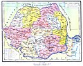
 Administrative map of Romania, 1952-1956.png 1,400 × 1,001; 338 KB
-
 Administrative Map of Romania, 1956.png 3,520 × 2,844; 819 KB
-
 Administrative map of Romania, 1960-1968.jpg 6,438 × 5,100; 5.22 MB
-
 Administrative map of Romania, 1960-1968.svg 1,650 × 1,250; 3.02 MB
-
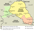
 Hungarian autonomous province01.png 443 × 371; 5 KB
-
 Hungarian autonomous province02 (hun).svg 710 × 647; 73 KB
-
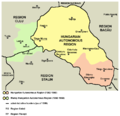 Hungarian autonomous province02.png 751 × 727; 60 KB
-
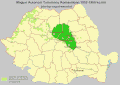
 Magyar Autonomous Region.png 619 × 599; 103 KB
-
 MAT.gif 800 × 564; 38 KB


.svg)

