Category:Magheraconluce
Jump to navigation
Jump to search
townland in Down, Northern Ireland | |||||
| Upload media | |||||
| Instance of | |||||
|---|---|---|---|---|---|
| Location | Northern Ireland | ||||
 | |||||
English: Magheraconluce is a small village close to Annahilt in County Down, Northern Ireland. In the 2001 Census it had a population of 282 people. It is situated in the Lisburn City Council area.
Subcategories
This category has the following 2 subcategories, out of 2 total.
G
H
Media in category "Magheraconluce"
The following 10 files are in this category, out of 10 total.
-
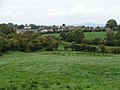 Annahilt from the south - geograph.org.uk - 2106747.jpg 2,048 × 1,536; 1.35 MB
-
 Grazing land alongside Magheraconluce Road - geograph.org.uk - 4743539.jpg 1,600 × 1,101; 199 KB
-
 Grazing land south of Magheraconluce Road - geograph.org.uk - 4741499.jpg 1,600 × 1,098; 239 KB
-

-
 Loughaghery Presbyterian Church - geograph.org.uk - 2105669.jpg 1,825 × 1,151; 775 KB
-
 Magheraconluce Road, County Down, February 2011 (01).JPG 4,272 × 2,848; 3.02 MB
-
 Road Junction - geograph.org.uk - 4522606.jpg 4,000 × 2,664; 2.12 MB
-
 Road Junction - geograph.org.uk - 4522616.jpg 4,000 × 2,664; 2.86 MB
-
 The Cargygray Road junction on the Magheraconluce Road - geograph.org.uk - 4741487.jpg 1,600 × 1,200; 228 KB
-
 The green, green grass - geograph.org.uk - 2105673.jpg 2,048 × 1,536; 1.38 MB


.JPG)


