Category:Maeslantkering
Jump to navigation
Jump to search
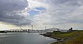
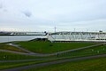
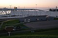
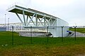
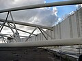
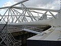
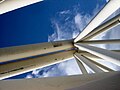
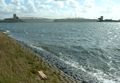
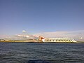
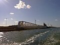
Nederlands: Afbeeldingen van de Maeslantkering een stormvloedkering op de grens van het Scheur en de Nieuwe Waterweg nabij Hoek van Holland tussen Rotterdam en de Noordzee. Het is een onderdeel van de Deltawerken in het zuidwesten van Nederland
English: Picutures of the Maeslantkering a movable flood barrier in de Nieuwe Waterweg canal near Hoek van Holland between Rotteram and the North Sea. It is part of the Delta Works flood defence system in the southwestern part of the Netherlands
Dutch storm surge barrier   | |||||
| Upload media | |||||
| Instance of | |||||
|---|---|---|---|---|---|
| Part of | |||||
| Location | Hook of Holland, Rotterdam, South Holland, Netherlands | ||||
| Architect | |||||
 | |||||
Media in category "Maeslantkering"
The following 92 files are in this category, out of 92 total.
-
 'Maeslantkering' Hoek van Holland (5835572366).jpg 680 × 1,024; 105 KB
-
 A2B Future (IMO 9122241).jpg 5,000 × 3,329; 9.72 MB
-
 Amadeus Aquamarijn (IMO 9223423).jpg 4,000 × 2,649; 1.96 MB
-
 Bij Maasdijk, de Maeslantkering foto1 2014-03-09 11.08.jpg 4,416 × 3,312; 8.48 MB
-
 De Maeslantkering - panoramio.jpg 1,280 × 782; 287 KB
-
 Den Haag - Madurodam - Maeslantkering.jpg 4,608 × 3,456; 4.71 MB
-
 Detail Maeslantkering.jpg 2,048 × 1,536; 1.05 MB
-
Functioneringssluiting-2013.webm 7.0 s, 1,024 × 400; 3.31 MB
-
 Gemaal van het Hoogheemraadschap van Delfland langs de Nieuwe Waterweg (32269702131).jpg 4,880 × 2,310; 4.71 MB
-
 KOGA met de THIALF t.h.v de Maeslantkering 12-9-2017 (36377624803).jpg 2,571 × 1,379; 3.2 MB
-
 KRVE 71 (27895587782).jpg 5,592 × 2,743; 3.99 MB
-
 LANTAU ARROW , BG DIAMOND & DIAMOND (46234640472).jpg 3,859 × 1,925; 4.19 MB
-
Locks protecting Port of Rotterdam.webm 1 min 12 s, 1,920 × 1,080; 54.81 MB
-
 Maeslantkering (27385469664).jpg 4,240 × 2,400; 2.99 MB
-
 Maeslantkering - Hoek van Holland - Port of Rotterdam (21156674584).jpg 4,570 × 2,571; 6.6 MB
-
 Maeslantkering - Noordzeeweg - Rotterdam - Rozenburg (21753508886).jpg 4,581 × 2,577; 7.58 MB
-
 Maeslantkering - panoramio - Adriaan van Oost.jpg 2,816 × 2,120; 1.44 MB
-
 Maeslantkering - panoramio.jpg 1,024 × 768; 157 KB
-
 Maeslantkering 1.jpg 1,600 × 1,200; 373 KB
-
 Maeslantkering 10.jpg 1,600 × 1,200; 409 KB
-
 Maeslantkering 11.jpg 1,600 × 1,200; 225 KB
-
 Maeslantkering 12.jpg 1,600 × 1,200; 717 KB
-
 Maeslantkering 13.jpg 1,600 × 1,200; 279 KB
-
 Maeslantkering 14.jpg 1,600 × 1,200; 310 KB
-
 Maeslantkering 15.jpg 1,600 × 1,200; 722 KB
-
 Maeslantkering 16.jpg 1,600 × 1,200; 266 KB
-
 Maeslantkering 17-9-2016 (29116991743).jpg 4,046 × 1,748; 1.72 MB
-
 Maeslantkering 17-9-2016 (29116992373).jpg 3,029 × 1,489; 3.01 MB
-
 Maeslantkering 17-9-2016 (29741611095).jpg 3,918 × 1,893; 2.3 MB
-
 Maeslantkering 17-9-2016 (29741611535).jpg 3,810 × 1,941; 1.92 MB
-
 Maeslantkering 17-9-2016 (29741611955).jpg 3,942 × 2,100; 3 MB
-
 Maeslantkering 17-9-2016 (29741612015).jpg 3,936 × 1,986; 2.34 MB
-
 Maeslantkering 17-9-2016 (29741612295).jpg 3,942 × 2,100; 3 MB
-
 Maeslantkering 17.jpg 1,600 × 1,200; 307 KB
-
 Maeslantkering 18.jpg 1,600 × 1,200; 274 KB
-
 Maeslantkering 19.JPG 4,320 × 2,880; 4.97 MB
-
 Maeslantkering 2.jpg 1,600 × 1,200; 382 KB
-
 Maeslantkering 20.JPG 4,320 × 2,880; 4.96 MB
-
 Maeslantkering 2017 1.jpg 5,472 × 3,648; 7.49 MB
-
 Maeslantkering 2017 2.jpg 5,472 × 3,648; 1.84 MB
-
 Maeslantkering 2017 3.jpg 5,472 × 3,648; 1.78 MB
-
 Maeslantkering 2017 4.jpg 5,472 × 3,648; 1.92 MB
-
 Maeslantkering 2017 5.jpg 5,472 × 3,648; 2.2 MB
-
 Maeslantkering 21.JPG 4,320 × 2,880; 5.03 MB
-
 Maeslantkering 22.JPG 4,320 × 2,880; 4.9 MB
-
 Maeslantkering 23.JPG 4,320 × 2,880; 4.88 MB
-
 Maeslantkering 24.JPG 4,320 × 2,880; 5.16 MB
-
 Maeslantkering 25.JPG 4,320 × 2,880; 5.01 MB
-
 Maeslantkering 26.JPG 4,320 × 2,880; 5.3 MB
-
 Maeslantkering 27.JPG 4,251 × 2,834; 2.32 MB
-
 Maeslantkering 28.JPG 4,320 × 2,880; 4.59 MB
-
 Maeslantkering 3.jpg 1,600 × 1,200; 374 KB
-
 Maeslantkering 4.jpg 1,600 × 1,200; 374 KB
-
 Maeslantkering 5.jpg 1,600 × 1,200; 286 KB
-
 Maeslantkering 6.jpg 1,600 × 1,200; 283 KB
-
 Maeslantkering 7.jpg 1,600 × 1,200; 307 KB
-
 Maeslantkering 8.jpg 1,600 × 1,200; 826 KB
-
 Maeslantkering 9.jpg 1,600 × 1,200; 251 KB
-
 Maeslantkering Bedieningsruimte ZZ bij nacht.jpg 2,200 × 1,467; 1.39 MB
-
Maeslantkering close up video.ogv 18 s, 640 × 480; 2.48 MB
-
 Maeslantkering closed.jpg 583 × 353; 33 KB
-
 Maeslantkering gesloten.png 1,600 × 1,105; 2.92 MB
-
 Maeslantkering N.jpg 2,592 × 1,944; 725 KB
-
 Maeslantkering northern half 1.jpg 3,930 × 2,620; 2.57 MB
-
 Maeslantkering northern half 2.jpg 3,882 × 2,588; 2.61 MB
-
 Maeslantkering northern half 3.jpg 3,963 × 2,642; 2.68 MB
-
 Maeslantkering Panorama.jpg 6,917 × 3,076; 4.01 MB
-
 Maeslantkering S.jpg 2,592 × 1,944; 871 KB
-
 Maeslantkering view.jpg 2,592 × 1,944; 455 KB
-
 Maeslantkering-01.jpg 200 × 137; 7 KB
-
 Maeslantkering-02.jpg 200 × 137; 6 KB
-
 Maeslantkering-04.jpg 300 × 226; 8 KB
-
 Maeslantkering.jpg 400 × 300; 55 KB
-
 Measlandkering Rotterdam Holland p2.jpg 2,048 × 1,536; 914 KB
-
 Measlandkering Rotterdam Holland p3.jpg 2,048 × 1,536; 961 KB
-
 Measlandkering Rotterdam Holland p4.jpg 2,048 × 1,536; 847 KB
-
 Measlandkering Rotterdam Holland p5.jpg 2,048 × 1,536; 911 KB
-
 Panorama sluiting Maeslantkering.jpg 1,798 × 919; 560 KB
-
 Proef of functioneringssluiting Maeslantkering 2015 - Hoek van Holland (21359117209).jpg 4,608 × 2,592; 5.78 MB
-
 Proef of functioneringssluiting Maeslantkering 2015 - Hoek van Holland (21534840262).jpg 4,475 × 2,517; 4.53 MB
-
 Proef of functioneringssluiting Maeslantkering 2015 - Hoek van Holland (21546039865).jpg 4,469 × 2,514; 4.71 MB
-
 Proefsluiting Maeslantkering (48735937788).jpg 5,400 × 2,508; 3.66 MB
-
 Proefsluiting Maeslantkering (48735937863).jpg 3,402 × 1,752; 2.9 MB
-
 Proefsluiting Maeslantkering (48736262771).jpg 3,516 × 1,782; 2.99 MB
-
 Proefsluiting Maeslantkering (48736262876).jpg 3,055 × 1,497; 2.9 MB
-
 Proefsluiting Maeslantkering (48736446592).jpg 5,740 × 2,896; 3.59 MB
-
 Rijnpoort, Hoek van Holland, Netherlands - panoramio.jpg 3,264 × 2,448; 3.26 MB
-
 Satellite image of Europoort, Netherlands (4.25E 51.90N) europoortkering.PNG 1,024 × 702; 1.78 MB
-
 Schaalmodel Maeslantkering.jpg 1,599 × 942; 525 KB
-
 Schip dat de Maeslantkering passeert.jpg 1,383 × 981; 428 KB
-
 Scot Mariner (IMO 9243916) Nieuwe Waterweg 2022.jpg 5,000 × 3,339; 5.31 MB
-
 Tharsis (IMO 9649196).jpg 4,000 × 2,699; 1.94 MB
.jpg)
.jpg)
.jpg)


.jpg)
.jpg)
.jpg)
.jpg)
.jpg)
.jpg)


.jpg)
.jpg)
.jpg)
.jpg)
.jpg)
.jpg)
.jpg)


.jpg)
.jpg)
.jpg)
.jpg)
.jpg)
.jpg)
.jpg)
.jpg)

_europoortkering.PNG)


_Nieuwe_Waterweg_2022.jpg)
.jpg)
.jpg)