Category:Maes Knoll
Jump to navigation
Jump to search
This is a category about listed building number 1005424. |
hillfort in Bath and North East Somerset, England, UK   | |||||
| Upload media | |||||
| Instance of |
| ||||
|---|---|---|---|---|---|
| Location |
| ||||
| Heritage designation |
| ||||
 | |||||
Media in category "Maes Knoll"
The following 12 files are in this category, out of 12 total.
-
 East from Maes Knoll - geograph.org.uk - 1384409.jpg 3,888 × 2,592; 5.83 MB
-
 Maes Knoll - geograph.org.uk - 837080.jpg 640 × 480; 88 KB
-
 Maes Knoll 2.jpg 5,124 × 3,237; 16.84 MB
-
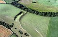
 Maes Knoll below the southern rampart - geograph.org.uk - 1393341.jpg 3,464 × 2,591; 5.59 MB
-
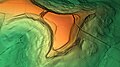 Maes Knoll Digital Terrain Model.jpg 1,920 × 1,080; 666 KB
-
 Maes Knoll from the top of Publow Hill - geograph.org.uk - 1382824.jpg 640 × 472; 121 KB
-
 Maes Knoll Somerset Map.jpg 720 × 630; 110 KB
-
 Maes Knoll Tump.jpg 3,264 × 2,448; 1.51 MB
-
 On Maes Knoll - geograph.org.uk - 1389069.jpg 2,955 × 1,211; 2.49 MB
-
 South of west on Maes Knoll - geograph.org.uk - 1393400.jpg 640 × 400; 100 KB
-
 Trig. point on Maes Knoll - geograph.org.uk - 1389278.jpg 640 × 508; 153 KB
-
 On Maes Knoll Hill Fort near Bristol - geograph.org.uk - 104038.jpg 640 × 480; 65 KB


