Category:Mae Sai District
Jump to navigation
Jump to search
district in Chiang Rai province, Thailand | |||||
| Upload media | |||||
| Instance of | |||||
|---|---|---|---|---|---|
| Named after | |||||
| Location | Chiang Rai, Thailand | ||||
| Population |
| ||||
| Elevation above sea level |
| ||||
 | |||||
Subcategories
This category has the following 7 subcategories, out of 7 total.
Media in category "Mae Sai District"
The following 17 files are in this category, out of 17 total.
-
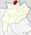
Amphoe 5709.png 375 × 435; 21 KB
-
Amphoe 5709.svg 679 × 764; 126 KB
-
Chiang Rai Province countryside 1.JPG 1,280 × 960; 378 KB
-
Chiang Rai Province countryside 2.JPG 1,280 × 960; 393 KB
-
Heart of the Daen Lao Range.jpg 7,606 × 2,226; 14.79 MB
-
Lanna-Mae Sai.png 390 × 166; 8 KB
-
Locator map Ban Dai.png 348 × 317; 19 KB
-
Locator map Pong Ngam.png 348 × 317; 19 KB
-
Locator map Wiang Phang Kham.png 348 × 317; 14 KB
-
Mae Sai hills, Northern Thailand.jpg 3,072 × 2,048; 3.99 MB
-
Map of Mae Sai (district).png 348 × 317; 16 KB
-
Rice Depot, Mae Sai, Thailand - panoramio.jpg 320 × 240; 42 KB
-
Santol & longan270.JPG 967 × 778; 163 KB
-
Thailand 2006 09 panorama doi pu chee fa range.jpg 2,324 × 400; 195 KB
-
Thailand, Burma Mae Sot border 1.jpg 3,264 × 2,448; 1.64 MB
-
Thailand, Burma Mae Sot border.jpg 3,264 × 2,448; 3.21 MB
-
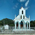
วัดครอบครัวศักดิ์สิทธิ์ บ้านผาหมี อำเภอแม่สาย.jpg 3,024 × 3,024; 2.75 MB


