Category:Madeley, Staffordshire
Jump to navigation
Jump to search
English: Madeley is a village and ward in the Borough of Newcastle-under-Lyme, North Staffordshire, England. It is split into three parts: Madeley, Middle Madeley, and Little Madeley. Madeley Heath is also considered by many to be part of Madeley. In the 2001 census, the population was recorded as 4,386.
village and civil parish in the borough of Newcastle-under-Lyme, North Staffordshire, England  | |||||
| Upload media | |||||
| Instance of | |||||
|---|---|---|---|---|---|
| Location | Newcastle-under-Lyme, Staffordshire, West Midlands, England | ||||
| Population |
| ||||
 | |||||
Subcategories
This category has the following 7 subcategories, out of 7 total.
A
- All Saints' Church, Madeley (12 F)
B
- Bar Hill, Staffordshire (7 F)
K
- Keele Tunnel (1 F)
M
- Madeley Old Manor (2 F)
- Madeley railway station (3 F)
O
- Madeley Old Hall (1 F)
Media in category "Madeley, Staffordshire"
The following 200 files are in this category, out of 287 total.
(previous page) (next page)-
 1868 house in Madeley - geograph.org.uk - 5709788.jpg 4,032 × 3,024; 2.79 MB
-
 A line of trees - geograph.org.uk - 3834866.jpg 640 × 430; 36 KB
-
 A nice one of its type........ - geograph.org.uk - 448002.jpg 468 × 640; 172 KB
-
 A525 at Bar Hill - geograph.org.uk - 3102051.jpg 640 × 481; 99 KB
-
 A525, Madeley - geograph.org.uk - 2682520.jpg 640 × 480; 109 KB
-
 A525-Station Road junction - geograph.org.uk - 1962697.jpg 640 × 480; 83 KB
-
 A531 Main Road looking east - geograph.org.uk - 3102042.jpg 640 × 480; 66 KB
-
 A531 near Bowsey Wood - geograph.org.uk - 3102044.jpg 640 × 480; 100 KB
-
 Agger Hill, Madeley Heath - geograph.org.uk - 5807068.jpg 3,028 × 2,386; 2.03 MB
-
 All Saints' Church, Madeley - geograph.org.uk - 5720530.jpg 4,032 × 3,024; 4.19 MB
-
 All Saints' Church, Madeley - geograph.org.uk - 6155015.jpg 1,600 × 1,200; 814 KB
-
 All Saints' Parish Church, Madeley - geograph.org.uk - 5716549.jpg 4,896 × 3,672; 6.65 MB
-
 Artificial lake by the M6 - geograph.org.uk - 5718928.jpg 4,032 × 3,024; 2.86 MB
-
 Artificial lake by the M6 - geograph.org.uk - 5718929.jpg 4,032 × 3,024; 2.61 MB
-
 Balsam ^ Bowsey Wood - geograph.org.uk - 4155179.jpg 424 × 640; 90 KB
-
 Bateswood former opencast coal site - geograph.org.uk - 812435.jpg 640 × 457; 143 KB
-
 Bateswood SWT Reserve, edge of plateau - geograph.org.uk - 4325896.jpg 2,592 × 1,944; 1.58 MB
-
 Bateswood SWT Reserve, pool on the plateau - geograph.org.uk - 4692979.jpg 3,264 × 2,448; 1.81 MB
-
 Bateswood SWT Reserve, pool on the plateau - geograph.org.uk - 4693038.jpg 3,264 × 2,448; 2.23 MB
-
 Bateswood SWT Reserve, steps up to the plateau - geograph.org.uk - 4693017.jpg 3,264 × 2,448; 3.01 MB
-
 Bateswood SWT Reserve, track round perimeter of plateau - geograph.org.uk - 4692969.jpg 2,448 × 3,264; 2.18 MB
-
 Bateswood SWT Reserve, track round perimeter of plateau - geograph.org.uk - 4692976.jpg 3,264 × 2,448; 2.21 MB
-
 Bateswood SWT Reserve, track round perimeter of plateau - geograph.org.uk - 4692997.jpg 3,264 × 2,448; 2.28 MB
-
 Bateswood SWT Reserve, track round perimeter of plateau - geograph.org.uk - 4693002.jpg 3,264 × 2,448; 3.37 MB
-
 Bateswood SWT Reserve, track round perimeter of plateau - geograph.org.uk - 4693022.jpg 3,264 × 2,448; 2.6 MB
-
 Bateswood SWT Reserve, track round perimeter of plateau - geograph.org.uk - 4693028.jpg 3,264 × 2,448; 2.6 MB
-
 Bateswood SWT Reserve, track round perimeter of plateau - geograph.org.uk - 4693061.jpg 3,264 × 2,448; 2.78 MB
-

-
 Bower End Lane-Moss Lane junction - geograph.org.uk - 1962691.jpg 640 × 480; 73 KB
-
 Bowsey Wood Ford - geograph.org.uk - 3944428.jpg 3,872 × 2,592; 4.79 MB
-
 Bridge carrying bridleway over the M6 - geograph.org.uk - 5717651.jpg 4,896 × 3,672; 6.45 MB
-
 Bridge carrying bridleway over the M6 - geograph.org.uk - 5717658.jpg 4,896 × 3,672; 6.32 MB
-
 Bridge over M6 southbound near Madeley - geograph.org.uk - 6303176.jpg 1,024 × 576; 88 KB
-
 Bridge over the M6 West of Keele Services - geograph.org.uk - 3466343.jpg 3,532 × 2,746; 1.8 MB
-

-
 Bridleway Near Bateswood - geograph.org.uk - 3112791.jpg 640 × 429; 83 KB
-
 Bridleway on hillside near Keele - geograph.org.uk - 5719857.jpg 4,032 × 3,024; 3.28 MB
-
 Bridleway To Madeley - geograph.org.uk - 3113038.jpg 429 × 640; 95 KB
-
 Bus shelter with daffodils - geograph.org.uk - 5708993.jpg 3,420 × 2,547; 3.58 MB
-
 Butcher's and convenience store - geograph.org.uk - 5709757.jpg 3,628 × 2,566; 2.75 MB
-
 By Madeley Pool - geograph.org.uk - 5176784.jpg 3,264 × 2,448; 3.27 MB
-
 Car park opposite church, Madeley - geograph.org.uk - 5720533.jpg 4,032 × 3,024; 4.2 MB
-
 Care home in Madeley - geograph.org.uk - 5709765.jpg 4,032 × 3,024; 3.03 MB
-
 Cattle track and bridleway off an M6 bridge - geograph.org.uk - 5719826.jpg 4,032 × 3,024; 2.57 MB
-
 Cattle track and field - geograph.org.uk - 5719833.jpg 4,032 × 3,024; 2.51 MB
-
 Churchyard of All Saints', Madeley - geograph.org.uk - 5716553.jpg 4,896 × 3,672; 6.87 MB
-
 Clay tile factory at Madeley - geograph.org.uk - 5717690.jpg 3,647 × 2,680; 2.89 MB
-
 County boundary sign - geograph.org.uk - 1962710.jpg 640 × 480; 65 KB
-
 Course of the Hazeley Brook - geograph.org.uk - 5718870.jpg 4,032 × 3,024; 3.76 MB
-
 Crewe Arms Hotel, Madeley - geograph.org.uk - 5717667.jpg 3,538 × 2,547; 2.37 MB
-
 Crewe Arms Hotel, Madeley - geograph.org.uk - 5717668.jpg 2,046 × 1,615; 769 KB
-
 Crewe Family Monument - Offley Well Head, Madeley Allotments (geograph 6805500).jpg 2,000 × 1,333; 2.23 MB
-
 Cutting near Madeley - geograph.org.uk - 3680547.jpg 640 × 365; 63 KB
-
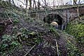
 Disused rail bridge over the active main line - geograph.org.uk - 6359808.jpg 2,000 × 1,333; 2.8 MB
-
 Disused railway bridge crosses M6 North - geograph.org.uk - 2105637.jpg 640 × 426; 365 KB
-

-
 Disused Railway Bridge over the M6 motorway, Keele - geograph.org.uk - 6386745.jpg 2,000 × 1,333; 2.46 MB
-

-
 End of the Line, disused railway line - geograph.org.uk - 6359805.jpg 2,000 × 1,333; 3.69 MB
-
 Entrance to Bateswood Nature Reserve - geograph.org.uk - 4134410.jpg 1,600 × 1,200; 630 KB
-
 Entrance to Bateswood SWT reserve - geograph.org.uk - 5884705.jpg 4,032 × 3,024; 5.98 MB
-
 Entrance to footpath through copse - geograph.org.uk - 5709047.jpg 4,032 × 3,024; 4.6 MB
-
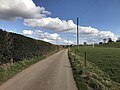
 Entrance to Madeley - geograph.org.uk - 3214867.jpg 640 × 480; 72 KB
-
 Farm pond off Leycett Lane - geograph.org.uk - 5716538.jpg 4,032 × 3,024; 2.93 MB
-
 Farmland off Heighley Lane - geograph.org.uk - 5175726.jpg 3,248 × 2,220; 1.28 MB
-
 Farmland off Heighley Lane - geograph.org.uk - 5175729.jpg 3,264 × 2,448; 1.75 MB
-
 Field by the M6 - Madeley Heath - geograph.org.uk - 3330481.jpg 4,000 × 3,000; 4.11 MB
-
 Fields looking towards Scot Hay - geograph.org.uk - 4692965.jpg 3,264 × 2,448; 1.62 MB
-
 Fish Ponds (or Decorative lakes) Old Madeley Manor - geograph.org.uk - 6360014.jpg 2,000 × 1,333; 2.15 MB
-
 Flat farmland - geograph.org.uk - 3686901.jpg 640 × 430; 45 KB
-
 Fly-tipping at Leycett - geograph.org.uk - 5343020.jpg 3,281 × 2,179; 4.21 MB
-
 Footbridge - Cattlebridge crossing the M6, Keele - geograph.org.uk - 6131500.jpg 2,000 × 1,333; 3.25 MB
-
 Footbridge over Checkley Brook - geograph.org.uk - 4155150.jpg 424 × 640; 98 KB
-
 Footpath and M6 - geograph.org.uk - 3113019.jpg 640 × 429; 42 KB
-
 Footpath and Manor View - geograph.org.uk - 4155094.jpg 640 × 424; 55 KB
-
 Footpath at Stoney Low Farm - geograph.org.uk - 3113254.jpg 640 × 429; 52 KB
-
 Footpath From Keele To Madeley - geograph.org.uk - 6131492.jpg 2,000 × 1,333; 1.89 MB
-
 Footpath From Scot Hay - geograph.org.uk - 3112874.jpg 429 × 640; 117 KB
-
 Footpath in Madeley Heath - geograph.org.uk - 5717680.jpg 3,792 × 2,844; 3 MB
-
 Footpath Near Madeley - geograph.org.uk - 3113315.jpg 429 × 640; 74 KB
-
 Footpath off track opposite Bateswood SWT Reserve - geograph.org.uk - 4692960.jpg 2,448 × 3,264; 3.63 MB
-
 Footpath to Bowsey Wood - geograph.org.uk - 4155116.jpg 640 × 424; 101 KB
-
 Former National School - geograph.org.uk - 719118.jpg 640 × 473; 240 KB
-
 Furnace Lane - geograph.org.uk - 5709762.jpg 4,032 × 3,024; 4.3 MB
-
 Furnace Lane - geograph.org.uk - 5709771.jpg 4,032 × 3,024; 4.29 MB
-
 Geese by Madeley Pool - geograph.org.uk - 5176800.jpg 3,264 × 2,448; 2.05 MB
-
 Grass and trees by Madeley Pool - geograph.org.uk - 5176831.jpg 4,896 × 3,672; 6.92 MB
-
 Hay Sprink - geograph.org.uk - 3680519.jpg 640 × 430; 46 KB
-
 Hazeley Brook - geograph.org.uk - 5717728.jpg 2,865 × 4,025; 6.52 MB
-
 Heighley Castle Way - geograph.org.uk - 5709023.jpg 4,032 × 3,024; 5.36 MB
-
 Heighley Castleway - geograph.org.uk - 4155104.jpg 424 × 640; 103 KB
-
 Heighley Lane at Heighley Castle Farm - geograph.org.uk - 2681578.jpg 640 × 480; 115 KB
-
 Hey Sprink - geograph.org.uk - 2820598.jpg 640 × 430; 47 KB
-
 Holmer Lake - geograph.org.uk - 723343.jpg 640 × 480; 89 KB
-
 Holmer Lake, Brookside - geograph.org.uk - 723342.jpg 640 × 480; 70 KB
-
-
 Hungerford House Farm - geograph.org.uk - 2920640.jpg 2,722 × 1,413; 1.59 MB
-
 Hungerford House Farm Bridge - geograph.org.uk - 3113084.jpg 640 × 429; 70 KB
-
 Hungerford House Farm Bridge, M6 - geograph.org.uk - 2643788.jpg 640 × 430; 41 KB
-
 Hungerford Lane - geograph.org.uk - 5718905.jpg 4,032 × 3,024; 2.82 MB
-
 Hungerford Lane - geograph.org.uk - 5718921.jpg 4,032 × 3,024; 2.73 MB
-
 Hungerford Lane approaching the M6 - geograph.org.uk - 5719015.jpg 4,032 × 3,024; 4.1 MB
-
 Junction of Heighley Castle Way and New Road, Madeley - geograph.org.uk - 5709007.jpg 4,032 × 3,024; 4.11 MB
-
 Junction of Newcastle Road and New Road, Madeley - geograph.org.uk - 5708967.jpg 4,032 × 3,024; 3.56 MB
-
 Landslip and Bridge, Keele Park Station - geograph.org.uk - 6386735.jpg 2,000 × 1,333; 3.54 MB
-
 Lea Court and The Madeley Centre - geograph.org.uk - 5708979.jpg 4,032 × 3,024; 2.75 MB
-
 Leycett Cricket Club - geograph.org.uk - 5716586.jpg 3,894 × 2,921; 2.97 MB
-
 Leycett Lane - geograph.org.uk - 5716528.jpg 4,032 × 3,024; 2.89 MB
-
 Leycett Lane - geograph.org.uk - 5716532.jpg 4,032 × 3,024; 3.65 MB
-
 Leycett Lane - geograph.org.uk - 5717538.jpg 4,032 × 3,024; 3.32 MB
-
 Leycett Lane, Madeley - geograph.org.uk - 2681778.jpg 640 × 480; 188 KB
-
 Leycett Lane, Madeley - geograph.org.uk - 2681781.jpg 640 × 480; 110 KB
-
 Leycett, bridleway to Bateswood - geograph.org.uk - 5158487.jpg 4,896 × 3,672; 6.69 MB
-
 Leycett, bridleway to Bateswood - geograph.org.uk - 5158544.jpg 4,896 × 3,672; 6.97 MB
-
 Little Madeley - geograph.org.uk - 447981.jpg 640 × 480; 131 KB
-
 M6 at Waltons Wood - geograph.org.uk - 2690041.jpg 4,000 × 3,000; 4.53 MB
-
 M6 bridge from A531 near Madeley - geograph.org.uk - 5175740.jpg 3,214 × 2,278; 2.08 MB
-
 M6 From Hungerford House Farm Bridge - geograph.org.uk - 3113123.jpg 640 × 429; 48 KB
-
 M6 looking north-west near Madeley - geograph.org.uk - 5719812.jpg 4,032 × 3,024; 3.15 MB
-
 M6 looking south-east near Madeley - geograph.org.uk - 5719815.jpg 4,032 × 3,024; 2.71 MB
-

-

-

-
 M6 motorway approaching Walton's Wood - geograph.org.uk - 1918253.jpg 640 × 480; 139 KB
-
 M6 motorway bridges the A525 - geograph.org.uk - 1918244.jpg 640 × 480; 174 KB
-
 M6 Motorway near Adderley Green - geograph.org.uk - 2244695.jpg 640 × 480; 48 KB
-
 M6 motorway near Madeley - geograph.org.uk - 1918242.jpg 640 × 480; 170 KB
-
 M6 motorway near Stoney Low - geograph.org.uk - 1918236.jpg 640 × 480; 154 KB
-
 M6 over the A531 - geograph.org.uk - 2681579.jpg 640 × 481; 134 KB
-

-

-
 M6 south at Waltons Wood - geograph.org.uk - 2823663.jpg 640 × 480; 29 KB
-
 M6 south near Bullthorns Wood - geograph.org.uk - 2823662.jpg 640 × 463; 30 KB
-
 M6 south near Madeley Heath - geograph.org.uk - 2823664.jpg 640 × 480; 32 KB
-
 M6 viewed from hillside near Keele - geograph.org.uk - 5719848.jpg 4,032 × 3,024; 3.09 MB
-
 M6 ^ Newcastle Road - geograph.org.uk - 4155079.jpg 640 × 424; 73 KB
-
 Madeley , M6 Motorway - geograph.org.uk - 6361812.jpg 6,000 × 4,000; 5.22 MB
-
 Madeley , M6 Motorway - geograph.org.uk - 6361814.jpg 6,000 × 4,000; 5.36 MB
-
 Madeley , M6 Motorway - geograph.org.uk - 6361815.jpg 6,000 × 4,000; 5.24 MB
-
 Madeley , M6 Motorway - geograph.org.uk - 6361816.jpg 6,000 × 4,000; 5.2 MB
-
 Madeley Heath M6 geograph-3390461-by-Ben-Brooksbank.jpg 2,383 × 1,155; 2.39 MB
-
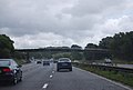
 Madeley Heath, traffic jam - geograph.org.uk - 1470038.jpg 640 × 421; 52 KB
-
 Madeley Manor - geograph.org.uk - 447986.jpg 640 × 480; 110 KB
-
 Madeley Manor Lake - geograph.org.uk - 4155237.jpg 640 × 424; 62 KB
-
 Madeley Methodist Church - geograph.org.uk - 2682528.jpg 480 × 640; 51 KB
-
 Madeley Mill - geograph.org.uk - 5176942.jpg 3,264 × 2,448; 1.88 MB
-
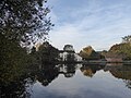
 Madeley Mill and Pool - geograph.org.uk - 6155889.jpg 1,600 × 1,200; 781 KB
-
 Madeley Mill ^ Pond, Staffs - geograph.org.uk - 5220382.jpg 5,184 × 2,920; 6.28 MB
-
 Madeley Mill, Staffordshire.jpg 1,600 × 1,200; 808 KB
-
 Madeley Old Hall - geograph.org.uk - 6155872.jpg 1,600 × 1,200; 762 KB
-
 Madeley Pond and Mill (Now Flats) - geograph.org.uk - 6360035.jpg 2,000 × 1,333; 1.88 MB
-
 Madeley Pool - geograph.org.uk - 2682772.jpg 640 × 480; 107 KB
-
 Madeley Pool - geograph.org.uk - 2682774.jpg 640 × 480; 138 KB
-
 Madeley Pool - geograph.org.uk - 5176822.jpg 4,896 × 3,672; 4.23 MB
-
 Madeley Pool - geograph.org.uk - 6156110.jpg 1,600 × 1,200; 490 KB
-
 Madeley Pool and former mill - geograph.org.uk - 4461222.jpg 640 × 468; 431 KB
-
 Madeley Pool and Mill - geograph.org.uk - 5176842.jpg 2,448 × 3,264; 1.97 MB
-
 Madeley Pool and Mill - geograph.org.uk - 5176860.jpg 4,896 × 3,672; 6.48 MB
-
 Madeley signs on Bowsey Wood Road - geograph.org.uk - 1962681.jpg 640 × 480; 76 KB
-
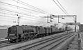
 Madeley, Down relief express on WCML, 1962 - geograph.org.uk - 4248084.jpg 2,395 × 1,433; 1.59 MB
-
 Madeley, Evening Spice - geograph.org.uk - 5176959.jpg 3,825 × 2,925; 2.66 MB
-
 Madeley, Methodist Church - geograph.org.uk - 5176984.jpg 4,896 × 3,672; 6.78 MB
-
 Madeley, Offley Arms - geograph.org.uk - 5177003.jpg 3,866 × 2,863; 2.92 MB
-
 Madeley, Poolside - geograph.org.uk - 5176966.jpg 3,149 × 2,194; 1.84 MB
-
 Madeley, Poolside Fish Bar - geograph.org.uk - 5176990.jpg 4,896 × 3,672; 6.64 MB
-
 Madeley, Staffs - All Saints Church - geograph.org.uk - 5220385.jpg 5,184 × 2,920; 6.71 MB
-
 Madely with Euston - Perth express geograph-2709818-by-Ben-Brooksbank.jpg 2,374 × 1,448; 781 KB
-
 Meadows School Madeley Heath - geograph.org.uk - 4155074.jpg 640 × 424; 62 KB
-

-
 Metal gate on public bridleway - geograph.org.uk - 5719829.jpg 4,032 × 3,024; 3.9 MB
-
 Milepost at NGR SJ 7636 4649.jpg 492 × 701; 43 KB
-
 Milepost at NGR SJ 7687 4413.jpg 492 × 701; 54 KB
-
 Milepost at NGR SJ 7764 4523.jpg 492 × 701; 55 KB
-
 Mining memorial at Madeley - geograph.org.uk - 5716524.jpg 4,032 × 3,024; 5 MB
-
 Monument - geograph.org.uk - 434713.jpg 640 × 480; 109 KB
-
 Moss Lane, Madeley - geograph.org.uk - 2682778.jpg 640 × 480; 120 KB
-
 Narrow muddy public footpath at Leycett - geograph.org.uk - 5717502.jpg 2,950 × 3,943; 6.12 MB
-
 Narrow passageway in Madeley - geograph.org.uk - 5709057.jpg 3,021 × 3,770; 3.88 MB
-
 Narrow passageway in Madeley - geograph.org.uk - 5709718.jpg 2,987 × 3,927; 2.6 MB
-
 Neatherset Hey Lane - geograph.org.uk - 3113336.jpg 640 × 429; 56 KB
-
 Netherset Hey Lane - geograph.org.uk - 5720504.jpg 4,032 × 3,024; 3.37 MB
-
 Netherset Hey Lane - geograph.org.uk - 5720511.jpg 4,032 × 3,024; 2.46 MB
-
 New housing estate in Madeley - geograph.org.uk - 5709042.jpg 4,032 × 3,024; 6.11 MB
-
 New Road, Madeley - geograph.org.uk - 5708985.jpg 4,032 × 3,024; 3.97 MB
-
 Newcastle-under-Lyme , The M6 Motorway - geograph.org.uk - 4934100.jpg 5,660 × 3,773; 6.14 MB
-
 Newcastle-under-Lyme , The M6 Motorway - geograph.org.uk - 4934103.jpg 6,000 × 4,000; 6.44 MB
-
 Newcastle-under-Lyme , The M6 Motorway - geograph.org.uk - 4934106.jpg 6,000 × 4,000; 6.5 MB
-
 Newcastle-under-Lyme , The M6 Motorway - geograph.org.uk - 4934113.jpg 6,000 × 4,000; 6.99 MB
-
 Newcastle-under-Lyme , The M6 Motorway - geograph.org.uk - 4934116.jpg 6,000 × 4,000; 6.64 MB
-
 Newcastle-under-Lyme District , The M6 Motorway - geograph.org.uk - 3725075.jpg 4,144 × 2,614; 5.37 MB
-
 Newcastle-under-Lyme District , The M6 Motorway - geograph.org.uk - 3725081.jpg 4,246 × 2,784; 5.41 MB
-
 North End of the Tunnel, Keele Disused Railway lines - geograph.org.uk - 6131465.jpg 2,000 × 1,333; 3.86 MB
-
 Northbound M6 near Madeley - geograph.org.uk - 4242769.jpg 640 × 427; 275 KB
-
 Northbound M6 near Madeley Heath - geograph.org.uk - 4242762.jpg 640 × 427; 233 KB
-
 Northbound M6, Walton's Wood - geograph.org.uk - 4242775.jpg 640 × 427; 237 KB
-
 Offley Arms, Madeley - geograph.org.uk - 2682769.jpg 480 × 640; 83 KB
-
 Old Hall at Madeley, Staffs - geograph.org.uk - 5220383.jpg 5,184 × 2,920; 6.02 MB
-
 Old Madeley Manor (Remains Of) - geograph.org.uk - 6359985.jpg 2,000 × 1,333; 2.6 MB
-

-
 Old Railway Bridge Near Stoney Low - geograph.org.uk - 3113246.jpg 429 × 640; 76 KB


.jpg)


_Old_Madeley_Manor_-_geograph.org.uk_-_6360014.jpg)


_-_geograph.org.uk_-_6360035.jpg)


,_All_Saints_Church,_Madeley_-_geograph.org.uk_-_5220386.jpg)


_-_geograph.org.uk_-_6359985.jpg)
.jpg)
