Category:Macclesfield Forest and Wildboarclough
Jump to navigation
Jump to search

civil parish in Cheshire East, England  | |||||
| Upload media | |||||
| Instance of | |||||
|---|---|---|---|---|---|
| Named after | |||||
| Location | Cheshire East, Cheshire, North West England, England | ||||
| Population |
| ||||
 | |||||
Subcategories
This category has the following 12 subcategories, out of 12 total.
A
B
- Bottom of the Oven (13 F)
C
- Cat and Fiddle Inn, Cheshire (53 F)
- Crag Hall, Cheshire (5 F)
D
- Danebower (48 F)
M
S
- Shining Tor (58 F)
- Shutlingsloe (86 F)
T
- Trentabank Reservoir (24 F)
W
Media in category "Macclesfield Forest and Wildboarclough"
The following 200 files are in this category, out of 633 total.
(previous page) (next page)-
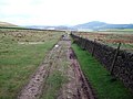
 "The Stanley Arms", Bottom-of-the-Oven - geograph.org.uk - 6555576.jpg 4,721 × 3,459; 5.5 MB
-
 A dangerous road - geograph.org.uk - 1949825.jpg 640 × 480; 56 KB
-
 A day out? - geograph.org.uk - 4961035.jpg 2,716 × 1,883; 1.98 MB
-
 A moorland stretch of the A54 - geograph.org.uk - 3209489.jpg 3,872 × 2,592; 4.84 MB
-
 A quick exit - geograph.org.uk - 4961033.jpg 3,390 × 2,525; 2.65 MB
-
 A young Cumberland Brook - geograph.org.uk - 3709217.jpg 3,872 × 2,592; 5.48 MB
-
 A537 - geograph.org.uk - 2231841.jpg 800 × 600; 101 KB
-
 A537 at Longclough - geograph.org.uk - 2858896.jpg 5,184 × 3,456; 4.06 MB
-
 A537 Buxton New Road - geograph.org.uk - 2858860.jpg 5,184 × 3,456; 3.47 MB
-
 A54 downhill below Heild Rocks - geograph.org.uk - 5062465.jpg 1,469 × 1,102; 413 KB
-
 A54 Road near Cheshire Knowl - geograph.org.uk - 3842124.jpg 4,000 × 3,000; 2.16 MB
-
 Above Stake Farm - geograph.org.uk - 3840038.jpg 4,912 × 3,264; 5.81 MB
-
 Above the Dane Valley - geograph.org.uk - 5091499.jpg 3,456 × 2,304; 4.93 MB
-
 Access to Topclose Farm - geograph.org.uk - 3028759.jpg 640 × 427; 251 KB
-
 Access track from Stake Farm to A537 - geograph.org.uk - 5217547.jpg 5,184 × 2,920; 4.35 MB
-
 Afternoon sunshine catches Torgate Hill below Shining Tor - geograph.org.uk - 5217497.jpg 5,184 × 2,920; 4.27 MB
-
 Against the skyline - geograph.org.uk - 4027241.jpg 4,320 × 3,240; 4.68 MB
-
 Along the lane at Edinboro' Cottages - geograph.org.uk - 5044869.jpg 1,142 × 857; 472 KB
-
 Along the lane below Shutlingsloe Farm - geograph.org.uk - 5049961.jpg 1,306 × 979; 609 KB
-
 Along the lane to Wildboarclough - geograph.org.uk - 5062475.jpg 1,142 × 857; 426 KB
-
 Alongside the Clough Brook - geograph.org.uk - 5062476.jpg 1,142 × 857; 366 KB
-
 Alright, we get the message - geograph.org.uk - 2401798.jpg 640 × 480; 146 KB
-
 Andrew's Edge - geograph.org.uk - 5391407.jpg 4,352 × 2,904; 1.87 MB
-
 Ankers Knowl - geograph.org.uk - 5094793.jpg 5,800 × 3,867; 6.26 MB
-
 Ankers Knowl Farm - geograph.org.uk - 363279.jpg 640 × 480; 116 KB
-
 Ankers Knowl Farm - geograph.org.uk - 5094794.jpg 5,800 × 3,867; 6.29 MB
-
 Ankers Knowl Farm - geograph.org.uk - 5391413.jpg 2,900 × 2,185; 1.53 MB
-

-
 Ankers Knowl Lane - geograph.org.uk - 3706770.jpg 3,689 × 2,459; 1.57 MB
-
 Ankers Knowl Lane - geograph.org.uk - 3706789.jpg 3,689 × 2,459; 3.18 MB
-
 Ankers Knowl Lane junction - geograph.org.uk - 2967708.jpg 640 × 480; 69 KB
-
 Ankers Lane junction with A537 - geograph.org.uk - 5998274.jpg 1,600 × 1,200; 647 KB
-
 Another fine drystone wall - geograph.org.uk - 6555567.jpg 4,922 × 3,502; 4.54 MB
-
 Approaching bend on the A537 - geograph.org.uk - 1902292.jpg 640 × 426; 44 KB
-
 Approaching the A54 - geograph.org.uk - 2560694.jpg 3,648 × 2,736; 5.96 MB
-
 Approaching the A54 at Holt - geograph.org.uk - 3029898.jpg 640 × 427; 254 KB
-
 Approaching the Cat and Fiddle Inn - geograph.org.uk - 5430898.jpg 1,600 × 1,200; 123 KB
-
 Approaching the hamlet of Walker Barn - geograph.org.uk - 6555482.jpg 3,578 × 4,647; 4.72 MB
-
 Autumn trees by Clough Brook - geograph.org.uk - 3205936.jpg 3,872 × 2,592; 7.27 MB
-
 Average speed cameras - geograph.org.uk - 4215356.jpg 2,736 × 2,725; 3.6 MB
-
 Average speed cameras on A537 - geograph.org.uk - 5998255.jpg 1,600 × 799; 364 KB
-
 Barbed wire trap - geograph.org.uk - 3114541.jpg 4,000 × 3,000; 2.66 MB
-
 Barn - geograph.org.uk - 1246303.jpg 640 × 480; 91 KB
-
 Barn by A537 near Greenways Farm - geograph.org.uk - 5998332.jpg 1,600 × 800; 550 KB
-
 Barn by Clough House below Tegg's Nose - geograph.org.uk - 5621918.jpg 5,184 × 2,920; 6.07 MB
-
 Barn by Clough House below Tegg's Nose - geograph.org.uk - 5621919.jpg 5,184 × 2,920; 6.44 MB
-
 Barn by Hooleyhey Lane - geograph.org.uk - 6555350.jpg 5,047 × 3,785; 5.29 MB
-
 Barn on a Hill - geograph.org.uk - 4185464.jpg 640 × 427; 333 KB
-
 Barns by Cumberland Brook - geograph.org.uk - 4027244.jpg 4,320 × 3,240; 4.99 MB
-
 Below Lower Barn - geograph.org.uk - 2755805.jpg 4,000 × 3,000; 4.64 MB
-
 Bend in the road - geograph.org.uk - 2292727.jpg 1,600 × 1,143; 553 KB
-
 Bennettshitch Farm - geograph.org.uk - 2490648.jpg 1,024 × 768; 259 KB
-
 Blaze Farm buildings - geograph.org.uk - 4752844.jpg 4,896 × 3,672; 6.69 MB
-
 Blaze Farm in the distance - geograph.org.uk - 2560649.jpg 2,759 × 2,204; 1,012 KB
-
 Blaze Farm sign - geograph.org.uk - 4752846.jpg 4,896 × 3,672; 6.7 MB
-
 Bog grasses - geograph.org.uk - 1399667.jpg 640 × 480; 99 KB
-
 Boggy ground, sheep grazing land - geograph.org.uk - 2947215.jpg 4,000 × 3,000; 2.27 MB
-
 Bollin Brook - geograph.org.uk - 3878203.jpg 2,592 × 3,386; 1.88 MB
-
 Bollin Brook upper valley - geograph.org.uk - 2728565.jpg 1,704 × 2,272; 1.45 MB
-
 Bollin Brook upper valley revisited - geograph.org.uk - 2823004.jpg 4,000 × 2,667; 3.11 MB
-
 Bottom end of Oven Lane - geograph.org.uk - 5051361.jpg 1,306 × 979; 808 KB
-
 Boundary Fence viewed from track near Stake Farm - geograph.org.uk - 6583384.jpg 1,920 × 1,080; 1.26 MB
-
 Bridge at Three Shire Heads on New Years Day - geograph.org.uk - 6505390.jpg 1,799 × 1,199; 486 KB
-
 Bridge over a side-stream - geograph.org.uk - 2619591.jpg 640 × 480; 102 KB
-
 Bridge over Tor Brook - geograph.org.uk - 1943524.jpg 1,280 × 854; 475 KB
-
 Bridge Parapet over Tor Brook - geograph.org.uk - 3028856.jpg 640 × 427; 251 KB
-
 Bridleway across the Cat & Fiddle moor - geograph.org.uk - 5053480.jpg 1,102 × 1,469; 468 KB
-
 Bridleway below Cut-thorn Hill - geograph.org.uk - 5058913.jpg 1,306 × 979; 583 KB
-
 Bridleway below Holt Farm - geograph.org.uk - 5058911.jpg 1,306 × 979; 529 KB
-
 Bridleway gate on the moor - geograph.org.uk - 5053483.jpg 1,306 × 979; 472 KB
-
 Bridleway on Whetstone Ridge - geograph.org.uk - 5053488.jpg 1,306 × 979; 469 KB
-
 Bridleway to Gradbach - geograph.org.uk - 6135638.jpg 768 × 1,024; 154 KB
-
 Bridleway ^ footpath junction - geograph.org.uk - 5058907.jpg 1,306 × 979; 505 KB
-
 Brookhouse - geograph.org.uk - 2933868.jpg 427 × 640; 104 KB
-
 Broughsplace - geograph.org.uk - 1943543.jpg 1,280 × 854; 278 KB
-
 Burntclff Top - geograph.org.uk - 5073747.jpg 4,941 × 3,395; 1.96 MB
-
 Buxton New Road - geograph.org.uk - 5094790.jpg 5,800 × 3,867; 6.15 MB
-
 Buxton Old and New Roads - geograph.org.uk - 4423821.jpg 1,800 × 1,350; 429 KB
-
 Cat and Fiddle Public House, Cheshire - geograph.org.uk - 6460586.jpg 5,184 × 3,888; 4.83 MB
-
 Cat and Fiddle road - geograph.org.uk - 4443785.jpg 4,291 × 1,891; 2.71 MB
-
 Cat and Fiddle Road - geograph.org.uk - 4473274.jpg 3,648 × 2,736; 3.24 MB
-
 Cat and Fiddle, and The Scaurs - geograph.org.uk - 4423832.jpg 1,800 × 1,350; 291 KB
-
 Charity Lane - geograph.org.uk - 2728705.jpg 2,272 × 1,704; 996 KB
-
 Charity Lane - geograph.org.uk - 4428581.jpg 1,350 × 1,800; 520 KB
-
 Charity Lane - geograph.org.uk - 4846161.jpg 1,350 × 1,013; 125 KB
-

-
 Charity Lane leading uphill - geograph.org.uk - 5051319.jpg 979 × 1,306; 494 KB
-
 Charity Lane starts to drop away - geograph.org.uk - 5051345.jpg 1,306 × 979; 555 KB
-
 Cheshire countryside - geograph.org.uk - 4752858.jpg 5,500 × 3,667; 6.37 MB
-
 Cheshire county boundary. A54 rising to Cheshire Knowl - geograph.org.uk - 6314839.jpg 4,552 × 3,380; 5.26 MB
-
 Cheshire hills - geograph.org.uk - 4752860.jpg 5,500 × 3,667; 6.43 MB
-
 Cheshire hills - geograph.org.uk - 4752870.jpg 4,896 × 3,672; 6.49 MB
-
 Cheshire moorland near Holt - geograph.org.uk - 6534646.jpg 4,907 × 3,707; 4.58 MB
-
 Cleared Area in Macclesfield Forest - geograph.org.uk - 4846149.jpg 833 × 751; 189 KB
-
 Closed to cars, fine for cyclists - geograph.org.uk - 5050806.jpg 1,306 × 979; 535 KB
-
 Clough Brook - geograph.org.uk - 1943526.jpg 854 × 1,280; 464 KB
-
 Clough Brook - geograph.org.uk - 2292771.jpg 457 × 640; 173 KB
-
 Clough Brook - geograph.org.uk - 2969190.jpg 480 × 640; 92 KB
-
 Clough Brook - geograph.org.uk - 3205930.jpg 3,872 × 2,592; 7.31 MB
-
 Clough Brook - geograph.org.uk - 3205959.jpg 3,872 × 2,592; 6.52 MB
-
 Clough Brook - geograph.org.uk - 3878195.jpg 3,888 × 2,409; 1.45 MB
-
 Clough Brook - geograph.org.uk - 3878198.jpg 3,888 × 2,400; 1.51 MB
-
 Clough Brook - geograph.org.uk - 3918134.jpg 2,592 × 3,888; 2.35 MB
-
 Clough Brook - geograph.org.uk - 4914106.jpg 3,072 × 1,728; 2.26 MB
-
 Clough Brook - geograph.org.uk - 4960792.jpg 4,000 × 3,000; 4.39 MB
-
 Clough Brook - geograph.org.uk - 4986317.jpg 3,544 × 2,648; 6.32 MB
-
 Clough Brook by Crag Inn, Wildboarclough - geograph.org.uk - 6686924.jpg 5,184 × 2,912; 6.22 MB
-
 Clough Brook in autumn - geograph.org.uk - 2292751.jpg 768 × 1,024; 339 KB
-
 Clough Brook Valley - geograph.org.uk - 1943546.jpg 1,280 × 854; 255 KB
-
 Clough Brook Valley - geograph.org.uk - 5483446.jpg 1,024 × 768; 150 KB
-
 Clough Brook, Wildboarclough - geograph.org.uk - 4919202.jpg 800 × 600; 199 KB
-
 Clough House - geograph.org.uk - 2292714.jpg 1,600 × 1,143; 352 KB
-
 Clough House - geograph.org.uk - 2325589.jpg 2,048 × 1,423; 526 KB
-
 Clough House - geograph.org.uk - 2559302.jpg 3,648 × 2,736; 4.44 MB
-
 Clough House - geograph.org.uk - 3878193.jpg 3,816 × 2,396; 1.55 MB
-
 Clough House Farm - geograph.org.uk - 2839950.jpg 5,184 × 3,456; 5.26 MB
-
 Clough House seen from Hardingland Farm - geograph.org.uk - 6555243.jpg 4,678 × 3,647; 5.86 MB
-
 Clough of shale - geograph.org.uk - 2559310.jpg 3,648 × 2,736; 5.63 MB
-
 Communications Mast at Cat and Fiddle - geograph.org.uk - 6567324.jpg 2,048 × 1,536; 1.06 MB
-
 Convenience store - geograph.org.uk - 4921873.jpg 3,072 × 1,728; 2.84 MB
-
 Cost cutting at the county council - geograph.org.uk - 6314851.jpg 4,466 × 3,260; 7.81 MB
-
 Cottage by Love Lane Bridge - geograph.org.uk - 2970850.jpg 640 × 480; 84 KB
-
 Cottage in the woods - geograph.org.uk - 2560659.jpg 3,648 × 2,736; 6.41 MB
-
 Cotton Grass - geograph.org.uk - 5091508.jpg 3,456 × 2,304; 5.36 MB
-
 Countryside north of Allgreave - geograph.org.uk - 6534678.jpg 4,900 × 3,635; 4.3 MB
-
 Crag Hall - geograph.org.uk - 4960991.jpg 3,809 × 2,857; 3.75 MB
-
 Crawling up Hacked Way Lane - geograph.org.uk - 5051049.jpg 857 × 1,142; 635 KB
-
 Crossing the Clough Brook - geograph.org.uk - 5049998.jpg 1,306 × 979; 604 KB
-
 Cumberland Brook - geograph.org.uk - 3028902.jpg 640 × 427; 267 KB
-
 Cumberland Brook - geograph.org.uk - 3028904.jpg 427 × 640; 249 KB
-
 Cumberland Brook - geograph.org.uk - 3209450.jpg 3,872 × 2,592; 6.75 MB
-
 Cumberland Brook - geograph.org.uk - 3209461.jpg 3,872 × 2,592; 5.18 MB
-
 Cumberland Brook - geograph.org.uk - 3709233.jpg 3,872 × 2,592; 4.18 MB
-
 Cumberland Brook and Clough House - geograph.org.uk - 2334006.jpg 1,600 × 1,200; 682 KB
-
 Cumberland Brook footbridge - geograph.org.uk - 4043095.jpg 1,024 × 680; 305 KB
-
 Cumberland Brook Ford - geograph.org.uk - 6009013.jpg 3,662 × 2,744; 2.45 MB
-
 Cumberland Cottage - geograph.org.uk - 1023040.jpg 640 × 480; 90 KB
-
 Cumberland Cottage - geograph.org.uk - 3209438.jpg 3,872 × 2,592; 3.77 MB
-
 Cumberland Cottage - geograph.org.uk - 4538043.jpg 3,648 × 2,736; 4.05 MB
-
 Cumberland gap^ - geograph.org.uk - 2334032.jpg 1,600 × 1,200; 555 KB
-
 Cumberland Road - geograph.org.uk - 2334071.jpg 1,600 × 1,200; 1,000 KB
-
 Cumberland track - geograph.org.uk - 2334092.jpg 2,272 × 1,704; 995 KB
-
 Cushion in St Stephen's Church, Forest Chapel - geograph.org.uk - 6555476.jpg 4,932 × 3,690; 4.38 MB
-
 Cut-Thorn Hillside - geograph.org.uk - 5911047.jpg 1,024 × 668; 255 KB
-
 Cycle Trackway - geograph.org.uk - 1246318.jpg 640 × 480; 64 KB
-
 Dane Bower Chimney - geograph.org.uk - 6602981.jpg 2,000 × 1,334; 3.19 MB
-
 Dane Cottage by Lovelane Bridge, Gradbach - geograph.org.uk - 5618918.jpg 5,184 × 2,920; 5.89 MB
-
 Dane valley. - geograph.org.uk - 5455087.jpg 640 × 427; 73 KB
-
 Danebower Quarries, near Wildboarclough - geograph.org.uk - 5298179.jpg 1,024 × 682; 171 KB
-
 Deep snow beside road, N of Wildboarclough - geograph.org.uk - 3742894.jpg 1,024 × 768; 199 KB
-
 Deep winter at the Cat ^ Fiddle Public House - geograph.org.uk - 6482561.jpg 1,799 × 1,199; 329 KB
-
 Derbyshire county boundary on A54 - geograph.org.uk - 6314844.jpg 3,060 × 2,289; 2.54 MB
-
 Derelict building - geograph.org.uk - 6135633.jpg 1,024 × 768; 345 KB
-
 Descending Charity Lane - geograph.org.uk - 5051349.jpg 1,102 × 1,469; 629 KB
-
 Descending Hacked Way Lane - geograph.org.uk - 2728736.jpg 2,272 × 1,704; 709 KB
-
 Descent towards Macclesfield Forest - geograph.org.uk - 3710595.jpg 3,714 × 2,476; 3.37 MB
-
 Developing grain above The Scaurs - geograph.org.uk - 3709176.jpg 3,872 × 2,592; 1.59 MB
-
 Dingers Hollow Farm - geograph.org.uk - 3878196.jpg 3,843 × 2,525; 1.8 MB
-
 Discussing the weather - geograph.org.uk - 5094798.jpg 5,800 × 3,867; 6.31 MB
-
 Distant pub - geograph.org.uk - 5094816.jpg 6,480 × 4,320; 4.51 MB
-
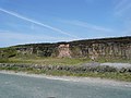 Disused Quarry - geograph.org.uk - 2389779.jpg 3,072 × 2,304; 3.12 MB
-
 Double bend, A54 west of Cut-thorn Hill - geograph.org.uk - 2620506.jpg 640 × 480; 348 KB
-
 Downhill stretch of the A54 - geograph.org.uk - 5058910.jpg 1,306 × 979; 438 KB
-
 Drive to Warrilowhead Farm - geograph.org.uk - 4598587.jpg 1,800 × 1,350; 473 KB
-
 Dry Stone Wall Above Banktop - geograph.org.uk - 4185471.jpg 640 × 427; 270 KB
-
 Dry Stone Wall Corner - geograph.org.uk - 4185468.jpg 640 × 427; 263 KB
-
 Dry Stone Wall near Smithy Farm - geograph.org.uk - 6563741.jpg 4,032 × 3,024; 2.41 MB
-
 Dryknowle Farm - geograph.org.uk - 4919352.jpg 800 × 600; 99 KB
-
 Drystone wall and a farm track - geograph.org.uk - 5062455.jpg 1,306 × 979; 473 KB
-
 Drystone wall at Bottom-of-the-Oven - geograph.org.uk - 6555355.jpg 5,117 × 3,854; 5.3 MB
-
 Eagle and Child - geograph.org.uk - 5225145.jpg 800 × 534; 118 KB
-
 Eagle and Child and barn with red door - geograph.org.uk - 2948312.jpg 4,000 × 3,000; 2.59 MB
-
 East from Burntcliff Top - geograph.org.uk - 2948280.jpg 4,000 × 3,000; 2.51 MB
-
 Entering access land - geograph.org.uk - 3709094.jpg 3,872 × 2,592; 1.94 MB
-
 Entering Derbyshire on the A54 - geograph.org.uk - 6534638.jpg 5,172 × 3,524; 4.86 MB
-
 Entrance drive to Brookhouse Farm - geograph.org.uk - 2944067.jpg 1,280 × 853; 293 KB
-
 Entrance to Car Park in Clough Brook - geograph.org.uk - 4185104.jpg 640 × 427; 306 KB
-

-
 Ewes awaiting their chosen hour - geograph.org.uk - 4913420.jpg 3,072 × 1,728; 3.48 MB
-

-
 Farm buildings - geograph.org.uk - 4752855.jpg 5,500 × 3,667; 4.5 MB
-
 Farm Buildings on A537 - geograph.org.uk - 2389788.jpg 1,885 × 1,373; 1.38 MB
-
 Farm near Blaze Farm - geograph.org.uk - 3205910.jpg 3,872 × 2,592; 4.27 MB
-
 Farm ruin in Macclesfield Forest - geograph.org.uk - 6555238.jpg 4,709 × 3,330; 4.97 MB
-
 Farm sign - geograph.org.uk - 4752869.jpg 4,896 × 3,672; 6.7 MB
-
-
 Field Barn, Wildboarclough - geograph.org.uk - 3093790.jpg 640 × 480; 69 KB
-
 Field below Higher Nabbs - geograph.org.uk - 3515249.jpg 1,600 × 1,064; 331 KB
-
 Field gate with notices - geograph.org.uk - 2948276.jpg 4,000 × 3,000; 2.48 MB
-
 Field on the Slope of Mount Pleasant - geograph.org.uk - 4185437.jpg 640 × 427; 245 KB
-
 Field track, near Clough Brook - geograph.org.uk - 2560670.jpg 3,648 × 2,736; 5.53 MB
-
 Fieldhead farm from A537 - geograph.org.uk - 2858874.jpg 5,184 × 3,456; 3.74 MB
-
 Fields above Clough House - geograph.org.uk - 3703831.jpg 3,872 × 2,592; 1.55 MB
-
 Fields above Hope, near Wildboarclough - geograph.org.uk - 5298188.jpg 1,024 × 682; 197 KB
-
 Five Ashes Farm - geograph.org.uk - 5786423.jpg 4,000 × 3,000; 4.78 MB
-
 Flasker Moor, in Higher Bangs (or Bongs) - geograph.org.uk - 2947209.jpg 4,000 × 3,000; 2.37 MB
-
 Footbridge at Wildboarclough - geograph.org.uk - 4921893.jpg 3,072 × 1,728; 4.46 MB
-
 Footbridge over Clough Brook - geograph.org.uk - 4185467.jpg 427 × 640; 341 KB
-
 Footbridge over Clough Brook - geograph.org.uk - 4960789.jpg 4,000 × 3,000; 5.06 MB
-
 Footbridge over Cumberland Brook - geograph.org.uk - 3209433.jpg 3,872 × 2,592; 6.3 MB


_-_geograph.org.uk_-_2947209.jpg)


