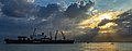
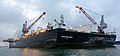
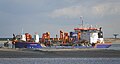
Category:Maasvlakte 2
port in Rotterdam, Netherlands  | |||||
| Upload media | |||||
| Instance of | |||||
|---|---|---|---|---|---|
| Part of | |||||
| Location | Maasvlakte, Rotterdam, South Holland, Netherlands | ||||
| Located in or next to body of water | |||||
| Main building contractor |
| ||||
| official website | |||||
 | |||||
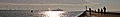
(en) The Maasvlakte 2 is part of the harbour and industrial area of the city of Rotterdam, the Netherlands. The project started on september 1, 2008 by reclaiming land from the North Sea through dykes and sand suppletion.
(nl) Maasvlakte 2 is het uitbreidingsproject van de Rotterdamse haven dat is gelegen ten westen van de Maasvlakte. Met deze uitbreiding van 2.000 hectare wordt de haven twintig procent groter. Bij de voltooiing zullen de havens in totaal 12.000 hectare beslaan. Op 1 september 2008 startte na jaren van plannen, discussies en protesten, de aanleg. Men verwacht in 2013 de uitbreiding in gebruik te kunnen nemen.
_G_tcm81-31824.jpg)
_G_tcm81-32296.jpg)
_G_tcm81-32298.jpg)
_G_tcm81-32300.jpg)
_G_tcm81-32302.jpg)


Source of some of the images: Havenbedrijf Rotterdam N.V., Projectorganisatie Maasvlakte 2.
Subcategories
This category has the following 8 subcategories, out of 8 total.
A
C
- Construction of Maasvlakte 2 (13 F)
M
- Maasvlaktestrand (8 F)
- Maps of Maasvlakte 2 (2 F)
P
R
- Radartoren Tweede Maasvlakte (7 F)
Y
Media in category "Maasvlakte 2"
The following 171 files are in this category, out of 171 total.
-
 2e Maasvlakte (16076975580).jpg 4,240 × 2,844; 4.9 MB
-
 ADVENTURE (35802419546).jpg 3,050 × 1,600; 1.97 MB
-
 ADVENTURE , SMIT CHEETAH , HERMOD & DOCKWISE VANGUARD (37240511355).jpg 2,401 × 1,193; 1.99 MB
-
 AH VARAZZE & H-591 (35802424186).jpg 2,924 × 1,956; 2.19 MB
-
 AH VARAZZE & H-591 (36007887166).jpg 2,954 × 1,462; 2.31 MB
-
 AH VARAZZE (35454903240).jpg 3,513 × 1,775; 1.81 MB
-
 AH VARAZZE (35802420716).jpg 3,505 × 1,893; 2.06 MB
-
 AH VARAZZE (35802423256).jpg 3,508 × 1,754; 2.71 MB
-
 AH VARAZZE , H-591 , ADVENTURE , WALVIS & EN AVANT & (35802419926).jpg 3,648 × 1,674; 2.75 MB
-
 AH VARAZZE , H-591 , ADVENTURE , WALVIS & EN AVANT 7 (35802419216).jpg 3,740 × 1,626; 2.08 MB
-
 AH VARAZZE , H-591 , ADVENTURE , WALVIS & EN AVANT 7 (35842985715).jpg 3,789 × 1,691; 4.34 MB
-
 AH VARAZZE , H-591 , ADVENTURE , WALVIS & TRITON (35842985975).jpg 3,470 × 1,580; 1.82 MB
-
 AH VARAZZE , H-591 , EN AVANT 9 & BUIZERD (36007886916).jpg 3,542 × 1,676; 3.04 MB
-
 AH VARAZZE , H-591 , WALVIS & EN AVANT 7 (35454903460).jpg 3,569 × 1,646; 1.27 MB
-
 APM terminal - Prinses Amaliahaven - Maasvlakte 2 - Port of Rotterdam (23586020385).jpg 4,608 × 2,592; 5.55 MB
-
 BEAR (47986626323).jpg 2,856 × 1,600; 3.12 MB
-
 Blue Whale (33961545943).jpg 2,230 × 1,206; 2.53 MB
-
 Bodil Knutsen (16238426976).jpg 4,288 × 2,848; 5.25 MB
-
 BOKA VANGUARD & KRVE (47420122112).jpg 3,386 × 1,744; 3.19 MB
-
 BOKA VANGUARD (33596431108).jpg 3,582 × 1,598; 3.04 MB
-
 BONGA & BOABARGE 34 (46584763832).jpg 3,379 × 1,641; 2.72 MB
-
 BONGA & BOABARGE 34 (46637009321).jpg 3,384 × 1,550; 2.51 MB
-
 Bumblebee & Pioneering Spirit (18413720393).jpg 3,880 × 1,758; 1.56 MB
-
 Bumblebee & Pioneering Spirit (19008167536).jpg 3,360 × 1,538; 1.53 MB
-
 Bumblebee , Pioneering Spirit & Tog Mor (19008410216).jpg 3,736 × 2,016; 1.73 MB
-
 Bumblebee , WALVIS & TYFOON (31106214196).jpg 3,260 × 1,164; 1.44 MB
-
 BYLGIA (35390416354).jpg 3,326 × 1,690; 4.5 MB
-
 BYLGIA (35390416564).jpg 3,345 × 1,754; 4.34 MB
-
 CROSSWAY EAGLE (27446490812).jpg 5,496 × 2,910; 2.44 MB
-
 CROSSWAY EAGLE (27545204965).jpg 5,514 × 2,820; 2.16 MB
-
 DOCKWISE VANGUARD & FAIRPLAY-24 (37240511765).jpg 2,496 × 1,186; 1.29 MB
-
 DOCKWISE VANGUARD & HERMOD (37146664441).jpg 3,816 × 1,781; 2.82 MB
-
 DOCKWISE VANGUARD & HERMOD (37268004601).jpg 3,327 × 1,733; 2.39 MB
-
 Dockwise Vanguard (ship, 2012) 001.jpg 5,087 × 2,481; 6.83 MB
-
 Eon - Europaweg - Maasvlakte 2 - Port of Rotterdam (22442758209).jpg 4,119 × 3,089; 3.74 MB
-
 ESNAAD 227 (28680280511).jpg 3,016 × 1,481; 1.82 MB
-
 EVER LUCENT gezien vanaf Maasvlakte 2 (15268433742).jpg 2,959 × 1,755; 1.8 MB
-
 FORTE & ENSCO 122 (14877017589).jpg 2,712 × 1,815; 1.63 MB
-
 FORTE & ENSCO 122 (15062547011).jpg 2,709 × 1,701; 1.27 MB
-
 FutureLand Maasvlakte Betonbewehrung.jpg 5,184 × 3,888; 7.68 MB
-
 FutureLand Maasvlakte Hauptgebäude.jpg 5,184 × 3,888; 4.13 MB
-
 FutureLand Maasvlakte Willkommen.jpg 5,184 × 3,888; 4.18 MB
-
 HELIOS & CRONOS (35447601334).jpg 3,560 × 1,630; 2.62 MB
-
 HELIOS & EDITH MAERSK (35447601194).jpg 3,274 × 1,404; 2.21 MB
-
 HELIOS (35447600904).jpg 3,028 × 1,684; 2.59 MB
-
 HELIOS (35447601064).jpg 3,441 × 1,634; 2.79 MB
-
 HERMOD & DOCKWISE VANGUARD (37240511255).jpg 2,584 × 1,400; 2 MB
-
 HERMOD & DOCKWISE VANGUARD (37240511295).jpg 2,543 × 1,228; 1.55 MB
-
 HERMOD & DOCKWISE VANGUARD (37240511445).jpg 2,466 × 1,302; 1.79 MB
-
 HERMOD & DOCKWISE VANGUARD (37240511495).jpg 2,526 × 1,280; 1.7 MB
-
 HERMOD & DOCKWISE VANGUARD (37240511575).jpg 2,631 × 1,219; 1.47 MB
-
 HERMOD & DOCKWISE VANGUARD (37240511665).jpg 2,477 × 1,367; 2.07 MB
-
 HERMOD & DOCKWISE VANGUARD (37240511735).jpg 2,571 × 1,379; 3.25 MB
-
 HMM ALGECIRAS & ROTTERDAM (49970357237).jpg 3,414 × 1,804; 4.51 MB
-
 HMM ALGECIRAS & VB CHEETAH (49969576158).jpg 3,141 × 1,713; 2.66 MB
-
 HMM ALGECIRAS & VB CHEETAH (49970089461).jpg 3,183 × 1,671; 2.81 MB
-
 HMM ALGECIRAS & VB CHEETAH (49970089591).jpg 3,616 × 1,621; 2.84 MB
-
 HMM ALGECIRAS (49969576408).jpg 3,402 × 1,851; 4.33 MB
-
 HMM ALGECIRAS.jpg 2,565 × 1,155; 1.88 MB
-
 Informatiecentrum Maasvlakte 2.jpg 2,592 × 1,944; 784 KB
-
 Innowation, 24.01.2017.jpg 3,439 × 1,931; 2.1 MB
-
 Iron Lady , Pioneering Spirit & Bumblebee (31325733956).jpg 3,705 × 1,482; 2.38 MB
-
 JIF (50228287422).jpg 2,962 × 1,500; 2.95 MB
-
 JIF MARLIN (50228287297).jpg 3,086 × 1,650; 4.05 MB
-
 JORINA (20144675155).jpg 3,443 × 1,786; 1.91 MB
-
 Koffer Milieueffectrapportage Maasvlakte 2.jpg 2,592 × 1,944; 1.36 MB
-
 Kraftwerk Maasvlakte.jpg 5,184 × 3,888; 3.73 MB
-
 Livex 2019 (47942574652).jpg 3,888 × 2,592; 7.52 MB
-
 Livex 2019 (47942591383).jpg 3,888 × 2,592; 5.56 MB
-
 Livex 2019 (47942607976).jpg 3,357 × 2,106; 5.82 MB
-
 Maasvlakte 2 (36408254474).jpg 2,620 × 1,409; 1.53 MB
-
 Maasvlakte 2 Freileitungen.jpg 5,184 × 3,888; 3.74 MB
-
 Maasvlakte 2, Rotterdam (154815619).jpg 2,048 × 1,365; 677 KB
-
 Maasvlakte Besucherparkplatz.jpg 5,184 × 3,888; 4.02 MB
-
 Maasvlakte-22OKT2022-1.jpg 4,032 × 3,024; 2.52 MB
-

-
 MSC ELODIE (36844566994).jpg 3,326 × 1,512; 1.88 MB
-
 Noordzee & Maasvlakte 2 (17021469188).jpg 3,520 × 1,949; 2.25 MB
-
 NOORDZEE A871 , NEW ABILITY & PIONEERING SPIRIT (26677984650).jpg 2,847 × 1,527; 1.9 MB
-
 Noordzee North Sea - Maasvlakte - Port of Rotterdam (23071212541).jpg 4,412 × 2,482; 10.89 MB
-
 Oceanic (32761482200).jpg 3,279 × 1,842; 2.2 MB
-
 Offshore Terminal Rotterdam (36147439611).jpg 3,584 × 1,786; 3.3 MB
-
Opening Maasvlakte 2 door minister IenM.webm 2 min 8 s, 1,024 × 576; 30.61 MB
-
 PARAGON HZ 1 (30154337633).jpg 3,362 × 1,869; 1.65 MB
-
 PARAGON HZ 1 (30158262874).jpg 3,807 × 1,578; 2 MB
-
 PARAGON HZ 1 (30158263144).jpg 3,213 × 1,776; 1.35 MB
-
 PARAGON HZ 1 (30158263424).jpg 4,558 × 2,551; 2.34 MB
-
 PARAGON HZ 1 (30158263654).jpg 3,231 × 1,893; 1.62 MB
-
 PARAGON HZ 1 (30672980102).jpg 4,607 × 2,454; 3.5 MB
-
 PATANI & Pioneering Spirit (34507745311).jpg 2,323 × 1,085; 1.41 MB
-
 Pers fotografen aan boord van de NIEUWE MAZE (49970357217).jpg 3,608 × 1,926; 4.45 MB
-
 Pieter Schelte & POLARIS (16302573932).jpg 3,163 × 1,958; 1.13 MB
-
 Pieter Schelte & TOG MOR. (16115995790).jpg 2,619 × 1,609; 1.43 MB
-
 Pieter Schelte (15641928564).jpg 4,176 × 2,774; 5.37 MB
-
 Pieter Schelte, IMO 9593505 at the Tweede Maasvlakte, Port of Rotterdam pic.JPG 4,175 × 2,772; 3.12 MB
-
 Pieter Schelte, TOG MOR & POLARIS (16117225909).jpg 3,362 × 2,172; 1.99 MB
-
 Pioneer Spirit (34252806140).jpg 2,559 × 1,121; 2.09 MB
-
 Pioneering Spirit & Bumblebee (26870234261).jpg 3,540 × 1,661; 1.94 MB
-
 Pioneering Spirit & KRVE 71 (34252806040) (cropped).jpg 739 × 633; 466 KB
-
 Pioneering Spirit & KRVE 71 (34252806040).jpg 2,272 × 1,222; 2.37 MB
-
 Pioneering Spirit & Lorelay (22416268094).jpg 3,708 × 1,634; 2.05 MB
-
 Pioneering Spirit & Loreley (28656363282).jpg 3,407 × 1,365; 2.97 MB
-
 Pioneering Spirit & Oceanic (32328619193).jpg 3,699 × 1,422; 2.78 MB
-
 Pioneering Spirit & RPA 16 (34597302026).jpg 2,336 × 1,190; 2.7 MB
-
 PIONEERING SPIRIT & SKANDI AFRICA (20638888911).jpg 3,648 × 1,801; 1.8 MB
-
 PIONEERING SPIRIT (22255762258).jpg 3,143 × 1,465; 1.87 MB
-
 PIONEERING SPIRIT (26951413185).jpg 2,847 × 1,527; 1.78 MB
-
 Pioneering Spirit (28146160733).jpg 3,228 × 1,698; 2.1 MB
-
 Pioneering Spirit (28684155161).jpg 3,092 × 1,350; 1.33 MB
-
 Pioneering Spirit (33646255925).jpg 3,042 × 1,371; 2.94 MB
-
 Pioneering Spirit (34252805770).jpg 2,575 × 1,383; 2.67 MB
-
 Pioneering Spirit (34507745061).jpg 2,373 × 1,290; 1.91 MB
-
 Pioneering Spirit (ship, 2014) 004.jpg 5,711 × 2,628; 8.93 MB
-
 Pioneering Spirit (ship, 2014) 005.jpg 3,360 × 1,538; 3.57 MB
-
 Pioneering Spirit (ship, 2014) 006.jpg 3,544 × 1,661; 3.92 MB
-
 Pioneering Spirit (ship, 2014) 007.jpg 4,505 × 2,534; 7.45 MB
-
 Pioneering Spirit (ship, 2014) 008.jpg 4,594 × 2,584; 7.5 MB
-
 Pioneering Spirit (ship, 2014) 009.jpg 3,860 × 1,466; 4.04 MB
-
 Pioneering Spirit (ship, 2014) 010.jpg 4,403 × 1,740; 3.07 MB
-
 Pioneering Spirit (ship, 2014) 011.jpg 2,595 × 1,211; 2.97 MB
-
 Pioneering Spirit (ship, 2014) 012.jpg 2,540 × 1,352; 3.35 MB
-
 Pioneering Spirit (ship, 2014) 013.jpg 2,595 × 1,153; 3 MB
-
 Pioneering Spirit (ship, 2014) 014.jpg 2,501 × 1,191; 2.82 MB
-
 Pioneering Spirit (ship, 2014) 015.jpg 2,277 × 1,174; 1.66 MB
-
 Pioneering Spirit (ship, 2014) 016.jpg 4,488 × 2,592; 8.46 MB
-
 Pioneering Spirit (ship, 2014) 017.jpg 4,399 × 2,278; 6.58 MB
-
 Pioneering Spirit (ship, 2014) 018.jpg 3,092 × 1,350; 3.23 MB
-
 PIONEERING SPIRIT , BUMBLEBEE (21818084933).jpg 3,218 × 1,424; 2.41 MB
-
 Pioneering Spirit , Lorelay & Bumblebee (26904639096).jpg 3,778 × 1,512; 3.26 MB
-
 PIONEERING SPIRIT , TRUSTEE & CROSSWAY EAGLE (26949359213).jpg 5,711 × 2,628; 3.59 MB
-
 Pioneering Spirit ,Lorelay & bumblebee (26870233821).jpg 2,919 × 1,196; 2.29 MB
-

-
 Pioneering Spirit vertrekt vanaf Maasvlakte 2 naar de Noordzee 6-8-2016 (28514572250).jpg 2,571 × 1,378; 1.84 MB
-
 Pioneering Spirit vertrekt vanaf Maasvlakte 2 naar de Noordzee 6-8-2016 (28693743602).jpg 2,369 × 1,303; 1.64 MB
-
 Radartoren (46284473785).jpg 3,002 × 1,936; 3.23 MB
-
 REYNAERT (34607984472).jpg 3,591 × 1,750; 2.81 MB
-
 ROTTERDAM & HMM ALGECIRAS (49970089511).jpg 3,138 × 1,623; 2.58 MB
-
 ROTTERDAM & HMM ALGECIRAS (49970089721).jpg 3,294 × 1,892; 4.29 MB
-
 ROTTERDAM & SMIT EBRO (37240511375).jpg 2,395 × 1,330; 1.92 MB
-
 ROTTERDAM (37240511215).jpg 2,436 × 1,300; 1.97 MB
-
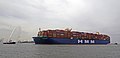 ROTTERDAM , HMM ALGECIRAS & VB CHEETAH.jpg 3,592 × 1,735; 3.11 MB
-
 Rotterdam Harbours Wikivoyage Banner.jpg 2,340 × 334; 663 KB
-
 Rotterdam Maasvlakte 2 - panoramio.jpg 3,512 × 2,634; 932 KB
-
 RPA 15 & Pioneering Spirit (33828521803).jpg 2,435 × 1,127; 2.22 MB
-
 RPA 15 & Pioneering Spirit (34638448335).jpg 2,511 × 1,221; 2.72 MB
-
 RPA 16 & RPA 15 (34638458665).jpg 2,337 × 1,147; 1.92 MB
-
 RPA 16 (34507744141).jpg 2,683 × 1,295; 2.97 MB
-
 RT ADRIAAN, SD REBEL, STENA DON, RT SPIRIT & SD STINGRAY (20044392078).jpg 3,448 × 1,856; 1.88 MB
-
 SAIPEM 7000 (32667648507).jpg 3,726 × 2,005; 3.5 MB
-
 SAIPEM 7000 (47557017082).jpg 3,276 × 2,096; 2.89 MB
-
 SIF (29715952967).jpg 2,890 × 1,699; 2.9 MB
-
 SKANDI AFRICA (20011331673).jpg 3,365 × 1,764; 2.12 MB
-
 Slufter, Tweede Maasvlakte, Harbour expansion, Rotterdam, NL.jpg 6,100 × 6,100; 6.9 MB
-

-
 SMIT CHEETAH , TEXELBANK & DOCKWISE VANGUARD (24982260169).jpg 5,087 × 2,481; 2.23 MB
-
 SMIT SEINE , SD REBEL & NS BURGAS (35447600754).jpg 3,440 × 1,652; 4.94 MB
-
 STENA NATALITA & PIONEER SPIRIT. (17198538112).jpg 3,395 × 1,844; 1.66 MB
-
 TRITON , SMIT PANTHER , SD REBEL & MUNICH MAERSK (35796617434).jpg 3,306 × 1,588; 2.63 MB
-
 TRITON , SMIT PANTHER , SD REBEL & MUNICH MAERSK (35796617794).jpg 3,310 × 1,630; 2.67 MB
-
 TRITON , SMIT PANTHER , SD REBEL & MUNICH MAERSK (35796618054).jpg 3,421 × 1,558; 2.89 MB
-
 TRITON , SMIT PANTHER, SD REBEL & MUNICH MAERSK (35796617114) (cropped).jpg 2,504 × 1,129; 1.86 MB
-
 TRITON , SMIT PANTHER, SD REBEL & MUNICH MAERSK (35796617114).jpg 2,504 × 1,286; 1.92 MB
-
 TRUSTEE & HERCULES TRIUMPH (15674595229).jpg 2,808 × 1,800; 1.35 MB
-
 VB CHEETAH & HMM ALGECIRAS (49970356932).jpg 3,450 × 1,752; 3.32 MB
-
 VENUS , SMIT PANTHER , STENA DON , HEBO-CAT 7 , SMIT CHEETAH & BEAGLE (40182094883).jpg 3,224 × 1,730; 3.64 MB
-
 Windmolen op Maasvlakte 2 (48914743478).jpg 3,026 × 1,576; 3.26 MB
-
Windturbine Maasvlakte 2 - 3.webm 4.6 s, 2,160 × 3,840; 1.65 MB
-
Windturbines Maasvlakte 2 - 4.webm 3.2 s, 3,840 × 2,160; 20.5 MB
-
Windturbines Maasvlakte 2 - 5.webm 2.6 s, 2,160 × 3,840; 31.35 MB
-
 Windturbines Maasvlakte 2 -1.jpg 3,072 × 4,080; 4.09 MB
-
 Windturbines Maasvlakte 2 -2.jpg 4,080 × 3,072; 7.62 MB
.jpg)
.jpg)
.jpg)
.jpg)
.jpg)
.jpg)
.jpg)
.jpg)
.jpg)
.jpg)
.jpg)
.jpg)
.jpg)
.jpg)
.jpg)
.jpg)
.jpg)
.jpg)
.jpg)
.jpg)
.jpg)
.jpg)
.jpg)
.jpg)
.jpg)
.jpg)
.jpg)
.jpg)
.jpg)
.jpg)
.jpg)
.jpg)
_001.jpg)
.jpg)
.jpg)
.jpg)
.jpg)
.jpg)


.jpg)
.jpg)
.jpg)
.jpg)
.jpg)
.jpg)
.jpg)
.jpg)
.jpg)
.jpg)
.jpg)
.jpg)
.jpg)
.jpg)
.jpg)
.jpg)


.jpg)
.jpg)
.jpg)


.jpg)
.jpg)
.jpg)
.jpg)

.jpg)


.jpg)
.jpg)
.jpg)
.jpg)
.jpg)
.jpg)
.jpg)
.jpg)
.jpg)
.jpg)
.jpg)
.jpg)
.jpg)
.jpg)
.jpg)
.jpg)
.jpg)
.jpg)

.jpg)
.jpg)
.jpg)
_(cropped).jpg)
.jpg)
.jpg)
.jpg)
.jpg)
.jpg)
.jpg)
.jpg)
.jpg)
.jpg)
.jpg)
.jpg)
_004.jpg)
_005.jpg)
_006.jpg)
_007.jpg)
_008.jpg)
_011.jpg)
_012.jpg)
_013.jpg)
_014.jpg)
_015.jpg)
_016.jpg)
_017.jpg)
_018.jpg)
.jpg)
.jpg)
.jpg)
.jpg)
.jpg)
.jpg)
.jpg)
.jpg)
.jpg)
.jpg)
.jpg)


.jpg)
.jpg)
.jpg)
.jpg)
.jpg)
.jpg)
.jpg)
.jpg)
.jpg)

.jpg)
.jpg)
.jpg)
.jpg)
.jpg)
.jpg)
.jpg)
_(cropped).jpg)
.jpg)
.jpg)
.jpg)
.jpg)
.jpg)


.jpg)
.jpg)
.jpg)
.jpg)
_009.jpg)
_010.jpg)
.jpg)
.jpg)