
Category:Maastricht in the 18th century
Subcategories
This category has the following 12 subcategories, out of 12 total.
Media in category "Maastricht in the 18th century"
The following 14 files are in this category, out of 14 total.
-
 Aanzicht - Heemskerk - 20104565 - RCE.jpg 1,199 × 1,171; 813 KB
-
 Atlas Schoemaker-GELDERLAND-1102RR-Gelderland, Maastricht.jpeg 1,350 × 1,162; 177 KB
-
 Bidweg Sterre der Zee 2 (ca 1700-1796).jpg 1,419 × 911; 725 KB
-
 Fortifikationskarta över Masstricht - Skoklosters slott - 98000a.tif 2,867 × 990; 8.13 MB
-
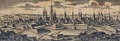
 Gezicht op Maastricht (unknown artist, 18th c.) - detail.jpg 5,675 × 2,169; 7.8 MB
-
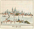
 Maas, Wyck en Maastricht, ca 1700.jpg 2,800 × 1,117; 1.8 MB
-
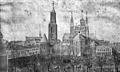 Tekening van het Vrijthof - Maastricht - 20407579 - RCE.jpg 1,200 × 717; 468 KB
-
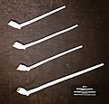 Top or Topic (CC, Maastricht), kleipijpen uit Maastricht, 17e-18e eeuw.jpg 2,099 × 2,017; 1.4 MB
-
 Von Geusau & anonymus, plattegrond Maastricht 1.jpg 2,331 × 2,201; 1.87 MB
-
 Von Geusau & anonymus, plattegrond Maastricht 2.jpg 2,629 × 2,032; 1.87 MB
-
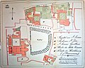
 Von Geusau & anonymus, plattegrond Maastricht 2a (cropped).jpg 1,079 × 765; 332 KB
-
 Von Geusau & anonymus, plattegrond Maastricht 3.jpg 2,888 × 2,309; 2.43 MB
-
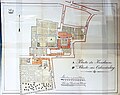
 Von Geusau & anonymus, plattegrond Maastricht 4 (cropped).jpg 1,780 × 1,221; 773 KB
-
 Von Geusau & anonymus, plattegrond Maastricht 4.jpg 2,996 × 2,368; 2.31 MB


.jpg)

,_kleipijpen_uit_Maastricht,_17e-18e_eeuw.jpg)


.jpg)

.jpg)

_-_detail.jpg)