Category:Maartenskerk (Hillegom)
Jump to navigation
Jump to search
| Object location | | View all coordinates using: OpenStreetMap |
|---|
protestant church in Hillegom, Netherlands  | |||||
| Upload media | |||||
| Instance of | |||||
|---|---|---|---|---|---|
| Dedicated to | |||||
| Location | Hillegom, South Holland, Netherlands | ||||
| Street address |
| ||||
| Located on street |
| ||||
| Heritage designation |
| ||||
| Religion or worldview | |||||
 | |||||
|
This is a category about rijksmonument number 22136
|
| Address |
|
Media in category "Maartenskerk (Hillegom)"
The following 47 files are in this category, out of 47 total.
-
 Fragment sacramentshuisje - Hillegom - 20112886 - RCE.jpg 893 × 1,200; 333 KB
-
 Hillegom Hoofdstraat 1929 - Oude Raadhuis en Maartenskerk - 20112872 - RCE.jpg 873 × 1,200; 209 KB
-
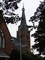 HILLEGOM karke.jpg 480 × 640; 304 KB
-
 Hillegom, de Maartenskerk RM22136 foto1 2014-04-13 15.02.jpg 3,133 × 4,352; 8.49 MB
-
 Hillegom, kerk2 2007-04-18 14.11 foto1.JPG 1,704 × 2,272; 1.12 MB
-
 Hillegom, ophaalbrug met de toren van de Maartenskerk RM22136 foto5 2017-04-09 16.06.jpg 4,352 × 2,904; 8.16 MB
-
 Hillegom, view to the Maartenskerk.jpg 2,551 × 1,701; 1.39 MB
-
 Hillegomse Korendag 2011.JPG 4,000 × 3,000; 4.1 MB
-
 Houttuin en Hoofdstraat - Hillegom - 20112913 - RCE.jpg 1,190 × 1,200; 350 KB
-
 Interieur koor - Hillegom - 20112900 - RCE.jpg 958 × 1,200; 211 KB
-
 Interieur naar het oosten - Hillegom - 20112899 - RCE.jpg 1,200 × 960; 204 KB
-
 Interieur, oude foto Gemeente Archief Leiden - Hillegom - 20112894 - RCE.jpg 1,200 × 1,181; 233 KB
-
 INTERIEUR, TEKSTBORD (TIEN GEBODEN BORD) - Hillegom - 20263065 - RCE.jpg 775 × 1,200; 187 KB
-
 INTERIEUR, TEKSTBORD - Hillegom - 20263064 - RCE.jpg 775 × 1,200; 204 KB
-
 Jan Adriaan van Eijk, Hillegom - Afb CROA00023000001.jpg 2,279 × 2,886; 732 KB
-
 Jan Adriaan van Eijk, Hillegom Afb CROA00020000001.jpg 2,285 × 2,839; 581 KB
-
 Maartenskerk - Hillegom - 20112869 - RCE.jpg 888 × 1,200; 171 KB
-
 Maartenskerk - Hillegom - 20112870 - RCE.jpg 876 × 1,200; 179 KB
-
 Maartenskerk - Hillegom - 20112871 - RCE.jpg 882 × 1,200; 185 KB
-
 Maartenskerk - Hillegom - 20112873 - RCE.jpg 1,200 × 876; 214 KB
-
 Maartenskerk - Hillegom - 20112874 - RCE.jpg 1,200 × 872; 229 KB
-
 Maartenskerk - Hillegom - 20112887 - RCE.jpg 958 × 1,200; 179 KB
-
 Maartenskerk - Hillegom - 20112888 - RCE.jpg 1,200 × 1,192; 337 KB
-
 Maartenskerk - Hillegom - 20112893 - RCE.jpg 1,200 × 1,185; 231 KB
-
 Maartenskerk - Hillegom - 20112903 - RCE.jpg 897 × 1,200; 247 KB
-
 Maartenskerk 1607 - Hillegom - 20112889 - RCE.jpg 1,188 × 1,200; 274 KB
-
 Maartenskerk Hillegom.JPG 2,304 × 3,072; 1.71 MB
-
 Maartenskerk interieur - Hillegom - 20112898 - RCE.jpg 1,200 × 953; 230 KB
-
 Maartenskerk, Epitaaf - Hillegom - 20263066 - RCE.jpg 775 × 1,200; 116 KB
-
 Na de restauratie naar het zuid-westen - Hillegom - 20112879 - RCE.jpg 885 × 1,200; 238 KB
-
 Na de restauratie naar het zuid-westen - Hillegom - 20112880 - RCE.jpg 887 × 1,200; 291 KB
-
 Na de restauratie naar het zuid-westen - Hillegom - 20112881 - RCE.jpg 885 × 1,200; 233 KB
-
 Na de restauratie naar het zuiden - Hillegom - 20112877 - RCE.jpg 880 × 1,200; 191 KB
-
 Na de restauratie naar het zuiden - Hillegom - 20112878 - RCE.jpg 881 × 1,200; 207 KB
-
 Preekstoel - Hillegom - 20112885 - RCE.jpg 902 × 1,200; 203 KB
-
 Preekstoel - Hillegom - 20112901 - RCE.jpg 964 × 1,200; 241 KB
-
 Prent ca. 1833 gezicht op de kerk - Hillegom - 20112891 - RCE.jpg 1,192 × 1,200; 283 KB
-
 Tekstbord - Hillegom - 20112904 - RCE.jpg 948 × 1,200; 216 KB
-
 Tekstbord - Hillegom - 20112905 - RCE.jpg 957 × 1,200; 215 KB
-
 Tekstbord - Hillegom - 20112906 - RCE.jpg 953 × 1,200; 134 KB
-
 Toren vanuit het westen - Hillegom - 20112876 - RCE.jpg 896 × 1,200; 171 KB
-
 Toren vanuit het zuiden - Hillegom - 20112875 - RCE.jpg 877 × 1,200; 199 KB
-
 Toren, exterieur - Hillegom - 20112902 - RCE.jpg 911 × 1,200; 231 KB
-
 Toren, noordzijde - Hillegom - 20112895 - RCE.jpg 960 × 1,200; 192 KB
-
 Toren, noordzijde - Hillegom - 20112896 - RCE.jpg 960 × 1,200; 232 KB
-
 Toren, westzijde - Hillegom - 20112897 - RCE.jpg 948 × 1,200; 218 KB
-


_-_Hillegom_-_20263065_-_RCE.jpg)


