Category:Maarnse Grindweg 49, Maarsbergen
Jump to navigation
Jump to search
| Object location | | View all coordinates using: OpenStreetMap |
|---|
 | |||||
| Upload media | |||||
| Instance of | |||||
|---|---|---|---|---|---|
| Part of | |||||
| Location | Maarsbergen, Utrechtse Heuvelrug, Utrecht, Netherlands | ||||
| Street address |
| ||||
| Heritage designation |
| ||||
 | |||||
Nederlands: De Cruijvoort
|
This is a category about rijksmonumentcomplex number 508997
|
Bakhuis
|
This is a category about rijksmonument number 508998
|
Kapberg
|
This is a category about rijksmonument number 508999
|
Veehouderij
|
This is a category about rijksmonument number 509000
|
| Address |
|
Media in category "Maarnse Grindweg 49, Maarsbergen"
The following 15 files are in this category, out of 15 total.
-
 Interieur, - Maarsbergen - 20369987 - RCE.jpg 1,188 × 1,200; 222 KB
-
 Interieur, bakhuis - Maarsbergen - 20369983 - RCE.jpg 1,180 × 1,200; 239 KB
-
 Interieur, bakhuis - Maarsbergen - 20369984 - RCE.jpg 1,183 × 1,200; 290 KB
-
 Interieur, kelder - Maarsbergen - 20369986 - RCE.jpg 1,181 × 1,200; 217 KB
-
 Maarsbergen - Cruyvoort achterzijde RM509000.JPG 4,536 × 3,354; 1.86 MB
-
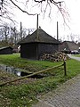
 Maarsbergen - Cruyvoort bakhuis detail RM508998.JPG 4,608 × 3,456; 750 KB
-
 Maarsbergen - Cruyvoort bakhuis, Maarnse Grindweg 49 RM508998.JPG 3,318 × 4,527; 4.31 MB
-
 Maarsbergen - Cruyvoort boerderij, Maarnse Grindweg 49 RM509000.JPG 4,608 × 3,456; 2.32 MB
-
 Maarsbergen - Cruyvoort hooiberg, Maarnse Grindweg 49 RM508999.JPG 3,456 × 4,608; 2.57 MB
-
 Maarsbergen - Cruyvoort schuur RM509673.JPG 4,608 × 3,456; 1.72 MB
-
 Maarsbergen - Cruyvoort schuur, Maarnse Grindweg 49 RM509673.JPG 4,470 × 3,306; 3.21 MB
-
 Overzicht boerderij - Maarsbergen - 20369977 - RCE.jpg 1,181 × 1,200; 357 KB
-
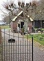
 Voor- en zijgevel boerderij - Maarsbergen - 20369981 - RCE.jpg 1,175 × 1,200; 359 KB
-
 Voor- en zijgevel boerderij - Maarsbergen - 20369985 - RCE.jpg 1,181 × 1,200; 356 KB
-
 Voorgevel boerderij - Maarsbergen - 20369982 - RCE.jpg 1,179 × 1,200; 337 KB


