Category:MC existing maps group 01 (GB counties)
Jump to navigation
Jump to search
Pages in category "MC existing maps group 01 (GB counties)"
This category contains only the following page.
Media in category "MC existing maps group 01 (GB counties)"
The following 91 files are in this category, out of 91 total.
-
 Aikin(1800) p237 - Bedfordshire.jpg 1,070 × 1,807; 309 KB
-
 Pigot and Co (1842) p1.022 - Map of Bedfordshire.jpg 1,293 × 2,172; 833 KB
-
 Aikin(1800) p352 - Berkshire.jpg 1,920 × 1,070; 369 KB
-
 Pigot and Co (1842) p1.042 - Map of Berkshire.jpg 2,160 × 1,293; 756 KB
-
 Aikin(1800) p232 - Buckinghamshire.jpg 1,070 × 1,911; 401 KB
-
 Pigot and Co (1842) p1.066 - Map of Buckinghamshire.jpg 1,293 × 2,172; 863 KB
-
 Aikin(1800) p262 - Cambridgeshire.jpg 1,174 × 1,781; 398 KB
-
 Pigot and Co (1842) p1.086 - Map of Cambridgeshire.jpg 1,293 × 2,172; 807 KB
-
 Aikin(1800) p114 - Cheshire.jpg 1,904 × 1,070; 373 KB
-
 Pigot and Co (1842) p2.018 - Map of Cheshire.jpg 2,144 × 1,310; 937 KB
-
 BRADSHAW(1854) p190 CHESHIRE.jpg 4,252 × 3,158; 6.5 MB
-
 Aikin(1800) p426 - Cornwall.jpg 1,949 × 1,184; 415 KB
-
 Pigot and Co (1842) p1.106 - Map of Cornwall.jpg 2,160 × 1,293; 787 KB
-
 Cornwall - Christopher Saxton, 1579, 5 - BL.jpg 1,469 × 1,166; 939 KB
-
 Aikin(1800) p060 - Durham.jpg 1,936 × 1,172; 381 KB
-
 Pigot and Co (1842) p2.094 - Map of Durham.jpg 2,144 × 1,310; 897 KB
-
 Aikin(1800) p051 - Cumberland.jpg 1,187 × 1,870; 431 KB
-
 Pigot and Co (1842) p2.042 - Map of Cumberland.jpg 1,310 × 2,158; 806 KB
-
 Pigot and Co (1842) p2.066 - Map of Derbyshire.jpg 1,310 × 2,158; 940 KB
-
 Aikin(1800) p155 - Derbyshire.jpg 1,070 × 1,797; 340 KB
-
 Aikin(1800) p411 - Devonshire.jpg 1,952 × 1,182; 393 KB
-
 Pigot and Co (1842) p1.130 - Map of Devonshire.jpg 2,160 × 1,363; 861 KB
-
 Devon - Lord Burghley's Atlas (1579), ff.11v-12 - BL Royal MS 18 D III.jpg 1,574 × 1,215; 1,000 KB
-
 Aikin(1800) p381 - Dorset.jpg 1,952 × 1,070; 346 KB
-
 Pigot and Co (1842) p1.166 - Map of Dorsetshire.jpg 2,160 × 1,359; 852 KB
-
 Aikin(1800) p294 - Essex.jpg 1,948 × 1,168; 481 KB
-
 Pigot and Co (1842) p1.186 - Map of Essex.jpg 2,160 × 1,349; 843 KB
-
 Aikin(1800) p210 - Gloucestershire.jpg 1,159 × 1,665; 392 KB
-
 Pigot and Co (1842) p1.220 - Map of Gloucestershire.jpg 1,343 × 2,172; 968 KB
-
 Aikin(1800) p368 - Hampshire.jpg 1,174 × 1,875; 436 KB
-
 Pigot and Co (1842) p1.248 - Map of Hampshire.jpg 1,293 × 2,172; 866 KB
-
 Aikin(1800) p134 - Herefordshire.jpg 1,193 × 1,818; 416 KB
-
 Pigot and Co (1842) p2.118 - Map of Herefordshire.jpg 1,310 × 2,158; 970 KB
-
 Pigot and Co (1842) p1.276 - Map of Hertfordshire.jpg 2,160 × 1,362; 804 KB
-
 Aikin(1800) p256 - Huntingdonshire.jpg 1,119 × 1,861; 376 KB
-
 Pigot and Co (1842) p1.304 - Map of Huntingdonshire.jpg 1,293 × 2,172; 748 KB
-
 Aikin(1800) p329 - Kent.jpg 1,952 × 1,070; 393 KB
-
 Aikin(1800) p099 - Lancashire.jpg 1,070 × 1,835; 373 KB
-
 Pigot and Co (1842) p2.138 - Map of Lancashire.jpg 1,310 × 2,158; 881 KB
-
 BRADSHAW(1854) p180 LANCASHIRE.jpg 3,099 × 4,315; 6.79 MB
-
 Aikin(1800) p174 - Leicestershire.jpg 1,173 × 1,600; 327 KB
-
 Pigot and Co (1842) p2.196 - Map of Leicestershire and Rutlandshire.jpg 2,144 × 1,310; 904 KB
-
 Aikin(1800) p244 - Lincolnshire.jpg 1,104 × 1,923; 451 KB
-
 Pigot and Co (1842) p2.224 - Map of Lincolnshire.jpg 1,310 × 2,158; 961 KB
-
 Aikin(1800) p309 - Middlesex.jpg 1,936 × 1,179; 314 KB
-
 Pigot and Co (1842) p1.360 - Map of Middlesex.jpg 2,070 × 1,345; 622 KB
-
 Pigot and Co (1842) p2.260 - Map of Monmouthshire.jpg 1,310 × 2,158; 832 KB
-
 Aikin(1800) p140 - Monmouthshire.jpg 1,117 × 1,626; 351 KB
-
 Aikin(1800) p271 - Norfolk.jpg 1,952 × 1,106; 391 KB
-
 Pigot and Co (1842) p1.416 - Map of Norfolk.jpg 2,160 × 1,345; 850 KB
-
 Aikin(1800) p187 - Northamptonshire.jpg 1,193 × 1,660; 321 KB
-
 Pigot and Co (1842) p2.280 - Map of Northamptonshire.jpg 1,310 × 2,158; 922 KB
-
 Aikin(1800) p040 - Northumberland.jpg 1,166 × 1,932; 458 KB
-
 Pigot and Co (1842) p2.300 - Map of Northumberland.jpg 1,310 × 2,158; 820 KB
-
 Aikin(1800) p146 - Nottinghamshire.jpg 1,070 × 1,905; 362 KB
-
 Pigot and Co (1842) p2.328 - Map of Nottinghamshire.jpg 1,310 × 2,158; 829 KB
-
 Aikin(1800) p222 - Oxfordshire.jpg 1,129 × 1,789; 344 KB
-
 Pigot and Co (1842) p1.448 - Map of Oxfordshire.jpg 1,293 × 2,172; 787 KB
-
 Aikin(1800) p182 - Rutland.jpg 1,176 × 1,565; 314 KB
-
 Aikin(1800) p125 - Shropshire.jpg 1,162 × 1,845; 395 KB
-
 Pigot and Co (1842) p2.352 - Map of Shropshire.jpg 1,310 × 2,158; 866 KB
-
 Aikin(1800) p394 - Somerset.jpg 1,910 × 1,104; 439 KB
-
 Pigot and Co (1842) p1.468 - Map of Somersetshire.jpg 2,160 × 1,293; 849 KB
-
 Aikin(1800) p165 - Staffordshire.jpg 1,070 × 1,900; 367 KB
-
 Pigot and Co (1842) p2.380 - Map of Staffordshire.jpg 1,310 × 2,158; 933 KB
-
 Aikin(1800) p285 - Suffolk.jpg 1,952 × 1,148; 405 KB
-
 Pigot and Co (1842) p1.500 - Map of Suffolk.jpg 2,160 × 1,372; 842 KB
-
 Aikin(1800) p322 - Surrey.jpg 1,856 × 1,165; 375 KB
-
 Pigot and Co (1842) p1.528 - Map of Surrey.jpg 2,160 × 1,293; 794 KB
-
 Pigot and Co (1842) p1.556 - Map of Sussex.jpg 2,160 × 1,293; 778 KB
-
 Aikin(1800) p344 - Sussex.jpg 1,952 × 1,006; 379 KB
-
 Aikin(1800) p196 - Warwickshire.jpg 1,126 × 1,876; 378 KB
-
 Pigot and Co (1842) p2.416 - Map of Warwickshire.jpg 1,310 × 2,158; 902 KB
-
 Aikin(1800) p091 - Westmorland.jpg 1,952 × 1,165; 397 KB
-
 Pigot and Co (1842) p2.444 - Map of Westmorland.jpg 2,144 × 1,310; 736 KB
-
 Aikin(1800) p359 - Wiltshire.jpg 1,070 × 1,925; 363 KB
-
 Pigot and Co (1842) p1.584 - Map of Wiltshire.jpg 1,293 × 2,172; 873 KB
-
 Aikin(1800) p203 - Worcestershire.jpg 1,143 × 1,740; 303 KB
-
 Pigot and Co (1842) p2.460 - Map of Worcestershire.jpg 1,310 × 2,158; 866 KB
-
 Aikin(1800) p070 - Yorkshire.jpg 2,020 × 1,184; 511 KB
-
 Pigot and Co (1842) p2.488 - Map of Yorkshire.jpg 4,148 × 3,722; 4.1 MB
-
 LEWIS(1833) p1.115 BRECKNOCKSHIRE.jpg 2,179 × 2,833; 2.76 MB
-
 LEWIS(1833) p1.199 CARNARVONSHIRE.jpg 2,885 × 2,361; 3.01 MB
-
 LEWIS(1833) p1.159 CARDINGSHIRE.jpg 2,789 × 2,257; 2.69 MB
-
 LEWIS(1833) p1.181 CARMARTHENSHIRE.jpg 2,887 × 2,285; 3.24 MB
-
 LEWIS(1833) p1.260 DENBIGHSHIRE.jpg 2,825 × 2,207; 3.35 MB
-
 LEWIS(1833) p1.301 FLINTSHIRE.jpg 2,795 × 2,205; 3.06 MB
-
 LEWIS(1833) p2.605 MERIONETSHIRE.jpg 2,895 × 2,371; 3.46 MB
-
 LEWIS(1833) p2.633 MONTGOMERYSHIRE.jpg 2,795 × 2,187; 2.79 MB
-
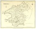 LEWIS(1833) p2.676 PEMBROKE.jpg 2,889 × 2,357; 3.29 MB
-
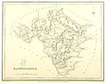 LEWIS(1833) p2.718 RADNORSHIRE.jpg 2,723 × 2,169; 2.73 MB
_p237_-_Bedfordshire.jpg)
_p1.022_-_Map_of_Bedfordshire.jpg)
_p352_-_Berkshire.jpg)
_p1.042_-_Map_of_Berkshire.jpg)
_p232_-_Buckinghamshire.jpg)
_p1.066_-_Map_of_Buckinghamshire.jpg)
_p262_-_Cambridgeshire.jpg)
_p1.086_-_Map_of_Cambridgeshire.jpg)
_p114_-_Cheshire.jpg)
_p2.018_-_Map_of_Cheshire.jpg)
_p190_CHESHIRE.jpg)
_p426_-_Cornwall.jpg)
_p1.106_-_Map_of_Cornwall.jpg)

_p060_-_Durham.jpg)
_p2.094_-_Map_of_Durham.jpg)
_p051_-_Cumberland.jpg)
_p2.042_-_Map_of_Cumberland.jpg)
_p2.066_-_Map_of_Derbyshire.jpg)
_p155_-_Derbyshire.jpg)
_p411_-_Devonshire.jpg)
_p1.130_-_Map_of_Devonshire.jpg)
,_ff.11v-12_-_BL_Royal_MS_18_D_III.jpg)
_p381_-_Dorset.jpg)
_p1.166_-_Map_of_Dorsetshire.jpg)
_p294_-_Essex.jpg)
_p1.186_-_Map_of_Essex.jpg)
_p210_-_Gloucestershire.jpg)
_p1.220_-_Map_of_Gloucestershire.jpg)
_p368_-_Hampshire.jpg)
_p1.248_-_Map_of_Hampshire.jpg)
_p134_-_Herefordshire.jpg)
_p2.118_-_Map_of_Herefordshire.jpg)
_p1.276_-_Map_of_Hertfordshire.jpg)
_p256_-_Huntingdonshire.jpg)
_p1.304_-_Map_of_Huntingdonshire.jpg)
_p329_-_Kent.jpg)
_p099_-_Lancashire.jpg)
_p2.138_-_Map_of_Lancashire.jpg)
_p180_LANCASHIRE.jpg)
_p174_-_Leicestershire.jpg)
_p2.196_-_Map_of_Leicestershire_and_Rutlandshire.jpg)
_p244_-_Lincolnshire.jpg)
_p2.224_-_Map_of_Lincolnshire.jpg)
_p309_-_Middlesex.jpg)
_p1.360_-_Map_of_Middlesex.jpg)
_p2.260_-_Map_of_Monmouthshire.jpg)
_p140_-_Monmouthshire.jpg)
_p271_-_Norfolk.jpg)
_p1.416_-_Map_of_Norfolk.jpg)
_p187_-_Northamptonshire.jpg)
_p2.280_-_Map_of_Northamptonshire.jpg)
_p040_-_Northumberland.jpg)
_p2.300_-_Map_of_Northumberland.jpg)
_p146_-_Nottinghamshire.jpg)
_p2.328_-_Map_of_Nottinghamshire.jpg)
_p222_-_Oxfordshire.jpg)
_p1.448_-_Map_of_Oxfordshire.jpg)
_p182_-_Rutland.jpg)
_p125_-_Shropshire.jpg)
_p2.352_-_Map_of_Shropshire.jpg)
_p394_-_Somerset.jpg)
_p1.468_-_Map_of_Somersetshire.jpg)
_p165_-_Staffordshire.jpg)
_p2.380_-_Map_of_Staffordshire.jpg)
_p285_-_Suffolk.jpg)
_p1.500_-_Map_of_Suffolk.jpg)
_p322_-_Surrey.jpg)
_p1.528_-_Map_of_Surrey.jpg)
_p1.556_-_Map_of_Sussex.jpg)
_p344_-_Sussex.jpg)
_p196_-_Warwickshire.jpg)
_p2.416_-_Map_of_Warwickshire.jpg)
_p091_-_Westmorland.jpg)
_p2.444_-_Map_of_Westmorland.jpg)
_p359_-_Wiltshire.jpg)
_p1.584_-_Map_of_Wiltshire.jpg)
_p203_-_Worcestershire.jpg)
_p2.460_-_Map_of_Worcestershire.jpg)
_p070_-_Yorkshire.jpg)
_p2.488_-_Map_of_Yorkshire.jpg)
_p1.115_BRECKNOCKSHIRE.jpg)
_p1.199_CARNARVONSHIRE.jpg)
_p1.159_CARDINGSHIRE.jpg)
_p1.181_CARMARTHENSHIRE.jpg)
_p1.260_DENBIGHSHIRE.jpg)
_p1.301_FLINTSHIRE.jpg)
_p2.605_MERIONETSHIRE.jpg)
_p2.633_MONTGOMERYSHIRE.jpg)
_p2.676_PEMBROKE.jpg)
_p2.718_RADNORSHIRE.jpg)