Category:M62 motorway in Merseyside
Jump to navigation
Jump to search
| Counties: | |
|---|---|
| Services: | |
| Connections: | |
| Coordinates: | |
Subcategories
This category has the following 3 subcategories, out of 3 total.
Media in category "M62 motorway in Merseyside"
The following 27 files are in this category, out of 27 total.
-
 Bridge under the M62 - geograph.org.uk - 83775.jpg 640 × 426; 78 KB
-
 End of the M 62 - geograph.org.uk - 1538999.jpg 640 × 414; 45 KB
-
 Footbridge over M62 - geograph.org.uk - 1151779.jpg 640 × 480; 97 KB
-
 Greystone Bridge 4.jpg 5,152 × 3,864; 6.9 MB
-
 Greystone Bridge 5.jpg 5,010 × 3,636; 7.35 MB
-

-
 M62 at Tarbock Island - geograph.org.uk - 999338.jpg 640 × 480; 108 KB
-
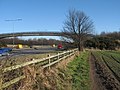
 M62 by Union Bank Farm - geograph.org.uk - 28264.jpg 640 × 426; 91 KB
-
 M62 east from Tarbock Island 1.jpg 5,184 × 3,456; 6.42 MB
-
 M62 east from Tarbock Island 2.jpg 5,184 × 3,456; 6.35 MB
-
 M62 east from Whitefield Lane Bridge.jpg 4,980 × 3,232; 8.06 MB
-
 M62 from Carr Lane Footbridge - geograph.org.uk - 1151674.jpg 640 × 480; 62 KB
-
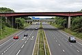
 M62 from Junction 7, Rainhill - geograph.org.uk - 28897.jpg 640 × 426; 93 KB
-
 M62 motorway beyond the tree - geograph.org.uk - 291341.jpg 640 × 425; 77 KB
-
 M62 motorway from Greystone Road footbridge (1).JPG 4,320 × 3,240; 3.12 MB
-
 M62 motorway from Greystone Road footbridge (2).JPG 4,320 × 3,240; 3.22 MB
-
M62 motorway from the Greystone Road footbridge.ogv 31 s, 1,280 × 720; 10.27 MB
-
 M62 motorway from the Yew Tree Road footbridge, Huyton (1).JPG 4,320 × 3,240; 3.54 MB
-
 M62 motorway from the Yew Tree Road footbridge, Huyton (2).JPG 4,320 × 3,240; 3.3 MB
-
 M62 west from Tarbock Island 1.jpg 5,184 × 3,456; 6.43 MB
-
 M62 west from Tarbock Island 2.jpg 5,184 × 3,456; 6.05 MB
-
 M62 west from Whitefield Lane Bridge.jpg 4,916 × 3,288; 7.63 MB
-
 Merging traffic - geograph.org.uk - 998655.jpg 640 × 464; 53 KB
-
 Merging traffic - geograph.org.uk - 998657.jpg 471 × 640; 56 KB
-
 Pedestrian subway under the M62 motorway at Roby.JPG 4,320 × 3,240; 3.16 MB
-

-
 Stobart truck on the M62, St Helens, 12 March 2013.jpg 640 × 480; 441 KB


.JPG)
.JPG)
.JPG)
.JPG)


