Category:M2 (road sign, France)
Jump to navigation
Jump to search
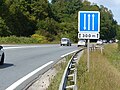
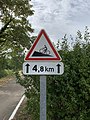
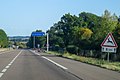
Le panonceau M2 peut être utilisé en complément des panneaux de type A, AB, B, C et CE [1].
Media in category "M2 (road sign, France)"
The following 160 files are in this category, out of 160 total.
-
 France road sign M2 (1500 m).svg 520 × 145; 10 KB
-
 France road sign M2.svg 400 × 145; 8 KB
-
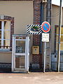 Chevannes-FR-45-publiphone-22.jpg 2,736 × 3,648; 1.93 MB
-
 Rue Dombasle - Montreuil (FR93) - 2020-10-14 - 1.jpg 4,032 × 3,024; 4.42 MB
-
 Warcq (Ardennes) city limit sign.JPG 3,648 × 2,736; 4.07 MB
-
 Plaque Rue Principale - Bénonces (FR01) - 2020-09-16 - 2.jpg 4,032 × 3,024; 4.93 MB
-
 Lachassagne - Panneaux itinéraires touristiques (sept 2018).jpg 2,569 × 4,327; 2.06 MB
-
 Linthes-FR-51-panneau-14.JPG 2,736 × 3,648; 1.53 MB
-
 Panneau entrée Neuville Dames 4.jpg 5,184 × 3,456; 6.1 MB
-
 Route Bourg - Vésines (FR01) - 2020-09-14 - 6.jpg 4,032 × 3,024; 4.25 MB
-
 Bureau Poste Coubron 1.jpg 4,032 × 3,024; 4.28 MB
-
 Bureau Poste Coubron 3.jpg 4,032 × 3,024; 4.41 MB
-
 Linthes-FR-51-panneau-15.JPG 3,648 × 2,736; 1.19 MB
-
 Rue de Navarre (Bellerive-sur-Allier) 2024-01-01.JPG 2,992 × 2,000; 1.99 MB
-
 Stades de Chevreuse 2012 4.jpg 5,184 × 3,456; 6.36 MB
-
 Marcenat VL30 sur 200 m 2015-08-12.JPG 2,816 × 2,112; 1.43 MB
-
 Route Bourg St Cyr Menthon 22.jpg 4,032 × 3,024; 1.52 MB
-
 Route Bourg St Cyr Menthon 8.jpg 5,184 × 3,456; 8.62 MB
-
 Route Mâcon St Cyr Menthon 18.jpg 4,032 × 3,024; 5.43 MB
-
 A49 panneau A16 5% 300 m.jpg 3,200 × 2,400; 2.86 MB
-
 A6 - 2019-09-16 - IMG 3239.jpg 2,206 × 1,473; 1.53 MB
-
 A6 - 2019-09-16 - IMG 3240.jpg 2,105 × 1,405; 1.37 MB
-
 Bairon-08-panneaux digue-D03.JPG 2,736 × 3,648; 1.09 MB
-
 D903 panneaux C29b M2 zoom.jpg 4,000 × 3,000; 4.75 MB
-
 D903 panneaux C29b M2.jpg 4,000 × 3,000; 4.8 MB
-
 Panneau B6d panonceau M2 300 m.jpg 5,472 × 3,648; 5.54 MB
-
 Poste d'appel d'urgence et d'un moyen de lutte contre l'incendie au tunnel du Galibier.jpg 3,800 × 2,850; 3.88 MB
-
 Signalisation routière entrée sud tunnel du Galibier (2).jpg 3,000 × 4,000; 3.82 MB
-
 Signalisation routière entrée sud tunnel du Galibier.jpg 4,000 × 3,000; 3.61 MB
-
 Sud Tunnel du Galibier en fin d'été (septembre 2024).JPG 3,060 × 2,336; 5.33 MB
-
 A43 - 2013-07-27 - IMG 1531.jpg 4,906 × 3,270; 8.69 MB
-
 A49 flèche lumineuse de rabattement, balise J14a, panneau A16.jpg 4,000 × 3,000; 4.54 MB
-

-
 Pente 14 pour cent (D 906B) 2015-08-26.JPG 2,816 × 2,112; 1.47 MB
-
 Rue des Prés Liats (Gannat) (1) 2022-02-13.JPG 2,992 × 2,000; 1.98 MB
-
 Rue des Prés Liats (Gannat) (2) 2022-02-13.JPG 2,992 × 2,000; 1.93 MB
-
 Rue Lattre Tassigny Pt Vaux 1.jpg 5,184 × 3,456; 7.61 MB
-
 Rue Lattre Tassigny Pt Vaux 2.jpg 5,184 × 3,456; 7.09 MB
-
 W2389-Rogerville A29 Panneau 97170.JPG 4,752 × 3,168; 3.75 MB
-
 Tunnel on N205.jpg 1,616 × 1,454; 1.12 MB
-
 Route Condeissiat Chaveyriat 1.jpg 4,032 × 3,024; 6.19 MB
-
 Contournement sud-ouest de Vichy depuis le pont de la D 221, vers Vichy 2022-06-11.JPG 2,992 × 2,000; 2.07 MB
-
 Grande Rue St André Bâgé 2.jpg 4,032 × 3,024; 4.81 MB
-
 Panneaux A19 B6d M2.jpg 4,000 × 2,248; 3.96 MB
-
 N202 panneaux C29b M2.jpg 3,800 × 2,850; 3.45 MB
-
 A51 tunnel d'Uriol panneaux B17 B14 M4m M2.jpg 3,808 × 2,856; 3.46 MB
-
 A51 tunnel d'Uriol panneaux B3a B6d M2 C111 M9z B14 B17 M4m.jpg 4,000 × 3,000; 4.77 MB
-
 D2209 03 2 voies dans un sens 1 dans l'autre.jpg 1,920 × 1,080; 495 KB
-
 Panneau A19 M2 700m.jpg 4,000 × 3,000; 4.66 MB
-
 A71 vers Clermont-Ferrand depuis la D 998 (Gannat) - Fin de montée 2022-02-13.JPG 2,992 × 2,000; 1.98 MB
-
 N88 Panneaux A16 M9j1 M2 1000m.jpg 1,600 × 1,200; 790 KB
-
 Route Vonnas St Genis Menthon 4.jpg 4,032 × 3,024; 5.33 MB
-
 Succession virage premier à droite (D 906B) 2015-08-26.JPG 2,816 × 2,112; 1.39 MB
-
 Panneau tunnel du Vieux Port à Bastia.jpg 3,840 × 2,880; 3.88 MB
-
 Entrée Sud Tunnel des Monts à Chambéry (hiver 2020).JPG 3,176 × 2,372; 3.88 MB
-
 N201 barrière XK3 avec B1 et KR2 devant le tunnel des Monts.jpg 3,600 × 2,700; 3.13 MB
-
 N201 PMV XC50 dédié devant le tunnel des Monts.jpg 3,800 × 2,850; 3.43 MB
-
 Col du Galibier 3 (cropped).jpg 4,707 × 3,135; 4.19 MB
-
 Col du Galibier 3.jpg 5,472 × 3,648; 5.78 MB
-
 Panneau A19 au col du Galibier.jpg 4,000 × 3,000; 4.7 MB
-
 Autoroute A43 - La Maurienne - 2012-07-16 - IMG 5857.jpg 4,582 × 3,055; 8.43 MB
-
 Autoroute A43 - La Maurienne - 2012-07-16 - IMG 5859.jpg 5,184 × 3,456; 7.65 MB
-
 Barby (Ardennes) city limit sign.JPG 4,320 × 3,240; 4.59 MB
-
 Barby (Ardennes) panneau d'agglomération.JPG 1,908 × 2,648; 2.22 MB
-
 Col de la Sausse - Attention animaux domestiques A15a2 (mai 2022).jpg 3,024 × 4,032; 4.44 MB
-
 D994 panneau A15a2.jpg 3,500 × 2,625; 3.09 MB
-
 Entrée de Pontaumur par la D 941 (ouest) 2023-07-02.JPG 2,992 × 2,000; 2.14 MB
-
 N205 panneaux A19 M9z M2.jpg 3,284 × 1,770; 1.83 MB
-
 N88 Panneaux A16 M9j1 M2 800m.jpg 1,600 × 1,200; 717 KB
-
 A432 - 2012-07-12 - IMG 5122.jpg 4,860 × 3,240; 8.99 MB
-
 Tunnel Duchère.jpg 2,276 × 2,031; 841 KB
-
 Autoroute A43 - La Maurienne - 2012-07-16 - IMG 5854.jpg 5,184 × 3,456; 11.27 MB
-
 A40 - 2014-08-25 - MG 9519.jpg 3,534 × 2,356; 6.39 MB
-
 D 998 vers Ébreuil - Pente 8 % sur 1300 m 2022-02-13.JPG 2,992 × 2,000; 2.37 MB
-
 Panneaux A14 B11 B12 Route Corsant Perrex 1.jpg 4,032 × 3,024; 5.45 MB
-
 Panneaux A14 B11 B12 Route Corsant Perrex 2.jpg 4,032 × 3,024; 6.56 MB
-
 Quincié-en-Beaujolais - Route du Petit Saint-Cyr - Panneau 2 m largeur maxi (mars 2019).jpg 3,456 × 4,608; 6.41 MB
-
 Route de Montmarault (Sazeret) - Sortie par D 68 2022-11-06.JPG 2,992 × 2,000; 1.92 MB
-
 A40 signalisation entrée est tunnel du Vuache.jpg 4,000 × 3,000; 4.79 MB
-
 Saint-Valérien-89-Fontaine.JPG 2,101 × 2,736; 1.06 MB
-
 A41 Panneau A16 M2.jpg 2,998 × 2,248; 2.07 MB
-
 Col de la Croix Paquet - Route côté Tarare et panneau A16.jpg 3,316 × 2,655; 2.75 MB
-
 Col de la Forclaz Panneaux A19 M2.jpg 3,264 × 2,448; 2.31 MB
-
 Grand Colombier -directissime 19W.JPG 2,592 × 1,944; 2.29 MB
-
 Grand Colombier -directissime 19W2.JPG 2,592 × 1,944; 2.29 MB
-
 Panneau A15b panonceau M2 sur la rocade sud de Grenoble.jpg 3,863 × 2,821; 3.35 MB
-
 Panneau A15b route Bourg St Cyr Menthon 1.jpg 3,456 × 5,184; 7.83 MB
-
 Panneau A15b route Bourg St Cyr Menthon 2.jpg 3,456 × 5,184; 5.91 MB
-
 Panneau A15b route Bourg St Cyr Menthon 3.jpg 5,184 × 3,456; 5.7 MB
-
 Panneau A15b route Bourg St Cyr Menthon 4.jpg 5,184 × 3,456; 6.43 MB
-
 Pente30%.jpg 375 × 500; 72 KB
-
 Pente30.JPG 1,000 × 1,000; 127 KB
-
 A43 - 2019-06-14 - IMG 2646.jpg 2,205 × 1,472; 2.34 MB
-
 Entrée tunnel de la Croix-Rousse et borne SOS côté Saône (fév 2019).jpg 4,608 × 3,456; 5.23 MB
-
 Tunnel de la Croix-Rousse - entrée est.jpg 4,192 × 3,104; 3.84 MB
-
 A48 - 2019-09-19 - IMG 3557.jpg 2,236 × 1,493; 2.14 MB
-

-
 D986 63 - Début de pente 12% direction Riom 20100809.JPG 1,600 × 1,200; 489 KB
-
 Panneau A15b panonceau M2 autoroute A41.jpg 4,800 × 3,200; 4.07 MB
-
 Panneau A16 et panonceaux M9j1 M2 M9z sur A41.jpg 4,404 × 2,936; 3.49 MB
-
 Panneau A16 et panonceaux M9j1 M2 M9z.jpg 1,440 × 1,920; 1.11 MB
-
 Panneau A16 panonceaux M9j1 M2 2 km M9z utilisez votre frein moteur.jpg 1,878 × 1,408; 662 KB
-
 Panneau A16 panonceaux M9j1 M9z motorbremsen.jpg 4,000 × 3,000; 3.33 MB
-
 Panneau A16 panonceaux M9j1 M9z utilisez votre frein moteur.jpg 3,264 × 2,448; 2.05 MB
-
 Sortie d'Arronnes vers Ferrières-sur-Sichon 2023-03-05.JPG 2,992 × 2,000; 2.26 MB
-
 Route Nationale 79 - Trivy (FR71) - 2021-12-25 - 2.jpg 4,032 × 3,024; 3.36 MB
-
 20201129 - Col de Llauro 06.jpg 4,000 × 3,000; 5.21 MB
-
 A432 - 2012-07-12 - IMG 5116.jpg 4,817 × 3,211; 10.76 MB
-
 Macon-voie-verte-sign.jpg 2,400 × 2,700; 1.06 MB
-
 A71 vers Paris depuis la D 998 (Gannat) - Descente (1) 2022-02-13.JPG 2,992 × 2,000; 2.11 MB
-
 A71 vers Paris depuis la D 998 (Gannat) - Descente (2) 2022-02-13.JPG 2,992 × 2,000; 1.91 MB
-
 A71 vers Paris depuis la D 998 (Gannat) - Descente (3) 2022-02-13.JPG 2,992 × 2,000; 1.98 MB
-
 D903 panneaux C12 M2 A1b.jpg 4,000 × 3,000; 4.76 MB
-
 D 998 vers Vichy depuis le giratoire de la ZA des Prés Liats (Gannat) 2022-02-13.JPG 2,992 × 2,000; 1.93 MB
-
 Route d'Ébreuil (D 998, sortie ouest de Gannat) 2022-02-13.JPG 2,992 × 2,000; 2.83 MB
-
 Col de la Pigière, panneaux A1d M2.jpg 3,600 × 2,700; 2.99 MB
-
 A432 - 2019-06-14 - IMG 2592.jpg 2,203 × 1,471; 1.48 MB
-
 A40 Panneaux A16 descente du col de Ceignes.jpg 4,000 × 3,000; 4.96 MB
-
 A43 panneaux A14 M2 M9j2.jpg 2,400 × 1,632; 793 KB
-
 As-Cy Grand Colombier Est 14.JPG 2,592 × 1,944; 2.24 MB
-
 D1206, panneaux C24a, A15b, M2.jpg 2,000 × 1,500; 978 KB
-
 FR 17 Saint-Porchaire - Route D137 - Balise J14a, panneau C29a et panonceau M2 bleu.jpg 3,264 × 2,448; 1.7 MB
-
 FR-03-Border.JPG 1,600 × 1,200; 446 KB
-
 Panneau A1d Route St Jean St Cyr Menthon 1.jpg 5,184 × 3,456; 7.83 MB
-
 Panneau A1d Route St Jean St Cyr Menthon 2.jpg 3,456 × 5,184; 7.07 MB
-
 Panneau A1d Route St Jean St Cyr Menthon 3.jpg 3,456 × 5,184; 5.18 MB
-
 Panneaux A14 M2 M9j2.jpg 3,000 × 2,000; 1.08 MB
-
 Rosis D180 panneau A15b.jpg 4,000 × 3,000; 4.74 MB
-
 Route St Jean St Cyr Menthon 1.jpg 5,184 × 3,456; 7.14 MB
-
 Succession de virages, premier à gauche (D 142, près de SRR) 2015-08-12.JPG 2,816 × 2,112; 1.38 MB
-
 A41 - 2014-08-25 - IMG-9620.jpg 3,523 × 2,349; 2.08 MB
-
 A43 - 2012-07-12 - IMG 5211.jpg 4,703 × 3,135; 13.19 MB
-
 A40 - 2014-08-25 - MG 9449.jpg 3,420 × 2,279; 5.48 MB
-
 D986 63 - Vers Riom, passage à niveau 20100809.JPG 1,600 × 1,200; 556 KB
-
 Tunnel Caluire.jpg 2,360 × 1,332; 660 KB
-
 A49 panneaux D46a, A15b, M2, D62c, D31d.jpg 3,963 × 2,952; 3.84 MB
-
 Foret de Chantilly - Panneau.jpg 1,024 × 1,365; 390 KB
-
 Foret domaniale de Mortagne.jpg 2,592 × 1,944; 1.65 MB
-
 Panneau XCE15g sur A43.jpg 2,580 × 1,935; 1.68 MB
-
 Tunnel puym2.JPG 1,600 × 1,200; 371 KB
-
 FR 17 Chaniers - Panneau SR3d sur la nationale 141.jpg 3,264 × 2,448; 1.58 MB
-
 Panneau Pente Vélos Voie Verte Bourgogne Sud Roche Vineuse 1.jpg 3,024 × 4,032; 4.85 MB
-
 Panneau Pente Vélos Voie Verte Bourgogne Sud Roche Vineuse 2.jpg 3,024 × 4,032; 4.68 MB
-
 La Chapelle-de-Mardore - Panneau sortie (mai 2021).jpg 3,016 × 4,032; 4.06 MB
-
 A6 - 2019-09-16 - IMG 3331.jpg 1,950 × 1,302; 1.72 MB
-
 N205 panneaux B34a A15b M2 interdit sauf service.jpg 4,000 × 2,248; 2.94 MB
-
 A411 panneaux A15b M2 signalisation Suisse France.jpg 4,000 × 3,000; 4.77 MB
-
 A64 - 2017-08-31 - IMG 4947.jpg 2,289 × 1,526; 1.36 MB
-
 Le Mont-Dore D 36 vers Besse autre danger.jpg 1,920 × 1,080; 739 KB
-
 Cusset - D 995 PK 4 Passage animaux sauvages.JPG 2,048 × 1,536; 1.16 MB
-
 D1206, panneaux B14, C29a, M2.jpg 3,644 × 2,760; 3 MB
-
 Panneaux B11 B10a A1c M2.jpg 3,600 × 2,700; 3.35 MB
-
 D311 panneau SR3b contrôles radars fréquents.jpg 3,600 × 2,700; 3.55 MB
-
 A6 - 2019-09-16 - IMG 3292.jpg 1,763 × 1,177; 1.53 MB
-
 Nangy A40 A15b M2.jpg 1,920 × 2,560; 2.74 MB
-
 Panneau A15b panonceau M2 D954 Savines-le-Lac.jpg 4,096 × 3,072; 5.67 MB
-
 Panneau A15a2 panonceau M2 11 km 01.jpg 4,000 × 3,000; 4.78 MB
-
 Panneau A15a2 panonceau M2 11 km 02.jpg 4,000 × 3,000; 4.41 MB
-
 Tunnel Mont-Blanc panneaux C111 M2.jpg 2,248 × 4,000; 3.28 MB
-
 D612 Panneau SR3b M2.jpg 4,000 × 3,000; 4.5 MB

_-_2020-10-14_-_1.jpg)
_city_limit_sign.JPG)
_-_2020-09-16_-_2.jpg)
.jpg)


_-_2020-09-14_-_6.jpg)


_2024-01-01.JPG)


.jpg)

.JPG)


_-_D%C3%A9but_cr%C3%A9neau_de_d%C3%A9passement_sur_400_m_2023-03-12.JPG)
_2015-08-26.JPG)
_(1)_2022-02-13.JPG)
_(2)_2022-02-13.JPG)


_-_Fin_de_mont%C3%A9e_2022-02-13.JPG)


_2015-08-26.JPG)

.JPG)


.jpg)


_city_limit_sign.JPG)
_panneau_d%27agglom%C3%A9ration.JPG)
.jpg)

_2023-07-02.JPG)


.jpg)
_-_Sortie_par_D_68_2022-11-06.JPG)


.jpg)


_-_2021-12-25_-_2.jpg)


_-_Descente_(1)_2022-02-13.JPG)
_-_Descente_(2)_2022-02-13.JPG)
_-_Descente_(3)_2022-02-13.JPG)

_2022-02-13.JPG)
_2022-02-13.JPG)


_2015-08-12.JPG)


.jpg)


.svg)