Category:M-553 (Michigan highway)
Jump to navigation
Jump to search
 | number: | (five hundred fifty-three) |
|---|---|---|
| State highways in Michigan: | 553 · 554 |
state highway in Michigan, United States   | |||||
| Upload media | |||||
| Instance of | |||||
|---|---|---|---|---|---|
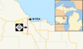
| Location | Marquette County, Michigan | ||||
| Transport network | |||||
| Owned by | |||||
| Maintained by | |||||
| Start time |
| ||||
| Inception |
| ||||
| Length |
| ||||
| Terminus | |||||
| |||||
English: Media relatated to M-553, a 19.618-mile (31.572 km) state highway in Marquette County, Michigan, United States.
Media in category "M-553 (Michigan highway)"
The following 12 files are in this category, out of 12 total.
-
 M-553.svg 600 × 600; 4 KB
-
 M-553 map.png 6,850 × 4,062; 599 KB
-
 Crossroads (M-553, CR 480).jpg 3,008 × 2,000; 2.35 MB
-
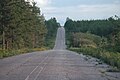
 Down the Hill on M-553.jpg 640 × 480; 59 KB
-
 Glass' Curve.JPG 3,008 × 2,000; 2.62 MB
-
 M-553 infobox on AARoads Wiki.png 618 × 844; 127 KB
-
 M-553 Sands Plains 1.jpg 3,008 × 2,000; 2.25 MB
-
 M-553 Sands Plains 2.jpg 3,008 × 2,000; 2.36 MB
-
 M-554.jpg 160 × 288; 85 KB
-
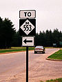
 Mich left m-553.jpg 1,298 × 1,078; 527 KB
-
 Old CR 553.jpg 3,008 × 2,000; 2.41 MB
-
 Small m-553.jpg 160 × 212; 39 KB
.jpg)


