Category:Mühlenteich (Wassermühle Bruneforth)
Jump to navigation
Jump to search
| Object location | | View all coordinates using: OpenStreetMap |
|---|
Media in category "Mühlenteich (Wassermühle Bruneforth)"
The following 3 files are in this category, out of 3 total.
-
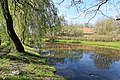
 Stavern - Staverner Straße - Wassermühle Bruneforth - Mühlenteich 01 ies.jpg 5,616 × 3,744; 26.96 MB
-
 Stavern - Staverner Straße - Wassermühle Bruneforth - Mühlenteich 02 ies.jpg 5,616 × 3,744; 28.76 MB
-
 Stavern - Staverner Straße - Wassermühle Bruneforth - Mühlenteich 03 ies.jpg 5,616 × 3,744; 32.83 MB


