Category:Lynsted with Kingsdown
Jump to navigation
Jump to search
English: Lynsted with Kingsdown is a civil parish in the Swale district, in the county of Kent, England.
civil parish in Swale, Kent, England | |||||
| Upload media | |||||
| Instance of | |||||
|---|---|---|---|---|---|
| Location | Swale, Kent, South East England, England | ||||
 | |||||
Subcategories
This category has the following 8 subcategories, out of 8 total.
B
- Bogle, Kent (3 F)
- Bumpit, Kent (2 F)
C
- Claxfield Farm (2 F)
- Claxfield House (4 F)
D
- Dungate (3 F)
K
L
S
- Sunderland Farm, Kent (2 F)
Media in category "Lynsted with Kingsdown"
The following 182 files are in this category, out of 182 total.
-
 Agricultural building, Tickham Farm - geograph.org.uk - 5255501.jpg 640 × 480; 73 KB
-
 Barn at Tickham Farm - geograph.org.uk - 5043089.jpg 2,254 × 1,660; 1.24 MB
-
 Bogle Road, approaching Lynsted Lane - geograph.org.uk - 5255531.jpg 640 × 480; 80 KB
-
 Bridleway beside Kingsdown Wood - geograph.org.uk - 1221693.jpg 640 × 480; 111 KB
-
 Bridleway junction near M2 Bridge - geograph.org.uk - 1221683.jpg 640 × 480; 89 KB
-
 Building on land adjacent to 67, London Road - geograph.org.uk - 3699270.jpg 1,175 × 881; 220 KB
-
 Bumpit Farm - geograph.org.uk - 1268897.jpg 640 × 480; 62 KB
-
 Cambridge Farm - geograph.org.uk - 6190691.jpg 4,000 × 3,000; 5.04 MB
-
 Cambridge Lane, near Lynsted - geograph.org.uk - 3698574.jpg 3,488 × 2,616; 2.83 MB
-
 Cellar Hill Cottage - geograph.org.uk - 1269321.jpg 640 × 480; 96 KB
-
 Cellar Hill, Teynham - geograph.org.uk - 3698984.jpg 3,488 × 2,616; 1.79 MB
-
 Children of James and Jane Hugessen, on Memorial - geograph.org.uk - 2974743.jpg 1,734 × 1,060; 1,022 KB
-
 Claxfield Farm - geograph.org.uk - 6190693.jpg 4,000 × 3,000; 4.72 MB
-
 Claxfield Farm - geograph.org.uk - 6190694.jpg 4,000 × 3,000; 4.81 MB
-
 Claxfield Road, near Lynsted - geograph.org.uk - 3698487.jpg 3,488 × 2,616; 2.29 MB
-
 Combine Harvester - geograph.org.uk - 1449684.jpg 640 × 320; 69 KB
-
 Communication mast - geograph.org.uk - 4190270.jpg 640 × 471; 82 KB
-
 Disused oast, Bumpit Farm - geograph.org.uk - 5255523.jpg 640 × 480; 60 KB
-
 Dover Castle Inn sign - geograph.org.uk - 6248920.jpg 3,456 × 4,608; 524 KB
-
 Dover Castle Inn, Teynham - geograph.org.uk - 3698968.jpg 3,488 × 2,616; 2.22 MB
-
 Down Court Road - geograph.org.uk - 3842594.jpg 640 × 480; 112 KB
-
 Down Court Road, near Milstead - geograph.org.uk - 5016227.jpg 3,264 × 2,448; 2 MB
-
 Drue Drurye, son of Sir Drue Drurye and Catherine - geograph.org.uk - 2974573.jpg 1,496 × 2,256; 814 KB
-
 Dully Road - geograph.org.uk - 6191575.jpg 4,000 × 3,000; 4.76 MB
-
 Dully Road heads away from Kingsdown Road - geograph.org.uk - 6165292.jpg 1,024 × 768; 268 KB
-
 Entrance to Lynsted Park - geograph.org.uk - 3399256.jpg 640 × 480; 127 KB
-

-
 Fingerpost, junction of Dully Road and Kingsdown Road - geograph.org.uk - 5016161.jpg 3,264 × 2,448; 2.28 MB
-
 Fingerpost, near Milstead - geograph.org.uk - 5016229.jpg 2,448 × 3,264; 2.48 MB
-
 Fingerpost, Rawling Street, Milstead - geograph.org.uk - 5016323.jpg 2,448 × 3,264; 3.11 MB
-

-
 Footbridge over M2 - geograph.org.uk - 5980549.jpg 1,024 × 576; 82 KB
-
 Footbridge, M2 - geograph.org.uk - 5208024.jpg 640 × 426; 46 KB
-
 Footpath by Tickham Lane - geograph.org.uk - 5255500.jpg 640 × 480; 98 KB
-
 Footpath off Lynsted Lane - geograph.org.uk - 5255540.jpg 480 × 640; 123 KB
-
 Footpath seen from Cambridge Lane - geograph.org.uk - 6190692.jpg 4,000 × 3,000; 4.75 MB
-
 Footpath to Lynsted - geograph.org.uk - 4814093.jpg 480 × 640; 141 KB
-
 Footpath to Lynsted - geograph.org.uk - 4814160.jpg 640 × 480; 131 KB
-
 French's Oast, Claxfield Road, Lynsted - geograph.org.uk - 6191475.jpg 4,000 × 3,000; 5.07 MB
-
 French's Oast, Claxfield Road, Lynsted - geograph.org.uk - 6191481.jpg 4,000 × 3,000; 4.94 MB
-
 French's Oast, Claxfield Road, Lynsted - geograph.org.uk - 6191488.jpg 3,583 × 2,688; 2.29 MB
-
 Garage and tree on Tickham Lane - geograph.org.uk - 5043088.jpg 2,304 × 1,728; 800 KB
-
 Hare Cottage - geograph.org.uk - 1221681.jpg 640 × 480; 95 KB
-
 Hedge Arch and footpath - geograph.org.uk - 1097173.jpg 481 × 640; 116 KB
-
 Hedge of Silver Birches - geograph.org.uk - 1097202.jpg 481 × 640; 133 KB
-
 House on Tickham Lane, Loyterton - geograph.org.uk - 5039665.jpg 2,304 × 1,728; 814 KB
-
 Houses in Upper Tickham - geograph.org.uk - 5043080.jpg 2,304 × 1,728; 823 KB
-
 Houses on Kingsdown Road, Kingsdown - geograph.org.uk - 5043055.jpg 2,304 × 1,728; 1.24 MB
-
 Kingsdown Road near Dungate - geograph.org.uk - 5062023.jpg 2,304 × 1,728; 839 KB
-
 Kingsdown Road near Dungate - geograph.org.uk - 5062024.jpg 2,304 × 1,728; 826 KB
-
 Kingsdown Road, Dungate - geograph.org.uk - 5016177.jpg 3,264 × 2,448; 1.96 MB
-
 Kingsdown Road, Dungate - geograph.org.uk - 5039649.jpg 2,304 × 1,728; 863 KB
-
 Kingsdown Road, Erriottwood - geograph.org.uk - 5110435.jpg 2,448 × 2,448; 1.5 MB
-
 Kingsdown Road, Erriotwood - geograph.org.uk - 5043061.jpg 2,304 × 1,728; 826 KB
-
 Kingsdown Road, Kingsdown - geograph.org.uk - 5016143.jpg 3,264 × 2,448; 2.65 MB
-
 Kingsdown Road, Kingsdown - geograph.org.uk - 5016150.jpg 3,264 × 2,448; 1.86 MB
-
 Kingsdown Road, Kingsdown - geograph.org.uk - 5016154.jpg 3,264 × 2,448; 1.95 MB
-
 Kingsdown Road, near Dungate - geograph.org.uk - 5016169.jpg 3,264 × 2,448; 2.07 MB
-
 Kingsdown Road, near Kingsdown - geograph.org.uk - 5016164.jpg 3,264 × 2,448; 1.88 MB
-
 Lacel House, London Road - geograph.org.uk - 4103884.jpg 1,175 × 881; 189 KB
-
-
 Lion Farm - geograph.org.uk - 6169087.jpg 1,024 × 684; 318 KB
-
 Lodge Cottage - geograph.org.uk - 1223327.jpg 640 × 480; 87 KB
-
 London Road - geograph.org.uk - 6249880.jpg 5,184 × 3,456; 1.04 MB
-
 London Road, Teynham - geograph.org.uk - 3698597.jpg 3,488 × 2,616; 2.2 MB
-
 London Road, Teynham - geograph.org.uk - 3698599.jpg 3,488 × 2,616; 1.59 MB
-
 London Road, Teynham - geograph.org.uk - 3698614.jpg 3,488 × 2,616; 1.68 MB
-
 London Road, Teynham - geograph.org.uk - 3698639.jpg 3,488 × 2,616; 2.25 MB
-
 London Road, Teynham - geograph.org.uk - 3698646.jpg 3,488 × 2,616; 2.16 MB
-
 London Road, Teynham - geograph.org.uk - 3698980.jpg 3,488 × 2,616; 2.21 MB
-
 London Road, Teynham - geograph.org.uk - 3698986.jpg 3,488 × 2,616; 2.25 MB
-
 London Road, Teynham - geograph.org.uk - 4489819.jpg 2,272 × 1,704; 575 KB
-
 London Road, Teynham - geograph.org.uk - 5006523.jpg 2,014 × 1,490; 956 KB
-
 London Road, Teynham - geograph.org.uk - 5110380.jpg 3,264 × 2,448; 1.89 MB
-
 Loyterton Farm - geograph.org.uk - 1450564.jpg 640 × 427; 65 KB
-
 Loyterton Farm, Tickham Lane, Lynsted - geograph.org.uk - 6540514.jpg 6,000 × 4,000; 6.17 MB
-
 Loyterton Farm, Tickham Lane, Lynsted - geograph.org.uk - 6540515.jpg 6,000 × 4,000; 6.17 MB
-
 Loyterton House - geograph.org.uk - 1268908.jpg 640 × 480; 110 KB
-
 Lynstead Lane, Teynham - geograph.org.uk - 5006552.jpg 2,004 × 1,474; 782 KB
-
 Lynsted Lane - geograph.org.uk - 5255537.jpg 640 × 477; 57 KB
-
 Lynsted Lane, Teynham - geograph.org.uk - 3698593.jpg 3,488 × 2,616; 2.27 MB
-
 Lynsted Park - geograph.org.uk - 1223320.jpg 640 × 480; 67 KB
-
 M2 Motorway - geograph.org.uk - 5016199.jpg 3,264 × 2,448; 1.72 MB
-
 M2 Motorway - geograph.org.uk - 5016205.jpg 3,264 × 2,448; 1.77 MB
-
 M2 near Milstead - geograph.org.uk - 3721307.jpg 640 × 480; 246 KB
-
 M2, Sawpit Road Bridge - geograph.org.uk - 2490191.jpg 640 × 430; 46 KB
-
 M2, Sawpit Road Bridge - geograph.org.uk - 3721301.jpg 640 × 480; 228 KB
-
 M2, westbound - geograph.org.uk - 5208025.jpg 640 × 426; 43 KB
-
 M2, westbound - geograph.org.uk - 5208027.jpg 640 × 426; 47 KB
-
 Mill Lane, Lynsted - geograph.org.uk - 5110409.jpg 3,264 × 2,448; 2.11 MB
-
 Mobile Mast in Cambridge Farm - geograph.org.uk - 1268889.jpg 480 × 640; 47 KB
-

-
 Nouds Lane, near Lynsted - geograph.org.uk - 5110395.jpg 3,264 × 2,448; 2.13 MB
-
 Nouds Lane, Tickham - geograph.org.uk - 5110397.jpg 3,264 × 2,448; 1.78 MB
-
 Nouds Road, near Teynham - geograph.org.uk - 3699004.jpg 3,488 × 2,616; 2.56 MB
-
 Nouds Road, near Teynham - geograph.org.uk - 5110383.jpg 3,264 × 2,448; 2.4 MB
-
 Nouds Road, near Teynham - geograph.org.uk - 5110387.jpg 3,264 × 2,448; 3.67 MB
-
 Nouds Road, near Teynham - geograph.org.uk - 5110392.jpg 3,264 × 2,448; 3.65 MB
-
 Oak Cottage, Ludgate Lane - geograph.org.uk - 6264202.jpg 5,184 × 3,456; 1.79 MB
-
 Oast House - geograph.org.uk - 6248906.jpg 5,184 × 3,456; 1.22 MB
-
 Oast House - geograph.org.uk - 6248908.jpg 3,000 × 4,000; 920 KB
-
 Oast House - geograph.org.uk - 6248912.jpg 4,000 × 3,000; 1,018 KB
-
 Oast House - geograph.org.uk - 6248913.jpg 3,000 × 4,000; 1.12 MB
-
 Oast House - geograph.org.uk - 6249130.jpg 4,853 × 2,519; 1.37 MB
-
 Oast House - geograph.org.uk - 6249134.jpg 3,148 × 4,722; 1.55 MB
-
 Oast House - geograph.org.uk - 6249137.jpg 5,184 × 3,456; 1.76 MB
-
 Oast House - geograph.org.uk - 6249140.jpg 5,184 × 3,456; 1.45 MB
-
 Oast House - geograph.org.uk - 6249142.jpg 5,184 × 3,456; 7.99 MB
-
 Oast House - geograph.org.uk - 6249144.jpg 5,184 × 3,456; 1.34 MB
-
 Oast House - geograph.org.uk - 6249893.jpg 5,184 × 3,456; 1.44 MB
-
 Oast House - geograph.org.uk - 6249894.jpg 5,061 × 3,374; 1.49 MB
-
 Oast House Cowl - geograph.org.uk - 6248909.jpg 3,218 × 3,218; 480 KB
-
 Oast House Cowl - geograph.org.uk - 6248910.jpg 4,608 × 3,456; 595 KB
-
 Oast House, Bogle Road - geograph.org.uk - 5255512.jpg 640 × 494; 97 KB
-
 Orchard by Tickham Lane - geograph.org.uk - 6479292.jpg 6,000 × 4,000; 7.46 MB
-
 Orchard near Tickham Farm - geograph.org.uk - 3842665.jpg 640 × 480; 140 KB
-
 Orchards near Lynsted - geograph.org.uk - 3698492.jpg 3,488 × 2,616; 2.27 MB
-
 Ordnance Survey Flush Bracket 11934 - geograph.org.uk - 4935841.jpg 4,000 × 3,000; 3.72 MB
-
 Park Farm, Lynsted - geograph.org.uk - 4814153.jpg 640 × 449; 67 KB
-
 Path just south of Lynsted village - geograph.org.uk - 3399234.jpg 640 × 480; 165 KB
-

-
 Polytunnels next to Mill Lane - geograph.org.uk - 3399276.jpg 640 × 463; 44 KB
-

-
 Providence House, Teynham - geograph.org.uk - 5255542.jpg 640 × 480; 96 KB
-
 Rape fields by Cellar Hill - geograph.org.uk - 727869.jpg 640 × 512; 47 KB
-
 Rosie's Café, Teynham - geograph.org.uk - 5255547.jpg 371 × 640; 49 KB
-
 Sandown Cottages, London Road, Teynham - geograph.org.uk - 3698995.jpg 3,488 × 2,616; 1.73 MB
-
 Sawpit Road Bridge Works - geograph.org.uk - 1221703.jpg 640 × 480; 100 KB
-
 Sawpit Road Bridge, M2 - geograph.org.uk - 5208026.jpg 640 × 426; 49 KB
-
 Sawpit Road, near Dungate - geograph.org.uk - 5016194.jpg 3,264 × 2,448; 2.31 MB
-
 Sheep on a winter diet - geograph.org.uk - 3842605.jpg 640 × 480; 129 KB
-
 Sheep on Bumpit Farm - geograph.org.uk - 5255516.jpg 640 × 365; 40 KB
-
 Sheep on Bumpit Farm - geograph.org.uk - 5255517.jpg 640 × 479; 81 KB
-
 Slough Road - geograph.org.uk - 4413949.jpg 640 × 480; 136 KB
-
 Slough Road, Dungate - geograph.org.uk - 5016187.jpg 3,264 × 2,448; 2.06 MB
-
 St Peter and St Paul Churchyard, Lynsted - geograph.org.uk - 6191524.jpg 4,000 × 3,000; 4.66 MB
-
 St Peter ^ St Paul Church, Lynsted - geograph.org.uk - 6264200.jpg 3,456 × 5,184; 1.4 MB
-
 Stile into private woodland, Lynsted - geograph.org.uk - 4814171.jpg 640 × 480; 148 KB
-
 Teynham - 2015 - geograph.org.uk - 4634520.jpg 3,648 × 2,736; 3.47 MB
-
 Teynham Library - geograph.org.uk - 5012235.jpg 2,048 × 1,536; 1.49 MB
-
 The Black Lion sign - geograph.org.uk - 6248931.jpg 2,778 × 3,703; 477 KB
-
 The Black Lion, Lynsted - geograph.org.uk - 5320027.jpg 640 × 428; 96 KB
-
 The Church of St Peter and St Paul at Lynsted - geograph.org.uk - 4935836.jpg 4,000 × 3,000; 3.45 MB
-
 The Fox, Teynham - geograph.org.uk - 3698653.jpg 3,488 × 2,616; 2.24 MB
-
 The Foxhunters on Kingsdown Road - geograph.org.uk - 6191574.jpg 4,000 × 3,000; 4.78 MB
-
 The George sign - geograph.org.uk - 6248918.jpg 3,456 × 4,608; 678 KB
-
 The George, Teynham - geograph.org.uk - 3698606.jpg 3,488 × 2,616; 2.19 MB
-
 The graveyard, Lynsted - geograph.org.uk - 4814181.jpg 640 × 447; 114 KB
-
-
 The Swan car park on London Road, Teynham - geograph.org.uk - 5003003.jpg 2,048 × 1,536; 1.48 MB
-
 The Swan on London Road, Teynham - geograph.org.uk - 5003004.jpg 2,048 × 1,536; 1.49 MB
-
 The Swan sign - geograph.org.uk - 6248917.jpg 3,456 × 4,608; 623 KB
-
 The Swan, Teynham - geograph.org.uk - 3698609.jpg 3,488 × 2,616; 2.2 MB
-
 The village sign for Kingsdown - geograph.org.uk - 6191557.jpg 3,909 × 2,933; 1.95 MB
-
 The village sign for Kingsdown - geograph.org.uk - 6191559.jpg 4,000 × 3,000; 4.64 MB
-
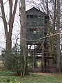 Three Storey Tree house - geograph.org.uk - 1223322.jpg 480 × 640; 122 KB
-
 Tickham Cottage, Nouds Lane, Norton - geograph.org.uk - 6177800.jpg 640 × 454; 86 KB
-
 Tickham Cottage, Tickham - geograph.org.uk - 5255507.jpg 640 × 480; 80 KB
-
 Tickham Farm - geograph.org.uk - 6479293.jpg 6,000 × 4,000; 7.94 MB
-

-
 Tickham Lane - geograph.org.uk - 727808.jpg 640 × 480; 98 KB
-
 Tickham Lane approaching Norton Lane - geograph.org.uk - 727810.jpg 640 × 480; 79 KB
-
 Tickham Lane at the junction of Norton Lane - geograph.org.uk - 5039682.jpg 2,304 × 1,728; 823 KB
-
 Tickham Lane, Lynsted - geograph.org.uk - 5110412.jpg 3,264 × 2,448; 2.07 MB
-
 Tickham Lane, Lynsted - geograph.org.uk - 5110419.jpg 3,264 × 2,448; 1.64 MB
-
 Tickham Lane, Tickham - geograph.org.uk - 5110402.jpg 3,264 × 2,448; 1.79 MB
-
 Tickham Lane, Tickham - geograph.org.uk - 5110404.jpg 3,264 × 2,448; 2.02 MB
-
 Tickham Lane, Tickham - geograph.org.uk - 5255494.jpg 640 × 480; 70 KB
-
 Tudor Cottage - geograph.org.uk - 1269315.jpg 640 × 480; 78 KB
-
 Tudor Cottage on Cellar Hill (geograph 6188538).jpg 4,000 × 3,000; 4.66 MB
-
 Tudor house on Cellar Hill - geograph.org.uk - 6188540.jpg 4,000 × 3,000; 4.83 MB
-
 Typical farming scene - geograph.org.uk - 1221689.jpg 640 × 480; 82 KB
-

-
 Very flinty soil - geograph.org.uk - 3842619.jpg 640 × 480; 175 KB
-
 View from Dully Road - geograph.org.uk - 6191578.jpg 3,869 × 2,903; 3.35 MB
-
 View from Mill Lane - geograph.org.uk - 6191538.jpg 4,000 × 3,000; 4.57 MB
-
 View from Mill Lane - geograph.org.uk - 6191544.jpg 4,000 × 3,000; 5.31 MB
-
 View from Mill Lane - geograph.org.uk - 6191545.jpg 4,000 × 3,000; 4.94 MB
-
 View from St Peter and St Paul Churchyard, Lynsted - geograph.org.uk - 6191519.jpg 4,000 × 3,000; 4.7 MB
-
 View north from Bogle Road - geograph.org.uk - 5320044.jpg 640 × 428; 109 KB
-
 Vigo Terrace, Teynham - geograph.org.uk - 3698578.jpg 3,488 × 2,616; 2.24 MB
-
 Wood Street, near Lynsted - geograph.org.uk - 3698481.jpg 3,488 × 2,616; 2.23 MB


.jpg)


