Category:Lynemouth
Jump to navigation
Jump to search
village in the United Kingdom  | |||||
| Upload media | |||||
| Instance of | |||||
|---|---|---|---|---|---|
| Location | Northumberland, North East England, England | ||||
| Population |
| ||||
 | |||||
English: Lynemouth is a village in Northumberland, England. The village is situated northeast of Ashington, and is in close proximity to the village of Ellington which is located to the north west. The village's location was decided by its close proximity to coal mines.
Subcategories
This category has the following 5 subcategories, out of 5 total.
Media in category "Lynemouth"
The following 68 files are in this category, out of 68 total.
-
 Across fields to the power station - geograph.org.uk - 4559712.jpg 640 × 428; 82 KB
-
 Albion Terrace, Lynemouth - geograph.org.uk - 1636485.jpg 640 × 479; 86 KB
-
 Albion Terrace, Lynemouth - geograph.org.uk - 3048853.jpg 640 × 480; 61 KB
-
 Albion Terrace, Lynemouth - geograph.org.uk - 5665563.jpg 2,000 × 1,500; 352 KB
-
 Allotment path, Lynemouth - geograph.org.uk - 348044.jpg 640 × 480; 70 KB
-
 Allotments at Lynemouth - geograph.org.uk - 348040.jpg 640 × 480; 90 KB
-
 Allotments, Lynemouth - geograph.org.uk - 3048827.jpg 640 × 480; 111 KB
-
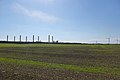
 Arable land south of Lynemouth - geograph.org.uk - 5665525.jpg 2,000 × 1,500; 265 KB
-
 Bridge over the Lyne - geograph.org.uk - 1636503.jpg 640 × 479; 95 KB
-
 Bridge Road - geograph.org.uk - 4179815.jpg 640 × 428; 81 KB
-
 Bridge Road, Lynemouth - geograph.org.uk - 5665530.jpg 2,000 × 1,500; 391 KB
-
 Coast Carvery ^ Cafe closed down - geograph.org.uk - 6441478.jpg 1,600 × 1,200; 282 KB
-
 Colliery site, Lynemouth - geograph.org.uk - 3232824.jpg 640 × 360; 196 KB
-
 Crossing the River Lyne (geograph 5670655).jpg 2,000 × 1,500; 279 KB
-
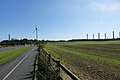
 Cycle Path by Park Road - geograph.org.uk - 1191060.jpg 640 × 480; 71 KB
-
 Cycle track towards Lynemouth - geograph.org.uk - 3048817.jpg 640 × 480; 101 KB
-
 Ellington Road, Lynemouth - geograph.org.uk - 2519879.jpg 640 × 480; 92 KB
-
 Entering Lynemouth - geograph.org.uk - 3321277.jpg 800 × 600; 91 KB
-
 Farmland near Lynemouth - geograph.org.uk - 3048814.jpg 640 × 480; 104 KB
-

-
 Former Methodist chapel, Lynemouth - geograph.org.uk - 5665594.jpg 2,000 × 1,500; 308 KB
-
 Home of the leek - geograph.org.uk - 348049.jpg 640 × 480; 89 KB
-
 Housing on Albion Terrace, Lynemouth - geograph.org.uk - 3697581.jpg 3,731 × 2,604; 1.27 MB
-
 In-Lyne - geograph.org.uk - 1636498.jpg 640 × 479; 65 KB
-
 Lane by allotments, Lynemouth - geograph.org.uk - 3048832.jpg 640 × 480; 110 KB
-
 Lane of Kingsley Road, Lynemouth - geograph.org.uk - 5665551.jpg 2,000 × 1,500; 283 KB
-
 Looking along Albion Terrace, Lynemouth - geograph.org.uk - 4702377.jpg 1,600 × 1,052; 252 KB
-
 Lyne Terrace, Lynemouth - geograph.org.uk - 3048845.jpg 640 × 480; 92 KB
-
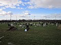 Lynemouth Cemetery - geograph.org.uk - 3321311.jpg 800 × 600; 104 KB
-
 Lynemouth Colliery site - geograph.org.uk - 1636439.jpg 640 × 402; 66 KB
-

-
 Lynemouth Miners' Institute - geograph.org.uk - 5665604.jpg 2,000 × 1,500; 337 KB
-
 Lynemouth Miners' Welfare Centre - geograph.org.uk - 1636472.jpg 640 × 479; 68 KB
-
 Lynemouth Power Station - geograph.org.uk - 2988999.jpg 4,320 × 3,240; 4.73 MB
-
 Lynemouth Resource Centre, Bridge Street, Lynemouth - geograph.org.uk - 5665629.jpg 2,000 × 1,500; 304 KB
-
 Lynemouth Welfare Pavilion - geograph.org.uk - 5665535.jpg 2,000 × 1,500; 360 KB
-
 Lynemouth World War 2 Memorial - geograph.org.uk - 5665612.jpg 2,000 × 1,500; 432 KB
-
 Market Square - geograph.org.uk - 1636492.jpg 640 × 479; 69 KB
-
 Market Square, Lynemouth - geograph.org.uk - 2519866.jpg 640 × 480; 87 KB
-
 Newsagents, Lynemouth - geograph.org.uk - 3048847.jpg 640 × 480; 73 KB
-
 Open ground off Albion Terrace, Lynemouth - geograph.org.uk - 5665571.jpg 2,000 × 1,500; 493 KB
-
 Park Road - geograph.org.uk - 4179817.jpg 640 × 428; 80 KB
-
 Park Road, Lynemouth - geograph.org.uk - 5665541.jpg 2,000 × 1,500; 349 KB
-
 Pit wheel memorial, Lynemouth - geograph.org.uk - 5665625.jpg 2,000 × 1,500; 803 KB
-
 Plaque on pit wheel, Lynemouth - geograph.org.uk - 5665634.jpg 2,000 × 1,500; 273 KB
-
 River Lyne - geograph.org.uk - 1191070.jpg 640 × 480; 71 KB
-
 River Lyne - geograph.org.uk - 1744744.jpg 600 × 450; 230 KB
-
 River Lyne - geograph.org.uk - 1744748.jpg 600 × 450; 192 KB
-
 River Lyne - geograph.org.uk - 2519919.jpg 640 × 480; 120 KB
-
 River Lyne - geograph.org.uk - 3600990.jpg 1,600 × 1,200; 327 KB
-
 River Lyne - geograph.org.uk - 4559700.jpg 640 × 428; 80 KB
-
 Road bridge crossing the River Lyne - geograph.org.uk - 5926489.jpg 640 × 421; 80 KB
-
 Road bridge over the River Lyne - geograph.org.uk - 2875531.jpg 3,648 × 2,736; 2.4 MB
-
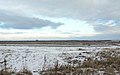
 Road to Cresswell - geograph.org.uk - 1191088.jpg 640 × 480; 67 KB
-
 Road towards Ellington - geograph.org.uk - 3048839.jpg 640 × 480; 89 KB
-
 Site entrance and wind turbine, Lynemouth Power Station - geograph.org.uk - 5662103.jpg 1,500 × 2,000; 246 KB
-
 St Aidan 's Church, Lynemouth - geograph.org.uk - 2988998.jpg 4,320 × 3,240; 5.42 MB
-
 Street furniture on Albion Terrace - geograph.org.uk - 4702371.jpg 1,600 × 1,206; 358 KB
-
 The River Lyne - geograph.org.uk - 3048858.jpg 640 × 480; 90 KB
-
 The River Lyne - geograph.org.uk - 3600983.jpg 1,600 × 1,180; 307 KB
-
 The River Lyne between Lynemouth and the sea - geograph.org.uk - 5670660.jpg 2,000 × 1,500; 329 KB
-
 Traffic calming measures - geograph.org.uk - 4702417.jpg 1,600 × 1,200; 279 KB
-
 West Market Street, Lynemouth - geograph.org.uk - 5665639.jpg 2,000 × 1,500; 398 KB
-
 Wind and coal power at Lynemouth - geograph.org.uk - 3321319.jpg 800 × 600; 70 KB
-
 Wind turbine - geograph.org.uk - 4702411.jpg 1,200 × 1,641; 350 KB
-
 Woodhorn Industry - geograph.org.uk - 4179816.jpg 640 × 428; 82 KB
-
 Cresswell Home Farm buildings - geograph.org.uk - 73183.jpg 640 × 480; 54 KB
-
 Cresswell Home Farm cottage - geograph.org.uk - 73188.jpg 640 × 480; 88 KB


.jpg)


_-_geograph.org.uk_-_2694648.jpg)


