Category:Lutheran chapel in Cieszyn-Krasna
Jump to navigation
Jump to search
| Object location | | View all coordinates using: OpenStreetMap |
|---|
church building in Cieszyn, Poland _01.jpg) | |||||
| Upload media | |||||
| Instance of | |||||
|---|---|---|---|---|---|
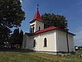
| Location | Cieszyn, Cieszyn County, Silesian Voivodeship, Poland | ||||
 | |||||
Media in category "Lutheran chapel in Cieszyn-Krasna"
The following 4 files are in this category, out of 4 total.
-
 Evangelical-Augsburg chapel in Krasna (Cieszyn) 01.jpg 2,112 × 2,816; 1.05 MB
-
 Evangelical-Augsburg chapel in Krasna (Cieszyn) 02.jpg 2,816 × 2,112; 1.23 MB
-
 Krasna 20180809 133050.jpg 3,264 × 2,448; 3.18 MB
-
 Krasna 20180809 133427.jpg 3,264 × 2,448; 2.05 MB
_02.jpg)

