Category:Lune Valley
Jump to navigation
Jump to search
Media in category "Lune Valley"
The following 64 files are in this category, out of 64 total.
-
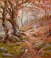
A November Morn in the Lune Valley.jpg 450 × 511; 70 KB
-
Anglers' hut by the Lune - geograph.org.uk - 1710044.jpg 1,280 × 960; 328 KB
-
Brown Moor and Castley Knotts - geograph.org.uk - 951691.jpg 640 × 427; 57 KB
-
Brown Moor summit - geograph.org.uk - 849922.jpg 640 × 480; 92 KB
-
Cairn - geograph.org.uk - 1137917.jpg 640 × 480; 66 KB
-
Carlin Gill - geograph.org.uk - 951778.jpg 640 × 364; 47 KB
-
Chapel, Firbank - geograph.org.uk - 98517.jpg 479 × 640; 93 KB
-
Dramatic skies over the Lune Valley - geograph.org.uk - 2290715.jpg 800 × 600; 119 KB
-
Footpath from Littledale Road - geograph.org.uk - 1710380.jpg 640 × 480; 74 KB
-
From Cleugh Gill - geograph.org.uk - 709922.jpg 640 × 480; 62 KB
-
Gragareth west slope - geograph.org.uk - 849831.jpg 640 × 480; 74 KB
-
Hill Farm, Brookhouse - geograph.org.uk - 1710360.jpg 640 × 480; 66 KB
-
Holme Fell - geograph.org.uk - 951677.jpg 640 × 349; 46 KB
-
Hornby Castle, Hornby, North Lancs. - geograph.org.uk - 52571.jpg 640 × 480; 147 KB
-
Hornby Castle.jpg 640 × 480; 60 KB
-
Low Borrowbridge Lune Valley 1731449 27ef1dc7.jpg 640 × 446; 104 KB
-
Lowgill Viaduct, Lune Valley, Cumbria - geograph.org.uk - 57433.jpg 534 × 402; 79 KB
-
Lune Gorge - geograph.org.uk - 600047.jpg 800 × 536; 120 KB
-
Lune Valley from Grayrigg Forest.jpg 1,024 × 768; 136 KB
-
M6 bridge over River Lune - geograph.org.uk - 1202454.jpg 640 × 480; 183 KB
-
Moorland road above the Lune Valley - geograph.org.uk - 1386666.jpg 640 × 480; 65 KB
-
Pasture, Killington - geograph.org.uk - 902169.jpg 640 × 480; 143 KB
-
Pastures and barn, Kelleth - geograph.org.uk - 902129.jpg 640 × 480; 106 KB
-
Pastures, Firbank - geograph.org.uk - 902161.jpg 640 × 480; 114 KB
-
Pastures, Orton - geograph.org.uk - 902088.jpg 640 × 480; 146 KB
-
Path to Winder - geograph.org.uk - 713759.jpg 640 × 480; 74 KB
-
River Lune and Fell Head - geograph.org.uk - 536860.jpg 640 × 427; 118 KB
-
Ruined building above Artle Beck - geograph.org.uk - 1748180.jpg 640 × 480; 79 KB
-
The A685, Tebay - geograph.org.uk - 992154.jpg 640 × 480; 141 KB
-
The footpath from Melling to Tatham - geograph.org.uk - 1732023.jpg 640 × 480; 123 KB
-
The Lune Valley near Tebay - geograph.org.uk - 50372.jpg 640 × 426; 78 KB
-
The Tebay Gap - geograph.org.uk - 1139235.jpg 640 × 480; 86 KB
-
Walled green lane below Great Ewe Fell - geograph.org.uk - 102484.jpg 640 × 480; 119 KB
-
Farmland, Lune Valley - geograph.org.uk - 30467.jpg 640 × 480; 74 KB
-
Flood Plain - geograph.org.uk - 302669.jpg 640 × 480; 57 KB
-
Former railway along Lune valley - geograph.org.uk - 98514.jpg 479 × 640; 125 KB
-
Hooksey - geograph.org.uk - 520223.jpg 640 × 427; 92 KB
-
Lane Caton Green - geograph.org.uk - 116815.jpg 480 × 640; 119 KB
-
Larum Gill - geograph.org.uk - 617275.jpg 640 × 480; 65 KB
-
Lune valley bridge. - geograph.org.uk - 92571.jpg 640 × 480; 62 KB
-
Lune Valley from above Claughton - geograph.org.uk - 338888.jpg 640 × 480; 92 KB
-
Lune Valley near Claughton - geograph.org.uk - 117928.jpg 640 × 480; 84 KB
-
M6 Motorway near Tebay. - geograph.org.uk - 92567.jpg 640 × 480; 75 KB
-
Orton - geograph.org.uk - 17836.jpg 640 × 480; 108 KB
-
Path overlooking Lune Valley - geograph.org.uk - 513600.jpg 640 × 427; 108 KB
-
River Lune near Sandbeds - geograph.org.uk - 302253.jpg 640 × 480; 105 KB
-
River Lune, near Caton - geograph.org.uk - 13167.jpg 640 × 480; 102 KB
-
River Lune, Sandbeds - geograph.org.uk - 302301.jpg 640 × 480; 96 KB
-
Scots Pine - geograph.org.uk - 127348.jpg 480 × 640; 123 KB
-
Sheep grazing in the Lune Valley - geograph.org.uk - 632683.jpg 640 × 480; 99 KB
-
Tarn at The Snab, near Gressingham - geograph.org.uk - 86771.jpg 640 × 480; 66 KB
-
The Lune Valley - geograph.org.uk - 632685.jpg 640 × 480; 83 KB
-
Vale of Lune - geograph.org.uk - 264072.jpg 640 × 480; 80 KB
-
Wall on Casterton Fell - geograph.org.uk - 478080.jpg 640 × 480; 76 KB


