Category:Lunan, Angus
Jump to navigation
Jump to search
village in Angus, Scotland, UK | |||||
| Upload media | |||||
| Instance of | |||||
|---|---|---|---|---|---|
| Location |
| ||||
 | |||||
Subcategories
This category has the following 3 subcategories, out of 3 total.
Media in category "Lunan, Angus"
The following 100 files are in this category, out of 100 total.
-
 Angus Lunan 01.jpg 3,806 × 2,349; 3.96 MB
-
 Angus Lunan 04.jpg 4,080 × 3,072; 3.73 MB
-
 Angus Lunan 06.jpg 4,080 × 3,072; 7.64 MB
-
 Beach at Lunan Bay - geograph.org.uk - 3552270.jpg 1,024 × 681; 72 KB
-
 Beach at Lunan Bay - geograph.org.uk - 4038041.jpg 640 × 480; 216 KB
-
 Beach at Lunan Bay - geograph.org.uk - 4038048.jpg 640 × 480; 219 KB
-
 Beach at Lunan Bay - geograph.org.uk - 4460623.jpg 640 × 427; 56 KB
-
 Beach, Lunan Bay - geograph.org.uk - 3717259.jpg 640 × 480; 53 KB
-
 Beach, Lunan Bay - geograph.org.uk - 6022184.jpg 1,024 × 576; 219 KB
-

-
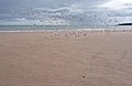
 Birds on the Beach - geograph.org.uk - 3080599.jpg 640 × 470; 365 KB
-
 Blowhole in dunes at Lunan Bay - geograph.org.uk - 3552275.jpg 1,024 × 681; 92 KB
-
 Braehead of Lunan - geograph.org.uk - 1093925.jpg 640 × 428; 48 KB
-
 Braehead of Lunan - geograph.org.uk - 1510261.jpg 640 × 480; 101 KB
-
 Buckie Den - geograph.org.uk - 1510258.jpg 640 × 480; 91 KB
-
 Buckie Den - geograph.org.uk - 5839292.jpg 640 × 427; 248 KB
-
 Coastal defences on the estuary of the River Lunan - geograph.org.uk - 5891108.jpg 3,264 × 2,448; 2.52 MB
-
 Coastline defences near Red Castle - geograph.org.uk - 4493011.jpg 640 × 480; 59 KB
-
 Complex Ripples - geograph.org.uk - 3080622.jpg 480 × 640; 574 KB
-
 Defences or Net Anchors^ - geograph.org.uk - 4258274.jpg 640 × 476; 349 KB
-
 Defensive features in the landscape by Red Castle - geograph.org.uk - 6439050.jpg 3,224 × 2,418; 5.12 MB
-
 Dune Runners - geograph.org.uk - 5070004.jpg 640 × 427; 287 KB
-
 Erosion and deposition, near tank traps, on the River Lunan - geograph.org.uk - 6059816.jpg 5,472 × 3,648; 5.42 MB
-
 Erosion in Action - geograph.org.uk - 4258289.jpg 474 × 640; 393 KB
-
 Farmland near Lunan Lodge - geograph.org.uk - 220389.jpg 640 × 438; 144 KB
-
 Fishing net on Lunan Bay beach - geograph.org.uk - 3073203.jpg 1,024 × 684; 144 KB
-
 High Spring Tide at Lunan Bay - geograph.org.uk - 1459662.jpg 640 × 427; 250 KB
-
 Horse by Lunan Dune - geograph.org.uk - 5801504.jpg 3,774 × 2,516; 1.49 MB
-
 Horses on Lunan Bay beach - geograph.org.uk - 3073176.jpg 1,024 × 681; 94 KB
-
 Horses on Lunan Bay beach - geograph.org.uk - 3073192.jpg 1,024 × 684; 84 KB
-
 House over the river - geograph.org.uk - 2312440.jpg 1,259 × 1,600; 335 KB
-
 It's Busy on the Beach - geograph.org.uk - 5839302.jpg 640 × 427; 355 KB
-
 Line of similarly shaped marks on Lunan Bay Beach - geograph.org.uk - 6176170.jpg 3,648 × 5,472; 5.23 MB
-
 Lunan - geograph.org.uk - 1510250.jpg 640 × 480; 122 KB
-
 Lunan Bay - geograph.org.uk - 1978224.jpg 640 × 480; 36 KB
-
 Lunan Bay - geograph.org.uk - 3340.jpg 640 × 430; 37 KB
-
 Lunan Bay - geograph.org.uk - 5555499.jpg 1,600 × 1,113; 208 KB
-
 Lunan Bay - geograph.org.uk - 5839295.jpg 640 × 427; 290 KB
-
 Lunan Bay - geograph.org.uk - 6808399.jpg 960 × 538; 83 KB
-
 Lunan Bay and Lunan Water - geograph.org.uk - 3073206.jpg 1,024 × 683; 171 KB
-
 Lunan Bay near Montrose - geograph.org.uk - 6486559.jpg 1,799 × 1,199; 385 KB
-
 Lunan Bay near Montrose - geograph.org.uk - 6486561.jpg 1,799 × 1,199; 381 KB
-
 Lunan bay shell. - panoramio.jpg 1,600 × 1,068; 414 KB
-
 Lunan Bay station site geograph-3766915-by-Ben-Brooksbank.jpg 2,279 × 1,450; 3.45 MB
-
 Lunan beach. - panoramio.jpg 1,400 × 935; 125 KB
-
 Lunan church (1 of 1).jpg 7,449 × 5,027; 6.58 MB
-
 Lunan Water - geograph.org.uk - 1008181.jpg 480 × 640; 87 KB
-
 Lunan Water - geograph.org.uk - 1008182.jpg 640 × 480; 76 KB
-
 Lunan Water - geograph.org.uk - 6023510.jpg 1,024 × 683; 373 KB
-
 Lunan Water and Home Farm - geograph.org.uk - 959457.jpg 640 × 409; 65 KB
-
 Lunan Water and Red Castle - geograph.org.uk - 6022194.jpg 1,024 × 576; 241 KB
-
 Lunan Water entering the sea at Lunan Bay - geograph.org.uk - 3073178.jpg 1,024 × 683; 98 KB
-
 Lunan Water outflow - geograph.org.uk - 6022190.jpg 1,024 × 576; 260 KB
-
 Lunan Water to the North Sea - geograph.org.uk - 2312450.jpg 1,600 × 787; 204 KB
-
 National Cycle Network Signpost - geograph.org.uk - 1184624.jpg 427 × 640; 119 KB
-
 Net Anchors or Defences^ - geograph.org.uk - 4258175.jpg 640 × 412; 229 KB
-
 North end of Lunan Bay - geograph.org.uk - 3552274.jpg 1,024 × 681; 100 KB
-
 North end of the beach, Lunan Bay - geograph.org.uk - 6603839.jpg 1,024 × 684; 202 KB
-
 North end of the beach, Lunan Bay - geograph.org.uk - 6603844.jpg 1,024 × 684; 205 KB
-
 North Sea at Lunan Bay - geograph.org.uk - 1918427.jpg 480 × 640; 159 KB
-

-
 Northward view of tank traps at Lunan Bay - geograph.org.uk - 5904022.jpg 3,264 × 2,448; 2.55 MB
-
 On the beach at Lunan Bay - geograph.org.uk - 3552277.jpg 1,024 × 681; 98 KB
-
 Outflow of the Lunan Water - geograph.org.uk - 6022195.jpg 1,024 × 576; 180 KB
-
 Outflow of the Lunan Water - geograph.org.uk - 6023513.jpg 1,024 × 683; 301 KB
-
 Pioneer, plant species colonising the beach at Lunan Bay - geograph.org.uk - 6175140.jpg 5,472 × 3,648; 6.38 MB
-
 Rail bridge. - panoramio.jpg 1,400 × 935; 143 KB
-
 Railway Bridge near Hawkhill - geograph.org.uk - 1093977.jpg 640 × 428; 63 KB
-
 Railway Bridge south of Lunan Lodge - geograph.org.uk - 1184595.jpg 640 × 426; 113 KB
-
 Railway Bridge south of Lunan Lodge - geograph.org.uk - 1184632.jpg 640 × 427; 108 KB
-
 Railway bridge, Lunan - geograph.org.uk - 1510253.jpg 640 × 480; 148 KB
-
 Red Castle at Lunan Bay, Angus - geograph.org.uk - 647815.jpg 640 × 512; 42 KB
-
 Red Castle silhouetted against the sky - geograph.org.uk - 6218155.jpg 5,472 × 3,648; 5 MB
-
 Red Castle viewed from across Lunan Water - geograph.org.uk - 6218006.jpg 5,472 × 3,648; 6.18 MB
-
 Redcastle - geograph.org.uk - 4443111.jpg 640 × 375; 230 KB
-

-
 Sanderling (Calidris alba) - geograph.org.uk - 5069996.jpg 640 × 427; 282 KB
-
 Sanderling (Calidris alba) - geograph.org.uk - 5070001.jpg 640 × 427; 281 KB
-
 Sandy beach at Lunan Bay - geograph.org.uk - 5865079.jpg 3,264 × 2,448; 2.21 MB
-

-
 Sea stacks at northern end of Lunan Bay - geograph.org.uk - 5555506.jpg 1,600 × 1,200; 316 KB
-
-
 Tank traps on the River Lunan estuary - geograph.org.uk - 5904014.jpg 3,264 × 2,448; 2.45 MB
-
 Telephone box near Braehead - geograph.org.uk - 1544049.jpg 640 × 481; 86 KB
-
 Terns on a fishing net, Lunan Bay - geograph.org.uk - 3073199.jpg 1,012 × 675; 294 KB
-
 The Birds - geograph.org.uk - 4264690.jpg 640 × 418; 228 KB
-
 The road to Lunan - geograph.org.uk - 1721530.jpg 514 × 768; 90 KB
-
 The south part of Lunan Bay - geograph.org.uk - 3073194.jpg 1,024 × 684; 181 KB
-
 Tidal ripples - geograph.org.uk - 5839311.jpg 480 × 640; 369 KB
-
 Tractor hauling boats on the beach at Lunan Bay - geograph.org.uk - 3061917.jpg 1,024 × 684; 122 KB
-
 Train crossing Buckie Viaduct - geograph.org.uk - 5860656.jpg 3,264 × 2,448; 2.15 MB
-

-

-

-
 View of estuary toward the mouth of the River Lunan - geograph.org.uk - 6059784.jpg 5,472 × 3,648; 4.42 MB
-
 View up the coast, Lunan Bay - geograph.org.uk - 3717260.jpg 640 × 480; 63 KB
-
 Walking dogs on Lunan Bay beach - geograph.org.uk - 6274393.jpg 5,472 × 3,648; 6.19 MB
-

-
 World War II tank traps near the mouth of the River Lunan - geograph.org.uk - 5867027.jpg 5,472 × 3,648; 5.56 MB
-
 Old School House - geograph.org.uk - 96120.jpg 640 × 426; 146 KB


.jpg)


_-_geograph.org.uk_-_5069996.jpg)
_-_geograph.org.uk_-_5070001.jpg)


