Category:Luggie Burn
Jump to navigation
Jump to search
stream in North Lanarkshire, Scotland, UK, tributary of North Calder Water | |||||
| Upload media | |||||
| Instance of | |||||
|---|---|---|---|---|---|
| Location | North Lanarkshire, Scotland | ||||
| Mouth of the watercourse |
| ||||
| Different from | |||||
 | |||||
Subcategories
This category has the following 3 subcategories, out of 3 total.
L
- Luggie Bridge, Aitkenhead (2 F)
- Luggie Viaduct (3 F)
T
Media in category "Luggie Burn"
The following 7 files are in this category, out of 7 total.
-
 Flax Mill on the Luggie - geograph.org.uk - 1816149.jpg 800 × 600; 256 KB
-
 Footbridge over the Luggie - geograph.org.uk - 1482379.jpg 480 × 640; 148 KB
-
 Path beside the Luggie Burn - geograph.org.uk - 1221015.jpg 640 × 480; 131 KB
-
 Path beside the Luggie Burn - geograph.org.uk - 1221018.jpg 640 × 480; 126 KB
-
 Rock outcrop - geograph.org.uk - 1464304.jpg 640 × 319; 65 KB
-
 The Bishop Burn - geograph.org.uk - 1464302.jpg 640 × 483; 65 KB
-
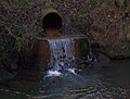
 Tunnel under The A8 - geograph.org.uk - 1482471.jpg 640 × 480; 114 KB


