Category:Lugar, East Ayrshire
Jump to navigation
Jump to search

English: Lugar is a small village in East Ayrshire, southwest Scotland. Lugar is in Auchinleck Parish, Kyle District, Ayrshire. It is SE of Kilmarnock.
village in East Ayrshire, Scotland, UK  | |||||
| Upload media | |||||
| Instance of | |||||
|---|---|---|---|---|---|
| Location |
| ||||
 | |||||
Subcategories
This category has the following 8 subcategories, out of 8 total.
B
- Bello Mill (14 F)
C
- Commondyke railway station (13 F)
L
- Lugar rocking stone (3 F)
- The Lugar Well (3 F)
P
- Lugar Parish Church (9 F)
W
- William Murdoch's Cave (6 F)
Media in category "Lugar, East Ayrshire"
The following 14 files are in this category, out of 14 total.
-
 A row of terraced houses on the A70 - geograph.org.uk - 1159208.jpg 640 × 480; 65 KB
-
 Auchinleck Burn below Lochnoran House - geograph.org.uk - 366379.jpg 640 × 426; 81 KB
-
 Barglachan Farm - geograph.org.uk - 366365.jpg 640 × 409; 43 KB
-
 Birnieknowe Farm - geograph.org.uk - 366372.jpg 640 × 426; 42 KB
-
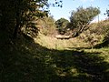 Course of old railway - geograph.org.uk - 1496346.jpg 640 × 480; 101 KB
-
 Dismantled railway track - geograph.org.uk - 366393.jpg 640 × 426; 73 KB
-
 Dixton Farm - geograph.org.uk - 372109.jpg 640 × 426; 52 KB
-
 Farm road to Roadinghead farm - geograph.org.uk - 373751.jpg 640 × 426; 57 KB
-
 Lugar Bowling Club - geograph.org.uk - 991748.jpg 640 × 427; 128 KB
-
 Lugar Parish Church ^ Manse - geograph.org.uk - 3746425.jpg 1,600 × 1,067; 646 KB
-
 Lugar, East Ayrshire.jpg 640 × 480; 163 KB
-
 Lugarite (Lugar Sill, Early Permian, 288 Ma; near Lugar, Ayrshire, Scotland) 12.jpg 3,876 × 2,930; 7.76 MB
-
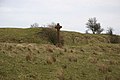 Memorial Cross - geograph.org.uk - 374693.jpg 640 × 426; 54 KB
-
 Wallaceton fields. - geograph.org.uk - 432055.jpg 640 × 480; 99 KB


_12.jpg)

