Category:Luddenham
Jump to navigation
Jump to search
English: Category:Villages in Kent
village and civil parish in Kent, United Kingdom  | |||||
| Upload media | |||||
| Instance of | |||||
|---|---|---|---|---|---|
| Location | Swale, Kent, South East England, England | ||||
| Population |
| ||||
| Different from | |||||
 | |||||
Subcategories
This category has the following 2 subcategories, out of 2 total.
M
O
Media in category "Luddenham"
The following 200 files are in this category, out of 248 total.
(previous page) (next page)-
 A boundary stone in Bysing Wood - geograph.org.uk - 2126728.jpg 640 × 480; 121 KB
-
 A circular walk around Oare (72) (geograph 7055239).jpg 4,207 × 3,155; 3.84 MB
-

-
 Aberdeen Angus cattle on Luddenham Farm - geograph.org.uk - 3115818.jpg 640 × 480; 120 KB
-

-

-
 Approaching Luddenham Court Farm - geograph.org.uk - 3115821.jpg 640 × 480; 66 KB
-
 Beech trees and bluebells, Bysing Wood - geograph.org.uk - 2924548.jpg 640 × 480; 155 KB
-
 Beech trees and bluebells, Bysing Wood - geograph.org.uk - 2924552.jpg 640 × 480; 142 KB
-

-
 Black Cottages, Luddenham - geograph.org.uk - 6428334.jpg 640 × 480; 57 KB
-
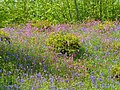
 Bluebell in Bysing Wood - geograph.org.uk - 4459947.jpg 640 × 480; 147 KB
-
 Bluebell time again in Bysing Wood - geograph.org.uk - 3467196.jpg 640 × 480; 168 KB
-
 Bluebell time again in Bysing Wood - geograph.org.uk - 3467207.jpg 640 × 522; 76 KB
-
 Bluebell time again in Bysing Wood - geograph.org.uk - 3467214.jpg 640 × 480; 126 KB
-
 Bluebell time again in Bysing Wood - geograph.org.uk - 3467225.jpg 640 × 480; 195 KB
-
 Bluebell time again in Bysing Wood - geograph.org.uk - 3467235.jpg 640 × 471; 146 KB
-
 Bluebell time again in Bysing Wood - geograph.org.uk - 6444143.jpg 640 × 496; 155 KB
-
 Bluebell time again in Bysing Wood - geograph.org.uk - 6444147.jpg 640 × 480; 161 KB
-
 Bluebell time again in Bysing Wood - geograph.org.uk - 6444152.jpg 640 × 455; 143 KB
-
 Bluebell time again in Bysing Wood - geograph.org.uk - 6444170.jpg 640 × 480; 144 KB
-
 Bluebell time again in Bysing Wood - geograph.org.uk - 6444176.jpg 478 × 640; 146 KB
-

-

-

-
 Bluebells in Bysing Wood - geograph.org.uk - 1852560.jpg 640 × 427; 166 KB
-
 Bluebells in Bysing Wood - geograph.org.uk - 1852573.jpg 640 × 427; 144 KB
-
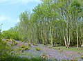
 Bysing Wood - geograph.org.uk - 2924561.jpg 640 × 473; 162 KB
-
 Bysing Wood bluebells - geograph.org.uk - 1852547.jpg 640 × 410; 143 KB
-
 Bysing Wood bluebells - geograph.org.uk - 2924540.jpg 640 × 480; 163 KB
-
 Bysing Wood bluebells - geograph.org.uk - 2924556.jpg 480 × 640; 146 KB
-
 Bysing Wood bluebells - geograph.org.uk - 2924574.jpg 640 × 480; 155 KB
-

-
 Bysing Wood Cottages, near Faversham - geograph.org.uk - 4483487.jpg 2,272 × 1,704; 956 KB
-
 Bysing Wood Faversham - geograph.org.uk - 4916544.jpg 640 × 457; 154 KB
-
 Bysing Wood footpath, near Faversham - geograph.org.uk - 4460197.jpg 480 × 640; 172 KB
-
 Bysing Wood near Faversham - geograph.org.uk - 4460251.jpg 480 × 640; 187 KB
-
 Bysing Wood near Faversham - geograph.org.uk - 4460257.jpg 480 × 640; 166 KB
-
 Bysing Wood near Faversham - geograph.org.uk - 4460270.jpg 480 × 640; 130 KB
-

-
 Bysing Wood Road, near Faversham - geograph.org.uk - 4483485.jpg 2,272 × 1,704; 1,002 KB
-

-
 Bysing Wood, Faversham - geograph.org.uk - 5361618.jpg 480 × 640; 165 KB
-
 Bysing Wood, Faversham - geograph.org.uk - 5361638.jpg 640 × 480; 165 KB
-
 Bysing Wood, near Faversham - geograph.org.uk - 4460057.jpg 640 × 480; 164 KB
-
 Bysing Wood, near Faversham - geograph.org.uk - 4460121.jpg 640 × 480; 153 KB
-
 Bysing Wood, near Faversham - geograph.org.uk - 6464021.jpg 640 × 480; 157 KB
-
 Bysing Wood, near Faversham - geograph.org.uk - 6709412.jpg 640 × 480; 65 KB
-

-
 Cattle at Luddenham Court Farm, - geograph.org.uk - 6429727.jpg 640 × 480; 76 KB
-
 Cattle at Luddenham Court Farm, - geograph.org.uk - 6790519.jpg 640 × 427; 66 KB
-
 Cattle in Luddenham Court Farm - geograph.org.uk - 6790514.jpg 458 × 640; 79 KB
-
 Cattle, Luddenham Marshes - geograph.org.uk - 5428701.jpg 640 × 428; 114 KB
-
 Celandines in Bysing Wood - geograph.org.uk - 6800095.jpg 640 × 446; 144 KB
-
 Cheesemans House, Luddenham - geograph.org.uk - 6429695.jpg 640 × 480; 92 KB
-
 Cherry Drive, Luddenham - geograph.org.uk - 4483480.jpg 2,272 × 1,704; 662 KB
-

-
 Coppiced beech trees in Bysing Wood - geograph.org.uk - 6429676.jpg 640 × 480; 139 KB
-
 Cottages, Luddenham - geograph.org.uk - 3842691.jpg 640 × 480; 154 KB
-
 Country cottages near Faversham - geograph.org.uk - 3718533.jpg 640 × 360; 60 KB
-
 Country lane, Luddenham - geograph.org.uk - 6428331.jpg 640 × 480; 120 KB
-
 Crossroads at Oare - geograph.org.uk - 5634190.jpg 640 × 480; 85 KB
-
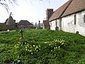 Daffodils in St Mary's Churchyard, Luddenham - geograph.org.uk - 4890858.jpg 4,608 × 3,456; 3.38 MB
-
 Daffodils in St Mary's Churchyard, Luddenham - geograph.org.uk - 4890883.jpg 4,608 × 3,456; 3.39 MB
-
 Dead tree and bluebells in Bysing Wood - geograph.org.uk - 6444157.jpg 640 × 464; 150 KB
-
 Dead tree in Bysing Wood - geograph.org.uk - 6434711.jpg 640 × 448; 137 KB
-
 Ditch at Luddenham Court Farm - geograph.org.uk - 3115873.jpg 480 × 640; 99 KB
-
 Ditch at Luddenham Court Farm - geograph.org.uk - 3115878.jpg 640 × 480; 141 KB
-

-
 Drain, Luddenham Court Farm - geograph.org.uk - 6790396.jpg 640 × 492; 155 KB
-
 Drain, Luddenham Court Farm - geograph.org.uk - 6790400.jpg 640 × 455; 104 KB
-

-
 Drainage ditch, Teynham Levels - geograph.org.uk - 3040428.jpg 640 × 430; 69 KB
-
 Embankment south of The Swale - geograph.org.uk - 3040420.jpg 640 × 373; 54 KB
-
 Entrance to Bysing Wood Pool - geograph.org.uk - 4460322.jpg 640 × 480; 147 KB
-
 Entrance to Luddenham Court - geograph.org.uk - 6428373.jpg 640 × 480; 58 KB
-

-
 Farmyard, Luddenham Court Farm - geograph.org.uk - 6790507.jpg 640 × 468; 95 KB
-
 Felled tree in Bysing Wood - geograph.org.uk - 6428294.jpg 640 × 480; 135 KB
-

-
 Flooded footpath in Bysing Wood - geograph.org.uk - 2924581.jpg 480 × 640; 153 KB
-
 Flooded lane, Luddenham - geograph.org.uk - 6790537.jpg 507 × 640; 95 KB
-

-
 Footpath and mossy bank in Bysing Wood - geograph.org.uk - 2924587.jpg 640 × 480; 165 KB
-
 Footpath at Four Oaks - geograph.org.uk - 4890897.jpg 4,608 × 3,456; 3.38 MB
-
 Footpath from Uplees Road to Uplees Road - geograph.org.uk - 4230389.jpg 4,000 × 3,000; 3.95 MB
-

-
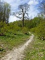
 Footpath to Luddenham - geograph.org.uk - 3115807.jpg 640 × 515; 88 KB
-
 Footpath to Luddenham - geograph.org.uk - 3115812.jpg 640 × 480; 95 KB
-
 Footpath to Luddenham Court Farm - geograph.org.uk - 3115885.jpg 640 × 464; 75 KB
-
 Footpath to Uplees Road - geograph.org.uk - 4228409.jpg 4,000 × 3,000; 4 MB
-
 Footpaths at Luddenham Court farm - geograph.org.uk - 1224830.jpg 640 × 480; 73 KB
-
 Four Oaks Cottages, Bysing Wood Road - geograph.org.uk - 6489309.jpg 640 × 428; 95 KB
-
 Four Oaks Cottages, Bysing Wood Road - geograph.org.uk - 6489317.jpg 640 × 483; 103 KB
-
 Frozen fields from Uplees Rd, Faversham - geograph.org.uk - 5263445.jpg 2,556 × 1,704; 434 KB
-
 Frozen pond, Uplees Rd, Faversham - geograph.org.uk - 5263455.jpg 5,472 × 3,648; 2.89 MB
-
 Fungus in Bysing Wood, Faversham - geograph.org.uk - 6709401.jpg 520 × 640; 93 KB
-
 Fungus in Bysing Wood, Faversham - geograph.org.uk - 6726308.jpg 456 × 640; 64 KB
-
 Fungus in Bysing Wood, Faversham - geograph.org.uk - 6726312.jpg 640 × 437; 73 KB
-

-

-
 Gnarled tree, mossy bank, Bysing Wood - geograph.org.uk - 5634196.jpg 640 × 486; 112 KB
-
 Gone fishing - geograph.org.uk - 2345609.jpg 640 × 474; 141 KB
-
 Gravestone in Luddenham churchyare - geograph.org.uk - 6429745.jpg 640 × 480; 108 KB
-

-
 Interior of St Mary's Church, Luddenham - geograph.org.uk - 4890868.jpg 4,608 × 3,456; 3.34 MB
-

-

-
 Kissing gate near Luddenham - geograph.org.uk - 6790370.jpg 640 × 466; 124 KB
-
 Kissing gate on Luddenham Court Farm - geograph.org.uk - 6790523.jpg 480 × 640; 63 KB
-
 Lane by Nash's Farm, Luddenham - geograph.org.uk - 6428394.jpg 640 × 480; 79 KB
-
 Lane leading from Luddenham Court - geograph.org.uk - 4483481.jpg 2,272 × 1,704; 634 KB
-
 Lane leading from Luddenham Court - geograph.org.uk - 4483482.jpg 2,272 × 1,704; 696 KB
-
 Lane near Nash's Farm - geograph.org.uk - 4713317.jpg 4,608 × 3,456; 3.47 MB
-
 Lane near Nash's Farm - geograph.org.uk - 4713318.jpg 4,608 × 3,456; 3.37 MB
-
 Leaving the track through Bysing Wood - geograph.org.uk - 2924564.jpg 640 × 480; 143 KB
-
 Looking to Wildmarsh - geograph.org.uk - 4713310.jpg 4,608 × 3,456; 3.36 MB
-
 Looking towards Nash's Farm - geograph.org.uk - 4713321.jpg 4,608 × 3,456; 3.42 MB
-

-
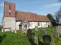
 Luddenham church - geograph.org.uk - 3842788.jpg 640 × 480; 216 KB
-
 Luddenham Church - geograph.org.uk - 6429735.jpg 516 × 640; 131 KB
-
 Luddenham Court Farm - geograph.org.uk - 4483479.jpg 2,272 × 1,704; 662 KB
-
 Luddenham Court Farm - geograph.org.uk - 6429751.jpg 640 × 486; 91 KB
-
 Luddenham Court Farm - geograph.org.uk - 6790377.jpg 640 × 482; 78 KB
-
 Luddenham Court Farm - geograph.org.uk - 6790383.jpg 640 × 455; 81 KB
-
 Luddenham Court Farm - geograph.org.uk - 6790390.jpg 640 × 456; 50 KB
-
 Luddenham Court Farm - geograph.org.uk - 6790511.jpg 640 × 485; 95 KB
-
 Luddenham Court Farm near Faversham - geograph.org.uk - 1759833.jpg 640 × 397; 88 KB
-
 Luddenham Court Farm, - geograph.org.uk - 3115814.jpg 640 × 475; 121 KB
-
 Luddenham Court Farm, - geograph.org.uk - 3115830.jpg 640 × 428; 65 KB
-
 Luddenham Gut entering The Swale - geograph.org.uk - 3040414.jpg 640 × 430; 51 KB
-
 Luddenham Marshes - geograph.org.uk - 4483472.jpg 2,272 × 1,704; 739 KB
-
 Luddenham Marshes - geograph.org.uk - 4483473.jpg 2,272 × 1,704; 464 KB
-
 Luddenham Marshes - geograph.org.uk - 4483476.jpg 2,272 × 1,704; 646 KB
-
 Luddenham Marshes - geograph.org.uk - 4490192.jpg 2,272 × 1,704; 870 KB
-
 Luddenham Marshes - geograph.org.uk - 4490202.jpg 2,272 × 1,704; 902 KB
-

-
 Luddenham School - geograph.org.uk - 6428319.jpg 640 × 480; 84 KB
-
 Marshy area, Teynham Levels - geograph.org.uk - 3040417.jpg 640 × 389; 70 KB
-
 Moss lined footpath in Bysing Wood - geograph.org.uk - 6444180.jpg 480 × 640; 155 KB
-
 Mud, The Swale - geograph.org.uk - 3040434.jpg 640 × 430; 53 KB
-
 Mudflats, The Swale - geograph.org.uk - 3040424.jpg 640 × 430; 53 KB
-
 Nash's Cottages, Luddenham - geograph.org.uk - 6429688.jpg 640 × 480; 100 KB
-
 Nash's Farm, Luddenham - geograph.org.uk - 6790540.jpg 640 × 471; 100 KB
-
 New gate, Luddenham Court Farm - geograph.org.uk - 4324554.jpg 3,114 × 2,445; 2.49 MB
-
 Norman doorway at St Mary's Church, Luddenham - geograph.org.uk - 4890892.jpg 4,608 × 3,456; 3.42 MB
-
 Oast Cottage and Black Cottages, Luddenham - geograph.org.uk - 4483474.jpg 2,272 × 1,704; 782 KB
-
 Once this was someone's car - geograph.org.uk - 1558715.jpg 640 × 427; 135 KB
-
 Path into Bysing Wood - geograph.org.uk - 6428287.jpg 640 × 440; 126 KB
-
 Path through Bysing Wood, Faversham - geograph.org.uk - 4916657.jpg 640 × 480; 153 KB
-
 Path through Bysing Woods - geograph.org.uk - 2924545.jpg 640 × 480; 156 KB
-
 Path to the marshes - geograph.org.uk - 4230383.jpg 4,000 × 3,000; 3.73 MB
-
 Poplars near Luddenham Court Farm - geograph.org.uk - 1058801.jpg 640 × 480; 61 KB
-
 Rape field by Bysing Wood - geograph.org.uk - 6800096.jpg 640 × 410; 85 KB
-
 Road to Luddenham School - geograph.org.uk - 6428300.jpg 489 × 640; 89 KB
-
 Road to Luddenham School - geograph.org.uk - 6428301.jpg 640 × 480; 118 KB
-
 Road to Luddenham School - geograph.org.uk - 6428304.jpg 480 × 640; 164 KB
-

-
 Saxon Shore Way - geograph.org.uk - 3040422.jpg 640 × 430; 71 KB
-
 Saxon Shore Way - geograph.org.uk - 3040437.jpg 640 × 430; 79 KB
-
 Saxon Shore Way by The Swale - geograph.org.uk - 3040431.jpg 640 × 430; 68 KB
-

-
 Sheep on Luddenham Court Farm - geograph.org.uk - 6790525.jpg 640 × 480; 83 KB
-
 Sheep pasture near Nash's Farm - geograph.org.uk - 302736.jpg 640 × 480; 111 KB
-
 Sheep pasture, Luddenham - geograph.org.uk - 302909.jpg 640 × 482; 90 KB
-
 Sign of spring, Luddenham Court Farm - geograph.org.uk - 6790407.jpg 640 × 532; 63 KB
-
 Small Pond at Luddenham Court Farm - geograph.org.uk - 1015038.jpg 640 × 481; 147 KB
-

-
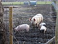 Sow and piglets on Luddenham Court Farm - geograph.org.uk - 302906.jpg 640 × 480; 135 KB
-
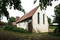
 St Mary's Church, Luddenham - geograph.org.uk - 4890850.jpg 4,608 × 3,456; 3.38 MB
-
 St Mary's Church, Luddenham - geograph.org.uk - 4890851.jpg 4,608 × 3,456; 3.38 MB
-
 St Mary's Churchyard, Luddenham - geograph.org.uk - 4890862.jpg 4,608 × 3,456; 3.36 MB
-
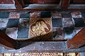
 St Mary, Luddenham - Brass, WWI - geograph.org.uk - 3015958.jpg 1,000 × 710; 157 KB
-
 St Mary, Luddenham - Chancel - geograph.org.uk - 3015872.jpg 1,000 × 665; 119 KB
-
 St Mary, Luddenham - Chancel - geograph.org.uk - 3015956.jpg 1,000 × 685; 130 KB
-
 St Mary, Luddenham - Churchyard - geograph.org.uk - 3015869.jpg 1,000 × 665; 252 KB
-
 St Mary, Luddenham - Churchyard - geograph.org.uk - 3015972.jpg 1,000 × 652; 206 KB
-
 St Mary, Luddenham - Churchyard - geograph.org.uk - 3015975.jpg 665 × 1,000; 213 KB
-
 St Mary, Luddenham - Churchyard - geograph.org.uk - 3015978.jpg 1,000 × 642; 230 KB
-
 St Mary, Luddenham - Churchyard - geograph.org.uk - 3015979.jpg 1,000 × 665; 197 KB
-
 St Mary, Luddenham - Coffin lid - geograph.org.uk - 3015960.jpg 1,000 × 600; 127 KB
-
 St Mary, Luddenham - Coffin lid detail - geograph.org.uk - 3015962.jpg 1,000 × 740; 199 KB
-
 St Mary, Luddenham - Exterior detail - geograph.org.uk - 3015969.jpg 660 × 1,000; 274 KB
-
 St Mary, Luddenham - Font - geograph.org.uk - 3015959.jpg 617 × 1,000; 88 KB
-
 St Mary, Luddenham - geograph.org.uk - 3015867.jpg 1,000 × 672; 190 KB
-
 St Mary, Luddenham - geograph.org.uk - 3015870.jpg 1,000 × 735; 179 KB
-
 St Mary, Luddenham - Harmonium - geograph.org.uk - 3015876.jpg 1,000 × 667; 127 KB
-
 St Mary, Luddenham - Medieval tiles - geograph.org.uk - 3015955.jpg 1,000 × 662; 155 KB
-
 St Mary, Luddenham - Piscina - geograph.org.uk - 3015877.jpg 1,000 × 667; 124 KB
-
 St Mary, Luddenham - Pulpit - geograph.org.uk - 3015957.jpg 1,000 × 700; 117 KB
-
 St Mary, Luddenham - Sanctuary - geograph.org.uk - 3015874.jpg 1,000 × 687; 150 KB
-
 St Mary, Luddenham - Sanctuary - geograph.org.uk - 3015875.jpg 1,000 × 687; 150 KB
-
 St Mary, Luddenham - Stoup - geograph.org.uk - 3015961.jpg 1,000 × 892; 142 KB
-
 St Mary, Luddenham - Tiles - geograph.org.uk - 3015880.jpg 863 × 1,000; 235 KB
-
 St Mary, Luddenham - Tiles - geograph.org.uk - 3015881.jpg 992 × 1,000; 227 KB
-
 St Mary, Luddenham - Tiles - geograph.org.uk - 3015888.jpg 1,000 × 660; 163 KB
-
 St Mary, Luddenham - West doorway - geograph.org.uk - 3015964.jpg 665 × 1,000; 219 KB
-
 Stile, Saxon Shore Way - geograph.org.uk - 3040438.jpg 640 × 430; 82 KB
-
 Straw bales, Luddenham Court Farm - geograph.org.uk - 3115832.jpg 640 × 465; 77 KB
-
 Teynham Levels - geograph.org.uk - 3040432.jpg 640 × 430; 50 KB

_(geograph_7055239).jpg)


