Category:Luccombe, Somerset
Jump to navigation
Jump to search
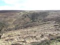
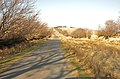
English: Luccombe is a village and civil parish in the Exmoor National Park in the English county of Somerset. It at the foot of the moor's highest hill, the 1,750ft Dunkery Beacon, and is about one mile south of the A39 road between Porlock and Minehead. Administratively it forms part of the district of West Somerset. The parish includes the hamlets of Stoke Pero and Horner.
village in West Somerset, Somerset in England  | |||||
| Upload media | |||||
| Instance of | |||||
|---|---|---|---|---|---|
| Location | Luccombe, Somerset West and Taunton, Somerset, South West England, England | ||||
 | |||||
Subcategories
This category has the following 9 subcategories, out of 9 total.
A
- Alderman's Barrow (1 F)
- Almsworthy Common (9 F)
F
- Ford near Cloutsham (6 F)
H
- Horner bridge (1 F)
N
- Nutscale Reservoir (12 F)
S
- St Mary's Church, Luccombe (6 F)
W
Media in category "Luccombe, Somerset"
The following 200 files are in this category, out of 682 total.
(previous page) (next page)-
 A bridleway through the woods - geograph.org.uk - 3638566.jpg 1,500 × 1,000; 355 KB
-
 A39 crossing New Bridge over Horner Water - geograph.org.uk - 6031254.jpg 1,600 × 1,067; 918 KB
-
 A39 east of Porlock - geograph.org.uk - 6031256.jpg 1,600 × 998; 568 KB
-
 Above Aller Combe - geograph.org.uk - 1284319.jpg 640 × 480; 100 KB
-
 Above Bagley Coombe - geograph.org.uk - 3245287.jpg 1,600 × 1,200; 469 KB
-
 Above Chetsford Water - geograph.org.uk - 3179478.jpg 640 × 401; 234 KB
-
 Above Halse Combe - geograph.org.uk - 2788850.jpg 640 × 427; 197 KB
-
 Above Hollow Combe - geograph.org.uk - 1982243.jpg 640 × 427; 241 KB
-
 Above Luccombe Hill - geograph.org.uk - 4819780.jpg 800 × 600; 91 KB
-
 Above Nutscale Water - geograph.org.uk - 3245407.jpg 1,600 × 1,094; 492 KB
-
 Above Yeals Combe - geograph.org.uk - 2788844.jpg 640 × 427; 214 KB
-
 Across Aller Combe - geograph.org.uk - 2786320.jpg 640 × 427; 219 KB
-
 Across Bagley Combe - geograph.org.uk - 2787370.jpg 640 × 426; 239 KB
-
 Alderman's Barrow Allotment - geograph.org.uk - 3179531.jpg 640 × 424; 221 KB
-
 Alderman's Barrow Allotment - geograph.org.uk - 3179535.jpg 640 × 424; 214 KB
-
 Aller Combe - geograph.org.uk - 1284353.jpg 640 × 480; 115 KB
-
 Allerford Packhorse Bridge - geograph.org.uk - 6161001.jpg 1,024 × 694; 1.13 MB
-
 Almsworthy Common - geograph.org.uk - 6398591.jpg 1,600 × 1,200; 729 KB
-
 Alongside Horner Water - geograph.org.uk - 2788787.jpg 640 × 427; 248 KB
-
 Alongside Horner Water - geograph.org.uk - 2788790.jpg 640 × 427; 249 KB
-
 Ancient Walling, Cloutsham - geograph.org.uk - 415244.jpg 640 × 480; 169 KB
-
 Bagley Combe - geograph.org.uk - 1284125.jpg 640 × 480; 109 KB
-
-
 Barn at Holnicote - geograph.org.uk - 1982194.jpg 640 × 427; 232 KB
-
 Barn at Holt - geograph.org.uk - 3174474.jpg 640 × 431; 213 KB
-
 Bench with a view of East Water Valley - geograph.org.uk - 4406636.jpg 1,600 × 1,066; 547 KB
-
 Blackford Combe - geograph.org.uk - 760531.jpg 640 × 480; 101 KB
-
 Blackford Combe - geograph.org.uk - 772603.jpg 480 × 640; 97 KB
-
 Blooming heather, on Luccombe Hill - geograph.org.uk - 2561856.jpg 768 × 1,024; 404 KB
-
 Bridge and ford number 1 - geograph.org.uk - 2611161.jpg 640 × 480; 161 KB
-
 Bridge and ford number 3 - geograph.org.uk - 2611168.jpg 640 × 480; 150 KB
-
 Bridge over Chetsford Water - geograph.org.uk - 148987.jpg 568 × 425; 130 KB
-
 Bridge over Chetsford Water - geograph.org.uk - 3179480.jpg 640 × 435; 168 KB
-
 Bridge over Chetsford Water - geograph.org.uk - 6398600.jpg 1,600 × 1,200; 1,006 KB
-
 Bridge over Chetsford Water, near Greenlands, near Exford - geograph.org.uk - 4117150.jpg 2,560 × 1,920; 2.13 MB
-
 Bridge over Horner Water - geograph.org.uk - 3657390.jpg 640 × 480; 157 KB
-
 Bridge over Horner Water - geograph.org.uk - 3657516.jpg 640 × 480; 130 KB
-
 Bridleway junction - geograph.org.uk - 2787402.jpg 640 × 427; 225 KB
-
 Bridleway Signpost, Luccombe Lane - geograph.org.uk - 1660552.jpg 640 × 430; 182 KB
-
 Bridleway to Lucott Farm - geograph.org.uk - 2788459.jpg 640 × 427; 258 KB
-
 Bridleway to Tarr Ball - geograph.org.uk - 2788464.jpg 640 × 427; 241 KB
-
 Bridleway to Wilmersham - geograph.org.uk - 3657418.jpg 640 × 480; 127 KB
-
 Bridleway towards Stoke Pero - geograph.org.uk - 2787397.jpg 640 × 426; 246 KB
-
 Bridleway, Cloutsham - geograph.org.uk - 3657499.jpg 640 × 480; 94 KB
-
 Bristol Channel ^ Welsh Coast - geograph.org.uk - 2395878.jpg 800 × 533; 340 KB
-

-
 Cairn, to the south west of Great Rowbarrow - geograph.org.uk - 2563022.jpg 1,024 × 768; 319 KB
-
 Cascade on Horner Water - geograph.org.uk - 5633563.jpg 1,024 × 768; 334 KB
-
 Cattle at Lucott Farm - geograph.org.uk - 2788455.jpg 640 × 427; 237 KB
-
 Cattle at Tarr Ball - geograph.org.uk - 2788753.jpg 640 × 428; 250 KB
-
 Cattle at Tarr Ball - geograph.org.uk - 2788762.jpg 640 × 428; 217 KB
-
 Cattle at West Luccombe Farm - geograph.org.uk - 2784230.jpg 640 × 427; 199 KB
-
 Cattle Grid on Lucott Moor - geograph.org.uk - 3430020.jpg 1,024 × 770; 174 KB
-
 Cattle grid on Porlock Allotment - geograph.org.uk - 6398615.jpg 1,600 × 1,200; 903 KB
-
 Cattle Grid, on Tarr Ball Hill - geograph.org.uk - 3428084.jpg 1,024 × 768; 157 KB
-
 Chapel Cross, Luccombe - geograph.org.uk - 2196522.jpg 640 × 480; 111 KB
-
 Chetsford Bridge - geograph.org.uk - 2668486.jpg 1,024 × 768; 303 KB
-
 Chetsford Bridge - geograph.org.uk - 3429840.jpg 1,024 × 768; 243 KB
-
 Chetsford Bridge - geograph.org.uk - 3551265.jpg 1,500 × 1,000; 388 KB
-
 Chetsford bridge - geograph.org.uk - 680394.jpg 640 × 480; 67 KB
-
 Chetsford Bridge - geograph.org.uk - 772167.jpg 640 × 480; 111 KB
-
 Chetsford Water (2) - geograph.org.uk - 6398598.jpg 1,600 × 1,200; 1,014 KB
-
 Chetsford Water - geograph.org.uk - 3429942.jpg 1,024 × 768; 252 KB
-
 Chetsford Water - geograph.org.uk - 3551263.jpg 1,500 × 1,000; 221 KB
-
 Chetsford Water - geograph.org.uk - 6398595.jpg 1,200 × 1,600; 1,013 KB
-
 Chetsford Water - geograph.org.uk - 680382.jpg 640 × 480; 51 KB
-
 Chetsford Water - geograph.org.uk - 760465.jpg 640 × 480; 102 KB
-
 Chisland Lane looking South-West - geograph.org.uk - 177398.jpg 480 × 640; 104 KB
-
 Chisland Lane near Luccombe - geograph.org.uk - 177220.jpg 480 × 640; 103 KB
-
 Chisland Lane, Luccombe - geograph.org.uk - 2196519.jpg 640 × 480; 95 KB
-
 Clouds Brushing Dunkery.jpg 5,483 × 1,076; 609 KB
-
 Cloutsham , The Farm - geograph.org.uk - 98785.jpg 484 × 640; 131 KB
-
 Cloutsham Ball - geograph.org.uk - 2561699.jpg 1,024 × 768; 231 KB
-
 Cloutsham Farm Exmoor Somerset - geograph.org.uk - 178269.jpg 640 × 455; 137 KB
-
 Cloutsham Farm, Bed and Breakfast - geograph.org.uk - 2564224.jpg 1,024 × 768; 260 KB
-
 Cloutsham Ford - geograph.org.uk - 5137140.jpg 6,000 × 4,000; 6.35 MB
-
 Coleridge Way at Halse Combe - geograph.org.uk - 4408078.jpg 1,920 × 1,440; 1.04 MB
-
 Coleridge Way near Halse Combe - geograph.org.uk - 4408028.jpg 1,920 × 1,440; 1.37 MB
-

-
 Copse on Stoke Ridge - geograph.org.uk - 2787379.jpg 427 × 640; 224 KB
-
 Cottage and mill, Horner - geograph.org.uk - 2373165.jpg 640 × 477; 362 KB
-
 Cottages along Horner main street - geograph.org.uk - 4406605.jpg 1,600 × 1,066; 470 KB
-
 Cottages at Horner - geograph.org.uk - 681560.jpg 640 × 427; 108 KB
-
 Cottages at Horner.jpg 3,640 × 2,848; 6.4 MB
-
 Cottages at West Luccombe - geograph.org.uk - 6092231.jpg 6,000 × 4,000; 4.53 MB
-
 Cottages, Horner - geograph.org.uk - 3422677.jpg 1,024 × 768; 271 KB
-
 Country Lane, Luccombe - geograph.org.uk - 2196529.jpg 1,024 × 768; 259 KB
-
 Country road, Cloutsham - geograph.org.uk - 2373153.jpg 640 × 481; 299 KB
-
 Cow at Tarr Ball - geograph.org.uk - 2788751.jpg 640 × 427; 246 KB
-
 Crook Horn Hill, near the Cattle Grid - geograph.org.uk - 98754.jpg 640 × 480; 152 KB
-
 Curious Green Wheel Sign - geograph.org.uk - 177401.jpg 640 × 464; 141 KB
-
 Cyclists in Horner Wood - geograph.org.uk - 2787420.jpg 640 × 467; 250 KB
-

-
 Deer on Honeycombe Hill - geograph.org.uk - 3179217.jpg 640 × 427; 204 KB
-
 Descent to Robin How - geograph.org.uk - 1982239.jpg 640 × 427; 238 KB
-
 Dicky's Path in Hollow Combe - geograph.org.uk - 1284474.jpg 480 × 640; 138 KB
-
 Dunkery Beacon , East Water - geograph.org.uk - 1212185.jpg 640 × 480; 128 KB
-
 Dunkery from Webber's Post.jpg 4,004 × 2,749; 3.77 MB
-
 Dunkery Hill , Exmoor Scenery - geograph.org.uk - 1212201.jpg 640 × 101; 19 KB
-
 Dunkery Hill , Footpath - geograph.org.uk - 1212177.jpg 640 × 299; 100 KB
-
 Dunkery Hill , Footpath - geograph.org.uk - 1212181.jpg 640 × 480; 143 KB
-
 Dunkery Hill , Footpath - geograph.org.uk - 1212191.jpg 640 × 480; 137 KB
-
 East Water - geograph.org.uk - 2565176.jpg 768 × 1,024; 320 KB
-
 East Water upstream of the ford - geograph.org.uk - 6064692.jpg 1,600 × 1,200; 1.04 MB
-
 East Water Valley Ford 1 - geograph.org.uk - 5137180.jpg 6,000 × 4,000; 6.25 MB
-
 East Water Valley Ford 2 - geograph.org.uk - 5137191.jpg 6,000 × 4,000; 5.96 MB
-
 East Water Valley Ford 3 - geograph.org.uk - 5137204.jpg 6,000 × 4,000; 6.41 MB
-
 East Water Valley Ford 4 - geograph.org.uk - 5137211.jpg 6,000 × 4,000; 5.32 MB
-
 East Water Valley Ford 5 - geograph.org.uk - 5137216.jpg 6,000 × 4,000; 5.51 MB
-
 East Water Valley Ford 6 - geograph.org.uk - 5137223.jpg 6,000 × 4,000; 6.05 MB
-
 East Water Valley Ford 7 - geograph.org.uk - 5137228.jpg 6,000 × 4,000; 5.96 MB
-
 East Water Valley Ford 8 - geograph.org.uk - 5137234.jpg 6,000 × 4,000; 5.92 MB
-
 Edge of Alderman's Barrow Allotment - geograph.org.uk - 3179495.jpg 640 × 427; 208 KB
-
 Edwardian postbox found in Horner - geograph.org.uk - 4406613.jpg 1,066 × 1,600; 578 KB
-
 Ember Combe - geograph.org.uk - 3179237.jpg 640 × 427; 183 KB
-
 Ember Combe - geograph.org.uk - 3429768.jpg 1,024 × 768; 236 KB
-
 Embercombe Water - geograph.org.uk - 3179229.jpg 640 × 429; 216 KB
-
 Embercombe Water - geograph.org.uk - 3179231.jpg 640 × 427; 191 KB
-
 Embercombe Water - geograph.org.uk - 3245398.jpg 1,600 × 1,200; 803 KB
-
 Entrance gateway, Pool Farm - geograph.org.uk - 3428023.jpg 1,024 × 768; 239 KB
-
 Entrance to sheep enclosure, above Bagley Combe - geograph.org.uk - 2563888.jpg 1,024 × 768; 315 KB
-
 Exmoor , Bronze Age Cairns - geograph.org.uk - 2623005.jpg 4,288 × 2,848; 6.11 MB
-
 Exmoor , Deer ^ Moorland - geograph.org.uk - 2623000.jpg 4,184 × 2,684; 3.56 MB
-
 Exmoor , Dunkery Beacon Path - geograph.org.uk - 1212172.jpg 640 × 293; 104 KB
-
 Exmoor , Dunkery Hill - geograph.org.uk - 1212203.jpg 640 × 480; 88 KB
-
 Exmoor , Dunkery Hill - geograph.org.uk - 1212207.jpg 640 × 164; 38 KB
-
 Exmoor , Dunkery Hill - geograph.org.uk - 1212239.jpg 640 × 140; 29 KB
-
 Exmoor , East Water - geograph.org.uk - 1212157.jpg 640 × 480; 137 KB
-
 Exmoor , East Water - geograph.org.uk - 1212159.jpg 640 × 480; 151 KB
-
 Exmoor , East Water - geograph.org.uk - 1212175.jpg 640 × 480; 109 KB
-
 Exmoor , East Water and Footpath - geograph.org.uk - 1212245.jpg 640 × 480; 111 KB
-
 Exmoor , Footbridge over East Water - geograph.org.uk - 1212167.jpg 640 × 480; 128 KB
-
 Exmoor , Moorland - geograph.org.uk - 2623007.jpg 4,276 × 2,828; 6.14 MB
-
 Exmoor , Moorland - geograph.org.uk - 2623012.jpg 4,282 × 2,838; 4.57 MB
-
 Exmoor , Moorland Footpath - geograph.org.uk - 2623008.jpg 4,214 × 2,730; 4.46 MB
-
 Exmoor , Moorland of Dunkery Hill - geograph.org.uk - 2622994.jpg 4,288 × 2,848; 6.95 MB
-
 Exmoor , Moorland Road - geograph.org.uk - 2623009.jpg 4,274 × 2,828; 4.25 MB
-
 Exmoor , Moorland Road - geograph.org.uk - 2623011.jpg 4,090 × 2,510; 3.82 MB
-
 Exmoor , Moorland Road - geograph.org.uk - 2623018.jpg 4,288 × 2,848; 6.72 MB
-
 Exmoor , Moorland Road - geograph.org.uk - 2623019.jpg 4,288 × 2,848; 5.93 MB
-
 Exmoor , Moorland Scene - geograph.org.uk - 2623017.jpg 4,212 × 2,730; 5.59 MB
-
 Exmoor , Moorland Scenery - geograph.org.uk - 2623010.jpg 4,288 × 2,848; 5.02 MB
-
 Exmoor , Moorland Scenery - geograph.org.uk - 2623013.jpg 4,210 × 2,726; 4.1 MB
-
 Exmoor , Moorland Scenery - geograph.org.uk - 2623016.jpg 4,210 × 2,728; 3.64 MB
-
 Exmoor , Moorland ^ Deer - geograph.org.uk - 2622991.jpg 4,288 × 2,848; 5.56 MB
-
 Exmoor , Moorland ^ Deer - geograph.org.uk - 2622992.jpg 4,184 × 2,684; 5.18 MB
-
 Exmoor , National Trust sign ^ Path - geograph.org.uk - 2623014.jpg 4,288 × 2,848; 6.61 MB
-
 Exmoor , Scientific Station - geograph.org.uk - 2623006.jpg 4,248 × 2,786; 4.67 MB
-
 Exmoor , Stag ^ Moorland - geograph.org.uk - 2622993.jpg 4,214 × 2,734; 5.4 MB
-
 Exmoor ponies grazing on ancient woodland at Horner Wood - geograph.org.uk - 3682236.jpg 4,288 × 3,216; 3.03 MB
-
 Exmoor Ponies, on Tarr Ball Hill - geograph.org.uk - 3428152.jpg 1,024 × 768; 250 KB
-
 Exmoor Ponies, on Wilmersham Common - geograph.org.uk - 3429778.jpg 1,024 × 768; 235 KB
-
 Exmoor Pony, above Nutscale Reservoir - geograph.org.uk - 3429731.jpg 1,024 × 768; 254 KB
-
 Exmoor, Cloutsham Gate - geograph.org.uk - 1810433.jpg 800 × 386; 401 KB
-
-
 Exmoor, Thurley Combe - geograph.org.uk - 1810356.jpg 800 × 535; 397 KB
-
 Exmoor, View towards Lucott Cross - geograph.org.uk - 1807712.jpg 800 × 595; 512 KB
-
 Exmoor, View towards Thurley Combe - geograph.org.uk - 1810349.jpg 800 × 535; 474 KB
-
 Farm track heading into The Paddock behind Holnicote House - geograph.org.uk - 4668840.jpg 3,128 × 2,346; 2.27 MB
-
 Farm track on Tarr Ball Hill - geograph.org.uk - 3428106.jpg 1,024 × 768; 225 KB
-
 Farm track with sheep heading up towards East Luccombe - geograph.org.uk - 4668835.jpg 3,128 × 2,346; 1.62 MB
-
 Farmland, east of Porlock - geograph.org.uk - 5398550.jpg 1,024 × 768; 148 KB
-
 Farmyard, Wilmersham - geograph.org.uk - 3428037.jpg 1,024 × 768; 159 KB
-
 Feeding in a circle - geograph.org.uk - 6092236.jpg 6,000 × 4,000; 4.15 MB
-
 Felled tree, lying over Horner Water - geograph.org.uk - 5633558.jpg 1,024 × 768; 350 KB
-
 Field boundaries close to the cattle grid, Lucott Moor - geograph.org.uk - 4117142.jpg 2,560 × 1,920; 2.1 MB
-
 Flood debris, Horner Water - geograph.org.uk - 3423188.jpg 1,024 × 768; 309 KB
-
 Flora's Ride - geograph.org.uk - 5633576.jpg 1,024 × 768; 230 KB
-
 Footbridge - geograph.org.uk - 4402125.jpg 1,600 × 1,200; 848 KB
-
 Footbridge 5 and ford 7 - geograph.org.uk - 2611123.jpg 640 × 480; 142 KB
-
 Footbridge in Horner Wood - geograph.org.uk - 2787436.jpg 640 × 427; 238 KB
-
 Footbridge over East Water - geograph.org.uk - 4870936.jpg 1,024 × 768; 367 KB
-

-
 Footbridge over Horner Water - geograph.org.uk - 1237901.jpg 640 × 480; 142 KB
-
 Footbridge over Horner Water - geograph.org.uk - 3423165.jpg 1,024 × 768; 239 KB
-
 Footbridge, West Luccombe - geograph.org.uk - 4408308.jpg 1,920 × 1,440; 1.25 MB
-
 Footpath by Nutscale Water - geograph.org.uk - 3551382.jpg 1,500 × 1,000; 394 KB
-
 Footpath from West Luccombe - geograph.org.uk - 2787460.jpg 640 × 427; 208 KB
-
 Footpath to Horner packhorse bridge - geograph.org.uk - 3638532.jpg 1,000 × 1,500; 262 KB
-
 Ford in Sideway Wood across East Water - geograph.org.uk - 6064690.jpg 1,200 × 1,600; 1.02 MB
-
 Ford, above Nutscale Reservoir - geograph.org.uk - 3429716.jpg 1,024 × 768; 319 KB
-
 Ford, near Hollow Combe - geograph.org.uk - 2565212.jpg 1,024 × 768; 312 KB
-
 Ford, West Luccombe - geograph.org.uk - 4408273.jpg 1,920 × 1,440; 1.16 MB
-
 From Dunkery Hill to Porlock - geograph.org.uk - 6064668.jpg 1,600 × 1,200; 583 KB
-
 From Granny's Path - geograph.org.uk - 2788848.jpg 640 × 427; 206 KB
-
 From Wilmersham Common - geograph.org.uk - 3179215.jpg 640 × 427; 202 KB
-
 Gated road to Stoke Pero - geograph.org.uk - 3428070.jpg 768 × 1,024; 244 KB
-
 Gillhams - geograph.org.uk - 2196810.jpg 768 × 1,024; 162 KB
-
 Goosemoor Common - geograph.org.uk - 4870961.jpg 1,024 × 815; 266 KB
-
 Great Rowbarrow.jpg 4,144 × 2,676; 5.16 MB
-
 Grit sack on the slope of Easter Hill - geograph.org.uk - 6064672.jpg 1,600 × 1,200; 658 KB
-
 Hairpin bend, near Cloutsham - geograph.org.uk - 2565182.jpg 1,024 × 768; 257 KB
-
 Head of Lang Combe - geograph.org.uk - 3179180.jpg 640 × 427; 198 KB
-
 Heath and woodland Exmoor Devon - geograph.org.uk - 212170.jpg 640 × 480; 146 KB
-

-
 Heather burning at Lucott Cross - geograph.org.uk - 3179505.jpg 640 × 427; 187 KB
-
 Heather burning at Lucott Cross - geograph.org.uk - 3179509.jpg 427 × 640; 205 KB
-
 Heather moor, after controlled burning - geograph.org.uk - 3925297.jpg 1,024 × 768; 270 KB
-
 Hedgebank west of Cloutsham Gate - geograph.org.uk - 6064739.jpg 1,600 × 1,200; 1 MB
-
 Highland cattle at Webber's Post - geograph.org.uk - 3174857.jpg 640 × 430; 217 KB


_-_geograph.org.uk_-_6398598.jpg)


