Category:Lowergate, Clitheroe
Jump to navigation
Jump to search
Subcategories
This category has only the following subcategory.
M
Media in category "Lowergate, Clitheroe"
The following 18 files are in this category, out of 18 total.
-

-

-
 Benchmark in Lowergate, Clitheroe - geograph.org.uk - 3372624.jpg 1,024 × 768; 149 KB
-
 Former Mount Zion Church - geograph.org.uk - 1100163.jpg 480 × 640; 63 KB
-

-
 Gateway on Lowergate, Clitheroe - geograph.org.uk - 2643596.jpg 480 × 640; 70 KB
-
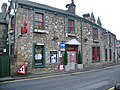
 Job centre, Lowergate, Clitheroe - geograph.org.uk - 2643597.jpg 640 × 480; 138 KB
-
 Junction of Lowergate and Moor Lane - geograph.org.uk - 2128773.jpg 640 × 480; 81 KB
-
 Key Street, Lowergate, Clitheroe - geograph.org.uk - 731747.jpg 640 × 480; 198 KB
-
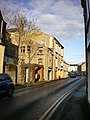
 Lowergate, Clitheroe - geograph.org.uk - 1655957.jpg 640 × 480; 64 KB
-
 Lowergate, Clitheroe - geograph.org.uk - 1655961.jpg 480 × 640; 82 KB
-
 Lowergate, Clitheroe - geograph.org.uk - 2324779.jpg 640 × 480; 129 KB
-
 Lowergate, Clitheroe - geograph.org.uk - 2324780.jpg 640 × 480; 155 KB
-
 Lowergate, Clitheroe - geograph.org.uk - 2643589.jpg 640 × 480; 126 KB
-
 Lowergate, Clitheroe - geograph.org.uk - 2685716.jpg 640 × 480; 98 KB
-
 Lowergate, Clitheroe - geograph.org.uk - 3142652.jpg 640 × 424; 66 KB
-
 Lowergate, Clitheroe - geograph.org.uk - 811355.jpg 640 × 480; 151 KB
-
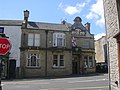 The Buck Inn 11 Lowergate, Clitheroe - geograph.org.uk - 1350997.jpg 640 × 480; 74 KB


