Category:Lower Saltonstall
Jump to navigation
Jump to search
Media in category "Lower Saltonstall"
The following 13 files are in this category, out of 13 total.
-
 A View of the Valley of Caty Well Brook - geograph.org.uk - 5539502.jpg 5,184 × 3,456; 5.65 MB
-
 Aqueduct at Caty Well - geograph.org.uk - 4045881.jpg 2,000 × 1,500; 1.23 MB
-
 Drainage channel above Caty Well - geograph.org.uk - 4045850.jpg 1,500 × 2,000; 1.49 MB
-
-
 Inscribed rock near water collection channel - geograph.org.uk - 4045859.jpg 2,000 × 1,500; 1.77 MB
-
 Little valley - geograph.org.uk - 4045868.jpg 2,000 × 1,500; 1.61 MB
-
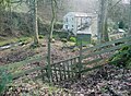
 Lower Saltonstall - geograph.org.uk - 1293583.jpg 640 × 480; 121 KB
-
 Redundant gateway on Halifax FP172, Warley - geograph.org.uk - 5990416.jpg 2,000 × 1,500; 945 KB
-
 Stile on Halifax FP173, Warley - geograph.org.uk - 5990394.jpg 2,000 × 1,500; 1.08 MB
-
 Stone slab footbridge over water channel - geograph.org.uk - 4045896.jpg 2,000 × 1,476; 1.37 MB
-
 Water collection channel above Caty Well - geograph.org.uk - 4045853.jpg 1,500 × 2,000; 1.62 MB
-
 Water collection channel above Caty Well - geograph.org.uk - 4045856.jpg 2,000 × 1,500; 1.5 MB
-
 Water collection channel near to its upstream end - geograph.org.uk - 4045862.jpg 2,000 × 1,500; 1.55 MB


