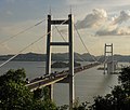
Category:Lower Hengdang
Jump to navigation
Jump to search
| Object location | | View all coordinates using: OpenStreetMap |
|---|
Island of Guangdong, China | |||||
| Upload media | |||||
 | |||||
English: Lower Hengdang or Xiahengdang or South Wangtong is an island in the Humen Strait of the Pearl River of southern China.
粵語: 下橫檔
中文:下横档
Media in category "Lower Hengdang"
The following 10 files are in this category, out of 10 total.
-
Canton to Bocca Tigris.jpg 2,580 × 1,442; 1.69 MB
-
Dongguan montage.jpg 1,280 × 1,650; 437 KB
-
Dongguan007.jpg 540 × 360; 51 KB
-
Humen Bridge-1.jpg 778 × 538; 479 KB
-
Humen Bridge-3.jpg 2,592 × 1,944; 2.42 MB
-
Humen Bridge-3edit.jpg 1,719 × 1,269; 1.11 MB
-
Humen Bridge-4.jpg 2,592 × 1,944; 2.67 MB
-
Humen Bridge-edit.jpg 1,452 × 1,234; 1.06 MB
-
Humen Bridge.JPG 2,304 × 1,728; 563 KB
-
Humen Bridge.jpg 1,944 × 2,592; 1.98 MB


