Category:Lower Benefield
Jump to navigation
Jump to search
Main Wikipedia article: Lower Benefield.
village in Northamptonshire, UK  | |||||
| Upload media | |||||
| Instance of | |||||
|---|---|---|---|---|---|
| Location | Benefield, North Northamptonshire, Northamptonshire, East Midlands, England | ||||
 | |||||
Subcategories
This category has the following 2 subcategories, out of 2 total.
L
- Lower Benefield War Memorial (2 F)
M
Media in category "Lower Benefield"
The following 18 files are in this category, out of 18 total.
-
 Farmhouse garden - geograph.org.uk - 387992.jpg 640 × 480; 103 KB
-
 Field and View South-west of Stoke Wood - geograph.org.uk - 551333.jpg 640 × 480; 110 KB
-

-
 Lower Benefield - geograph.org.uk - 187407.jpg 640 × 480; 89 KB
-
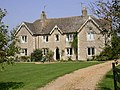
 Rectory Farm, Lower Benefield - geograph.org.uk - 1180206.jpg 640 × 480; 60 KB
-
 Rectory Farm, Lower Benefield - geograph.org.uk - 4559550.jpg 4,320 × 3,240; 2.91 MB
-
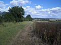
 Track through field of rape - geograph.org.uk - 388026.jpg 640 × 480; 63 KB
-
 Wadenhoe Lodge - geograph.org.uk - 49315.jpg 640 × 480; 142 KB
-
 Ash tree, Bearshank Wood - geograph.org.uk - 527281.jpg 480 × 640; 310 KB
-
 Byway by Winning Foot Hill near Oundle - geograph.org.uk - 528091.jpg 480 × 640; 325 KB
-

-
 Churchfield farm - geograph.org.uk - 387983.jpg 640 × 480; 110 KB
-
 Field Edge and Views from Green Side Wood - geograph.org.uk - 509956.jpg 640 × 480; 121 KB
-
 Minor road to Lower Benefield - geograph.org.uk - 491960.jpg 640 × 480; 78 KB
-
 Oaks - geograph.org.uk - 387068.jpg 640 × 439; 68 KB
-
 Pilton Lodge farm - geograph.org.uk - 397686.jpg 640 × 427; 78 KB
-

-
 Track to Bearshank wood - geograph.org.uk - 388032.jpg 640 × 480; 70 KB


