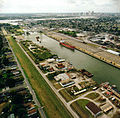
Category:Lower 9th Ward before Katrina
Jump to navigation
Jump to search
Images of the Lower 9th Ward section of New Orleans before it was devastated by the Federal levee failure disaster during Hurricane Katrina in 2005.
Subcategories
This category has only the following subcategory.
J
Media in category "Lower 9th Ward before Katrina"
The following 34 files are in this category, out of 34 total.
-
ICanal1997AQ08.jpg 1,976 × 1,260; 273 KB
-
IHNC Lock 1998 lrg.jpg 800 × 528; 353 KB
-
IHNC- MR to Lake 1929 Franck.jpg 1,186 × 900; 455 KB
-
Ihnc-01.jpg 788 × 773; 67 KB
-
Ihnc-02.jpg 822 × 740; 69 KB
-
Ihnc-03.jpg 820 × 731; 72 KB
-
Ihnc-04.jpg 787 × 775; 93 KB
-
Ihnc-05.jpg 874 × 683; 87 KB
-
Ihnc-07.jpg 766 × 778; 90 KB
-
Ihnc-12.jpg 888 × 684; 103 KB
-
Industrial Canal aerial view.jpg 1,500 × 999; 322 KB
-
Industrial Canal and Claiborne Bridge.jpg 1,500 × 1,000; 676 KB
-
L9W1997AQ07.jpg 2,020 × 1,280; 299 KB
-
Louisiana - New Orleans - NARA - 23940573.jpg 4,364 × 3,400; 2.22 MB
-
Louisiana - New Orleans - NARA - 23940575.jpg 4,364 × 3,400; 2.02 MB
-
Louisiana - New Orleans - NARA - 23940581.jpg 4,364 × 3,400; 2.24 MB
-
MRGOGreenBridge1997AQ08.jpg 1,292 × 1,972; 170 KB
-
New Orleans Industrial Canal from the air circa 1960 - 1964.png 1,464 × 946; 1.47 MB
-
New Orleans skyline from Lower 9th Ward Riverfront 01.jpg 3,046 × 2,015; 2.28 MB
-
New Orleans skyline from Lower 9th Ward Riverfront 02.jpg 3,081 × 2,046; 2.61 MB
-
NOLA9thFloodedBetsy.jpg 696 × 917; 139 KB
-
Report on Hurricane Betsy USACE New Orleans 1965.Flood Street.jpg 1,345 × 839; 649 KB
-
RobinsonAtlasL9W83.jpg 4,000 × 2,490; 1.47 MB
-
Sanborn Fire Insurance Map from New Orleans, Orleans Parish, Louisiana. LOC sanborn03376 008-36.tif 6,498 × 7,796; 144.94 MB
-
Steamboat2Low9PreK.jpg 1,510 × 1,036; 577 KB
-
SteamboatHousesL9W1992.jpg 1,527 × 926; 428 KB
-
SteamboatLeveeLow9Beads.jpg 1,515 × 969; 403 KB
-
WhiteWaifsHomeNewOrleans1907.jpg 700 × 501; 79 KB


