Category:Low tide in the Scottish Borders
Jump to navigation
Jump to search
Media in category "Low tide in the Scottish Borders"
The following 13 files are in this category, out of 13 total.
-
 Beach at Cowdrait - geograph.org.uk - 347229.jpg 640 × 480; 101 KB
-
 Burnmouth Bay - geograph.org.uk - 355435.jpg 640 × 480; 95 KB
-
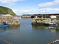 Burnmouth Harbour - geograph.org.uk - 571323.jpg 640 × 480; 75 KB
-
 Cove Harbour - geograph.org.uk - 571390.jpg 640 × 480; 62 KB
-
 Cove Harbour - geograph.org.uk - 572974.jpg 640 × 480; 77 KB
-
 Cove Harbour - geograph.org.uk - 572997.jpg 640 × 480; 64 KB
-
 Harbour Steps - geograph.org.uk - 572969.jpg 480 × 640; 87 KB
-
 Low tide at Burnmouth Bay - geograph.org.uk - 356270.jpg 640 × 480; 97 KB
-
 Reed Point, Cove - geograph.org.uk - 171214.jpg 640 × 480; 163 KB
-
 Rocks, south of Hilton Bay - geograph.org.uk - 355442.jpg 640 × 480; 118 KB
-
 View of Lower Burnmouth - geograph.org.uk - 356473.jpg 640 × 480; 92 KB
-
 Wuddy Rocks - geograph.org.uk - 597048.jpg 640 × 427; 80 KB
-
 Wuddy Rocks, St Abbs - geograph.org.uk - 597044.jpg 640 × 427; 63 KB


