
Category:Low tide in the Isle of Wight
Media in category "Low tide in the Isle of Wight"
The following 58 files are in this category, out of 58 total.
-
 Appley Beach, Shanklin - geograph.org.uk - 1432242.jpg 640 × 480; 83 KB
-
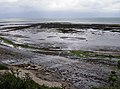
 Approaching Newtown Creek - geograph.org.uk - 1087285.jpg 640 × 427; 141 KB
-
 Approaching Newtown Creek - geograph.org.uk - 1087287.jpg 427 × 640; 176 KB
-

-
 Beach at low tide, Hillhead - geograph.org.uk - 515299.jpg 427 × 640; 88 KB
-
 Bembridge Ducie Beach during August 2011 low tide.jpg 683 × 1,024; 360 KB
-
 Bembridge Foreland - geograph.org.uk - 484645.jpg 640 × 477; 106 KB
-
 Bembridge Harbour Causeway - geograph.org.uk - 96557.jpg 640 × 480; 143 KB
-
 Bembridge Ledge - geograph.org.uk - 469559.jpg 640 × 477; 111 KB
-
 Bembridge Ledge - geograph.org.uk - 484653.jpg 640 × 477; 93 KB
-
 Bembridge lifeboat station - geograph.org.uk - 471568.jpg 640 × 477; 115 KB
-
-
 Black Rock Ledge, Bembridge - geograph.org.uk - 484605.jpg 640 × 477; 104 KB
-
 Boats on the Medina - geograph.org.uk - 485354.jpg 640 × 477; 87 KB
-
 Coastal slump at Black Rock Ledge - geograph.org.uk - 484624.jpg 640 × 477; 97 KB
-
 Fishing traps on Spur Lake - geograph.org.uk - 1088512.jpg 640 × 427; 200 KB
-
 Foreland Beach - geograph.org.uk - 61568.jpg 640 × 440; 69 KB
-
-
 Low tide at Hanover Point - geograph.org.uk - 514768.jpg 640 × 427; 89 KB
-
 Low tide at hanover point isle of wight.jpg 2,816 × 1,877; 1.09 MB
-
 Marker Buoy - geograph.org.uk - 1450560.jpg 640 × 480; 64 KB
-
 Mermaid Rock - geograph.org.uk - 1380433.jpg 640 × 426; 191 KB
-
 Newtown Creek - geograph.org.uk - 1087307.jpg 640 × 427; 194 KB
-
 Newtown Creek at low tide 2.JPG 3,712 × 2,088; 3.45 MB
-
 Newtown Creek at low tide 3.JPG 3,712 × 2,088; 3.32 MB
-
 Newtown Creek at low tide.JPG 3,712 × 2,088; 3.16 MB
-
 Off Hanover Point - geograph.org.uk - 1378746.jpg 640 × 427; 133 KB
-
 Off Hanover Point - geograph.org.uk - 1378754.jpg 640 × 427; 151 KB
-
 Part of Bembridge Foreland - geograph.org.uk - 484644.jpg 640 × 477; 108 KB
-
 Private quay and slipway - geograph.org.uk - 601833.jpg 640 × 477; 50 KB
-
 Private quay and slipway - geograph.org.uk - 601838.jpg 640 × 477; 52 KB
-
 Ryde Marina - geograph.org.uk - 1403317.jpg 640 × 480; 71 KB
-
 Ryde West Sands - geograph.org.uk - 530323.jpg 640 × 479; 136 KB
-

-
 Seagrove Bay - geograph.org.uk - 530886.jpg 640 × 479; 108 KB
-
 Seaview Duver Beach at low tide 2.JPG 4,000 × 3,000; 4.75 MB
-
 Seaview Duver Beach at low tide 3.JPG 4,000 × 3,000; 4.7 MB
-
 Seaview Duver Beach at low tide 4.JPG 4,000 × 3,000; 4.46 MB
-
 Seaview Duver Beach at low tide.JPG 4,000 × 3,000; 4.59 MB
-
 Shanklin Beach at low tide - geograph.org.uk - 1713551.jpg 1,024 × 768; 228 KB
-
 Shanklin Beach at low tide - geograph.org.uk - 1713554.jpg 1,024 × 768; 255 KB
-
 Shanklin Beach near Appleby Steps - geograph.org.uk - 55476.jpg 640 × 412; 68 KB
-
 Shore at Round Tower Point - geograph.org.uk - 514714.jpg 427 × 640; 84 KB
-
 Shoreline near Ryde House - geograph.org.uk - 530318.jpg 479 × 640; 182 KB
-
 Spur Lake - geograph.org.uk - 1027355.jpg 640 × 427; 182 KB
-
 Spur Lake - geograph.org.uk - 1088507.jpg 640 × 427; 178 KB
-
 The Run, Bembridge - geograph.org.uk - 484639.jpg 640 × 477; 90 KB
-
 The Undercliff - geograph.org.uk - 1378557.jpg 640 × 426; 167 KB
-
 Tidelands near Ryde - geograph.org.uk - 797539.jpg 640 × 480; 63 KB
-
 Trickling into the Sea - geograph.org.uk - 530343.jpg 640 × 479; 153 KB
-
 Waders on the foreshore - geograph.org.uk - 836178.jpg 640 × 480; 268 KB
-
 Western Haven at Low Tide - geograph.org.uk - 411340.jpg 640 × 480; 124 KB
-
 Wootton Creek - geograph.org.uk - 371473.jpg 640 × 480; 94 KB
-
 Wootton Creek at low tide from New Road 2.JPG 4,000 × 3,000; 4.46 MB
-
 Wootton Creek at low tide from New Road.JPG 4,000 × 3,000; 4.51 MB
-
 Wootton Woodside Beach 2.JPG 4,000 × 3,000; 4.42 MB
-
 Wootton Woodside Beach 3.JPG 4,000 × 3,000; 4.46 MB
-
 Wootton Woodside Beach.JPG 4,000 × 3,000; 4.5 MB


