Category:Low tide in Norfolk, England
Jump to navigation
Jump to search
Ceremonial counties of England: Cheshire · Cornwall · Cumbria · Devon · Dorset · Durham · East Riding of Yorkshire · East Sussex · Essex · Gloucestershire · Greater London · Hampshire · Kent · Lancashire · Lincolnshire · Merseyside · Norfolk · North Yorkshire · Northumberland · Somerset · Suffolk · Tyne and Wear · West Sussex ·
City-counties:
Former historic counties:
Other former counties:
City-counties:
Former historic counties:
Other former counties:
Subcategories
This category has only the following subcategory.
P
Media in category "Low tide in Norfolk, England"
The following 130 files are in this category, out of 130 total.
-
 -2021-12-18 Trimingham beach, Norfolk (3).JPG 3,864 × 5,152; 4 MB
-
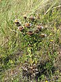 A Carline thistle (Carlina spec.) - geograph.org.uk - 909975.jpg 480 × 640; 208 KB
-
 A very vast beach - geograph.org.uk - 909862.jpg 640 × 480; 199 KB
-
 An exceptionally low tide - geograph.org.uk - 793091.jpg 640 × 480; 195 KB
-
 At the edge of the pinewoods - geograph.org.uk - 909962.jpg 480 × 640; 204 KB
-
 Barrier across River Burn estuary - geograph.org.uk - 1382939.jpg 640 × 475; 183 KB
-
 Bay between two stone spits - geograph.org.uk - 793082.jpg 640 × 480; 204 KB
-
 Beach huts on the sea wall - geograph.org.uk - 540045.jpg 640 × 478; 129 KB
-
 Beach, Blakeney Point - geograph.org.uk - 1405393.jpg 640 × 480; 31 KB
-
 Blakeney - geograph.org.uk - 792368.jpg 640 × 428; 114 KB
-
 Boats along the creek at low tide - geograph.org.uk - 1115622.jpg 640 × 427; 293 KB
-
 Bob Hall's Sands - geograph.org.uk - 1478084.jpg 640 × 427; 65 KB
-

-
 Brancaster Harbour Looking East - geograph.org.uk - 490961.jpg 640 × 480; 79 KB
-
 Brancaster Harbour Looking Northwest - geograph.org.uk - 490968.jpg 640 × 480; 87 KB
-
 Brancaster Staithe - geograph.org.uk - 11545.jpg 640 × 480; 77 KB
-
 Burnham Harbour - geograph.org.uk - 369426.jpg 640 × 480; 62 KB
-
 Burnham Overy Staithe - geograph.org.uk - 847936.jpg 640 × 342; 117 KB
-
 Clubhouse at low tide - geograph.org.uk - 1329731.jpg 640 × 427; 56 KB
-
 Corystes cassivelaunus - geograph.org.uk - 581812.jpg 640 × 480; 104 KB
-
 Creek, Deepdale marsh - geograph.org.uk - 389112.jpg 640 × 480; 80 KB
-
 Cromer pier 2012.jpg 1,600 × 1,067; 1.04 MB
-
 Distinct outcrop - geograph.org.uk - 792857.jpg 640 × 480; 162 KB
-
 Dog cooling its paws - geograph.org.uk - 941170.jpg 480 × 640; 108 KB
-
 Dune vegetation - geograph.org.uk - 909958.jpg 480 × 640; 175 KB
-
 Eastern End of Brancaster Harbour - geograph.org.uk - 480557.jpg 640 × 480; 66 KB
-

-
 Edge of the water - geograph.org.uk - 1454306.jpg 3,072 × 2,304; 1.54 MB
-
 Exposed by a low tide - geograph.org.uk - 793094.jpg 480 × 640; 207 KB
-
 Exposed by a low tide - geograph.org.uk - 794745.jpg 640 × 480; 181 KB
-
 Exposed foreshore - geograph.org.uk - 794856.jpg 480 × 640; 208 KB
-
 Foreshore at West Runton - geograph.org.uk - 794869.jpg 640 × 480; 143 KB
-
 Golden Lion Hotel - geograph.org.uk - 586350.jpg 640 × 554; 92 KB
-
 Great Yarmouth, the beach - geograph.org.uk - 1602712.jpg 640 × 480; 49 KB
-
 Harbour Channel - geograph.org.uk - 542411.jpg 640 × 427; 67 KB
-
 Holkham Bay - geograph.org.uk - 177543.jpg 640 × 428; 115 KB
-
 Holkham Beach during a large ebb tide - geograph.org.uk - 941183.jpg 480 × 640; 195 KB
-
 Hunstanton Cliffs - geograph.org.uk - 372531.jpg 640 × 480; 110 KB
-
 Hunstanton Pier - geograph.org.uk - 586346.jpg 640 × 480; 93 KB
-

-
 Low tide - geograph.org.uk - 1043945.jpg 640 × 428; 75 KB
-
 Low tide - geograph.org.uk - 1454243.jpg 2,304 × 3,072; 1.73 MB
-
 Low tide - geograph.org.uk - 1483535.jpg 640 × 427; 101 KB
-
 Low Tide - geograph.org.uk - 444721.jpg 480 × 640; 50 KB
-
 Low Tide - geograph.org.uk - 581802.jpg 640 × 480; 65 KB
-
 Low tide - geograph.org.uk - 941116.jpg 480 × 640; 134 KB
-
 Low tide along Blakeney Point - geograph.org.uk - 1492675.jpg 640 × 427; 64 KB
-
 Low tide along Blakeney Point - geograph.org.uk - 1492681.jpg 640 × 427; 65 KB
-
 Low tide at Blakeney. - geograph.org.uk - 486519.jpg 640 × 479; 108 KB
-
 Low tide at Denver - geograph.org.uk - 682168.jpg 640 × 427; 75 KB
-
 Low Tide at Wells-Next-The-Sea - geograph.org.uk - 663362.jpg 640 × 429; 42 KB
-
 Low tide Hunstanton - geograph.org.uk - 1552054.jpg 640 × 480; 67 KB
-
 Low tide Hunstanton - geograph.org.uk - 1552062.jpg 640 × 480; 68 KB
-
 Low Tide in Holkham Bay - geograph.org.uk - 443297.jpg 640 × 480; 75 KB
-
 Low tide, Blakeney harbour - geograph.org.uk - 1690374.jpg 427 × 640; 225 KB
-

-
 Lowest of the low, Burn estuary exposed - geograph.org.uk - 1384081.jpg 640 × 480; 176 KB
-
 Lynn Ferry jetty - geograph.org.uk - 230293.jpg 640 × 550; 97 KB
-
 Miles and miles of beach - geograph.org.uk - 941177.jpg 480 × 640; 151 KB
-
 Morston Creek at Low Tide - geograph.org.uk - 473886.jpg 640 × 480; 101 KB
-
 Mussel Bed Structure Hunstanton - geograph.org.uk - 1094755.jpg 640 × 480; 72 KB
-
 Mussel beds at Old Hunstanton - geograph.org.uk - 641710.jpg 640 × 480; 30 KB
-
 Mussel collecting, Blakeney Harbour - geograph.org.uk - 1568314.jpg 640 × 484; 100 KB
-
 Naturists' area - geograph.org.uk - 909954.jpg 480 × 640; 202 KB
-
 North Flats, Breydon Water, Norfolk - geograph.org.uk - 40540.jpg 640 × 252; 55 KB
-
 Not alone - geograph.org.uk - 947846.jpg 3,008 × 2,000; 1.87 MB
-
 Old mooring post - geograph.org.uk - 838420.jpg 480 × 640; 199 KB
-
 On the ridge of the dune - geograph.org.uk - 909969.jpg 640 × 480; 182 KB
-
 Oystercatchers may safely graze ... - geograph.org.uk - 1384055.jpg 640 × 480; 193 KB
-
 Path across the marsh - geograph.org.uk - 1024217.jpg 640 × 480; 149 KB
-
 Patterns in the sand - geograph.org.uk - 941121.jpg 480 × 640; 148 KB
-
 Patterns in the still wet sand - geograph.org.uk - 941174.jpg 480 × 640; 113 KB
-
 Peat deposits - geograph.org.uk - 598787.jpg 640 × 426; 21 KB
-
 Pebble spit - geograph.org.uk - 793097.jpg 640 × 480; 196 KB
-
 Playing on the beach - geograph.org.uk - 560440.jpg 640 × 478; 105 KB
-
 Pools on the beach - geograph.org.uk - 941133.jpg 480 × 640; 132 KB
-
 Ripples in the sand - geograph.org.uk - 909851.jpg 480 × 640; 158 KB
-
 River meets sea - geograph.org.uk - 941150.jpg 640 × 480; 122 KB
-
 Salthouse beach, North Norfolk.jpg 640 × 427; 95 KB
-
 Saltmarsh path - geograph.org.uk - 582672.jpg 640 × 426; 41 KB
-
 Samphire Pickers - geograph.org.uk - 270286.jpg 640 × 480; 97 KB
-

-
 Sand, sea and sky meet - geograph.org.uk - 949054.jpg 640 × 469; 43 KB
-
 Sandbank exposed by low tide - geograph.org.uk - 581794.jpg 640 × 480; 77 KB
-
 Sea fishing - geograph.org.uk - 941162.jpg 640 × 432; 91 KB
-
 Sheringham beach - geograph.org.uk - 560438.jpg 640 × 478; 107 KB
-
 Shoreline in Holkham Bay - geograph.org.uk - 409237.jpg 640 × 480; 73 KB
-
 Sluice at Holme - geograph.org.uk - 949004.jpg 640 × 480; 129 KB
-
 Snettisham Beach at low tide.jpg 1,490 × 1,040; 270 KB
-
 Splashing in the water - geograph.org.uk - 909854.jpg 480 × 640; 183 KB
-
 Stubborn Sand - geograph.org.uk - 1492356.jpg 640 × 426; 77 KB
-
 Stubborn Sand - geograph.org.uk - 814731.jpg 640 × 426; 58 KB
-
 Stubborn Sand - geograph.org.uk - 948038.jpg 3,008 × 2,000; 2.02 MB
-
 Surfing beach at Sheringham - geograph.org.uk - 560412.jpg 640 × 478; 136 KB
-
 The 'John Willy' at King's Lynn - geograph.org.uk - 777710.jpg 640 × 427; 94 KB
-
 The Elusive Square Near Kelling Hard - geograph.org.uk - 409383.jpg 640 × 480; 128 KB
-
 The end of Gun Hill (geograph 2128399).jpg 1,600 × 1,200; 876 KB
-
 The Moorings at low tide - geograph.org.uk - 1075832.jpg 480 × 640; 96 KB
-
 The New Cut - geograph.org.uk - 1659958.jpg 480 × 640; 93 KB
-

-
 The tide is out - geograph.org.uk - 909835.jpg 480 × 640; 175 KB
-
-
 Thornham saltmarsh - geograph.org.uk - 598184.jpg 640 × 516; 55 KB
-
 Three hours before low tide - geograph.org.uk - 1371047.jpg 640 × 480; 68 KB
-
 Tidal deposits - geograph.org.uk - 909876.jpg 480 × 640; 189 KB
-

-
 View across the river mouth - geograph.org.uk - 941155.jpg 480 × 640; 105 KB
-
 View from His Master's Hill - geograph.org.uk - 909314.jpg 480 × 640; 192 KB
-
 Warham Salt Marshes - geograph.org.uk - 964367.jpg 640 × 480; 111 KB
-
 Weir in River Burn estuary - geograph.org.uk - 1382943.jpg 640 × 480; 188 KB
-
 Wells beach at low tide - geograph.org.uk - 1208741.jpg 640 × 480; 52 KB
-
 Wells next the sea - geograph.org.uk - 544090.jpg 478 × 640; 235 KB
-
 Wells saltmarshes - geograph.org.uk - 950207.jpg 640 × 480; 90 KB
-

-

-
 West Runton beach - geograph.org.uk - 270685.jpg 480 × 640; 139 KB
-
 Westwards at the shoreline - geograph.org.uk - 1373873.jpg 640 × 480; 57 KB
-

-
 Where dunes and pinewoods meet - geograph.org.uk - 909964.jpg 480 × 640; 204 KB
-

-
 Winterton Beach at low tide - geograph.org.uk - 581800.jpg 480 × 640; 70 KB
-
 Wooden groyne and revetments - geograph.org.uk - 792677.jpg 480 × 640; 183 KB
-
 Worm casts - geograph.org.uk - 1024065.jpg 640 × 480; 76 KB
-
 Boat at Brancaster Staithe - geograph.org.uk - 661381.jpg 640 × 427; 53 KB
-
 Boats at Brancaster Staithe - geograph.org.uk - 659213.jpg 427 × 640; 61 KB
-
 Boats at Brancaster Staithe - geograph.org.uk - 661380.jpg 640 × 427; 50 KB
-
 Boats at Brancaster Staithe - geograph.org.uk - 661474.jpg 640 × 429; 74 KB
-
 Boats at Brancaster Staithe - geograph.org.uk - 661475.jpg 640 × 429; 65 KB
-
 Boats at Brancaster Staithe - geograph.org.uk - 661476.jpg 640 × 429; 60 KB
-
 Saltmarsh channel - geograph.org.uk - 582658.jpg 640 × 426; 35 KB
.JPG)
_-_geograph.org.uk_-_909975.jpg)


.jpg)


_from_Scolt_Head_Island_-_geograph.org.uk_-_611309.jpg)


_-_geograph.org.uk_-_674603.jpg)


