Category:Low tide in Ceredigion
Jump to navigation
Jump to search


Subcategories
This category has only the following subcategory.
B
- Sunken forest at Borth sands (48 F)
Media in category "Low tide in Ceredigion"
The following 33 files are in this category, out of 33 total.
-
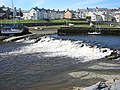 A weir on the Rheidol. - geograph.org.uk - 512118.jpg 640 × 480; 239 KB
-
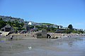
 Aberaeron Harbour - geograph.org.uk - 743633.jpg 640 × 427; 60 KB
-
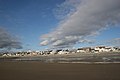
 Aberporth Beach - geograph.org.uk - 743661.jpg 640 × 430; 83 KB
-
 Aberystwyth harbour dredging - geograph.org.uk - 720160.jpg 640 × 479; 66 KB
-

-
 Afon Teifi - geograph.org.uk - 531267.jpg 640 × 480; 91 KB
-
 Beach between Tresaith and Penbryn - geograph.org.uk - 1626110.jpg 640 × 480; 46 KB
-
 Belle Vue Terrace, Aberaeron - geograph.org.uk - 593978.jpg 640 × 438; 100 KB
-
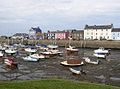
 Boats in New Quay Harbour - geograph.org.uk - 1777080.jpg 2,048 × 1,360; 679 KB
-
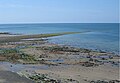
 Borth beach at low spring tide - geograph.org.uk - 557236.jpg 640 × 427; 51 KB
-
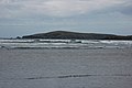 Cardigan Island - geograph.org.uk - 429248.jpg 640 × 426; 84 KB
-
 Cliffs north of Wallog - geograph.org.uk - 1128909.jpg 640 × 480; 59 KB
-
 Cliffs south of Borth - geograph.org.uk - 558581.jpg 640 × 427; 60 KB
-
 Dyfi Estuary at low tide - geograph.org.uk - 10233.jpg 640 × 480; 116 KB
-
 Dyfi Estuary at low tide(2) - geograph.org.uk - 10235.jpg 640 × 480; 115 KB
-
 Estuary at low tide - geograph.org.uk - 1549404.jpg 640 × 480; 41 KB
-
 Fisherman, Borth Beach - geograph.org.uk - 1225191.jpg 640 × 427; 63 KB
-
 Inner Harbour Wall and Life Boat Station - geograph.org.uk - 1777085.jpg 2,048 × 1,360; 708 KB
-
 Low tide at Sarn Gynfelyn - geograph.org.uk - 845252.jpg 640 × 444; 78 KB
-
 Low tide at the beach of Llangrannog - geograph.org.uk - 917204.jpg 640 × 367; 69 KB
-
 Low tide in New Quay Harbour - geograph.org.uk - 743405.jpg 640 × 427; 108 KB
-
 Low tide near Borth - geograph.org.uk - 627766.jpg 640 × 427; 58 KB
-
 Low tide on Poppit sands - geograph.org.uk - 427254.jpg 426 × 640; 66 KB
-
 Low tide on the Leri - geograph.org.uk - 1144528.jpg 640 × 427; 79 KB
-
 Low tide, Afon Teifi - geograph.org.uk - 825931.jpg 640 × 480; 74 KB
-
-
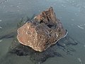 Petrified tree stump at Ynyslas, Ceredigion, Wales.jpg 3,456 × 2,592; 3.1 MB
-
 Retreating tide on Poppit Sands - geograph.org.uk - 1034842.jpg 640 × 480; 62 KB
-
 Rocks at low tide - geograph.org.uk - 1439360.jpg 640 × 426; 338 KB
-
 The Dyfi estuary - geograph.org.uk - 1079741.jpg 1,024 × 685; 924 KB
-

-
 The true mouth of the River Teifi - geograph.org.uk - 1034872.jpg 640 × 480; 38 KB
-
 Ynyslas tide out - panoramio.jpg 1,408 × 1,056; 317 KB


_-_geograph.org.uk_-_10235.jpg)


