Category:Low Worsall
Jump to navigation
Jump to search
village in United Kingdom  | |||||
| Upload media | |||||
| Instance of | |||||
|---|---|---|---|---|---|
| Location | Hambleton, North Yorkshire, Yorkshire and the Humber, England | ||||
| Population |
| ||||
| Area |
| ||||
 | |||||
Subcategories
This category has the following 4 subcategories, out of 4 total.
Media in category "Low Worsall"
The following 35 files are in this category, out of 35 total.
-
 Apex of a Tees Meander - geograph.org.uk - 1961218.jpg 2,816 × 2,112; 1.59 MB
-
 B1264 towards Low Worsall - geograph.org.uk - 3283544.jpg 640 × 480; 85 KB
-
 B1264 towards Yarm - geograph.org.uk - 3277585.jpg 640 × 480; 69 KB
-
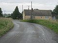 Bungalow at Worsall Toll Bar - geograph.org.uk - 3143673.jpg 640 × 480; 53 KB
-
 Corner Cottage in Village Road, Low Worsall - geograph.org.uk - 3146898.jpg 3,648 × 2,736; 2.76 MB
-
 East Worsall Farm - geograph.org.uk - 3277538.jpg 800 × 600; 133 KB
-

-
 Entering Stockton-on-Tees - geograph.org.uk - 3277596.jpg 800 × 600; 123 KB
-
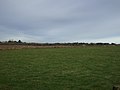
 Farmland near Hole Beck - geograph.org.uk - 3283540.jpg 640 × 480; 74 KB
-
 Farmland, East Worsall Farm - geograph.org.uk - 3277540.jpg 800 × 600; 136 KB
-
 Farmland, Highfield - geograph.org.uk - 3277583.jpg 800 × 600; 114 KB
-
 Farmland, Low Worsall Moor - geograph.org.uk - 3277543.jpg 640 × 480; 37 KB
-
 Farmland, Low Worsall Moor - geograph.org.uk - 3277586.jpg 640 × 480; 41 KB
-
 Farmland, Worsall Grange Farm - geograph.org.uk - 3277592.jpg 800 × 600; 128 KB
-
 Footpath to and beyond East Worsall Farm - geograph.org.uk - 3143680.jpg 3,648 × 2,736; 1.93 MB
-
 Footpath towards Hillilees - geograph.org.uk - 3277590.jpg 800 × 600; 140 KB
-
 Grazing land near Picton - geograph.org.uk - 2435080.jpg 640 × 481; 59 KB
-
 Hares (Lepus capensis) near Picton - geograph.org.uk - 2435070.jpg 640 × 480; 108 KB
-
 Lane towards Kirklevington - geograph.org.uk - 3277588.jpg 800 × 600; 141 KB
-
 Pylon in pylon corridor - geograph.org.uk - 4469532.jpg 4,000 × 2,250; 3.24 MB
-

-
 Road towards Worsall Toll Bar - geograph.org.uk - 3277541.jpg 800 × 600; 150 KB
-
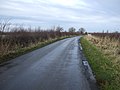 Road towards Worsall Toll Bar - geograph.org.uk - 3277545.jpg 800 × 600; 120 KB
-
 Soggy grazing, Saltergill - geograph.org.uk - 3283538.jpg 640 × 480; 77 KB
-
 The Old Smithy - geograph.org.uk - 4908462.jpg 640 × 480; 137 KB
-
 The Ship Inn at Low Worsall - geograph.org.uk - 2903003.jpg 3,648 × 2,736; 3.03 MB
-
 The Ship Inn, Worsall - geograph.org.uk - 122611.jpg 640 × 480; 71 KB
-
 Track to Highfield Farm - geograph.org.uk - 3277584.jpg 800 × 600; 118 KB
-
 Track towards the River Tees from Low Worsall Village Green - geograph.org.uk - 3146910.jpg 2,334 × 1,634; 1.05 MB
-
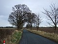
 Trees beside the B1264 - geograph.org.uk - 3283541.jpg 1,024 × 768; 267 KB
-
 Village Green, Low Worsall - geograph.org.uk - 114392.jpg 640 × 480; 96 KB
-
 Worsall Grove Farm - geograph.org.uk - 3283536.jpg 1,200 × 900; 228 KB
-
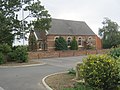 Worsall Methodist Church 1885 - geograph.org.uk - 3146887.jpg 3,648 × 2,736; 2.63 MB
-
 Worsall Village Hall - geograph.org.uk - 3137815.jpg 3,648 × 2,736; 1.77 MB
-
 Roadside Verge, Stockton-on-Tees Boundary - geograph.org.uk - 199030.jpg 640 × 480; 126 KB


_near_Picton_-_geograph.org.uk_-_2435070.jpg)


