Category:Lount
Jump to navigation
Jump to search
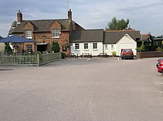
English: Lount is a small village near Ashby-De-La-Zouch in in north-west Leicestershire, England. It has a population of 50 (approx). It has no local amenities apart from a public house. The village straddles the B587 road and is situated near to the A42 road.
village in United Kingdom | |||||
| Upload media | |||||
| Instance of | |||||
|---|---|---|---|---|---|
| Location | Staunton Harold, North West Leicestershire, Leicestershire, East Midlands, England | ||||
 | |||||
Media in category "Lount"
The following 18 files are in this category, out of 18 total.
-
Alistair's Wood - geograph.org.uk - 913339.jpg 640 × 476; 91 KB
-
B587 Nottingham Road near Lount - geograph.org.uk - 916953.jpg 640 × 360; 59 KB
-
Lount Wood - geograph.org.uk - 1177630.jpg 640 × 480; 59 KB
-
Nottingham Road lay-by near Lount - geograph.org.uk - 1230555.jpg 640 × 480; 74 KB
-
Nottingham Road near Lount - geograph.org.uk - 916938.jpg 640 × 358; 77 KB
-
Nottingham Road towards Lount - geograph.org.uk - 913301.jpg 616 × 640; 101 KB
-
Out of control in Lount - geograph.org.uk - 1230567.jpg 640 × 443; 65 KB
-
Park Pale Wood - geograph.org.uk - 913355.jpg 640 × 480; 95 KB
-
Picnic bench at Park Pale Wood - geograph.org.uk - 913374.jpg 640 × 419; 106 KB
-
Track near Lount Wood - geograph.org.uk - 913310.jpg 640 × 473; 83 KB
-
View from Park Pale Wood - geograph.org.uk - 913364.jpg 640 × 480; 84 KB
-
View towards Lount Wood - geograph.org.uk - 913349.jpg 640 × 447; 103 KB
-
A42 Bridge - geograph.org.uk - 238931.jpg 640 × 480; 100 KB
-
A42 on a grim day in December. - geograph.org.uk - 1085758.jpg 640 × 480; 28 KB
-
The Ferrers Arms - geograph.org.uk - 238930.jpg 640 × 480; 84 KB
-
Three Ways - geograph.org.uk - 238929.jpg 640 × 480; 114 KB


