Category:Lotherton cum Aberford
Jump to navigation
Jump to search
civil parish in West Yorkshire, United Kingdom  | |||||
| Upload media | |||||
| Instance of | |||||
|---|---|---|---|---|---|
| Location | Leeds, West Yorkshire, Yorkshire and the Humber, England | ||||
| Population |
| ||||
 | |||||
Subcategories
This category has the following 3 subcategories, out of 3 total.
Media in category "Lotherton cum Aberford"
The following 200 files are in this category, out of 202 total.
(previous page) (next page)-
 A path leading to Wakefield Lodge - geograph.org.uk - 3070339.jpg 800 × 600; 151 KB
-
 A small Copse off Lotherton Lane - geograph.org.uk - 4094609.jpg 1,600 × 1,064; 729 KB
-
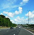
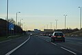
 A1(M) - geograph.org.uk - 3038415.jpg 640 × 430; 47 KB
-
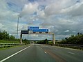
 A1(M) - junction 44 in 1 1-2 miles - geograph.org.uk - 2646820.jpg 640 × 428; 83 KB
-

-
 A1(M) at Aberford - geograph.org.uk - 5871000.jpg 2,238 × 2,319; 1.7 MB
-
 A1(M) at junction 44 - geograph.org.uk - 2040831.jpg 640 × 480; 57 KB
-
 A1(M) junction 43 - geograph.org.uk - 2646830.jpg 640 × 428; 80 KB
-
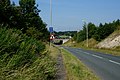
 A1(M) junction near Aberford - geograph.org.uk - 2040837.jpg 640 × 480; 65 KB
-
 A1(M) near Aberford - geograph.org.uk - 2040840.jpg 640 × 480; 46 KB
-
 A1(M) near Aberford - geograph.org.uk - 5870996.jpg 3,708 × 2,779; 3 MB
-
 A1(M) near Aberford - geograph.org.uk - 6857813.jpg 1,024 × 683; 1.1 MB
-
 A1(M) northbound - geograph.org.uk - 3038391.jpg 640 × 457; 41 KB
-
 A1(M) northbound - geograph.org.uk - 3038404.jpg 640 × 410; 42 KB
-
 A1(M) passing Aberford - geograph.org.uk - 4793140.jpg 640 × 407; 44 KB
-
 A1(M), J43 - geograph.org.uk - 4806070.jpg 640 × 313; 20 KB
-
 A1(M), southbound - geograph.org.uk - 4806054.jpg 640 × 373; 27 KB
-
 A1(M), southbound to J43 - geograph.org.uk - 4806052.jpg 640 × 382; 30 KB
-
 A1(M), southbound to J43 - geograph.org.uk - 4806057.jpg 640 × 395; 31 KB
-
 A1(M), southbound to J43 - geograph.org.uk - 4806068.jpg 640 × 426; 43 KB
-
 Aberford Almshouse - geograph.org.uk - 5574873.jpg 1,280 × 853; 681 KB
-
 Aberford Almshouse - geograph.org.uk - 5574875.jpg 1,280 × 853; 664 KB
-
 Aberford Almshouse - geograph.org.uk - 5574876.jpg 1,280 × 853; 677 KB
-
 Aberford Bridge - geograph.org.uk - 5865764.jpg 1,024 × 768; 229 KB
-
 Aberford Bridge - geograph.org.uk - 6826776.jpg 2,000 × 1,497; 1.57 MB
-

-
 Aberford House - geograph.org.uk - 5865743.jpg 1,024 × 759; 171 KB
-

-
 Aberford Village Hall - geograph.org.uk - 6826638.jpg 2,000 × 1,264; 1.31 MB
-
 Abstract art installation in the Lotherton hall estate - geograph.org.uk - 5858153.jpg 2,000 × 1,500; 1.16 MB
-
 Benchmark at Lotherton Park Farm - geograph.org.uk - 3164684.jpg 2,048 × 1,536; 674 KB
-
 Blossom over Copley Lane - geograph.org.uk - 5372676.jpg 640 × 427; 317 KB
-
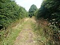
 Boundary Trail, Lotherton Hall - geograph.org.uk - 4194398.jpg 1,024 × 768; 142 KB
-
 Boundary Walk, Lotherton Hall - geograph.org.uk - 4194405.jpg 1,024 × 768; 172 KB
-
 Bragdale, looking west towards Hook Moor - geograph.org.uk - 3164631.jpg 2,048 × 1,536; 620 KB
-
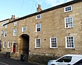
 Building on Main Street Aberford - geograph.org.uk - 4921688.jpg 1,200 × 799; 403 KB
-
 Café at Lotherton Hall - geograph.org.uk - 4093514.jpg 1,600 × 1,064; 483 KB
-
 Catch of the Day - geograph.org.uk - 5066845.jpg 1,024 × 767; 350 KB
-
 Cock Beck, Aberford - geograph.org.uk - 5850340.jpg 1,241 × 1,600; 397 KB
-
 Construction site, Bunkers Hill, Aberford - geograph.org.uk - 4403475.jpg 1,024 × 615; 106 KB
-
 Copley Lane - geograph.org.uk - 3164696.jpg 2,048 × 1,536; 510 KB
-
 Copley Lane meets Lotherton Lane - geograph.org.uk - 5372678.jpg 640 × 427; 261 KB
-
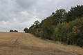
 Crop field off Stocking Lane - geograph.org.uk - 2782632.jpg 640 × 480; 86 KB
-
 Crossroads in Aberford - geograph.org.uk - 5335747.jpg 2,276 × 1,690; 1.44 MB
-
 Crossroads, B1217 - geograph.org.uk - 1933046.jpg 1,024 × 681; 200 KB
-
 Driveway at Lotherton Hall - geograph.org.uk - 4093532.jpg 1,600 × 1,064; 624 KB
-
 Driveway to Hicklam House and former lodge, Aberford - geograph.org.uk - 6826613.jpg 2,000 × 1,341; 1.36 MB
-
 Entrance drive and ticket booth at Lotherton Hall - geograph.org.uk - 3164679.jpg 2,048 × 1,536; 658 KB
-
 Farm buildings, Whitehouse Farm, Aberford - geograph.org.uk - 6826627.jpg 2,000 × 1,278; 1.18 MB
-
 Farmland near Bragdale - geograph.org.uk - 4093477.jpg 1,600 × 1,064; 839 KB
-
 Farmland near Bragdale - geograph.org.uk - 4093482.jpg 1,600 × 1,064; 736 KB
-
 Farmland off Collier Lane - geograph.org.uk - 2755133.jpg 640 × 480; 40 KB
-
 Farmland off Copley Lane - geograph.org.uk - 2755068.jpg 640 × 480; 57 KB
-
 Farmland off the B1217 - geograph.org.uk - 2755125.jpg 640 × 480; 55 KB
-
 Farmland towards the A1(M) - geograph.org.uk - 2755132.jpg 640 × 480; 48 KB
-
 Farmland towards the A1(M) - geograph.org.uk - 2755135.jpg 640 × 480; 34 KB
-
 Female Snowy Owl - geograph.org.uk - 2276401.jpg 640 × 513; 78 KB
-
 Field beside Stocking Lane - geograph.org.uk - 5922071.jpg 5,170 × 2,859; 4.63 MB
-
 Field boundary leading to Ringhay Wood - geograph.org.uk - 5372618.jpg 640 × 427; 204 KB
-
 Fields beside Collier Lane - geograph.org.uk - 5372683.jpg 640 × 427; 257 KB
-
 Fields off Copley Lane - geograph.org.uk - 5372641.jpg 640 × 427; 212 KB
-
 Fields off Lotherton Lane - geograph.org.uk - 5372688.jpg 640 × 427; 170 KB
-
 Fingerpost on Kingfisher Lane - geograph.org.uk - 4094713.jpg 1,600 × 1,064; 835 KB
-
 Flytipping on Kingfisher Lane - geograph.org.uk - 4094696.jpg 1,600 × 1,064; 893 KB
-
 Footbridge - off Main Street - geograph.org.uk - 5271030.jpg 640 × 480; 81 KB
-
 Footbridge over Cock Beck - geograph.org.uk - 544820.jpg 640 × 427; 187 KB
-
 Footbridge over the Cock Beck at Aberford - geograph.org.uk - 5865730.jpg 1,024 × 768; 203 KB
-
 Footpath and farm buildings at Aberford - geograph.org.uk - 5790001.jpg 1,024 × 768; 223 KB
-
 Footpath enters The Rein - geograph.org.uk - 4094789.jpg 1,600 × 1,064; 781 KB
-
 Footpath off Kingfisher Lane - geograph.org.uk - 4094747.jpg 1,600 × 1,064; 683 KB
-
 Footpath off Kingfisher Lane - geograph.org.uk - 4094750.jpg 1,600 × 1,064; 635 KB
-
 Footpath off Kingfisher Lane - geograph.org.uk - 4094766.jpg 1,600 × 1,064; 790 KB
-
 Footpath off Kingfisher Lane - geograph.org.uk - 4094779.jpg 1,600 × 1,064; 747 KB
-
 Footpath towards South Dyke - geograph.org.uk - 4094760.jpg 1,600 × 1,064; 876 KB
-
 Footpath towards South Dyke - geograph.org.uk - 4094773.jpg 1,600 × 1,064; 742 KB
-
 Footpath towards South Dyke - geograph.org.uk - 4094785.jpg 1,600 × 1,064; 672 KB
-
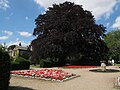 Formal garden at Lotherton Hall (1) - geograph.org.uk - 5066714.jpg 1,024 × 768; 219 KB
-
 Formal garden at Lotherton Hall (2) - geograph.org.uk - 5066719.jpg 1,024 × 768; 315 KB
-
 Galton Cottages on Lotherton Lane - geograph.org.uk - 4094632.jpg 1,600 × 1,064; 585 KB
-
 Gate off Copley Lane - geograph.org.uk - 5372677.jpg 640 × 427; 254 KB
-
 Gates made by the Mouseman - geograph.org.uk - 4921714.jpg 1,200 × 799; 521 KB
-
 Geometry in the Landscape, Lotherton hall estate - geograph.org.uk - 5858124.jpg 2,000 × 1,500; 1.06 MB
-
 Great North Road, Aberford - geograph.org.uk - 2583091.jpg 640 × 462; 69 KB
-
 Ha-ha at Lotherton Hall - geograph.org.uk - 5066695.jpg 1,024 × 768; 273 KB
-
 Hicklam House, Aberford.jpg 2,000 × 1,272; 1.79 MB
-
 Hook Moor - geograph.org.uk - 5920624.jpg 5,184 × 3,456; 7.69 MB
-
 Hook Moor Windfarm near Micklefield - geograph.org.uk - 4925950.jpg 1,200 × 799; 311 KB
-
 Houses at Aberford - geograph.org.uk - 2583045.jpg 640 × 480; 95 KB
-
 Ice Cream Van at Lotherton Hall - geograph.org.uk - 4087743.jpg 1,600 × 1,064; 773 KB
-
 In the orchard, Lotherton Hall estate - geograph.org.uk - 5858192.jpg 2,000 × 1,500; 1.16 MB
-

-
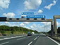
 J44, One and half miles, A1(M) - geograph.org.uk - 3038398.jpg 640 × 430; 46 KB
-
 Kingfisher Lane off Stocking Lane - geograph.org.uk - 4094689.jpg 1,600 × 1,064; 620 KB
-
 Lodge to Hicklam House, Aberford - geograph.org.uk - 5865790.jpg 1,024 × 768; 247 KB
-

-
 Looking along The Rein - geograph.org.uk - 544817.jpg 640 × 427; 206 KB
-
 Lotherton bird garden, black swan - geograph.org.uk - 5066837.jpg 1,024 × 768; 316 KB
-
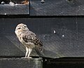 Lotherton bird garden, burrowing owl - geograph.org.uk - 5066812.jpg 1,013 × 818; 145 KB
-
 Lotherton bird garden, condor - geograph.org.uk - 5066832.jpg 469 × 496; 84 KB
-
 Lotherton bird garden, eagle owl - geograph.org.uk - 5066819.jpg 1,024 × 767; 163 KB
-
 Lotherton bird garden, egrets etcetera - geograph.org.uk - 5066842.jpg 1,023 × 768; 210 KB
-
 Lotherton bird garden, flamingos - geograph.org.uk - 5066809.jpg 1,024 × 768; 305 KB
-

-
 Lotherton bird garden, purple glossy starling - geograph.org.uk - 5066849.jpg 1,024 × 768; 185 KB
-
 Lotherton bird garden, rhea - geograph.org.uk - 5066827.jpg 1,024 × 768; 273 KB
-
 Lotherton Cum Aberford , A1(M) - geograph.org.uk - 6635004.jpg 6,000 × 4,000; 7.6 MB
-
 Lotherton Cum Aberford , A1(M) - geograph.org.uk - 6635005.jpg 6,000 × 4,000; 6.99 MB
-
 Lotherton Cum Aberford , A1(M) - geograph.org.uk - 6635009.jpg 6,000 × 4,000; 7.36 MB
-
 Lotherton Hall - geograph.org.uk - 5921181.jpg 5,184 × 3,456; 7.59 MB
-
 Lotherton Hall - geograph.org.uk - 6403550.jpg 2,000 × 1,080; 2.31 MB
-
 Lotherton Hall - geograph.org.uk - 6403551.jpg 2,000 × 1,087; 2.46 MB
-
 Lotherton Hall Deer Hide and Picnic Area - geograph.org.uk - 6515243.jpg 1,024 × 768; 204 KB
-
 Lotherton Hall Food Festival - geograph.org.uk - 6505782.jpg 3,264 × 2,448; 890 KB
-
 Lotherton Hall Food Festival - geograph.org.uk - 6505783.jpg 1,024 × 768; 145 KB
-
 Lotherton Hall Food Festival - geograph.org.uk - 6505785.jpg 1,024 × 768; 153 KB
-
 Lotherton Hall from the south - geograph.org.uk - 5066729.jpg 1,024 × 768; 158 KB
-
 Lotherton Hall from the west - geograph.org.uk - 5066733.jpg 1,024 × 768; 172 KB
-
 Lotherton Hall Gardens - geograph.org.uk - 6505788.jpg 1,024 × 768; 184 KB
-
 Lotherton Hall Gardens - geograph.org.uk - 6505790.jpg 1,024 × 768; 128 KB
-
 Lotherton Lane approaching Main Street - geograph.org.uk - 5372695.jpg 640 × 427; 189 KB
-
 Lotherton Lane towards Aberford - geograph.org.uk - 2755129.jpg 640 × 480; 27 KB
-
 Lotherton Lane towards Aberford - geograph.org.uk - 4094589.jpg 1,600 × 1,064; 531 KB
-
 Lotherton Lane towards Aberford - geograph.org.uk - 4094599.jpg 1,600 × 1,064; 635 KB
-
 Lotherton Lane towards Aberford - geograph.org.uk - 4094616.jpg 1,600 × 1,064; 623 KB
-
 Lotherton Lane towards Aberford - geograph.org.uk - 4094636.jpg 1,600 × 1,064; 632 KB
-
 Lotherton Lane towards Aberford - geograph.org.uk - 4094657.jpg 1,600 × 1,064; 797 KB
-
 Lotherton Lane towards Aberford - geograph.org.uk - 4094669.jpg 1,600 × 1,064; 827 KB
-
 M1 - A1(M) merge - geograph.org.uk - 4793138.jpg 640 × 426; 33 KB
-
 M1-A1(M) junction near Aberford - geograph.org.uk - 6820701.jpg 1,024 × 725; 165 KB
-
 Main Street (The Great North Road), Aberford - geograph.org.uk - 4921338.jpg 1,200 × 799; 273 KB
-
 Main Street (The Great North Road), Aberford - geograph.org.uk - 4921404.jpg 1,200 × 799; 407 KB
-
 Main Street, Aberford - geograph.org.uk - 1921440.jpg 1,024 × 681; 149 KB
-
 Male Snowy Owl - geograph.org.uk - 2276393.jpg 534 × 640; 81 KB
-
 Manor Farmhouse, Aberford.jpg 3,696 × 2,927; 1.93 MB
-
 Milestone, Aberford.jpg 480 × 640; 447 KB
-
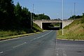
 Motorway bridge over Lotherton Lane - geograph.org.uk - 2782627.jpg 640 × 480; 61 KB
-
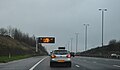
 Northbound A1M near Aberford - geograph.org.uk - 6399028.jpg 800 × 533; 210 KB
-
 Northbound M1, Hook Moor Interchange - geograph.org.uk - 6398928.jpg 800 × 533; 214 KB
-
 On the eastern edge of Leeds MDC - geograph.org.uk - 4807020.jpg 1,024 × 768; 133 KB
-
 On the Lotherton Hall Boundary Trail Walk - geograph.org.uk - 5858171.jpg 2,000 × 1,500; 1.37 MB
-
 One in the eye for the Gascoignes - geograph.org.uk - 5066668.jpg 1,024 × 767; 128 KB
-
 Parterre, Lotherton Hall - geograph.org.uk - 5921134.jpg 5,184 × 3,456; 7.22 MB
-
 Path across the orchard, Lotherton Hall Estate - geograph.org.uk - 5858179.jpg 2,000 × 1,500; 1.1 MB
-
 Path leading to Lotherton Hall - geograph.org.uk - 4093496.jpg 1,600 × 1,064; 826 KB
-
 Path leading to Ringhay Wood - geograph.org.uk - 4925952.jpg 1,200 × 799; 356 KB
-
 Path leading to The Rein - geograph.org.uk - 4925838.jpg 1,200 × 799; 666 KB
-
 Path towards The Rein - geograph.org.uk - 4087752.jpg 1,600 × 1,064; 770 KB
-
 Pay booth at Lotherton Hall - geograph.org.uk - 4093528.jpg 1,600 × 1,064; 617 KB
-
 Peacock Butterfly on Lotherton Lane - geograph.org.uk - 4094646.jpg 1,600 × 1,115; 491 KB
-

-
 Plaque on the Village Hall, Aberford - geograph.org.uk - 6826634.jpg 2,000 × 1,307; 958 KB
-
 Price list at Lotherton Hall - geograph.org.uk - 4093540.jpg 1,247 × 1,600; 486 KB
-
 Public Footpath through the Lotherton Hall grounds - geograph.org.uk - 5857468.jpg 2,000 × 1,500; 1.05 MB
-

-
 Public right of way at Lotherton Hall - geograph.org.uk - 4093500.jpg 1,600 × 1,064; 856 KB
-
 Public right of way at Lotherton Hall - geograph.org.uk - 4093505.jpg 1,600 × 1,064; 832 KB
-
 Ranger's Walk - geograph.org.uk - 3737623.jpg 1,024 × 768; 235 KB
-
 Ranger's Walk heading North towards Lotherton Hall (1) - geograph.org.uk - 5921022.jpg 5,184 × 3,456; 5.4 MB
-
 Ranger's Walk heading North towards Lotherton Hall (2) - geograph.org.uk - 5921026.jpg 5,184 × 3,456; 5.92 MB
-
 Ranger's Walk towards Ringhay Wood - geograph.org.uk - 3164663.jpg 2,048 × 1,536; 575 KB
-
 Rangers Walk in Ringhay Wood - geograph.org.uk - 4925963.jpg 1,200 × 799; 532 KB
-
 Ringhay Wood in autumn, from Ranger's Walk - geograph.org.uk - 3737627.jpg 1,024 × 768; 263 KB
-
 Road descends under the A1(M) - geograph.org.uk - 5372691.jpg 640 × 427; 226 KB
-
 Service Road for the Hook Moor Wind Farm - geograph.org.uk - 5920636.jpg 5,184 × 3,456; 5.7 MB
-

-
 Small wood off Collier Lane - geograph.org.uk - 2755131.jpg 480 × 640; 118 KB
-

-
 St. Ricarius Church - geograph.org.uk - 5372699.jpg 427 × 640; 302 KB
-
 Stile off Kingfisher Lane - geograph.org.uk - 4094755.jpg 1,600 × 1,064; 878 KB
-
 Stocking Lane heading east - geograph.org.uk - 2782635.jpg 640 × 480; 74 KB
-
 Stocking Lane off Lotherton Lane - geograph.org.uk - 4094680.jpg 1,600 × 1,064; 688 KB
-
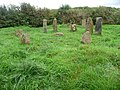 Stone circle, Lotherton Hall estate - geograph.org.uk - 4194399.jpg 1,024 × 768; 218 KB
-
 Summerhouse at Lotherton Hall - geograph.org.uk - 5066723.jpg 1,024 × 767; 224 KB
-
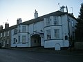 Swan Hotel, Aberford - geograph.org.uk - 3291965.jpg 2,048 × 1,536; 472 KB
-
 The A1M from Lotherton Lane - geograph.org.uk - 4087747.jpg 1,600 × 1,064; 543 KB
-
 The centrpiece, Lotherton House formal garden - geograph.org.uk - 5858052.jpg 2,000 × 1,500; 1.24 MB
-
 The Chapel, Lotherton Hall - geograph.org.uk - 6403548.jpg 2,000 × 1,225; 3.21 MB
-
 The Cock Beck at Aberford - geograph.org.uk - 5865724.jpg 1,024 × 778; 223 KB
-
 The former Swan Hotel, Aberford - geograph.org.uk - 6826752.jpg 2,000 × 1,283; 1.1 MB
-
 The former Swan Inn on Main Street, Aberford - geograph.org.uk - 4921731.jpg 1,200 × 799; 360 KB
-
 The Great North Road towards Aberford - geograph.org.uk - 3070331.jpg 800 × 600; 157 KB
-
 The hay bale maze, Lotherton Hall estate - geograph.org.uk - 5857447.jpg 2,000 × 1,330; 981 KB
-
 The Pilgrim Priest at Lotherton Hall - geograph.org.uk - 5066701.jpg 1,024 × 768; 280 KB
-
 The Rein - geograph.org.uk - 5922064.jpg 5,184 × 3,456; 5.26 MB
-
 The south front of the western end of Lotherton Hall - geograph.org.uk - 5857546.jpg 2,000 × 1,500; 1.04 MB
-
 The Swan Hotel, Aberford - geograph.org.uk - 2782615.jpg 640 × 480; 65 KB
-
 The Swan Hotel, Aberford - geograph.org.uk - 2783232.jpg 800 × 600; 99 KB
-
 The War Memorial at Aberford - geograph.org.uk - 3070361.jpg 600 × 800; 186 KB
-
 The War Memorial at Aberford - geograph.org.uk - 3070367.jpg 600 × 800; 129 KB
-
 The War Memorial at Aberford - geograph.org.uk - 3070368.jpg 800 × 600; 146 KB
-
 Track (footpath) off Collier Lane - geograph.org.uk - 2755134.jpg 640 × 480; 46 KB
-
 Track leading to Ranger's Walk - geograph.org.uk - 4093487.jpg 1,600 × 1,064; 554 KB
-
 Track on Hook Moor - geograph.org.uk - 5744307.jpg 1,600 × 1,200; 405 KB
-
 Trees on a mound off Lotherton Lane - geograph.org.uk - 5802041.jpg 1,024 × 768; 172 KB
-
 Unmarked county boundary, north of Copley Lane - geograph.org.uk - 4807010.jpg 1,024 × 768; 183 KB
-

-
 View towards Woodhouse Grange - geograph.org.uk - 5802036.jpg 1,024 × 768; 187 KB
-
 Village Hall, Aberford - geograph.org.uk - 1921438.jpg 1,024 × 681; 158 KB
-
 War memorial at Aberford - geograph.org.uk - 5790008.jpg 1,024 × 768; 324 KB
-
 Wide Track on Hook Moor - geograph.org.uk - 5920620.jpg 5,184 × 3,456; 5.15 MB


_-_geograph.org.uk_-_3038415.jpg)
_-_junction_44_in_1_1-2_miles_-_geograph.org.uk_-_2646820.jpg)
_about_to_divide_into_the_A1_and_the_M1_-_geograph.org.uk_-_5396381.jpg)
_at_Aberford_-_geograph.org.uk_-_5871000.jpg)
_at_junction_44_-_geograph.org.uk_-_2040831.jpg)
_junction_43_-_geograph.org.uk_-_2646830.jpg)
_junction_near_Aberford_-_geograph.org.uk_-_2040837.jpg)
_near_Aberford_-_geograph.org.uk_-_2040840.jpg)
_near_Aberford_-_geograph.org.uk_-_5870996.jpg)
_near_Aberford_-_geograph.org.uk_-_6857813.jpg)
_northbound_-_geograph.org.uk_-_3038391.jpg)
_northbound_-_geograph.org.uk_-_3038404.jpg)
_passing_Aberford_-_geograph.org.uk_-_4793140.jpg)
,_J43_-_geograph.org.uk_-_4806070.jpg)
,_southbound_-_geograph.org.uk_-_4806054.jpg)
,_southbound_to_J43_-_geograph.org.uk_-_4806052.jpg)
,_southbound_to_J43_-_geograph.org.uk_-_4806057.jpg)
,_southbound_to_J43_-_geograph.org.uk_-_4806068.jpg)


_-_geograph.org.uk_-_2755132.jpg)
_-_geograph.org.uk_-_2755135.jpg)


_-_geograph.org.uk_-_5066714.jpg)
_-_geograph.org.uk_-_5066719.jpg)


_-_geograph.org.uk_-_3038398.jpg)


_-_geograph.org.uk_-_6635004.jpg)
_-_geograph.org.uk_-_6635005.jpg)
_-_geograph.org.uk_-_6635009.jpg)


_merge_-_geograph.org.uk_-_4793138.jpg)
_junction_near_Aberford_-_geograph.org.uk_-_6820701.jpg)
,_Aberford_-_geograph.org.uk_-_4921338.jpg)
,_Aberford_-_geograph.org.uk_-_4921404.jpg)


_-_geograph.org.uk_-_5921022.jpg)
_-_geograph.org.uk_-_5921026.jpg)


_-_geograph.org.uk_-_5372691.jpg)


_in_the_play_and_picnic_area,_Lotherton_Hall_Estate_-_geograph.org.uk_-_5858186.jpg)


_off_Collier_Lane_-_geograph.org.uk_-_2755134.jpg)


