Category:Lorton, Cumbria
Jump to navigation
Jump to search
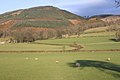
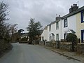
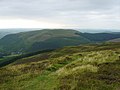
English: Lorton is a civil parish in the district of Allerdale, in the county of Cumbria, England, containing two small villages - Low Lorton and High Lorton, both approximately four miles south of Cockermouth. At the time of the 2001 census, the parish had a total population of 250 people. Lorton also has a small primary school, a church and a post office.
civil parish in Cumbria, England, United Kingdom  | |||||
| Upload media | |||||
| Instance of | |||||
|---|---|---|---|---|---|
| Location | Allerdale, Cumbria, North West England, England | ||||
| Population |
| ||||
| Said to be the same as | Lorton (Wikimedia duplicated page, civil parish) | ||||
 | |||||
Media in category "Lorton, Cumbria"
The following 200 files are in this category, out of 413 total.
(previous page) (next page)-
 A bench on the road to Hopebeck - geograph.org.uk - 2699584.jpg 2,592 × 1,944; 1.55 MB
-
 A dog, a busman's holiday by Whitbeck Bridge - geograph.org.uk - 5463872.jpg 1,200 × 802; 847 KB
-
 A Gated Road - geograph.org.uk - 5278086.jpg 2,399 × 1,599; 533 KB
-
 A mixture of farming. - geograph.org.uk - 98706.jpg 640 × 446; 70 KB
-
 A5292 approaching Scawgill Bridge - geograph.org.uk - 3092239.jpg 640 × 480; 60 KB
-
 AA village sign, Low Lorton - geograph.org.uk - 2820860.jpg 640 × 480; 341 KB
-
 Above Aiken Beck - geograph.org.uk - 1301233.jpg 640 × 480; 91 KB
-
 Above Aiken Plantation - geograph.org.uk - 2863190.jpg 1,920 × 2,560; 1.43 MB
-
 Above Darling How - geograph.org.uk - 4352061.jpg 4,608 × 3,456; 3.54 MB
-
 Above the Footbridge - geograph.org.uk - 1301299.jpg 480 × 640; 103 KB
-
 Access to a walled field - geograph.org.uk - 5804238.jpg 1,600 × 1,042; 427 KB
-
 Acorn Cottage in High Lorton - geograph.org.uk - 31360.jpg 640 × 480; 97 KB
-
 Agricultural Compound by Whit Beck - geograph.org.uk - 5492351.jpg 4,103 × 3,135; 2.83 MB
-
 Aiken Beck - geograph.org.uk - 1296777.jpg 480 × 640; 92 KB
-
 Aiken Beck - geograph.org.uk - 1301262.jpg 640 × 480; 131 KB
-
 Aiken Beck - geograph.org.uk - 3882720.jpg 640 × 480; 132 KB
-
 Aiken Beck - geograph.org.uk - 4272504.jpg 2,048 × 1,536; 1.48 MB
-
 Aiken Beck below Spout Force - geograph.org.uk - 6218429.jpg 480 × 640; 136 KB
-
 Aiken Beck below Spout Force - geograph.org.uk - 6218432.jpg 640 × 480; 145 KB
-
 Aiken Beck below Spout Force - geograph.org.uk - 6219343.jpg 640 × 480; 142 KB
-
 Aiken Plantation - geograph.org.uk - 1297523.jpg 640 × 480; 67 KB
-
 Aiken Plantation - geograph.org.uk - 1297532.jpg 640 × 480; 67 KB
-
 Aiken Plantation - geograph.org.uk - 4661587.jpg 1,600 × 1,200; 366 KB
-
 Aiken Plantation - geograph.org.uk - 895016.jpg 640 × 480; 104 KB
-
 Aiken Plantation - geograph.org.uk - 895022.jpg 640 × 480; 118 KB
-
 Aiken Plantation, Whinlatter - geograph.org.uk - 91229.jpg 640 × 464; 112 KB
-

-
 Approaching Boonbeck - geograph.org.uk - 5902670.jpg 640 × 427; 174 KB
-
 Approaching Hobcarton End - geograph.org.uk - 1383857.jpg 640 × 480; 76 KB
-
 Around the aged ash tree near Low Lorton - geograph.org.uk - 5463863.jpg 1,200 × 800; 850 KB
-
 B5289 by the High Lorton turning - geograph.org.uk - 3092144.jpg 800 × 600; 76 KB
-
 B5392 near Armaside - geograph.org.uk - 4035763.jpg 1,024 × 768; 176 KB
-
 Barn converted to garage, Low Lorton - geograph.org.uk - 2820846.jpg 640 × 426; 230 KB
-
 Beck at Scawgill - geograph.org.uk - 3476206.jpg 640 × 427; 397 KB
-
 Beck, Darling How - geograph.org.uk - 1301222.jpg 480 × 640; 139 KB
-
 Below Broom Fell - geograph.org.uk - 2293156.jpg 640 × 426; 88 KB
-
 Below Todd Fell - geograph.org.uk - 5482502.jpg 640 × 427; 97 KB
-
 Billy Minikin memorial - geograph.org.uk - 759361.jpg 480 × 640; 93 KB
-
 Black Crag - geograph.org.uk - 1383879.jpg 640 × 480; 78 KB
-
 Blaze Beck - geograph.org.uk - 3407394.jpg 1,920 × 2,560; 2.08 MB
-
 Boonbeck - geograph.org.uk - 5903620.jpg 640 × 427; 159 KB
-
 Bridge over Hobcarton Gill - geograph.org.uk - 5492091.jpg 4,608 × 3,456; 4.37 MB
-
 Broom Fell Summit - geograph.org.uk - 2214699.jpg 640 × 480; 59 KB
-
 Brown How Summit - geograph.org.uk - 2214939.jpg 640 × 480; 88 KB
-
 Brown How summit shelter - geograph.org.uk - 1163130.jpg 640 × 480; 75 KB
-
 Cairn and fence on Broom Fell - geograph.org.uk - 6340217.jpg 2,000 × 1,286; 2.15 MB
-
 Cairns on Broom Fell - geograph.org.uk - 2074187.jpg 2,000 × 1,500; 2.52 MB
-
 Car park entrance at Hobcarton - geograph.org.uk - 4272545.jpg 2,048 × 1,536; 1.16 MB
-
 Climbing from Hobcarton Forest towards Grisedale Pike - geograph.org.uk - 4660480.jpg 1,600 × 1,200; 314 KB
-
 Cottages, Lorton - geograph.org.uk - 1034323.jpg 640 × 480; 122 KB
-
 Cross wall on Swineside - geograph.org.uk - 4048855.jpg 4,000 × 3,000; 3.31 MB
-
 Crossroads in Lorton - geograph.org.uk - 3882770.jpg 640 × 480; 120 KB
-
 Darling How - geograph.org.uk - 1300673.jpg 480 × 640; 136 KB
-
 Darling How - geograph.org.uk - 2863186.jpg 2,560 × 1,920; 2.13 MB
-
 Darling How Farm - geograph.org.uk - 1163120.jpg 640 × 480; 88 KB
-
 Darling How Farm - geograph.org.uk - 2293066.jpg 640 × 426; 77 KB
-
 Darling How farm - geograph.org.uk - 4272506.jpg 2,048 × 1,151; 759 KB
-
 Darling How Plantation - geograph.org.uk - 1296767.jpg 640 × 480; 77 KB
-
 Darling How Plantation - geograph.org.uk - 1300670.jpg 640 × 480; 95 KB
-
 Darling How Plantation - geograph.org.uk - 3371222.jpg 2,560 × 1,920; 389 KB
-
 Dead trees on Ladyside Pike - geograph.org.uk - 4660383.jpg 1,600 × 1,200; 418 KB
-
 Descending Broom Fell - geograph.org.uk - 1300655.jpg 640 × 480; 72 KB
-
 Descending from the top of Grisedale Pike - geograph.org.uk - 6401656.jpg 1,800 × 1,200; 498 KB
-
 Descending Graystones - geograph.org.uk - 1301254.jpg 480 × 640; 75 KB
-
 Descending Graystones - geograph.org.uk - 3407380.jpg 2,560 × 1,920; 804 KB
-
 Descending Greystones - geograph.org.uk - 3506375.jpg 2,560 × 1,920; 2.15 MB
-
 Descending Lord's Seat - geograph.org.uk - 5402893.jpg 1,920 × 1,280; 497 KB
-
 Descending Whinlatter - geograph.org.uk - 3506385.jpg 2,560 × 1,920; 2.05 MB
-
 Direction Sign – Signpost - geograph.org.uk - 6506628.jpg 720 × 960; 94 KB
-
 Disused fence posts near Grisedale Pike summit - geograph.org.uk - 3749351.jpg 1,024 × 768; 440 KB
-
 Disused quarry on south side of Graystones - geograph.org.uk - 6001866.jpg 1,500 × 1,125; 1.45 MB
-
 Dripping Spruce Bud - geograph.org.uk - 5402894.jpg 1,920 × 1,280; 556 KB
-
 Dry Stone Wall - geograph.org.uk - 3476236.jpg 640 × 427; 517 KB
-
 Dusk - geograph.org.uk - 4358544.jpg 4,608 × 3,456; 3.21 MB
-
 Dusk at Whitbeck Bridge - geograph.org.uk - 5482510.jpg 640 × 427; 45 KB
-
 Early morning mist above Whit Beck - geograph.org.uk - 4661527.jpg 1,600 × 1,200; 461 KB
-

-
 Emerging from the Forest - geograph.org.uk - 1301243.jpg 640 × 480; 69 KB
-
 Entering the Forest - geograph.org.uk - 1383886.jpg 640 × 480; 100 KB
-
 Entering Whinlatter Forest Park on the A5292 - geograph.org.uk - 3092255.jpg 1,600 × 1,200; 374 KB
-
 Farm buildings, Scales - geograph.org.uk - 1512713.jpg 640 × 480; 87 KB
-
 Field with sheep in Vale of Lorton - geograph.org.uk - 6335146.jpg 2,000 × 1,090; 1.58 MB
-
 Fields near Armaside - geograph.org.uk - 3381967.jpg 2,592 × 1,944; 1.77 MB
-
 Fields near Newhouse Farm - geograph.org.uk - 5492360.jpg 3,486 × 2,527; 2.1 MB
-
 Fishing Lane - geograph.org.uk - 3148712.jpg 800 × 600; 214 KB
-
 Footbridge over Spout Gill - geograph.org.uk - 501972.jpg 600 × 450; 96 KB
-
 Footpath by Widow Hause - geograph.org.uk - 2214721.jpg 640 × 480; 71 KB
-
 Footpath from Embleton High Common - geograph.org.uk - 4082400.jpg 640 × 480; 77 KB
-
 Footpath to High Swinside - geograph.org.uk - 2293035.jpg 640 × 426; 99 KB
-
 Footpath to Spout Force - geograph.org.uk - 6617303.jpg 4,032 × 1,960; 4.79 MB
-
 Forest Edge - geograph.org.uk - 1376394.jpg 640 × 480; 86 KB
-
 Forest path - geograph.org.uk - 2683586.jpg 640 × 480; 99 KB
-
 Forest path - geograph.org.uk - 2683593.jpg 640 × 480; 74 KB
-
 Forest path - geograph.org.uk - 2683601.jpg 640 × 480; 94 KB
-
 Forest Road - geograph.org.uk - 895030.jpg 640 × 480; 102 KB
-
 Forest road in valley of Aiken Beck - geograph.org.uk - 6001484.jpg 1,500 × 1,125; 1.76 MB
-
 Forest Track - geograph.org.uk - 2248449.jpg 2,560 × 1,920; 1.75 MB
-
 Forest Track - geograph.org.uk - 894340.jpg 640 × 480; 67 KB
-
 Forest track below Ullister Hill - geograph.org.uk - 2732230.jpg 1,024 × 768; 297 KB
-
 Forest track in Whinlatter Pass - geograph.org.uk - 4430780.jpg 640 × 427; 94 KB
-
 Forest track, Aiken Plantation - geograph.org.uk - 4272487.jpg 2,048 × 1,536; 1.24 MB
-
 Forested slopes of Hobcarton End - geograph.org.uk - 3093462.jpg 800 × 584; 93 KB
-
 Forestry Track at Hobcarton Plantation - geograph.org.uk - 5492229.jpg 4,608 × 3,456; 3.95 MB
-
 Forestry Track in Hobcarton Plantation - geograph.org.uk - 5492056.jpg 4,608 × 3,456; 4.6 MB
-
 Forestry Track in Hobcarton Plantation - geograph.org.uk - 5492216.jpg 4,608 × 3,456; 3.98 MB
-
 Froam Hobcarton Plantation - geograph.org.uk - 1376387.jpg 640 × 480; 78 KB
-
 From Hobcarton End - geograph.org.uk - 1383873.jpg 640 × 480; 75 KB
-
 Frosty Wall Whinlatter Pass - geograph.org.uk - 80972.jpg 640 × 480; 154 KB
-
 Gate at edge of access land - geograph.org.uk - 4082413.jpg 640 × 480; 75 KB
-
 Grassy Whinlatter - geograph.org.uk - 4272465.jpg 2,048 × 1,536; 1.42 MB
-
 Graveyard at St Cuthbert's Church - geograph.org.uk - 6000678.jpg 1,500 × 1,063; 1.46 MB
-
 Graystones Summit - geograph.org.uk - 2214737.jpg 640 × 480; 86 KB
-
 Grisedale Pike - geograph.org.uk - 6682658.jpg 4,032 × 2,530; 1.73 MB
-
 Grisedale Pike from Lord's Seat - geograph.org.uk - 2477155.jpg 1,024 × 768; 145 KB
-
 Grisedale Pike looking towards Hobcarton Crag - geograph.org.uk - 4661068.jpg 1,600 × 1,200; 326 KB
-
 Ground on Graystones beyond ruined wall - geograph.org.uk - 6000775.jpg 1,500 × 1,042; 1.38 MB
-
 Harrot. - geograph.org.uk - 98723.jpg 640 × 426; 46 KB
-
 Heather, Lord's Seat - geograph.org.uk - 895014.jpg 640 × 480; 56 KB
-
 High How - geograph.org.uk - 6002045.jpg 1,500 × 1,125; 2.01 MB
-
 High Lorton - geograph.org.uk - 1732831.jpg 640 × 480; 60 KB
-
 High Lorton Junction - geograph.org.uk - 3148672.jpg 800 × 600; 197 KB
-
 High Mill - geograph.org.uk - 1511522.jpg 640 × 480; 109 KB
-
 High Mill Bridge - geograph.org.uk - 1511533.jpg 640 × 480; 157 KB
-
 High Mill Path - geograph.org.uk - 3148377.jpg 800 × 600; 91 KB
-
 High Swinside Farm - geograph.org.uk - 1512687.jpg 640 × 498; 117 KB
-
 High Swinside Farm - geograph.org.uk - 2699595.jpg 2,592 × 1,944; 2.12 MB
-
 Hill slope rising to Kirk Fell - geograph.org.uk - 6088008.jpg 1,600 × 1,200; 868 KB
-
 Hobcarton Crag below Hopegill Head - geograph.org.uk - 3750337.jpg 1,024 × 768; 528 KB
-
 Hobcarton Crag from Hopegill Head - geograph.org.uk - 3506190.jpg 640 × 425; 184 KB
-
 Hobcarton End - geograph.org.uk - 2683643.jpg 640 × 480; 60 KB
-
 Hobcarton Gill - geograph.org.uk - 1376390.jpg 480 × 640; 131 KB
-
 Hobcarton Head - geograph.org.uk - 6371601.jpg 640 × 360; 66 KB
-
 Hobcarton Pike - geograph.org.uk - 38859.jpg 640 × 407; 43 KB
-
 Hobcarton Plantation - geograph.org.uk - 1376385.jpg 640 × 480; 78 KB
-
 Hobcarton Plantation seen from Hobcarton Crag - geograph.org.uk - 3750331.jpg 1,024 × 768; 538 KB
-

-
 Holiday cottages, High Swinside - geograph.org.uk - 1512690.jpg 640 × 482; 128 KB
-
 Hope Gill from Hopegill Head - geograph.org.uk - 2296334.jpg 640 × 426; 39 KB
-
 House at Hole Mire - geograph.org.uk - 3092227.jpg 1,024 × 768; 192 KB
-
 In Aiken Plantation - geograph.org.uk - 2863189.jpg 1,920 × 2,560; 1.59 MB
-
 In Aiken Plantation - geograph.org.uk - 3506387.jpg 2,560 × 1,920; 2.06 MB
-
 In Darling How - geograph.org.uk - 1300677.jpg 640 × 480; 77 KB
-
 In Darling How - geograph.org.uk - 894329.jpg 480 × 640; 78 KB
-
 In Darling How Plantation - geograph.org.uk - 3407323.jpg 2,560 × 1,920; 1.99 MB
-
 In Darling How Plantation - geograph.org.uk - 3504404.jpg 1,920 × 2,560; 2.01 MB
-
 In Darling How Plantation - geograph.org.uk - 4352049.jpg 4,608 × 3,456; 3.79 MB
-
 In Lorton Vale - geograph.org.uk - 2220085.jpg 2,592 × 1,944; 1.86 MB
-
 In Lorton Vale - geograph.org.uk - 2220090.jpg 2,592 × 1,944; 1.34 MB
-
 In the Forest - geograph.org.uk - 1383892.jpg 480 × 640; 95 KB
-
 Junction at High Lorton - geograph.org.uk - 5492257.jpg 4,200 × 2,277; 2.44 MB
-
 Kirk Fell and Greystones - geograph.org.uk - 1163113.jpg 640 × 480; 72 KB
-
 Kirk Fell from Lord's Seat - geograph.org.uk - 2477165.jpg 1,024 × 768; 176 KB
-
 Ladyside Pike - geograph.org.uk - 2683620.jpg 640 × 480; 43 KB
-
 Ladyside Pike - geograph.org.uk - 2699630.jpg 2,592 × 1,944; 1.36 MB
-
 Ladyside Pike - geograph.org.uk - 3445984.jpg 2,560 × 1,920; 2.05 MB
-
 Ladyside pike. - geograph.org.uk - 2408057.jpg 640 × 480; 46 KB
-
 Landslip Aiken Beck - geograph.org.uk - 3407332.jpg 2,560 × 1,920; 2.06 MB
-
 Landslip on Aiken Beck - geograph.org.uk - 2732218.jpg 1,024 × 768; 304 KB
-
 Lane approaching Boonbeck - geograph.org.uk - 1512724.jpg 640 × 480; 116 KB
-
 Lane entering Lorton - geograph.org.uk - 1511509.jpg 640 × 480; 112 KB
-
 Leaving Comb Plantation - geograph.org.uk - 3416650.jpg 2,560 × 1,920; 2.2 MB
-
 Lichen and Rocks - geograph.org.uk - 2248451.jpg 2,560 × 1,920; 1.51 MB
-
 Littlethwaite Gill - geograph.org.uk - 4272519.jpg 2,048 × 1,536; 1.73 MB
-
 Looking down Willybrag Gill - geograph.org.uk - 1163123.jpg 640 × 480; 136 KB
-
 Looking over Blaze Beck - geograph.org.uk - 6184592.jpg 4,032 × 3,024; 5.3 MB
-

-
 Looking towards Widow Hause - geograph.org.uk - 894306.jpg 640 × 480; 114 KB
-
 Lord's Seat - geograph.org.uk - 5482506.jpg 640 × 427; 58 KB
-
 Lord's Seat Summit - geograph.org.uk - 2214677.jpg 640 × 480; 77 KB
-
 Lorton Fells - geograph.org.uk - 3476211.jpg 640 × 427; 392 KB
-
 Lorton Low Bridge - geograph.org.uk - 2220017.jpg 2,592 × 1,944; 1.97 MB
-
 Lorton Low Bridge - geograph.org.uk - 2595819.jpg 2,592 × 1,944; 1.86 MB
-
 Lorton Vale - geograph.org.uk - 30396.jpg 640 × 407; 128 KB
-
 Lorton Village Hall - geograph.org.uk - 1512758.jpg 640 × 427; 89 KB
-
 Lorton Village School - geograph.org.uk - 1511498.jpg 640 × 480; 82 KB
-
 Low Lorton - Post Office - geograph.org.uk - 31364.jpg 640 × 529; 148 KB
-
 Low Lorton Junction - geograph.org.uk - 3148390.jpg 800 × 600; 134 KB
-
 Low Lorton Road - geograph.org.uk - 3148566.jpg 800 × 522; 106 KB
-
 Minor road near High Armaside - geograph.org.uk - 3381981.jpg 2,592 × 1,944; 1.8 MB
-
 Misty morning - geograph.org.uk - 4661565.jpg 1,600 × 1,200; 148 KB
-

-
 Mountain bike trail at Whinlatter - geograph.org.uk - 5988147.jpg 4,032 × 3,024; 3.23 MB
-
 Murky day in Lorton Vale - geograph.org.uk - 4838562.jpg 1,600 × 1,064; 275 KB
-
 Nearing Darling How - geograph.org.uk - 2214754.jpg 640 × 480; 73 KB
-
 Newhouse Farm from the B5289 - geograph.org.uk - 3092127.jpg 800 × 585; 71 KB
-
 Northern slopes of Whinlatter pass - geograph.org.uk - 4035758.jpg 1,024 × 768; 244 KB
-

-

-

-

-

-
 Old Wall - geograph.org.uk - 1376403.jpg 480 × 640; 80 KB
-
 Old Wall - geograph.org.uk - 2690795.jpg 2,560 × 1,920; 1.23 MB
-
 Old Wall above Wythop Moss - geograph.org.uk - 654456.jpg 640 × 480; 82 KB
-
 Old Wall, Graystones - geograph.org.uk - 3506369.jpg 2,560 × 1,920; 1.95 MB
-
 Old Wall, Graystones - geograph.org.uk - 894348.jpg 480 × 640; 75 KB
-
 Old Wall, Greystones - geograph.org.uk - 2863857.jpg 2,560 × 1,920; 835 KB
-
 On Brown How - geograph.org.uk - 2863780.jpg 2,560 × 1,920; 852 KB
-
 On Brown How - geograph.org.uk - 895662.jpg 640 × 480; 63 KB
-
 On Greystones - geograph.org.uk - 1300667.jpg 640 × 480; 72 KB


