Category:Longside
Jump to navigation
Jump to search
English: Longside is a village located in Aberdeenshire, Scotland. It lies seven miles inland from Peterhead and two miles from Mintlaw on the A950. Its population in 2001 was 721. The River Ugie flows through it
village located in Aberdeenshire, Scotland, UK  | |||||
| Upload media | |||||
| Instance of | |||||
|---|---|---|---|---|---|
| Location |
| ||||
| Population |
| ||||
| official website | |||||
 | |||||
Subcategories
This category has the following 2 subcategories, out of 2 total.
L
- Longside railway station (1 F)
O
Media in category "Longside"
The following 58 files are in this category, out of 58 total.
-
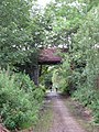
 A bridge on the Buchan Line - geograph.org.uk - 551219.jpg 640 × 426; 69 KB
-
 Cuttyhill Croft - geograph.org.uk - 240857.jpg 640 × 480; 55 KB
-
 Farmland land around Linshart - geograph.org.uk - 188260.jpg 640 × 424; 45 KB
-
 Farmland, near Willowbank - geograph.org.uk - 225113.jpg 480 × 360; 41 KB
-
-
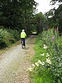 Formartine and Buchan Way -Another Bridge - geograph.org.uk - 509299.jpg 480 × 640; 110 KB
-
 Longside, Main Street.jpg 640 × 480; 63 KB
-
 Main street - Longside.jpg 4,032 × 2,268; 5.77 MB
-
 River Ugie from Buchan Line - geograph.org.uk - 242579.jpg 640 × 480; 76 KB
-
 Sawmill at Braehead - geograph.org.uk - 430965.jpg 640 × 480; 58 KB
-
 View towards Longside - geograph.org.uk - 430951.jpg 640 × 480; 82 KB
-
 Aden country park campsite 1 - geograph.org.uk - 774864.jpg 640 × 480; 95 KB
-
 Aden country park campsite 2 - geograph.org.uk - 774870.jpg 640 × 480; 74 KB
-
 Approach to Mains of Buthlaw - geograph.org.uk - 261838.jpg 640 × 480; 44 KB
-
 Auchlee Farm - geograph.org.uk - 430931.jpg 640 × 480; 61 KB
-
 Babby Duthie's Rock 2 - geograph.org.uk - 482427.jpg 640 × 483; 100 KB
-
 Babby Duthie's Rock, Ravenscraig. - geograph.org.uk - 481416.jpg 640 × 483; 130 KB
-
 Big Bungalow Being Built - geograph.org.uk - 404455.jpg 640 × 480; 129 KB
-
 Braeside of Fortrie - geograph.org.uk - 395781.jpg 640 × 480; 55 KB
-
 Bridge over River Ugie - geograph.org.uk - 335188.jpg 640 × 480; 88 KB
-
 Bridge over small stream... - geograph.org.uk - 403542.jpg 640 × 480; 143 KB
-
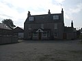 Bruce Arms Hotel, Longside - geograph.org.uk - 242578.jpg 640 × 480; 52 KB
-
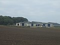
 Contractors' Depot, Mintlaw - geograph.org.uk - 398181.jpg 640 × 480; 75 KB
-
 Cottages at Flushing, near Longside - geograph.org.uk - 260732.jpg 640 × 480; 86 KB
-
 Country lane north of Longside - geograph.org.uk - 430958.jpg 640 × 480; 111 KB
-
 Disused farm shed at Woodside - geograph.org.uk - 265573.jpg 640 × 480; 75 KB
-
 Disused shed at Middle Hythie - geograph.org.uk - 432748.jpg 640 × 480; 86 KB
-
 Downiehills Farm - geograph.org.uk - 260694.jpg 640 × 480; 50 KB
-
 Eastern edge of Longside Airfield - geograph.org.uk - 260710.jpg 640 × 480; 80 KB
-
 Faichfield Quarry - geograph.org.uk - 260727.jpg 640 × 480; 61 KB
-
 Fence building work at Tiffrey - geograph.org.uk - 261851.jpg 640 × 480; 55 KB
-
 Field at Mains of Ludquharn - geograph.org.uk - 354506.jpg 640 × 480; 69 KB
-
 Fields at Mains of Kinmundy - geograph.org.uk - 443099.jpg 589 × 442; 62 KB
-
 Flushing junction - geograph.org.uk - 260737.jpg 640 × 480; 71 KB
-

-
 Hillhead of Mintlaw - geograph.org.uk - 403548.jpg 640 × 480; 63 KB
-
 Horse Paddock at South Dumpston - geograph.org.uk - 507727.jpg 640 × 480; 71 KB
-
 Inverveddie Farm - geograph.org.uk - 404439.jpg 640 × 480; 101 KB
-
 Jamie Fleeman's grave, Longside - geograph.org.uk - 261867.jpg 480 × 640; 79 KB
-
 Mains of Kinmundy - geograph.org.uk - 404446.jpg 640 × 480; 78 KB
-
 Middle Hythie - geograph.org.uk - 432746.jpg 640 × 480; 110 KB
-
 Middleton of Rora - geograph.org.uk - 507724.jpg 640 × 480; 100 KB
-
 Monyruy 'Big Hoose' - geograph.org.uk - 261835.jpg 640 × 480; 70 KB
-
 Murky morning at Monyruy - geograph.org.uk - 261833.jpg 640 × 480; 54 KB
-
 Nether Hythie Cottages - geograph.org.uk - 432744.jpg 640 × 480; 81 KB
-
 New Houses at North Longmuir - geograph.org.uk - 466181.jpg 640 × 480; 66 KB
-
 Road to Auchlee Farm - geograph.org.uk - 430941.jpg 640 × 480; 61 KB
-
 Road to Cairngall Farm, Longside - geograph.org.uk - 261846.jpg 640 × 480; 50 KB
-
 Road to Dumbmill - geograph.org.uk - 474963.jpg 640 × 480; 100 KB
-
 Ruined cottage at Middle Hythie - geograph.org.uk - 432751.jpg 640 × 480; 86 KB
-

-
-
 South Cortiecram - geograph.org.uk - 395784.jpg 640 × 480; 53 KB
-
 St John's Church, Longside - geograph.org.uk - 261842.jpg 640 × 480; 85 KB
-
 The South Ugie - geograph.org.uk - 188274.jpg 640 × 424; 59 KB
-
 Trees at Hill of Longhaven - geograph.org.uk - 434095.jpg 640 × 480; 71 KB
-
 View to Auchtydonald Farm - geograph.org.uk - 440761.jpg 640 × 480; 112 KB
-
 View to Hillhead Dairy - geograph.org.uk - 399220.jpg 640 × 480; 54 KB


