Category:Longhope, Gloucestershire
Jump to navigation
Jump to search
village and civil parish in Gloucestershire, United Kingdom  | |||||
| Upload media | |||||
| Instance of | |||||
|---|---|---|---|---|---|
| Location | Forest of Dean, Gloucestershire, South West England, England | ||||
| Population |
| ||||
| Said to be the same as | Longhope (Wikimedia duplicated page, civil parish) | ||||
 | |||||
Subcategories
This category has the following 6 subcategories, out of 6 total.
A
- All Saints church, Longhope (17 F)
B
- Longhope Baptist Church (3 F)
L
- Longhope War Memorial (3 F)
M
Y
- Yew Tree, Longhope (3 F)
Media in category "Longhope, Gloucestershire"
The following 200 files are in this category, out of 368 total.
(previous page) (next page)-
 'The Gloucestershire Way', near Longhope - geograph.org.uk - 87722.jpg 640 × 426; 138 KB
-
 A40 approaching Hopeswood Park - geograph.org.uk - 6213261.jpg 1,600 × 901; 478 KB
-
 A40 at Dursley Cross - geograph.org.uk - 6180665.jpg 640 × 360; 128 KB
-
 A40 at Longhope - geograph.org.uk - 2968199.jpg 800 × 451; 181 KB
-
 A40 at Longhope - geograph.org.uk - 3082024.jpg 1,200 × 676; 464 KB
-
 A40 bends near Brights Hill, 1 - geograph.org.uk - 6559675.jpg 1,600 × 900; 685 KB
-
 A40 eastbound - geograph.org.uk - 4267764.jpg 640 × 473; 76 KB
-
 A40 near Boxbush - geograph.org.uk - 2354757.jpg 640 × 480; 113 KB
-
 A40 near Boxbush - geograph.org.uk - 2504629.jpg 800 × 601; 395 KB
-
 A40 near Dursley Cross - geograph.org.uk - 2678257.jpg 1,024 × 577; 563 KB
-
 A40 westbound - geograph.org.uk - 4267755.jpg 640 × 480; 76 KB
-
 A40 westbound - geograph.org.uk - 4267781.jpg 640 × 480; 111 KB
-
 A40, bendy section - geograph.org.uk - 2044073.jpg 640 × 480; 234 KB
-
 A4136 east of Longhope - geograph.org.uk - 1470140.jpg 640 × 480; 244 KB
-
 Abandoned caravan - geograph.org.uk - 6487174.jpg 1,600 × 1,067; 1.14 MB
-
 Abandoned caravan and shed - geograph.org.uk - 6487160.jpg 1,600 × 1,067; 1.22 MB
-
 Access gate onto May Hill, Glos - geograph.org.uk - 3795648.jpg 640 × 480; 89 KB
-
 All dogs on leads please - geograph.org.uk - 4053594.jpg 3,872 × 2,592; 4.88 MB
-
 All Saints' church, Longhope - geograph.org.uk - 6511715.jpg 1,600 × 900; 489 KB
-
 All Saints' churchyard, Longhope - geograph.org.uk - 6517874.jpg 1,600 × 1,026; 985 KB
-
 Among the trees on May Hill - geograph.org.uk - 5526425.jpg 1,024 × 768; 298 KB
-
 Another time, another place^ - geograph.org.uk - 1072804.jpg 640 × 358; 66 KB
-
 Ascending May Hill - geograph.org.uk - 5521091.jpg 4,184 × 2,789; 2.31 MB
-
 Autumn in Longhope - geograph.org.uk - 3210890.jpg 1,024 × 680; 268 KB
-
 Autumnal pasture, near Hopeswood Park - geograph.org.uk - 2641664.jpg 800 × 600; 418 KB
-
 Avenue of poplar trees - geograph.org.uk - 3209467.jpg 680 × 1,024; 321 KB
-
 Barrel Lane railway bridge - geograph.org.uk - 3941485.jpg 3,872 × 2,592; 4.84 MB
-
 Bearfoot Cottage - geograph.org.uk - 3941505.jpg 3,872 × 2,592; 4.25 MB
-
 Bearfoot Wood - geograph.org.uk - 2400541.jpg 1,024 × 680; 381 KB
-
 Beech Grove - geograph.org.uk - 1280543.jpg 640 × 480; 233 KB
-
 Belted Galloway on May Hill - geograph.org.uk - 5521272.jpg 4,184 × 2,789; 2.44 MB
-
 Belted Galloways on May Hill - geograph.org.uk - 3579016.jpg 1,024 × 768; 303 KB
-
 Bent and broken - geograph.org.uk - 3384574.jpg 640 × 427; 106 KB
-
 Black and white house at Longhope - geograph.org.uk - 4053623.jpg 3,872 × 2,592; 4.01 MB
-
 Bluebells and cowslips - geograph.org.uk - 2936810.jpg 1,024 × 680; 292 KB
-
 Bluebells in Bearfoot Wood - geograph.org.uk - 2400547.jpg 680 × 1,024; 390 KB
-
 Breakheart Hill - geograph.org.uk - 1859586.jpg 640 × 426; 91 KB
-
 Brew House at Hillside Brewery - geograph.org.uk - 6402905.jpg 4,896 × 3,264; 6.31 MB
-
 Brewery shop at Hollybush Farm - geograph.org.uk - 6402859.jpg 4,896 × 3,264; 5.15 MB
-
 Bright's Hill - geograph.org.uk - 102576.jpg 640 × 480; 90 KB
-
 BT building, Longhope - geograph.org.uk - 3527789.jpg 800 × 451; 212 KB
-
 Central Stores Longhope - geograph.org.uk - 3213259.jpg 1,024 × 680; 190 KB
-
 Church rd, Longhope - geograph.org.uk - 701634.jpg 640 × 480; 55 KB
-
 Church Road, Longhope - geograph.org.uk - 3597538.jpg 800 × 598; 228 KB
-
 Clear message - geograph.org.uk - 845521.jpg 640 × 447; 139 KB
-
 Copse silhouette on May Hill - geograph.org.uk - 5718706.jpg 2,048 × 1,536; 834 KB
-
 Cottage at Boxbush - geograph.org.uk - 2589328.jpg 800 × 481; 309 KB
-
 Cottages opposite the church, Longhope - geograph.org.uk - 845492.jpg 640 × 445; 110 KB
-
 Course of old railway at Boxbush - geograph.org.uk - 4052920.jpg 2,592 × 3,872; 4.7 MB
-
 Course of old railway near Longhope - geograph.org.uk - 3944271.jpg 2,592 × 3,872; 4.32 MB
-
 Course of old railway near Longhope - geograph.org.uk - 3958329.jpg 2,592 × 3,872; 4.76 MB
-
 Crowds on May Hill greet the May Day sunrise - geograph.org.uk - 4454721.jpg 3,456 × 2,304; 2.86 MB
-
 Culvert by Hopeswood Park - geograph.org.uk - 3305467.jpg 800 × 600; 237 KB
-
 Developing fruit - geograph.org.uk - 1355530.jpg 640 × 480; 293 KB
-
 Distant geese - geograph.org.uk - 3232742.jpg 1,200 × 676; 372 KB
-

-
 Dream cottage - geograph.org.uk - 2343022.jpg 800 × 567; 457 KB
-
 Drive to Lyndors farm - geograph.org.uk - 2641675.jpg 800 × 600; 427 KB
-
 Dursley Cross - geograph.org.uk - 3189995.jpg 1,200 × 676; 393 KB
-
 Dursley Cross, 1 - geograph.org.uk - 6180652.jpg 1,600 × 900; 688 KB
-
 Dursley Cross, 2 - geograph.org.uk - 6180656.jpg 1,600 × 899; 794 KB
-
 Dursley Cross, 3 - geograph.org.uk - 6180658.jpg 1,600 × 1,200; 788 KB
-
 Dursley Cross, 4 - geograph.org.uk - 6180662.jpg 640 × 360; 121 KB
-
 Earthwork on May Hill - geograph.org.uk - 5521237.jpg 3,184 × 2,123; 2.41 MB
-
 Empty casks at Hillside Brewery - geograph.org.uk - 6402866.jpg 4,896 × 3,264; 6.4 MB
-
 Entrance to Hart's Barn - geograph.org.uk - 4306718.jpg 640 × 360; 62 KB
-
 Entrance to Harts Barn craft centre - geograph.org.uk - 1479792.jpg 640 × 480; 245 KB
-

-
 Entrance to Longhope Manor - geograph.org.uk - 6365998.jpg 1,600 × 900; 800 KB
-
 ERF "C" series tractor unit - geograph.org.uk - 4053630.jpg 3,872 × 2,592; 3.09 MB
-
 Farm track at Dursley Cross - geograph.org.uk - 3944243.jpg 2,592 × 3,872; 4.52 MB
-
 Farm track on the slopes of May Hill - geograph.org.uk - 3941497.jpg 2,592 × 3,872; 4.38 MB
-
 Farmer's Boy Inn - geograph.org.uk - 6204342.jpg 1,600 × 903; 547 KB
-
 Farmland above Longhope - geograph.org.uk - 3209217.jpg 1,024 × 680; 245 KB
-
 Farmland above Longhope - geograph.org.uk - 3211763.jpg 1,024 × 680; 292 KB
-
 Farmland on the edge of the forest - geograph.org.uk - 2936805.jpg 1,024 × 680; 254 KB
-
 Farmland west of Longhope - geograph.org.uk - 1355519.jpg 640 × 480; 243 KB
-
 Felled trees, Boxbush - geograph.org.uk - 6078273.jpg 1,600 × 901; 764 KB
-
 Field above Longhope - geograph.org.uk - 3209203.jpg 1,024 × 680; 295 KB
-
 Field patterns, Longhope - geograph.org.uk - 1862145.jpg 426 × 640; 110 KB
-
 First past the post - geograph.org.uk - 486687.jpg 640 × 528; 445 KB
-
 Footpath and track above Longhope - geograph.org.uk - 3211769.jpg 1,024 × 680; 306 KB
-
 Footpath below Hope Wood - geograph.org.uk - 3209436.jpg 1,024 × 680; 297 KB
-
 Footpath by the A40 - geograph.org.uk - 2890900.jpg 1,024 × 577; 304 KB
-
 Footpath junction on May Hill, Glos - geograph.org.uk - 3795644.jpg 640 × 480; 146 KB
-
 Footpath marker post on May Hill looking west - geograph.org.uk - 4933863.jpg 3,264 × 2,448; 2.18 MB
-
 Footpath past Hobbs Quarry - geograph.org.uk - 3211754.jpg 1,024 × 680; 379 KB
-
 Footpath stile - geograph.org.uk - 3212567.jpg 1,024 × 680; 273 KB
-
 Footpath to Longhope at Barn Farm - geograph.org.uk - 4279842.jpg 800 × 435; 73 KB
-
 Ford at Court Farm, Longhope - geograph.org.uk - 4053612.jpg 2,592 × 3,872; 4.65 MB
-
 Forest Bakehouse, Longhope - geograph.org.uk - 3996017.jpg 1,600 × 1,064; 439 KB
-
 Former railway trackbed - geograph.org.uk - 2937231.jpg 1,024 × 680; 339 KB
-
 Foxgloves by the track - geograph.org.uk - 1355535.jpg 640 × 480; 277 KB
-
 Free range - geograph.org.uk - 724502.jpg 640 × 480; 209 KB
-
 Fungi in Hope Wood - geograph.org.uk - 267996.jpg 480 × 640; 150 KB
-
 Fungi in Hope Wood, detail - geograph.org.uk - 268001.jpg 480 × 640; 101 KB
-
 Furniture manufacturer, Longhope - geograph.org.uk - 1280554.jpg 640 × 480; 219 KB
-
 Gloucestershire and Wysis Way - geograph.org.uk - 2400516.jpg 1,024 × 680; 179 KB
-
 Gloucestershire boundary wall - geograph.org.uk - 5481137.jpg 4,561 × 2,945; 5.2 MB
-
 Gloucestershire Way footpath - geograph.org.uk - 845499.jpg 466 × 640; 186 KB
-
 Gloucestershire Way footpath - geograph.org.uk - 845511.jpg 640 × 456; 158 KB
-
 Gloucestershire Way stile and sign - geograph.org.uk - 6511700.jpg 1,600 × 900; 940 KB
-
 Harold Read's haulage yard, Longhope - geograph.org.uk - 4052881.jpg 3,872 × 2,592; 2.61 MB
-
 Harts Barn car park, Longhope - geograph.org.uk - 3841866.jpg 800 × 539; 131 KB
-
 Harts Barn craft centre - geograph.org.uk - 1479793.jpg 640 × 480; 238 KB
-
 Harts Barn main house, Longhope - geograph.org.uk - 3841972.jpg 800 × 729; 173 KB
-
 Harts Barn pond, Longhope - geograph.org.uk - 3841886.jpg 800 × 508; 127 KB
-
 Harts House - geograph.org.uk - 1479789.jpg 640 × 480; 238 KB
-
 Harvested wheat crop - geograph.org.uk - 6256996.jpg 1,600 × 900; 643 KB
-
 Haulage yard, Longhope - geograph.org.uk - 836274.jpg 640 × 483; 118 KB
-
 Herefordshire viewed through the trees - geograph.org.uk - 5526431.jpg 1,024 × 768; 248 KB
-
 Hidden street sign, Longhope - geograph.org.uk - 836248.jpg 640 × 383; 195 KB
-
 High ground above Longhope - geograph.org.uk - 3209255.jpg 1,024 × 680; 235 KB
-
 High Wood - geograph.org.uk - 3212553.jpg 1,024 × 680; 282 KB
-
 Hillside by Lyndors Farm - geograph.org.uk - 2612339.jpg 800 × 600; 403 KB
-
 Hillside grazing, Longhope - geograph.org.uk - 845539.jpg 640 × 480; 157 KB
-
 Hillside near Hobbs Lane - geograph.org.uk - 836240.jpg 640 × 466; 195 KB
-
 Hillside north of Station Lane - geograph.org.uk - 836233.jpg 640 × 480; 199 KB
-
 Hilltop trees on May Hill - geograph.org.uk - 5526439.jpg 1,024 × 768; 133 KB
-
 Hobbs Lane at Dursley Cross - geograph.org.uk - 6425107.jpg 1,600 × 900; 675 KB
-
 Hollybush Farm - geograph.org.uk - 3263885.jpg 1,200 × 676; 430 KB
-
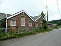
 Hope Brook Primary School - geograph.org.uk - 3212906.jpg 1,024 × 680; 237 KB
-
 Hopeswood Park, Longhope - geograph.org.uk - 1280550.jpg 640 × 480; 203 KB
-
 House by the A40, Boxbush - geograph.org.uk - 6553369.jpg 1,600 × 900; 629 KB
-
 House in a valley - geograph.org.uk - 2044071.jpg 640 × 480; 258 KB
-
 House on the A40, Box Bush - geograph.org.uk - 5541922.jpg 1,960 × 1,412; 696 KB
-
 Houses and road junction, Longhope - geograph.org.uk - 3211748.jpg 1,024 × 680; 196 KB
-
 Hungry sheep - geograph.org.uk - 3305463.jpg 800 × 600; 188 KB
-
 Inscription on Pound House - geograph.org.uk - 3211744.jpg 1,024 × 680; 235 KB
-
 Iron Age earthwork on May Hill summit - geograph.org.uk - 4933856.jpg 3,264 × 2,448; 2.34 MB
-
 Jubilee plaque - geograph.org.uk - 2406544.jpg 680 × 1,024; 252 KB
-
 Lady's smock - geograph.org.uk - 2937227.jpg 680 × 1,024; 198 KB
-
 Land by the A4136 - geograph.org.uk - 6368356.jpg 1,600 × 900; 661 KB
-
 Lane junction, May Hill - geograph.org.uk - 6464642.jpg 1,600 × 900; 926 KB
-
 Lane off the A4136 - geograph.org.uk - 3384521.jpg 640 × 427; 62 KB
-
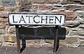 Latchen - street sign, Longhope - geograph.org.uk - 837224.jpg 640 × 410; 150 KB
-
 Leafing up - geograph.org.uk - 1280523.jpg 640 × 480; 229 KB
-
 Level crossing gate - geograph.org.uk - 3210880.jpg 1,024 × 680; 255 KB
-
 Long Hope and Little London - geograph.org.uk - 3764558.jpg 1,600 × 1,071; 330 KB
-
 Longhope - geograph.org.uk - 3211767.jpg 1,024 × 680; 241 KB
-
 Longhope - geograph.org.uk - 4267790.jpg 640 × 480; 58 KB
-
 Longhope and its old railway - geograph.org.uk - 4052927.jpg 3,872 × 2,592; 3.49 MB
-
 Longhope church and cottages - geograph.org.uk - 6517892.jpg 1,600 × 900; 651 KB
-
 Longhope Post Office - geograph.org.uk - 3213260.jpg 1,024 × 680; 123 KB
-
 Longhope Post Office - geograph.org.uk - 3996005.jpg 1,600 × 1,064; 540 KB
-
 Longhope Post Office - geograph.org.uk - 4267802.jpg 640 × 480; 74 KB
-
 Longhope Post Office - geograph.org.uk - 486916.jpg 467 × 640; 274 KB
-
 Longhope primary school 1 - geograph.org.uk - 1355499.jpg 640 × 480; 223 KB
-
 Longhope primary school 2 - geograph.org.uk - 1355503.jpg 640 × 480; 222 KB
-
 Longhope Telephone Exchange, Glos - geograph.org.uk - 5362553.jpg 2,592 × 1,944; 1.41 MB
-
 May Day dawn on May Hill - geograph.org.uk - 4454793.jpg 3,456 × 2,304; 3.42 MB
-
 May Day sunrise above Bearfoot Wood on May Hill - geograph.org.uk - 4454710.jpg 3,456 × 2,304; 2.74 MB
-
 May Hill - geograph.org.uk - 3300523.jpg 2,592 × 1,944; 2 MB
-
 May Hill - geograph.org.uk - 3433719.jpg 1,195 × 707; 85 KB
-
 May Hill - geograph.org.uk - 3433724.jpg 1,046 × 702; 107 KB
-
 May Hill - geograph.org.uk - 3433739.jpg 1,031 × 680; 108 KB
-
 May Hill - geograph.org.uk - 4268695.jpg 1,024 × 568; 367 KB
-
 May Hill - geograph.org.uk - 5522169.jpg 3,184 × 2,123; 1.73 MB
-
 May Hill Sign - geograph.org.uk - 3300531.jpg 2,592 × 1,944; 1.07 MB
-
 May Hill Trig Pillar - geograph.org.uk - 5521195.jpg 3,184 × 2,123; 1.82 MB
-

-
 Meadow at Boxbush - geograph.org.uk - 3944259.jpg 3,872 × 2,592; 4.42 MB
-
 Memorial bench on May Hill, Glos - geograph.org.uk - 3795788.jpg 640 × 480; 121 KB
-

-
 Mitcheldean - geograph.org.uk - 3764634.jpg 1,600 × 1,071; 487 KB
-

-
 New builds in School Lane - geograph.org.uk - 845505.jpg 480 × 640; 165 KB
-
 New Year's Day walkers descend May Hill - geograph.org.uk - 4297789.jpg 1,836 × 3,264; 1.08 MB
-
 Oak tree near Chessgrove Farm - geograph.org.uk - 3212615.jpg 680 × 1,024; 258 KB
-
 Occupation crossing at Longhope - geograph.org.uk - 3941515.jpg 3,872 × 2,592; 4.1 MB
-
 Old Boundary Marker - geograph.org.uk - 6439047.jpg 454 × 454; 135 KB
-
 Old Boundary Marker - geograph.org.uk - 6439052.jpg 447 × 447; 121 KB
-
 Old cottages at May Hill - geograph.org.uk - 4053559.jpg 3,872 × 2,592; 4.12 MB
-
 Old level crossing gates at Longhope - geograph.org.uk - 4052891.jpg 3,872 × 2,592; 3.72 MB
-
 Old railway line near Boxbush - geograph.org.uk - 3944279.jpg 2,592 × 3,872; 4.75 MB
-
 Old roadside barn - geograph.org.uk - 3212598.jpg 1,024 × 680; 278 KB
-
 Oldmoors Wood - geograph.org.uk - 3232740.jpg 1,200 × 900; 507 KB
-
 On May Hill - geograph.org.uk - 3579013.jpg 1,024 × 768; 169 KB
-
 On top of May Hill, Glos - geograph.org.uk - 3795670.jpg 640 × 480; 90 KB
-
 Orchard Bank Farm - geograph.org.uk - 3382278.jpg 640 × 427; 51 KB
-
 Ornamental lake near Blakemore Farm - geograph.org.uk - 6475216.jpg 1,600 × 900; 523 KB
-
 Panorama view from May Hill - geograph.org.uk - 5526435.jpg 1,024 × 286; 118 KB
-
 Parthenocissus quinquefolia, Virginia Creeper - geograph.org.uk - 6643138.jpg 1,600 × 1,600; 1.14 MB
-
 Pastoral scene near the A40 - geograph.org.uk - 1470189.jpg 640 × 480; 250 KB
-
 Pasture below Oldmoors Wood - geograph.org.uk - 6078278.jpg 1,600 × 901; 689 KB
-
 Pasture by Oldmoors Wood - geograph.org.uk - 3494360.jpg 800 × 451; 168 KB
-
 Pasture land by Kiln Wood - geograph.org.uk - 3572627.jpg 800 × 600; 274 KB
-
 Pasture land by Longhope Brook - geograph.org.uk - 3494324.jpg 800 × 451; 196 KB
-
 Pasture south of the A40 - geograph.org.uk - 1470210.jpg 640 × 480; 237 KB
-

-
 Path near Huntley Hill - geograph.org.uk - 3385851.jpg 640 × 427; 108 KB
-
 Path on May Hill - geograph.org.uk - 5193239.jpg 4,000 × 3,000; 3.04 MB
-

-
 Picnicing among the trees - geograph.org.uk - 5525387.jpg 768 × 1,024; 355 KB
-
 Plaque on the summit of May Hill - geograph.org.uk - 5525396.jpg 1,024 × 768; 334 KB
-
 Playing field, Longhope - geograph.org.uk - 3212903.jpg 1,024 × 680; 259 KB
-
 Pond at Hart's Barn - geograph.org.uk - 5832888.jpg 1,600 × 1,200; 1,021 KB
-
 Pond at Harts Barn Craft Centre - geograph.org.uk - 4443554.jpg 2,560 × 1,920; 2.87 MB
-
 Pond on Longhope Brook - geograph.org.uk - 4408698.jpg 3,276 × 2,184; 2.01 MB
-
 Pony in the gloom - geograph.org.uk - 1621763.jpg 640 × 451; 65 KB


