Category:Longhill, Kingston upon Hull
Jump to navigation
Jump to search
suburb in the city of Kingston upon Hull, East Riding of Yorkshire, England, UK | |||||
| Upload media | |||||
| Instance of | |||||
|---|---|---|---|---|---|
| Part of | |||||
| Location | City of Kingston upon Hull, East Riding of Yorkshire, Yorkshire and the Humber, England | ||||
 | |||||
Subcategories
This category has the following 4 subcategories, out of 4 total.
Media in category "Longhill, Kingston upon Hull"
The following 32 files are in this category, out of 32 total.
-
 Abandoned - geograph.org.uk - 721608.jpg 640 × 479; 110 KB
-
 Ark Royal, Hull - geograph.org.uk - 6365969.jpg 4,565 × 3,122; 2.64 MB
-
 Ark Royal, Hull - geograph.org.uk - 6365970.jpg 640 × 433; 72 KB
-
 Asda Supermarket, Bilton - geograph.org.uk - 6366569.jpg 5,184 × 3,888; 3.01 MB
-
 Barham Road, Hull - geograph.org.uk - 6340440.jpg 640 × 493; 67 KB
-

-
 Elizabeth II postbox on Barham Road, Hull - geograph.org.uk - 6340438.jpg 1,970 × 3,583; 1.45 MB
-
 Elizabeth II postbox on Greenwich Avenue, Hull - geograph.org.uk - 6341761.jpg 1,785 × 3,256; 1.01 MB
-
 Elizabeth II postbox, Asda Supermarket, Bilton - geograph.org.uk - 6366567.jpg 2,360 × 4,600; 2.11 MB
-
 Entrance to Asda Supermarket, Bilton - geograph.org.uk - 6366568.jpg 3,767 × 2,512; 1.41 MB
-
 Frome Road, Hull - geograph.org.uk - 644233.jpg 640 × 464; 172 KB
-
 Ganstead Lane, Hull - geograph.org.uk - 6344981.jpg 4,516 × 3,427; 3.09 MB
-
 Ganstead Lane, Hull - geograph.org.uk - 6344982.jpg 5,184 × 3,888; 4.9 MB
-
 George V postbox on Ganstead Lane, Hull - geograph.org.uk - 6344979.jpg 2,390 × 4,628; 2.61 MB
-
 George V postbox on Holderness Road, Hull - geograph.org.uk - 6340354.jpg 1,930 × 3,578; 1.33 MB
-
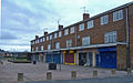 Greenwich Avenue shops, Hull - geograph.org.uk - 643342.jpg 640 × 401; 195 KB
-
 Holderness Road, Hull - geograph.org.uk - 6340355.jpg 3,510 × 2,399; 1.26 MB
-
 Holderness Road, Hull - geograph.org.uk - 6340356.jpg 3,512 × 2,539; 1.21 MB
-
 Houses on Ark Royal, Hull - geograph.org.uk - 6365967.jpg 640 × 391; 72 KB
-
 Houses on Ganstead Lane, Hull - geograph.org.uk - 6344980.jpg 4,914 × 3,212; 3.1 MB
-

-

-
 Longhill Health Care Centre, Hull - geograph.org.uk - 644798.jpg 640 × 425; 149 KB
-
 Longhill Playing Fields, Kingston upon Hull (geograph 5605267).jpg 2,816 × 2,112; 2.42 MB
-
 Saltshouse Road, Kingston upon Hull - geograph.org.uk - 6365948.jpg 2,592 × 1,944; 1.52 MB
-
 Saltshouse Road, Kingston upon Hull - geograph.org.uk - 6365956.jpg 2,592 × 1,944; 3.21 MB
-

-
 Shops on Barham Road, Hull - geograph.org.uk - 6340441.jpg 800 × 557; 79 KB
-
 Shops on Greenwich Avenue, Hull - geograph.org.uk - 6341762.jpg 640 × 480; 76 KB
-
 Shops on Greenwich Avenue, Hull - geograph.org.uk - 6341763.jpg 640 × 480; 66 KB
-
 The Royal Charter public house, Hull - geograph.org.uk - 6345755.jpg 800 × 600; 120 KB
-
 Wansbeck Road, Longhill - geograph.org.uk - 721596.jpg 640 × 449; 85 KB


.jpg)


