Category:Long Sutton, Lincolnshire
Jump to navigation
Jump to search
English: Long Sutton is a market town in Lincolnshire, England. Located in South Holland district, it lies close to the Wash.
town in Lincolnshire, England  | |||||
| Upload media | |||||
| Instance of | |||||
|---|---|---|---|---|---|
| Location | South Holland, Lincolnshire, East Midlands, England | ||||
| Said to be the same as | Long Sutton (Wikimedia duplicated page, civil parish) | ||||
 | |||||
Subcategories
This category has the following 8 subcategories, out of 8 total.
Media in category "Long Sutton, Lincolnshire"
The following 200 files are in this category, out of 308 total.
(previous page) (next page)-
 A view from Winter's Lane, south of Long Sutton - geograph.org.uk - 1973875.jpg 2,848 × 2,136; 2.98 MB
-
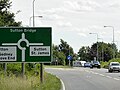
 A1101 - A17 Roundabout, Long Sutton - geograph.org.uk - 5679538.jpg 640 × 428; 92 KB
-
 A17 approaching B1390 roundabout - geograph.org.uk - 3641887.jpg 640 × 481; 48 KB
-

-
 A17 eastbound - geograph.org.uk - 5888587.jpg 640 × 428; 43 KB
-
 A17 eastbound - geograph.org.uk - 5888592.jpg 640 × 412; 52 KB
-
 A17 eastbound - geograph.org.uk - 5888598.jpg 640 × 393; 53 KB
-
 A17 eastbound - geograph.org.uk - 5888604.jpg 640 × 400; 43 KB
-
 A17 Eastbound near Long Sutton - geograph.org.uk - 4961001.jpg 640 × 427; 326 KB
-
 A17 services, Long Sutton - geograph.org.uk - 5851572.jpg 1,600 × 1,067; 309 KB
-
 A17 westbound at Delph Road junction - geograph.org.uk - 3641892.jpg 640 × 481; 45 KB
-
 Across the Fields from Wisbech Road - geograph.org.uk - 914030.jpg 640 × 427; 131 KB
-
 Alleyway to the shops, Long Sutton - geograph.org.uk - 2222689.jpg 480 × 640; 143 KB
-
 Allotments on Daniel's Gate, Long Sutton - geograph.org.uk - 2724318.jpg 4,320 × 3,240; 5.32 MB
-

-
 B1359 at The Old Ship Inn - geograph.org.uk - 3613686.jpg 640 × 480; 55 KB
-

-
 B1359 Wisbech Road, Long Sutton - geograph.org.uk - 5679542.jpg 640 × 428; 91 KB
-
-

-

-
-

-

-

-

-

-
 Bend in Jarvis's Gate - geograph.org.uk - 3359461.jpg 2,256 × 1,504; 2.51 MB
-
 Benny's Diner - geograph.org.uk - 4717402.jpg 640 × 480; 57 KB
-
 Blacksmith's Cottage - geograph.org.uk - 1234323.jpg 640 × 426; 74 KB
-
 BP garage on A17 at Wisbech Road - geograph.org.uk - 5551853.jpg 1,600 × 1,038; 328 KB
-
 Bridge on Wisbech Road - geograph.org.uk - 913836.jpg 640 × 427; 167 KB
-
 Bridge Road - geograph.org.uk - 4717447.jpg 640 × 480; 63 KB
-
 Bridge Road in Little Sutton - geograph.org.uk - 3566271.jpg 2,346 × 1,971; 1.7 MB
-
 Bridge Road in Long Sutton - geograph.org.uk - 3565255.jpg 3,264 × 2,448; 2.99 MB
-
 Bridleway on the bank - geograph.org.uk - 1874566.jpg 2,848 × 2,136; 3.08 MB
-
 Brunswick Mill, Long Sutton - geograph.org.uk - 5551850.jpg 1,065 × 1,600; 439 KB
-
 Burlies' Gate - geograph.org.uk - 4718498.jpg 640 × 480; 65 KB
-
 Burlies' Gate leading off Old Gate - geograph.org.uk - 5227328.jpg 3,776 × 2,520; 3.76 MB
-
 Bus stop and shelter, Long Sutton - geograph.org.uk - 4717455.jpg 640 × 480; 73 KB
-
 Bus stop on the B1359, Long Sutton - geograph.org.uk - 4717453.jpg 640 × 480; 54 KB
-
 Cemetery dedication plaque - geograph.org.uk - 1240481.jpg 426 × 640; 118 KB
-
 Church rooms, Long Sutton (geograph 2222556).jpg 640 × 480; 98 KB
-
 Colsuan Gardens - geograph.org.uk - 5583818.jpg 640 × 480; 61 KB
-
 Colsuan Gardens, Long Sutton - geograph.org.uk - 3401912.jpg 2,256 × 1,504; 1.72 MB
-
 Community Fire Station - geograph.org.uk - 1237026.jpg 640 × 426; 53 KB
-
 Community Fire Station, Long Sutton - geograph.org.uk - 2723020.jpg 4,320 × 3,240; 5 MB
-
 Cottage in Long Sutton - geograph.org.uk - 2222565.jpg 640 × 480; 76 KB
-
 Cottage on Roman Bank - geograph.org.uk - 2222562.jpg 640 × 480; 78 KB
-
 Cottages on Swapcoat Lane, Long Sutton - geograph.org.uk - 2983249.jpg 1,024 × 768; 191 KB
-
 Council houses. Woad Lane, Long Sutton - geograph.org.uk - 2982088.jpg 1,024 × 768; 128 KB
-
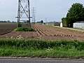
 Crop field and power lines - geograph.org.uk - 4718505.jpg 640 × 480; 63 KB
-
 Crop field and powerlines - geograph.org.uk - 4718512.jpg 640 × 480; 46 KB
-
 Crop field off Spendla's Lane - geograph.org.uk - 4718411.jpg 640 × 480; 54 KB
-
 Crop field, Long Sutton - geograph.org.uk - 4717444.jpg 640 × 480; 60 KB
-
 Crown and Woolpack - geograph.org.uk - 1238969.jpg 640 × 426; 70 KB
-
 Daniel's Gate - geograph.org.uk - 5583700.jpg 640 × 480; 74 KB
-
 Desolation on London Road - geograph.org.uk - 913822.jpg 640 × 404; 117 KB
-
-
 Drain and field off Lutton Garnsgate - geograph.org.uk - 4719849.jpg 640 × 480; 55 KB
-
 Drain beside National Cycle Route 1 - geograph.org.uk - 4718407.jpg 640 × 480; 81 KB
-
 Drain next to Spendla's Lane - geograph.org.uk - 5227329.jpg 3,496 × 2,208; 2.47 MB
-
 Drain off Spendla's Lane - geograph.org.uk - 4718413.jpg 640 × 480; 45 KB
-
 Drain off Woad Lane - geograph.org.uk - 4719918.jpg 640 × 480; 75 KB
-
 Drainage ditch from Wanton's Cross Gate - geograph.org.uk - 2175885.jpg 2,848 × 2,136; 3.05 MB
-
 Dry drain beside Wanton's Cross Gate - geograph.org.uk - 4718508.jpg 640 × 480; 86 KB
-
 Dyke across field - geograph.org.uk - 5583797.jpg 640 × 480; 66 KB
-
 Dyke across field - geograph.org.uk - 5583807.jpg 640 × 480; 73 KB
-
 Dyke across field - geograph.org.uk - 5583809.jpg 640 × 480; 65 KB
-
 Dyke and path - geograph.org.uk - 5583820.jpg 640 × 495; 61 KB
-

-

-
 Eastbound A17 near Long Sutton - geograph.org.uk - 4960995.jpg 640 × 480; 393 KB
-
 Eastbound A17, Long Sutton - geograph.org.uk - 4960990.jpg 640 × 480; 325 KB
-
 Electricity pylons north of Bridge Road - geograph.org.uk - 3565256.jpg 3,264 × 2,448; 3.26 MB
-
 Electricity transmission line - geograph.org.uk - 5583800.jpg 640 × 480; 51 KB
-
 Entering Long Sutton - geograph.org.uk - 4717443.jpg 640 × 480; 61 KB
-
 Farm building off Jarvis's Gate - geograph.org.uk - 4547380.jpg 640 × 480; 75 KB
-
 Farm Buildings - geograph.org.uk - 915766.jpg 640 × 420; 93 KB
-
 Farm Buildings and Track - geograph.org.uk - 914129.jpg 640 × 427; 162 KB
-
 Farm buildings off Bridge Road - geograph.org.uk - 4717448.jpg 640 × 480; 58 KB
-
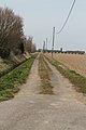 Farm Track off Bridge Road - geograph.org.uk - 3402123.jpg 1,504 × 2,256; 1.64 MB
-
 Farm Track off St James' Road - geograph.org.uk - 3361005.jpg 1,504 × 2,256; 1.66 MB
-
 Farmland and Premier Foods - geograph.org.uk - 915770.jpg 640 × 417; 148 KB
-
 Farmland off Woad Lane - geograph.org.uk - 4719920.jpg 640 × 480; 72 KB
-
 Farmland south of Bridge Road - geograph.org.uk - 3566308.jpg 3,025 × 2,329; 2.96 MB
-

-
 Fenced off house, Long Sutton - geograph.org.uk - 6223099.jpg 1,600 × 1,067; 316 KB
-
 Field and wind turbine - geograph.org.uk - 4718261.jpg 640 × 480; 51 KB
-
 Field near the A17 - geograph.org.uk - 4717465.jpg 640 × 480; 57 KB
-
 Field north of Woodward's Lane - geograph.org.uk - 4718199.jpg 640 × 480; 87 KB
-
 Field off Lutton Garnsgate - geograph.org.uk - 4719850.jpg 640 × 480; 40 KB
-
 Field off Markillie Lane - geograph.org.uk - 4718262.jpg 640 × 480; 66 KB
-
 Field off Wisbech Road (A1101) - geograph.org.uk - 4718192.jpg 640 × 480; 74 KB
-
 Field towards the A17 - geograph.org.uk - 4718184.jpg 640 × 480; 51 KB
-
 Fields and dike off Brown's Gate, Long Sutton - geograph.org.uk - 2175643.jpg 2,848 × 2,136; 3.15 MB
-
-
 Fieldside footpath - geograph.org.uk - 1236915.jpg 640 × 426; 57 KB
-
 Flat farmland north of Woad Lane - geograph.org.uk - 4719910.jpg 640 × 480; 72 KB
-
 Flat farmland off Burlies' Gate - geograph.org.uk - 4718497.jpg 640 × 480; 69 KB
-

-
 Footbridge and Pylon - geograph.org.uk - 5583733.jpg 640 × 480; 50 KB
-
 Footpath off Brown's Gate - geograph.org.uk - 3361170.jpg 2,192 × 1,370; 3.06 MB
-
 Footpath off Roman Bank - geograph.org.uk - 3415677.jpg 2,256 × 1,504; 2.16 MB
-
 Foreman's Bridge - geograph.org.uk - 1844959.jpg 2,848 × 2,136; 3.05 MB
-
 Foreman's Bridge - geograph.org.uk - 5581510.jpg 2,592 × 1,944; 1.82 MB
-
 Former Bull Hotel, Long Sutton - geograph.org.uk - 4719884.jpg 640 × 480; 75 KB
-
 Free School, Market Street - geograph.org.uk - 1233949.jpg 640 × 426; 82 KB
-
 Free School, Market Street - geograph.org.uk - 1233964.jpg 426 × 640; 65 KB
-
 Frozen ditch, Spendla's Lane, Long Sutton - geograph.org.uk - 2175660.jpg 2,848 × 2,136; 3.05 MB
-
 Garnsgate - geograph.org.uk - 619125.jpg 640 × 427; 87 KB
-
 Garnsgate Road - geograph.org.uk - 4719860.jpg 640 × 480; 52 KB
-
 Garnsgate Road, Long Sutton - geograph.org.uk - 2175906.jpg 2,848 × 2,136; 3.02 MB
-

-
 Georgian house on Market Street - geograph.org.uk - 1233883.jpg 640 × 426; 90 KB
-
 Georgian Houses - geograph.org.uk - 1233735.jpg 640 × 426; 74 KB
-
-
 Georgian Terrace - geograph.org.uk - 1233861.jpg 640 × 426; 73 KB
-
 Georgian Terrace - geograph.org.uk - 1233914.jpg 640 × 426; 79 KB
-
 Georgian terrace, Long Sutton - geograph.org.uk - 2153004.jpg 1,024 × 797; 164 KB
-
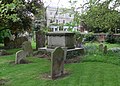 Gravestones at St Mary's Church - geograph.org.uk - 3566434.jpg 2,864 × 2,063; 2.54 MB
-
 Grazing near Long Sutton - geograph.org.uk - 4718181.jpg 640 × 480; 65 KB
-
 Greenhouses in Little Sutton - geograph.org.uk - 3565253.jpg 2,430 × 1,815; 1.81 MB
-
 Harrison's mill in Long Sutton - geograph.org.uk - 2222544.jpg 474 × 640; 126 KB
-
 Harrison's mill in Long Sutton - geograph.org.uk - 2222545.jpg 525 × 640; 174 KB
-
 Harrison's mill in Long Sutton - geograph.org.uk - 2222546.jpg 480 × 640; 157 KB
-
 Harrison's Mill, Roman Bank, Long Sutton - geograph.org.uk - 2724350.jpg 4,320 × 3,240; 5.72 MB
-
 High Street, Long Sutton - geograph.org.uk - 3594027.jpg 2,592 × 1,944; 1.28 MB
-
 Hole in the wall at Barclays Bank, Long Sutton - geograph.org.uk - 3141276.jpg 4,320 × 3,240; 5.71 MB
-
 House on St James Road - geograph.org.uk - 4718491.jpg 640 × 480; 79 KB
-
 Houses adjoining St Mary's churchyard - geograph.org.uk - 2222674.jpg 640 × 480; 174 KB
-
 Houses in Woodlands, Long Sutton - geograph.org.uk - 2222537.jpg 640 × 438; 87 KB
-
 Houses on Daniel's Gate, Long Sutton - geograph.org.uk - 5679603.jpg 640 × 428; 116 KB
-
 Houses on London Road, Long Sutton - geograph.org.uk - 5679595.jpg 640 × 428; 126 KB
-
 Houses on Park Road, Long Sutton - geograph.org.uk - 4719900.jpg 640 × 480; 74 KB
-
 Houses on Park Road, Long Sutton - geograph.org.uk - 4719906.jpg 640 × 480; 61 KB
-
 Houses on the B1359, Long Sutton - geograph.org.uk - 4717459.jpg 640 × 480; 81 KB
-
 Ivy covered gravestones - geograph.org.uk - 3566377.jpg 3,051 × 2,257; 3.11 MB
-
 Jarvis's Gate - geograph.org.uk - 4547384.jpg 640 × 480; 65 KB
-
 John Swains Way - geograph.org.uk - 6223102.jpg 1,600 × 1,067; 410 KB
-
 Junction of Delph Road with A17 - geograph.org.uk - 3361210.jpg 2,109 × 1,344; 2.14 MB
-
 Junction of roads at The Olde Ship Inn at Long Sutton - geograph.org.uk - 4248922.jpg 4,000 × 3,000; 2.54 MB
-
 Lancaster Drive - geograph.org.uk - 5583816.jpg 640 × 480; 61 KB
-
 Lane past Moorswood Farm - geograph.org.uk - 5581502.jpg 2,592 × 1,944; 1.29 MB
-
 Large tree, St James Road, Long Sutton - geograph.org.uk - 2175684.jpg 2,848 × 2,136; 2.96 MB
-
 Layby on the Eastbound A17 - geograph.org.uk - 4961003.jpg 640 × 427; 321 KB
-
 Layby on Westbound A17 near Long Sutton - geograph.org.uk - 4961014.jpg 640 × 427; 320 KB
-
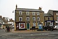 Lenton's Butchers - geograph.org.uk - 1233753.jpg 640 × 426; 68 KB
-
 Lincolnshire farmland - geograph.org.uk - 619829.jpg 640 × 427; 74 KB
-
 London Road (B1359), Long Sutton in 1987 - geograph.org.uk - 2730176.jpg 1,113 × 760; 150 KB
-
 London Road from Bridge Road - geograph.org.uk - 913723.jpg 640 × 427; 117 KB
-
 London Road Milepost - geograph.org.uk - 1239026.jpg 426 × 640; 95 KB
-
 Long Sutton - geograph.org.uk - 28559.jpg 640 × 480; 139 KB
-
 Long Sutton 3 Spalding 16 - geograph.org.uk - 1186764.jpg 640 × 480; 86 KB
-
 Long Sutton Fire Station - geograph.org.uk - 4719862.jpg 640 × 480; 38 KB
-
 Long Sutton fire station - geograph.org.uk - 836137.jpg 640 × 427; 163 KB
-
 Long Sutton Harrison's Mill, Lincolnshire - geograph.org.uk - 476842.jpg 426 × 640; 189 KB
-
 Long Sutton High Street 1914.jpg 1,074 × 664; 477 KB
-
 Long Sutton Medical Centre - geograph.org.uk - 2983250.jpg 1,024 × 768; 104 KB
-
 Long Sutton Scout ^ Guide Hall - geograph.org.uk - 6223097.jpg 1,600 × 1,067; 368 KB
-
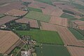
 Long Sutton to the Wash, aerial 2019 - geograph.org.uk - 6304197.jpg 1,024 × 683; 147 KB
-
 Long Sutton Village Sign - geograph.org.uk - 6292892.jpg 4,000 × 3,000; 3.03 MB
-
 Long Sutton war memorial - geograph.org.uk - 2222551.jpg 640 × 480; 92 KB
-
 Long Sutton's Village Pump - geograph.org.uk - 913787.jpg 401 × 640; 174 KB
-
 Long Sutton, High Street - geograph.org.uk - 3594030.jpg 2,592 × 1,944; 1.29 MB
-
 Looking towards Sharpe's Bridge - geograph.org.uk - 1845001.jpg 2,848 × 2,136; 2.94 MB
-
 Looking west from Foreman's Bridge - geograph.org.uk - 1844895.jpg 2,848 × 2,136; 3.03 MB
-
 Looking west from Red House Bridge - geograph.org.uk - 1844887.jpg 2,848 × 2,136; 2.95 MB
-
 Lutton Drain - geograph.org.uk - 1234333.jpg 640 × 426; 50 KB
-
 Lutton Garnsgate - geograph.org.uk - 619795.jpg 640 × 427; 139 KB
-
 Maple Tree Farm - geograph.org.uk - 3091724.jpg 640 × 480; 100 KB
-
 Maple Tree Farm - geograph.org.uk - 3361224.jpg 2,256 × 1,504; 1.7 MB
-
 Market Place - geograph.org.uk - 5520918.jpg 480 × 640; 59 KB
-
 Market place, Long Sutton - geograph.org.uk - 3015367.jpg 640 × 480; 65 KB
-
 Market Place, Long Sutton - geograph.org.uk - 4719867.jpg 640 × 480; 67 KB
-
 Market Street, Long Sutton - geograph.org.uk - 3613674.jpg 640 × 480; 64 KB
-
 Markillie Lane - geograph.org.uk - 3415684.jpg 2,256 × 1,504; 1.99 MB
-
 Markillie Lane - geograph.org.uk - 4718263.jpg 640 × 480; 56 KB
-
 Milestone on the Wisbech Road - geograph.org.uk - 915459.jpg 640 × 438; 216 KB
-
 Mill Hill, Long Sutton - geograph.org.uk - 913716.jpg 465 × 640; 134 KB
-

-

-
 Minster Court - geograph.org.uk - 5583815.jpg 640 × 480; 71 KB
-
 Monkey Puzzle Tree, Daniel's Gate, Long Sutton - geograph.org.uk - 3401926.jpg 1,504 × 2,256; 2.42 MB
-
 Moorswood Farm - geograph.org.uk - 4718513.jpg 640 × 480; 72 KB
-
 Moorswood Gate - geograph.org.uk - 4718518.jpg 640 × 480; 118 KB
-
 National Cycle Route 1 - geograph.org.uk - 4718397.jpg 640 × 480; 59 KB
-
 National Cycle Route 1 - geograph.org.uk - 4718406.jpg 640 × 480; 53 KB
-

-
 Newly planted field - geograph.org.uk - 5583720.jpg 640 × 480; 43 KB
-
 Newly planted field - geograph.org.uk - 5583736.jpg 640 × 480; 43 KB
-

-
 Old Farm Building - geograph.org.uk - 915757.jpg 640 × 427; 138 KB
-
 Old Milepost - geograph.org.uk - 1186574.jpg 480 × 640; 112 KB
-
 Old mill tower on Roman Bank, Long Sutton - geograph.org.uk - 2724363.jpg 4,320 × 3,240; 5.99 MB
-

-
 On the edge of the South Holland Main Drain - geograph.org.uk - 1844986.jpg 2,848 × 2,136; 2.99 MB
-
 Ordnance Survey Cut Mark with Bolt - geograph.org.uk - 4275839.jpg 4,000 × 3,000; 4.37 MB
-
 Ordnance Survey Flush Bracket G4133 - geograph.org.uk - 4275978.jpg 4,000 × 3,000; 3.13 MB
-
 Ordnance Survey Flush Bracket S0300 - geograph.org.uk - 4275834.jpg 4,000 × 3,000; 3.93 MB


_-_geograph.org.uk_-_4718504.jpg)


.jpg)


_-_geograph.org.uk_-_4718191.jpg)


_-_geograph.org.uk_-_4718192.jpg)


_-_geograph.org.uk_-_4717464.jpg)


,_Long_Sutton_in_1987_-_geograph.org.uk_-_2730176.jpg)


