Category:Long Melford
Jump to navigation
Jump to search
Deutsch: Long Melford (örtlich auch nur Melford) ist ein längliches, altes Dorf im County von Suffolk, Großbritannien. Es hat etwa 3500 Einwohner. Melford ist für seine ungewöhnlich große Pfarrkirche bekannt, die Holy Trinity Church, die eher die Ausmaße einer Kathedrale hat.
English: Long Melford (or Melford, as it is known locally) is a large village and civil parish in the county of Suffolk, England. It is on Suffolk's border with Essex, which is marked by the River Stour, approximately from Bury St. Edmunds. The parish also includes the hamlets of Bridge Street and Cuckoo Tye.
village and civil parish in Babergh, Suffolk, England  | |||||
| Upload media | |||||
| Instance of | |||||
|---|---|---|---|---|---|
| Location | Babergh, Suffolk, East of England, England | ||||
| Population |
| ||||
| official website | |||||
 | |||||
Subcategories
This category has the following 21 subcategories, out of 21 total.
B
- Bridge Street Farmhouse (1 F)
- Brook House, Long Melford (1 F)
C
- Chapel at Melford Place (1 F)
- Cuckoo Tye (2 F)
E
- The Elms, Long Melford (2 F)
G
H
K
- Kentwell Hall (116 F)
L
- Long Melford Library (9 F)
- Long Melford railway station (5 F)
M
R
- Rodbridge Corner (1 F)
S
- Summer House at Melford Hall (2 F)
T
- Trinity Hospital, Long Melford (14 F)
V
- Long Melford Village Sign (4 F)
W
- Water Conduit, Long Melford (2 F)
Media in category "Long Melford"
The following 200 files are in this category, out of 594 total.
(previous page) (next page)-
 "Therapies and Potions", Long Melford - geograph.org.uk - 695667.jpg 640 × 480; 68 KB
-
 1-5, Church Walk, Long Melford.jpg 3,456 × 2,304; 863 KB
-
 11, The Green, Long Melford.jpg 3,496 × 2,364; 659 KB
-
 1st Long Melford Scout ^ Guide Hut - geograph.org.uk - 4008723.jpg 2,948 × 2,214; 1.1 MB
-
 2004 melford elderly people.JPG 2,848 × 2,136; 1.38 MB
-

-
 4 and 5, Hall Street, Long Melford.jpg 3,456 × 2,304; 624 KB
-
 5 and 6, Chapel Green, Long Melford.jpg 3,456 × 2,304; 576 KB
-
 8-10, Little St Mary's, Long Melford.jpg 3,456 × 2,304; 659 KB
-
 A reminder of when this was a schoolroom - geograph.org.uk - 4076577.jpg 1,600 × 1,200; 1.07 MB
-
 A view of Chad Brook from Bridge Street Road - geograph.org.uk - 2282275.jpg 3,648 × 2,736; 2.37 MB
-
 A War Grave in Long Melford churchyard jungle - geograph.org.uk - 5272326.jpg 3,456 × 2,592; 3.95 MB
-
 A1092 at Long Melford - geograph.org.uk - 3855670.jpg 640 × 480; 312 KB
-
 A1092 crosses the River Glem - geograph.org.uk - 3610239.jpg 3,648 × 2,736; 2 MB
-
 A1092 High Street, Long Melford - geograph.org.uk - 4007685.jpg 3,072 × 2,227; 765 KB
-
 A1092 High Street, Long Melford - geograph.org.uk - 4033685.jpg 3,072 × 2,304; 1.02 MB
-
 A1092 High Street, Long Melford - geograph.org.uk - 4200762.jpg 3,072 × 2,304; 1.84 MB
-
 A1092 High Street, Long Melford - geograph.org.uk - 4200779.jpg 3,072 × 2,304; 1.75 MB
-
 A1092 High Street, Long Melford - geograph.org.uk - 4200896.jpg 2,930 × 1,940; 1.55 MB
-
 A1092 junction with B1066 - geograph.org.uk - 3610223.jpg 3,574 × 2,661; 1.44 MB
-
 A1092 towards Long Melford - geograph.org.uk - 3855658.jpg 640 × 480; 261 KB
-
 A1092 towards Long Melford - geograph.org.uk - 5525598.jpg 640 × 480; 63 KB
-
 A1092 Westgate Street, Long Melford - geograph.org.uk - 4010075.jpg 3,011 × 2,262; 715 KB
-
 A1092 Westgate Street, Long Melford - geograph.org.uk - 4010500.jpg 3,072 × 2,304; 982 KB
-
 A1092 Westgate Street, Long Melford - geograph.org.uk - 4011565.jpg 2,930 × 2,201; 1.15 MB
-
 A1092 Windmill Hill, Long Melford - geograph.org.uk - 4010525.jpg 3,072 × 2,304; 777 KB
-
 A1092 Windmill Hill, Long Melford - geograph.org.uk - 4011052.jpg 3,072 × 2,304; 1.26 MB
-
 A1092 Windmill Hill, Long Melford - geograph.org.uk - 4011055.jpg 3,072 × 2,304; 939 KB
-
 A1092 Windmill Hill, Long Melford - geograph.org.uk - 4011059.jpg 3,072 × 2,205; 621 KB
-
 A1092, Windmill Hill - geograph.org.uk - 3855660.jpg 640 × 480; 277 KB
-
 A131 Melford Road, Sudbury - geograph.org.uk - 4006578.jpg 2,931 × 2,201; 834 KB
-
 A134 approaches junction with A1092 - geograph.org.uk - 3610195.jpg 3,463 × 2,482; 1.11 MB
-
 A134 Bury Road, Long Melford - geograph.org.uk - 4033644.jpg 3,072 × 2,304; 822 KB
-
 A134 Bury Road, Long Melford - geograph.org.uk - 4033697.jpg 3,072 × 2,304; 768 KB
-
 A134 Bury Road, Long Melford - geograph.org.uk - 4033722.jpg 1,782 × 1,857; 333 KB
-
 A134 Bury Road, Long Melford - geograph.org.uk - 4033724.jpg 3,072 × 2,304; 1.05 MB
-
 A134 Crossroads near Long melford - geograph.org.uk - 3856210.jpg 640 × 480; 299 KB
-
 A134 heading North from Sudbury Road - geograph.org.uk - 2079009.jpg 640 × 480; 60 KB
-
 A134 near Bridge Street - geograph.org.uk - 5400424.jpg 640 × 414; 39 KB
-
 A134 near Long Melford - geograph.org.uk - 3856195.jpg 640 × 480; 266 KB
-
 A134 passes Primrose Hill Cottage - geograph.org.uk - 3610185.jpg 3,289 × 2,397; 947 KB
-
 A134, Bridge Street - geograph.org.uk - 5400444.jpg 640 × 480; 69 KB
-
 A134, Southbound near Long Melford - geograph.org.uk - 3856205.jpg 640 × 480; 267 KB
-
 Ale House at Kentwell Hall - geograph.org.uk - 4477131.jpg 4,209 × 3,630; 4.87 MB
-
 Allotments - geograph.org.uk - 1465310.jpg 640 × 480; 98 KB
-
 Alpacas near Long Melford - geograph.org.uk - 517197.jpg 640 × 428; 129 KB
-
 Approach drive and avenue in the park, Melford Hall - geograph.org.uk - 4076517.jpg 1,600 × 1,200; 1.15 MB
-
 Are you sure this is the right way^ - geograph.org.uk - 2080698.jpg 640 × 480; 63 KB
-
 Aurora House, Long Melford.jpg 3,456 × 2,304; 642 KB
-
 Austin Maestro mail van.jpg 3,105 × 2,141; 1.19 MB
-
 B1064 at the junction with the B1064 Hall Street - geograph.org.uk - 4011572.jpg 3,072 × 1,857; 1.2 MB
-
 B1064 Hall Street on Melford Green - geograph.org.uk - 4009523.jpg 2,948 × 2,214; 768 KB
-
 B1064 Hall Street, Long Melford - geograph.org.uk - 4006762.jpg 2,983 × 2,241; 1.06 MB
-
 B1064 Hall Street, Long Melford - geograph.org.uk - 4008008.jpg 3,072 × 2,304; 946 KB
-
 B1064 Hall Street, Long Melford - geograph.org.uk - 4008699.jpg 3,072 × 2,304; 960 KB
-
 B1064 Hall Street, Long Melford - geograph.org.uk - 4009499.jpg 3,072 × 2,304; 1.08 MB
-
 B1064 Hall Street, Long Melford - geograph.org.uk - 4009514.jpg 3,072 × 2,304; 1.11 MB
-
 B1066 at Windmill Hill - geograph.org.uk - 4635782.jpg 1,240 × 930; 396 KB
-
 B1066 Lower Street ^ Windmill Hill Postbox - geograph.org.uk - 4010532.jpg 3,072 × 2,304; 769 KB
-
 B1066 Lower Street ^ Windmill Hill Postbox - geograph.org.uk - 4010543.jpg 3,072 × 2,304; 1.11 MB
-
 B1066 Lower Street ^ Windmill Hill Postbox - geograph.org.uk - 4010567.jpg 3,072 × 2,304; 1.23 MB
-
 B1066 Lower Street, Cranmore Green - geograph.org.uk - 4042612.jpg 3,072 × 2,304; 1,003 KB
-
 B1066 Lower Street, Long Melford - geograph.org.uk - 4011050.jpg 3,072 × 2,304; 994 KB
-
 B1066 Lower Street, Long Melford - geograph.org.uk - 4042641.jpg 3,065 × 2,249; 1.04 MB
-
 B1066, Cranmore Hill - geograph.org.uk - 5525607.jpg 640 × 480; 99 KB
-
 Barn, Cranmore Green Farm - geograph.org.uk - 5525608.jpg 640 × 480; 58 KB
-
 Barns at Kentwell Hall near Long Melford - geograph.org.uk - 6477032.jpg 1,799 × 1,199; 336 KB
-
 Beer barrels outside Nethergate Brewery - geograph.org.uk - 6088343.jpg 1,920 × 1,280; 1.32 MB
-
 Bells House, Long Melford.jpg 3,456 × 2,304; 519 KB
-
 Bend - geograph.org.uk - 2179270.jpg 1,200 × 1,600; 458 KB
-
 Blithe House, Long Melford.jpg 3,535 × 2,424; 579 KB
-
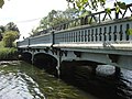 Bridge at Rodbridge - geograph.org.uk - 499196.jpg 640 × 480; 113 KB
-
 Bridge Street Road east of Lineage Cottage - geograph.org.uk - 3610166.jpg 3,648 × 2,736; 1.58 MB
-
 Bridge Street Road junction with A134 - geograph.org.uk - 3610181.jpg 3,648 × 2,736; 2.26 MB
-
 Bridge Street Road west of Dunton's Farm - geograph.org.uk - 3610171.jpg 3,648 × 2,736; 1.35 MB
-
 Bridge View, Long Melford.jpg 3,572 × 2,482; 763 KB
-
 Bridleway - geograph.org.uk - 2998567.jpg 1,024 × 768; 240 KB
-
 Bridleway to Long Melford - geograph.org.uk - 2267948.jpg 3,633 × 2,620; 1.65 MB
-
 Brook House, Long Melford - geograph.org.uk - 6154945.jpg 2,592 × 1,936; 1.94 MB
-

-
 Bull Lane Farm - geograph.org.uk - 3519338.jpg 1,024 × 768; 250 KB
-
 Bull Lane, Long Melford - geograph.org.uk - 4009482.jpg 3,011 × 2,262; 788 KB
-
 Bury St Edmunds 10 Miles - geograph.org.uk - 5400412.jpg 640 × 480; 64 KB
-
 Bury To Sudbury - geograph.org.uk - 2281737.jpg 1,600 × 1,200; 747 KB
-
 Butts Avenue, Kentwell Hall - geograph.org.uk - 4477089.jpg 4,896 × 3,672; 5.32 MB
-
 Bypass - geograph.org.uk - 2179256.jpg 1,600 × 1,200; 515 KB
-
 Chapel Green, Long Melford.jpg 2,304 × 3,456; 654 KB
-
 Chapel House and Chapel Green at the southern end of the village.jpg 2,048 × 1,536; 1.29 MB
-
 Chapelside, Long Melford.jpg 3,456 × 2,304; 529 KB
-

-
 Cherry Tree Cottage, Long Melford.jpg 3,456 × 2,304; 1,000 KB
-
 Chimney and Roof Detail, Trinity Hospital, Long Melford - geograph.org.uk - 6217317.jpg 2,613 × 2,613; 1.26 MB
-
 Chimneys, Long Melford.jpg 2,304 × 3,456; 2.71 MB
-
 Church House, Long Melford.jpg 3,572 × 2,482; 768 KB
-
 Church Walk - geograph.org.uk - 1514769.jpg 640 × 457; 176 KB
-
 Church Walk - geograph.org.uk - 1514781.jpg 640 × 397; 177 KB
-
 Church Walk - geograph.org.uk - 479131.jpg 640 × 480; 97 KB
-
 Church Walk sign - geograph.org.uk - 4010109.jpg 2,888 × 2,169; 1.91 MB
-
 Church Walk, Long Melford - geograph.org.uk - 2984615.jpg 2,560 × 1,920; 1.07 MB
-
 Church Walk, Long Melford - geograph.org.uk - 4010104.jpg 2,856 × 2,145; 749 KB
-
 Church Walk, Long Melford - geograph.org.uk - 4010417.jpg 3,072 × 2,304; 1.02 MB
-

-
 Circus on Melford Green, May 2014 - geograph.org.uk - 3972800.jpg 3,648 × 2,052; 1.85 MB
-
 Cleeve Cottage, Long Melford.jpg 3,535 × 2,424; 597 KB
-

-
 Close up, Elizabeth II postbox, Bridge Street - geograph.org.uk - 5401685.jpg 1,337 × 2,524; 739 KB
-
 CO10 101D WB2078 Long Melford Church, Suffolk.jpg 2,089 × 3,535; 1.93 MB
-
 Cock and Bell Lane - geograph.org.uk - 691037.jpg 480 × 640; 81 KB
-

-
 Cock and Bell Lane, Long Melford - geograph.org.uk - 4558314.jpg 1,800 × 3,200; 1.19 MB
-
 Cock ^ Bell Lane sign - geograph.org.uk - 4009502.jpg 2,850 × 2,011; 1,004 KB
-
 Cock ^ Bell Lane, Long Melford - geograph.org.uk - 4008752.jpg 2,189 × 2,713; 554 KB
-
 Cock ^ Bell Lane, Long Melford - geograph.org.uk - 4009501.jpg 2,270 × 3,030; 1.37 MB
-
 Concrete Bridge - geograph.org.uk - 2702072.jpg 1,024 × 768; 319 KB
-
 Conduit House, Long Melford.jpg 3,456 × 2,304; 653 KB
-
 CoOp Foodstore, Long Melford - geograph.org.uk - 695632.jpg 640 × 480; 68 KB
-
 Coppin's Farm - geograph.org.uk - 2700192.jpg 1,024 × 768; 182 KB
-

-
 Cottage fronts, Long Melford - geograph.org.uk - 1880587.jpg 480 × 640; 174 KB
-
 Cottage, barn and field edge - geograph.org.uk - 2080479.jpg 640 × 480; 67 KB
-
 Cottages in Long Melford - geograph.org.uk - 1880580.jpg 640 × 480; 103 KB
-
 Cottages in Long Melford - geograph.org.uk - 3433609.jpg 2,592 × 1,728; 1.1 MB
-
 Cottages in Southgate gardens - geograph.org.uk - 2079003.jpg 640 × 480; 71 KB
-
 Country house - geograph.org.uk - 5354598.jpg 640 × 480; 143 KB
-
 Country Road - geograph.org.uk - 2998576.jpg 1,024 × 768; 187 KB
-
 Cramore Green Lane Cramore Green - geograph.org.uk - 4042629.jpg 3,072 × 2,304; 884 KB
-
 Cranmoregreen Lane - geograph.org.uk - 1470461.jpg 640 × 480; 78 KB
-
 Crop field near the River Glem - geograph.org.uk - 5525610.jpg 640 × 480; 75 KB
-
 Crop field off the A1092 - geograph.org.uk - 5400408.jpg 640 × 480; 53 KB
-
 Cultivator and farmland - geograph.org.uk - 2080692.jpg 640 × 480; 67 KB
-
 Denmark House, Long Melford.jpg 3,456 × 2,304; 508 KB
-

-
 Distant Copse - geograph.org.uk - 2179259.jpg 1,600 × 1,200; 413 KB
-
 Driveway at Kentwell Hall - geograph.org.uk - 4477100.jpg 4,896 × 3,672; 5.58 MB
-
 East of England Co-operative, Long Melford (27082610802).jpg 2,972 × 2,227; 3.6 MB
-
 Elizabeth II postbox and telephone box, Bridge Street - geograph.org.uk - 5401682.jpg 2,136 × 2,848; 1.2 MB
-
 Elizabeth II postbox on High Street, Long Melford - geograph.org.uk - 5401693.jpg 2,664 × 1,880; 1.19 MB
-
 Elizabeth II postbox, Windmill Hill - geograph.org.uk - 5526159.jpg 2,848 × 2,136; 1.25 MB
-
 Ely House, Long Melford.jpg 3,535 × 2,424; 580 KB
-
 Entering Glemsford on the A1092 Lower Road - geograph.org.uk - 4011065.jpg 2,965 × 2,228; 1.02 MB
-
 Entering Long Melford on the A1092 Windmill Hill - geograph.org.uk - 4011558.jpg 2,983 × 2,241; 1.04 MB
-
 Entering Long Melford on the B1064 Hall Street - geograph.org.uk - 4006734.jpg 2,872 × 2,158; 1.02 MB
-
 Entering Long Melford on the B1064 Sudbury Road - geograph.org.uk - 4006624.jpg 2,983 × 2,241; 1.17 MB
-

-
 Entrance to Long Melford Village Hall - geograph.org.uk - 4008742.jpg 2,712 × 2,037; 779 KB
-
 Essential Beauty and The Write Message, Long Melford.jpg 3,456 × 2,304; 614 KB
-
 Estate Agents Board - geograph.org.uk - 4007657.jpg 2,270 × 3,030; 1.35 MB
-
 Estate track, Kentwell estate - geograph.org.uk - 2080587.jpg 640 × 480; 59 KB
-

-
 Ex-Servicemen ^ Social Club - geograph.org.uk - 4009483.jpg 2,289 × 3,056; 1.13 MB
-
 Falkland House, Long Melford.jpg 3,456 × 2,304; 3.42 MB
-
 Farm equipment, bridleway and copse - geograph.org.uk - 2080571.jpg 640 × 480; 89 KB
-
 Farm Machinery - geograph.org.uk - 2997301.jpg 1,024 × 768; 190 KB
-
 Farm track (bridleway), Kiln Farm - geograph.org.uk - 5400418.jpg 640 × 480; 81 KB
-

-
 Farm track towards Cuckoo Tye Farm - geograph.org.uk - 6173150.jpg 6,000 × 4,000; 7.1 MB
-
 Farmer Gate - geograph.org.uk - 2179249.jpg 1,600 × 1,200; 413 KB
-
 Farmers Ford - geograph.org.uk - 2402827.jpg 1,600 × 1,200; 604 KB
-
 Farmland near Bridge Street - geograph.org.uk - 6257558.jpg 3,888 × 2,592; 5.05 MB
-
 Ferns and Lion House, Long Melford 01.jpg 3,456 × 2,304; 3.57 MB
-
 Ferns and Lion House, Long Melford 02.jpg 3,456 × 2,304; 2.94 MB
-
 Field Boundary - geograph.org.uk - 2179257.jpg 1,200 × 1,600; 693 KB
-
 Field entrance near Kiln Farm - geograph.org.uk - 5400416.jpg 640 × 480; 54 KB
-
 Field near Bridge Street - geograph.org.uk - 5400421.jpg 640 × 480; 60 KB
-
 Field, Cranmore Hill - geograph.org.uk - 5525605.jpg 640 × 480; 66 KB
-
 Fields at the end of Ropers Lane - geograph.org.uk - 995625.jpg 640 × 480; 93 KB
-
 Fire Station, Long Melford - geograph.org.uk - 539979.jpg 640 × 480; 98 KB
-
 Fish Pond at Kentwell Hall - geograph.org.uk - 4477052.jpg 4,896 × 3,672; 6.07 MB
-

-
 Footbridge - geograph.org.uk - 2402818.jpg 1,600 × 1,200; 635 KB
-
 Footbridge - geograph.org.uk - 2701871.jpg 768 × 1,024; 379 KB
-
 Footbridge over the River Stour - geograph.org.uk - 2080476.jpg 640 × 480; 89 KB
-
 Footpath - geograph.org.uk - 2179246.jpg 1,600 × 1,200; 552 KB
-
 Footpath - geograph.org.uk - 2701521.jpg 1,024 × 768; 193 KB
-
 Footpath - geograph.org.uk - 2701832.jpg 1,024 × 768; 316 KB
-
 Footpath - geograph.org.uk - 2701862.jpg 768 × 1,024; 221 KB
-
 Footpath And Bridleway Signs - geograph.org.uk - 2179247.jpg 1,200 × 1,600; 665 KB
-
 Footpath by Parsonage Farm - geograph.org.uk - 2252725.jpg 3,648 × 2,736; 2.44 MB
-
 Footpath off the A1092 High Street - geograph.org.uk - 4200777.jpg 3,072 × 2,304; 1.87 MB
-
 Footpath off the A1092 High Street - geograph.org.uk - 4200778.jpg 3,072 × 2,304; 1.78 MB
-
 Footpath on the dismantled railway line, Long Melford - geograph.org.uk - 3972847.jpg 3,648 × 2,736; 5.65 MB
-
 Footpath through arable land, Long Melford - geograph.org.uk - 3972779.jpg 2,964 × 1,667; 1.72 MB
-
 Footpath to Acton - geograph.org.uk - 186708.jpg 640 × 480; 86 KB
-
 Footpath to Cranmore Hill - geograph.org.uk - 4635780.jpg 1,240 × 930; 787 KB
-
 Footpath to High Street, Long Melford - geograph.org.uk - 3972946.jpg 3,648 × 2,736; 3.43 MB
-
 Footpath to Long Melford - geograph.org.uk - 186699.jpg 640 × 480; 121 KB
-
 Footpath to Melford Hall - geograph.org.uk - 4008017.jpg 2,304 × 3,072; 2.06 MB
-
 Footpath to St. Edmunds Way - geograph.org.uk - 4011057.jpg 2,983 × 2,226; 1.03 MB
-
 Footpath way marker post - geograph.org.uk - 2080688.jpg 640 × 480; 94 KB
-
 Ford End, Long Melford.jpg 2,304 × 3,456; 2.54 MB
-
 Ford Hall - geograph.org.uk - 6257535.jpg 3,888 × 2,592; 4.22 MB
-
 Forest Track - geograph.org.uk - 2701670.jpg 768 × 1,024; 408 KB
-
 Formal avenue in the garden of Melford Hall - geograph.org.uk - 4076556.jpg 1,200 × 1,600; 1.31 MB
-
 Former almshouses, Long Melford - geograph.org.uk - 4076585.jpg 1,600 × 1,200; 1.12 MB
-
 Former Blythe's Grocers, Hall Street - geograph.org.uk - 5457409.jpg 1,024 × 683; 149 KB
-
 Former Fuel Filling Station - geograph.org.uk - 4007634.jpg 3,011 × 2,262; 1.46 MB
-
 Former Petrol Station, Southgate Street - geograph.org.uk - 539431.jpg 640 × 480; 119 KB
-
 Formerly "The Patisserie", Long Melford.jpg 2,304 × 3,456; 3.06 MB
-
 Formerly Mullucks - geograph.org.uk - 4009489.jpg 1,408 × 2,056; 490 KB
-
 Fortress, B 17, 43-38137 'Miss-b-havin' crash, 15-10-1944 - geograph.org.uk - 6507318.jpg 3,280 × 2,588; 1.45 MB


_-_geograph.org.uk_-_5354587.jpg)


.jpg)


,_Kiln_Farm_-_geograph.org.uk_-_5400418.jpg)


