Category:Long Marston, Hertfordshire
Jump to navigation
Jump to search
village to the north of Tring in Hertfordshire, England  | |||||
| Upload media | |||||
| Instance of | |||||
|---|---|---|---|---|---|
| Location | Tring Rural, Dacorum, Hertfordshire, East of England, England | ||||
 | |||||
English: Long Marston is a small village to the north of Tring in Hertfordshire, in the Tring Rural parish council area. It is located roughly 5 miles east of Aylesbury and 11 miles north-west of Hemel Hempstead.
Subcategories
This category has the following 4 subcategories, out of 4 total.
L
M
- Marston Gate railway station (4 F)
Media in category "Long Marston, Hertfordshire"
The following 53 files are in this category, out of 53 total.
-
 Alnwick Farm - geograph.org.uk - 429125.jpg 640 × 480; 91 KB
-

-

-
 Black poplar - geograph.org.uk - 428704.jpg 480 × 640; 220 KB
-
 Boarcroft Farm - geograph.org.uk - 130387.jpg 468 × 640; 155 KB
-
 Broadmead Farm - geograph.org.uk - 429158.jpg 640 × 480; 106 KB
-
 Chapel at Long Marston - geograph.org.uk - 26647.jpg 640 × 479; 54 KB
-
-

-
 Field South East of Red House Farm - geograph.org.uk - 133520.jpg 640 × 480; 97 KB
-
 Flooded Footpath - geograph.org.uk - 1734673.jpg 2,592 × 1,944; 2.44 MB
-
 Folly Farm - geograph.org.uk - 429044.jpg 640 × 479; 84 KB
-
 Food, Glorious Food - geograph.org.uk - 1425900.jpg 638 × 480; 61 KB
-
 Footbridge and path through wheat field - geograph.org.uk - 429142.jpg 480 × 640; 312 KB
-
 Footpath beside Lower Icknield Way - geograph.org.uk - 129676.jpg 640 × 480; 161 KB
-
 GOC Cheddington 032 Sheep (10571447613).jpg 3,910 × 2,939; 4.09 MB
-
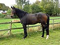 GOC Cheddington 036 Horse (10590696493).jpg 3,979 × 2,989; 3.94 MB
-
 GOC Cheddington 038 Long Marston war memorial (10590701473).jpg 2,964 × 3,952; 3.2 MB
-
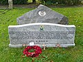 GOC Cheddington 039 Memorial in Long Marston (10590490194).jpg 3,564 × 2,673; 2.92 MB
-
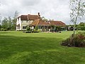
 GOC Cheddington 040 Redmays, Long Marston (10590705673).jpg 3,745 × 2,819; 3.15 MB
-
 GOC Cheddington 046 Tower of the Old Church of All Saints, Long Marston (10605995304).jpg 3,216 × 4,288; 3.88 MB
-
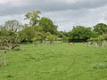
 GOC Cheddington 059 Cattle (10625119483).jpg 4,288 × 2,436; 2.85 MB
-
 Hawthorn hedge by Alnwick Drive - geograph.org.uk - 429170.jpg 640 × 480; 306 KB
-
 Horse at Red House Farm - geograph.org.uk - 429036.jpg 640 × 480; 195 KB
-
 House at Red House Farm - geograph.org.uk - 429074.jpg 640 × 480; 109 KB
-
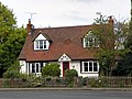
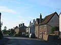
 House on Tring Road - geograph.org.uk - 130388.jpg 640 × 480; 113 KB
-
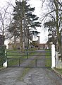
 Intriguing gateway - geograph.org.uk - 181246.jpg 640 × 480; 167 KB
-
 Long Leys Farm - geograph.org.uk - 130342.jpg 640 × 480; 106 KB
-
 Long Marston Cricket Club - Geograph - 6416121.jpg 1,600 × 1,066; 413 KB
-
 Maize seedlings by Alnwick Drive - geograph.org.uk - 429103.jpg 640 × 640; 327 KB
-

-

-
 Oilseed rape in flower - geograph.org.uk - 428735.jpg 640 × 480; 253 KB
-

-
 Old Church Cottage, Long Marston - geograph.org.uk - 181249.jpg 640 × 480; 109 KB
-
 Orchard with sheep, Broadmead farm - geograph.org.uk - 429135.jpg 640 × 480; 205 KB
-
 Pasture north of Alnwick Drive - geograph.org.uk - 429111.jpg 640 × 480; 176 KB
-
 Queens Head Inn Long Marston - geograph.org.uk - 26648.jpg 640 × 480; 17 KB
-
 Red House Farm - geograph.org.uk - 130399.jpg 640 × 480; 123 KB
-

-
 Sheep at Red House Farm - geograph.org.uk - 429032.jpg 640 × 480; 215 KB
-

-
 The Children's Play Area, Long Marston - geograph.org.uk - 1425882.jpg 640 × 482; 142 KB
-

-
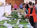
 The Happy Spider wins a prize - geograph.org.uk - 1425904.jpg 638 × 480; 57 KB
-
 The Long Marston & Puttenham Horticultural Show, Hertfordshire.jpg 638 × 480; 56 KB
-
 The Long Marston Village Show, 2009 - geograph.org.uk - 1425884.jpg 638 × 480; 55 KB
-

-
 Whitwell Farm - geograph.org.uk - 130391.jpg 640 × 458; 81 KB
-
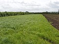 Wide grass headland of maize field - geograph.org.uk - 428729.jpg 640 × 480; 248 KB
-
-
 Young apple trees at Alnwick Farm - geograph.org.uk - 429132.jpg 640 × 480; 254 KB
-
 Aylesbury Arm, Bridge No 6 - geograph.org.uk - 1442990.jpg 640 × 480; 74 KB


.jpg)
.jpg)
.jpg)
.jpg)
.jpg)
.jpg)
.jpg)


