Category:Long Lane, Garston
Jump to navigation
Jump to search
| Object location | | View all coordinates using: OpenStreetMap |
|---|

Long Lane is a road in Liverpool running northwest from Liverpool South Parkway to Brodie Avenue.
Subcategories
This category has the following 3 subcategories, out of 3 total.
L
- Long Lane Church, Garston (7 F)
- Long Lane mobile antenna (2 F)
Media in category "Long Lane, Garston"
The following 6 files are in this category, out of 6 total.
-
 Benchmark at 13 Long Lane, Garston.jpg 5,184 × 3,456; 9.31 MB
-
 Benchmark on Nursery Lane.jpg 5,184 × 3,456; 8.57 MB
-
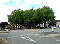
 Long Lane at Cardwell Road.jpg 4,539 × 3,351; 10.89 MB
-
 Long Lane by the recreation ground.jpg 4,560 × 3,438; 11.94 MB
-
 Mini roundabout, Long Lane & Brodie Avenue.jpg 5,011 × 3,730; 9.28 MB
-
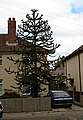 Monkey puzzle tree, Long Lane.jpg 3,010 × 4,343; 1.22 MB


