Category:Long Drax
Jump to navigation
Jump to search
settlement and civil parish in North Yorkshire, England, UK  | |||||
| Upload media | |||||
| Instance of | |||||
|---|---|---|---|---|---|
| Location | Selby, North Yorkshire, Yorkshire and the Humber, England | ||||
| Population |
| ||||
 | |||||
Media in category "Long Drax"
The following 192 files are in this category, out of 192 total.
-
 A bend in the River Ouse - geograph.org.uk - 5351916.jpg 1,024 × 768; 179 KB
-
 A distant view of Drax power station - geograph.org.uk - 5918391.jpg 4,320 × 2,820; 1.25 MB
-
 A minor road leading to Drax - geograph.org.uk - 3642826.jpg 800 × 600; 84 KB
-
 A path leading to Carr Lane - geograph.org.uk - 3068367.jpg 800 × 600; 91 KB
-
 A path leading to Redhouse Lane - geograph.org.uk - 3068365.jpg 800 × 600; 129 KB
-
 A645 at New Road roundabout - geograph.org.uk - 5921455.jpg 1,024 × 761; 138 KB
-
 A645 nears Drax power station - geograph.org.uk - 5921450.jpg 1,024 × 774; 159 KB
-
 A645 towards Camblesforth - geograph.org.uk - 2963778.jpg 640 × 480; 76 KB
-
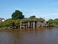 Abutments, dismantled railway bridge, Long Drax (geograph 5132316).jpg 1,024 × 768; 158 KB
-
 Across the Ouse to Long Drax - geograph.org.uk - 1987085.jpg 3,210 × 1,863; 1.03 MB
-
 Across the River Ouse - geograph.org.uk - 3436032.jpg 4,000 × 2,248; 2.03 MB
-
 Along New Road - geograph.org.uk - 6127245.jpg 1,024 × 683; 477 KB
-
 Along New Road - geograph.org.uk - 6127246.jpg 1,024 × 683; 495 KB
-
 Along Redhouse Lane - geograph.org.uk - 6127286.jpg 1,024 × 683; 464 KB
-
 Approaching Long Drax - geograph.org.uk - 6127261.jpg 1,024 × 683; 471 KB
-
 Back of the boiler house - geograph.org.uk - 5054537.jpg 1,280 × 828; 307 KB
-
 Barmby barrage. - geograph.org.uk - 537252.jpg 640 × 480; 96 KB
-
 Barmby Tidal barrage, from the River Ouse - geograph.org.uk - 5132362.jpg 1,024 × 768; 174 KB
-
 Barn conversions at Baxter Hall - geograph.org.uk - 4003262.jpg 1,024 × 768; 126 KB
-
 Baxter Hall and converted farm buildings - geograph.org.uk - 5737976.jpg 4,912 × 3,495; 3.51 MB
-
 Bend in the path - geograph.org.uk - 4009337.jpg 1,024 × 768; 181 KB
-
 Biomass day tanks - geograph.org.uk - 5054504.jpg 906 × 1,280; 267 KB
-
 Biomass silos, Drax Power Station - geograph.org.uk - 6015806.jpg 1,280 × 960; 273 KB
-
 Biomass storage area - geograph.org.uk - 5054529.jpg 1,280 × 875; 267 KB
-
 Bridge abutment - geograph.org.uk - 4003273.jpg 1,024 × 768; 179 KB
-
 Buildings at Long Drax - geograph.org.uk - 3642778.jpg 800 × 600; 108 KB
-
 Bungalow near Long Drax - geograph.org.uk - 2275259.jpg 1,600 × 1,200; 489 KB
-
 By the cooling towers - geograph.org.uk - 5054541.jpg 883 × 1,280; 284 KB
-
 Carr Lane towards Drax - geograph.org.uk - 3642831.jpg 800 × 600; 100 KB
-
 Carrying sustainable biomass - geograph.org.uk - 5054521.jpg 1,280 × 874; 347 KB
-
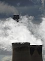
 Climate changer - geograph.org.uk - 5408703.jpg 1,024 × 768; 99 KB
-
 Coal scoop - geograph.org.uk - 5054526.jpg 1,280 × 853; 281 KB
-
 Confluence of the Derwent and the Ouse - geograph.org.uk - 5132359.jpg 1,024 × 768; 146 KB
-
 Contrasting curves - geograph.org.uk - 6013711.jpg 1,208 × 818; 228 KB
-

-
 Cooling towers across the Ouse - geograph.org.uk - 2981421.jpg 618 × 640; 182 KB
-
 Cooling towers and biomass storage - geograph.org.uk - 6015792.jpg 1,280 × 960; 185 KB
-
 Cooling towers and railway - geograph.org.uk - 6127227.jpg 1,024 × 683; 423 KB
-
 Cooling towers reflected - geograph.org.uk - 3788891.jpg 1,500 × 1,000; 1.3 MB
-
 Cooling towers, Drax Power Station - geograph.org.uk - 6013341.jpg 1,280 × 1,280; 250 KB
-
 Cooling towers, Drax Power Station - geograph.org.uk - 6015807.jpg 1,280 × 874; 192 KB
-
 Corner Farm, Long Drax - geograph.org.uk - 2275241.jpg 1,600 × 1,200; 394 KB
-
 Corner Farm, Long Drax - geograph.org.uk - 3642790.jpg 800 × 600; 119 KB
-

-
 Country lane, Long Drax - geograph.org.uk - 2275245.jpg 1,600 × 1,200; 526 KB
-
 CRT workboats on the River Ouse - geograph.org.uk - 5132406.jpg 1,024 × 768; 142 KB
-
 Drainage ditch near Baxter Hall - geograph.org.uk - 2275224.jpg 1,600 × 1,200; 623 KB
-
 Drainage ditch near Nelliefield Farm - geograph.org.uk - 2275234.jpg 1,600 × 1,200; 383 KB
-
 Drax Abbey Farm - geograph.org.uk - 3068369.jpg 800 × 600; 108 KB
-
 Drax Chimneys - geograph.org.uk - 3922159.jpg 1,944 × 2,592; 1.18 MB
-
 Drax from New Road - geograph.org.uk - 6127236.jpg 1,024 × 683; 496 KB
-
 Drax in the sunlight - geograph.org.uk - 6015760.jpg 1,280 × 819; 176 KB
-

-

-

-

-
 Drax Power Station - Biomass Storage - geograph.org.uk - 3584383.jpg 640 × 480; 84 KB
-

-
 Drax Power Station - cooling towers - geograph.org.uk - 3585641.jpg 640 × 485; 52 KB
-
 Drax Power Station - cooling towers - geograph.org.uk - 3585643.jpg 640 × 480; 74 KB
-

-
 Drax Power Station - geograph.org.uk - 2328563.jpg 1,600 × 1,131; 190 KB
-
 Drax Power Station - geograph.org.uk - 2746588.jpg 1,280 × 910; 199 KB
-
 Drax Power Station - geograph.org.uk - 3068377.jpg 800 × 600; 92 KB
-
 Drax Power Station - geograph.org.uk - 3240667.jpg 640 × 480; 55 KB
-
 Drax Power Station - geograph.org.uk - 3250473.jpg 1,024 × 513; 69 KB
-
 Drax Power Station - geograph.org.uk - 3584362.jpg 640 × 480; 90 KB
-
 Drax Power Station - geograph.org.uk - 3584459.jpg 640 × 480; 92 KB
-
 Drax Power Station - geograph.org.uk - 3585629.jpg 640 × 475; 86 KB
-
 Drax Power Station - geograph.org.uk - 3585638.jpg 640 × 480; 62 KB
-
 Drax Power Station - geograph.org.uk - 3683855.jpg 640 × 480; 57 KB
-
 Drax power station - geograph.org.uk - 4003285.jpg 1,024 × 768; 147 KB
-
 Drax Power Station - geograph.org.uk - 5595081.jpg 640 × 475; 64 KB
-
 Drax Power Station - geograph.org.uk - 5935137.jpg 5,376 × 3,024; 2.67 MB
-
 Drax Power Station - geograph.org.uk - 5935140.jpg 4,513 × 2,911; 2.14 MB
-
 Drax Power Station - geograph.org.uk - 5935158.jpg 5,376 × 3,024; 4.05 MB
-
 Drax Power Station - geograph.org.uk - 6015812.jpg 1,280 × 648; 126 KB
-
 Drax Power Station - geograph.org.uk - 6215093.jpg 1,600 × 1,065; 536 KB
-

-

-
 Drax Power Station - Northern Cooling Towers - geograph.org.uk - 5891126.jpg 1,024 × 768; 198 KB
-
 Drax Power Station - permissive footpath - geograph.org.uk - 3588553.jpg 480 × 640; 147 KB
-
 Drax Power Station - Southern Cooling Towers - geograph.org.uk - 5891138.jpg 1,024 × 768; 160 KB
-
 Drax Power Station from Barmby Barrage - geograph.org.uk - 3922148.jpg 2,534 × 1,810; 1.22 MB
-
 Drax Power Station from Camela Lane - geograph.org.uk - 4490795.jpg 3,552 × 2,000; 2.27 MB
-
 Drax Power Station from New Road - geograph.org.uk - 5737997.jpg 4,826 × 3,537; 3.17 MB
-
 Drax Power Station from West Hill, High Hunsley - geograph.org.uk - 4267150.jpg 5,184 × 3,888; 4.56 MB
-
 Drax Power Station intake pumphouse - geograph.org.uk - 5132376.jpg 1,024 × 768; 154 KB
-
 Drax power station seen from Camella Road - geograph.org.uk - 4011932.jpg 1,024 × 768; 190 KB
-
 Drax Power Station, South Gate - geograph.org.uk - 5935161.jpg 5,376 × 3,024; 3.38 MB
-
 Drax Powerstation Jetty - geograph.org.uk - 1208158.jpg 640 × 480; 77 KB
-

-

-
 English Village Salads, Camblesforth - geograph.org.uk - 5057993.jpg 1,280 × 897; 320 KB
-
 Entering Long Drax - geograph.org.uk - 6127265.jpg 1,024 × 683; 501 KB
-
 Entrance to Drax power station - geograph.org.uk - 2275274.jpg 1,600 × 1,200; 355 KB
-
 Entrance to Drax Power Station - geograph.org.uk - 5935133.jpg 4,871 × 2,741; 2.86 MB
-

-
 Ewes and lambs at Long Drax - geograph.org.uk - 6127272.jpg 1,024 × 683; 537 KB
-
 Fans in the boiler house - geograph.org.uk - 5054552.jpg 1,280 × 853; 289 KB
-
 Farm track near Drax power station - geograph.org.uk - 2275263.jpg 1,600 × 1,200; 392 KB
-
 Farm track near Long Drax - geograph.org.uk - 2275254.jpg 640 × 480; 80 KB
-
 Farmland at Long Drax - geograph.org.uk - 6127268.jpg 1,024 × 683; 481 KB
-
 Farmland beside Pear Tree Avenue - geograph.org.uk - 6127253.jpg 1,024 × 683; 546 KB
-
 Farmland beside Redhouse Lane - geograph.org.uk - 6127279.jpg 1,024 × 683; 477 KB
-
 Farmland near Derwent View Farm - geograph.org.uk - 6127269.jpg 1,024 × 683; 471 KB
-
 Farmland near Drax power station - geograph.org.uk - 2275270.jpg 1,600 × 1,200; 516 KB
-
 Farmland next to Pear Tree Avenue - geograph.org.uk - 6127256.jpg 1,024 × 683; 514 KB
-
 Farmland north of Drax - geograph.org.uk - 6127291.jpg 1,024 × 683; 427 KB
-
 Farmland north of Pear Tree Avenue - geograph.org.uk - 6127255.jpg 1,024 × 683; 550 KB
-
 Fellow walker peruses notice on Wren Hall Lane - geograph.org.uk - 5935142.jpg 5,376 × 3,024; 5.27 MB
-
 Field of oil seed rape in flower - geograph.org.uk - 5760159.jpg 800 × 600; 92 KB
-
 Footbridge across Car Dyke - geograph.org.uk - 5935119.jpg 5,376 × 3,024; 3.56 MB
-
 Footbridge crossing the private road on the Drax site - geograph.org.uk - 2328583.jpg 1,600 × 1,066; 585 KB
-

-
 Footpath to Pear Tree Avenue - geograph.org.uk - 4003266.jpg 1,024 × 768; 145 KB
-
 Footpath towards Barlow - geograph.org.uk - 6127250.jpg 1,024 × 683; 471 KB
-
 Former rail bridge at Long Drax - geograph.org.uk - 3068357.jpg 800 × 600; 146 KB
-
 Greenhouses through the trees - geograph.org.uk - 1198677.jpg 640 × 480; 142 KB
-
 Gypsum Road South - geograph.org.uk - 5054534.jpg 1,280 × 851; 424 KB
-
 Gypsum storage shed - geograph.org.uk - 5054533.jpg 853 × 1,280; 291 KB
-
 Have you a head for heights^ - geograph.org.uk - 5054568.jpg 853 × 1,280; 151 KB
-
 Hemingbrough Hope - geograph.org.uk - 5351983.jpg 1,024 × 768; 175 KB
-
 High pressure turbine - geograph.org.uk - 5054558.jpg 1,280 × 853; 341 KB
-
 Horses in Long Drax - geograph.org.uk - 6127271.jpg 1,024 × 683; 470 KB
-
 Inside the turbine hall - geograph.org.uk - 5054561.jpg 1,280 × 866; 390 KB
-
 Jetty, west bank, River Ouse - geograph.org.uk - 5132303.jpg 1,024 × 768; 142 KB
-
 Lock with radial gates, Barmby Tidal Barrage - geograph.org.uk - 5132368.jpg 1,024 × 768; 155 KB
-
 Long Drax (Langrick) - geograph.org.uk - 5132324.jpg 1,024 × 614; 105 KB
-
 Long Drax - geograph.org.uk - 1208141.jpg 640 × 480; 58 KB
-
 Long Drax - geograph.org.uk - 6127270.jpg 1,024 × 683; 446 KB
-
 Looking towards Drax ash tip - geograph.org.uk - 5934965.jpg 5,139 × 2,891; 2.09 MB
-
 Lytag plant, Drax - geograph.org.uk - 3585647.jpg 640 × 472; 84 KB
-
 Minor road towards Drax - geograph.org.uk - 3642804.jpg 800 × 600; 119 KB
-
 Model of the power station in the Visitor Centre - geograph.org.uk - 5054510.jpg 1,280 × 853; 326 KB
-
 Muddy footpath near Drax - geograph.org.uk - 2275217.jpg 1,600 × 1,200; 490 KB
-
 New Road by Drax Power Station - geograph.org.uk - 3585634.jpg 480 × 640; 97 KB
-
 New Road south of Drax Abbey Farm - geograph.org.uk - 5737991.jpg 3,752 × 4,884; 4.39 MB
-
 New Road towards Drax - geograph.org.uk - 3068374.jpg 800 × 600; 107 KB
-
 Not an everyday hazard to walkers^ - geograph.org.uk - 5755674.jpg 800 × 600; 183 KB
-
 Notice on Wren Hall Lane - geograph.org.uk - 5935148.jpg 2,906 × 4,017; 1.87 MB
-
 Old railway bridge - geograph.org.uk - 6127275.jpg 1,024 × 683; 673 KB
-
 On the banks of the Ouse - geograph.org.uk - 531508.jpg 640 × 427; 69 KB
-
 On the vibrating floor - geograph.org.uk - 5054546.jpg 853 × 1,280; 254 KB
-
 Pear Tree Avenue - geograph.org.uk - 6127251.jpg 1,024 × 683; 689 KB
-
 Permissive path - geograph.org.uk - 6127224.jpg 1,024 × 683; 761 KB
-
 Pond by Drax Abbey Farm - geograph.org.uk - 5935129.jpg 5,376 × 3,024; 5.03 MB
-
 Power across the Ouse, near Drax - geograph.org.uk - 2981436.jpg 426 × 640; 220 KB
-

-

-
 Pumphouse and navigation light 20, River Ouse - geograph.org.uk - 5132392.jpg 1,024 × 768; 120 KB
-
 Pumping station and the River Ouse - geograph.org.uk - 4003278.jpg 1,024 × 768; 175 KB
-
 Railway Bridge crossed here - geograph.org.uk - 3861264.jpg 4,000 × 3,000; 3.56 MB
-
 Rainbow power - geograph.org.uk - 5483902.jpg 640 × 410; 137 KB
-
 Ready for the tour - geograph.org.uk - 5054515.jpg 850 × 1,280; 249 KB
-
 Redhouse Lane - geograph.org.uk - 6127277.jpg 1,024 × 683; 482 KB
-
 Redhouse Lane - geograph.org.uk - 6127288.jpg 1,024 × 683; 484 KB
-
 Ride in Ash Spring Wood - geograph.org.uk - 4009323.jpg 1,024 × 768; 264 KB
-
 River Ouse - geograph.org.uk - 2452971.jpg 640 × 407; 36 KB
-
 River Ouse at Hemingbrough Hope - geograph.org.uk - 5133679.jpg 1,024 × 615; 72 KB
-
 River Ouse near Nelliefield Farm - geograph.org.uk - 5132299.jpg 1,024 × 768; 126 KB
-
 Riverside Wharf on the River Ouse near Drax - geograph.org.uk - 3861342.jpg 4,000 × 3,000; 3.09 MB
-
 Road to Drax Abbey Farm - geograph.org.uk - 1219798.jpg 640 × 480; 125 KB
-
 Road to Drax Golf Club - geograph.org.uk - 2275306.jpg 1,600 × 1,200; 534 KB
-
 Road to Long Drax - geograph.org.uk - 6127259.jpg 1,024 × 683; 587 KB
-
 Rounding Hemingbrough Hope, River Ouse - geograph.org.uk - 5132426.jpg 1,024 × 768; 131 KB
-
 Small house, giant cooling towers - geograph.org.uk - 4503350.jpg 800 × 533; 114 KB
-
 Small lake in front of Drax Abbey Farm - geograph.org.uk - 2328587.jpg 1,600 × 1,066; 751 KB
-
 Straw bales - geograph.org.uk - 2328579.jpg 1,600 × 1,066; 311 KB
-
 Stubble field near to Drax Power Station - geograph.org.uk - 5629889.jpg 1,500 × 1,006; 1.18 MB
-
 Stubble field with tree beyond - geograph.org.uk - 5630049.jpg 1,500 × 829; 880 KB
-
 Sun and shade at Drax Power Station - geograph.org.uk - 6015800.jpg 1,280 × 860; 179 KB
-
 Sun-crossed - geograph.org.uk - 6011622.jpg 1,280 × 897; 246 KB
-
 Sunset behind Drax Power Station, Drax, North Yorkshire - geograph.org.uk - 5817800.jpg 3,264 × 1,836; 176 KB
-
 The Camera Never Lies - geograph.org.uk - 584536.jpg 640 × 476; 107 KB
-

-
 The Old Lodge, Pear Tree Avenue, Long Drax - geograph.org.uk - 5737980.jpg 5,067 × 3,801; 4.47 MB
-
 The River Ouse at Hemingbrough Landing - geograph.org.uk - 5132414.jpg 1,024 × 615; 89 KB
-
 The River Ouse near Barmby on the Marsh - geograph.org.uk - 4503342.jpg 800 × 533; 112 KB
-
 The River Ouse, Hemingbrough - geograph.org.uk - 577476.jpg 640 × 460; 135 KB
-
 The road to Long Drax - geograph.org.uk - 395226.jpg 640 × 480; 83 KB
-
 Track to Nelliefield Farm (footpath) - geograph.org.uk - 2275230.jpg 1,600 × 1,200; 347 KB
-
 Tractor at work - geograph.org.uk - 6127257.jpg 1,024 × 683; 399 KB
-
 Trees on the north-east bank, River Ouse - geograph.org.uk - 5132386.jpg 1,024 × 615; 143 KB
-
 View from High Hunsley to Drax Power Station - geograph.org.uk - 4267288.jpg 3,670 × 4,873; 2.85 MB
-
 View from Pear Tree Avenue to Drax Power Station - geograph.org.uk - 5737985.jpg 4,880 × 3,587; 3.48 MB
-
 View over fields to Drax Power Station - geograph.org.uk - 5755680.jpg 800 × 600; 126 KB
-
 View towards Drax power station - geograph.org.uk - 4009306.jpg 1,024 × 768; 145 KB
-
 Water course by Drax Power Station - geograph.org.uk - 3584347.jpg 640 × 480; 107 KB
-
 Woodland off New Road - geograph.org.uk - 4009348.jpg 1,024 × 768; 91 KB
-
 Workboat heading upstream near Newhay Farm - geograph.org.uk - 5133683.jpg 1,024 × 614; 92 KB
-
 Long Drax (Langrick) - geograph.org.uk - 115887.jpg 640 × 480; 192 KB


.jpg)


_-_geograph.org.uk_-_5132324.jpg)


_-_geograph.org.uk_-_2275230.jpg)


_-_geograph.org.uk_-_115887.jpg)