Category:Lone Peak (Utah)
Jump to navigation
Jump to search
mountain in the Wasatch Range on the border of Utah and Salt Lake counties in Utah, United States  | |||||
| Upload media | |||||
| Instance of | |||||
|---|---|---|---|---|---|
| Located in protected area | |||||
| Location | Salt Lake County, Utah | ||||
| Mountain range | |||||
| Topographic prominence |
| ||||
 | |||||
English: Media related to Lone Peak (Utah), a mountain in the center of the Lone Peak Wildernesson on the border of Salt Lake and Utah counties in northern Utah, United States.
Subcategories
This category has only the following subcategory.
Media in category "Lone Peak (Utah)"
The following 40 files are in this category, out of 40 total.
-

-

-
 East across American Fork at Wasatch Range on southbound FrontRunner, Jul 16.jpg 2,592 × 1,944; 2.34 MB
-
 East at gravel pits on Traverse Mountains, Apr 17.jpg 2,592 × 1,944; 2.43 MB
-
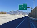
 East at I-15 & SR-154 interchange, Draper, Utah, Nov 16.jpg 2,592 × 1,944; 2.43 MB
-
 East at southern terminus SR-154 in Draper, Utah, Nov 16.jpg 2,592 × 1,944; 2.4 MB
-
 East on SR-154 at SR-68 interchange, Bluffdale, Utah, Nov 11.jpg 2,592 × 1,944; 2.34 MB
-
 East on SR-71 in Riverton, Utah, Jun 16.jpg 2,592 × 1,944; 2.31 MB
-
 Jacobs Ladder Trail to Lone Peak.jpg 3,036 × 4,048; 5.62 MB
-
 Lone Peak (13447187335).jpg 15,142 × 3,426; 8.6 MB
-
 Lone Peak - Cherry Canyon Cabin.jpg 2,281 × 2,197; 3.88 MB
-
 Lone Peak - panoramio.jpg 2,160 × 1,440; 673 KB
-
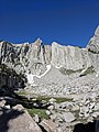 Lone Peak Cirque (Utah).jpg 1,202 × 1,602; 596 KB
-
 Lone Peak Cirque.jpg 4,048 × 3,036; 4.94 MB
-
 Lone Peak from FrontRunner, Jul 16.jpg 2,592 × 1,944; 2.38 MB
-
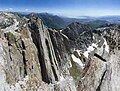
 Lone Peak Question Mark Wall.jpg 3,036 × 4,048; 5.57 MB
-
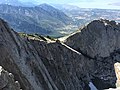 Lone Peak South Summit and Question Mark Wall.jpg 3,264 × 2,448; 1.86 MB
-
 Lone Peak South Summit wall.jpg 3,036 × 4,048; 5.82 MB
-
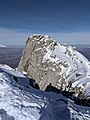 Lone Peak Summit in the Winter.jpg 2,850 × 3,800; 1.57 MB
-
 Lone Peak Summit.jpg 3,036 × 4,048; 5.97 MB
-
 Lone Peak Sundial.jpg 250 × 375; 23 KB
-
 Lone Peak-Utah-Question mark wall.jpg 1,200 × 1,600; 401 KB
-
 Lone Peak.jpg 4,288 × 2,848; 6.51 MB
-
 Lone peak.jpg 725 × 552; 70 KB
-
 LonePeak Utah Peak and QmarkWall.jpg 1,600 × 1,200; 353 KB
-
 LonePeak Utah Saddle View.jpg 1,034 × 756; 123 KB
-
 LonePeak Utah Scamble.jpg 1,600 × 1,200; 365 KB
-
 Mountain Views.jpg 4,128 × 2,322; 2.71 MB
-
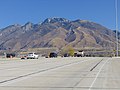
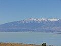 North across Utah Lake at Lone Peak, Jun 17.jpg 2,592 × 1,944; 2.32 MB
-
 North at I-15 & SR-180 interchange, American Fork, Utah, Aug 16.jpg 2,592 × 1,944; 2.35 MB
-
 North at SR-129 & SR-114 Junction, Lindon, Utah, Jun 16.jpg 2,592 × 1,944; 2.39 MB
-
 North at SR-92 & SR-129 in Highland, Utah, Jun 16.jpg 2,592 × 1,944; 2.4 MB
-
 North at US-89 & SR-180 junction, American Fork, Utah, Aug 16.jpg 2,592 × 1,944; 2.4 MB
-
 Northeast from northern end of SR-74, Alpine, Utah, Jun 16.jpg 2,592 × 1,944; 2.41 MB
-
 Question Mark Wall on Lone Peak.jpg 2,772 × 3,697; 2.04 MB
-
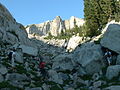
 Scrambling may be required.jpg 2,336 × 3,504; 4.46 MB
-
 Southeast at Lone Peak on FrontRunner, Jul 16.jpg 2,592 × 1,944; 2.36 MB
-
 UP ballast tamper in Draper, Utah, Jul 16.jpg 2,592 × 1,944; 2.28 MB
-
 West at southern terminus SR-154 in Draper, Utah, Nov 16.jpg 2,592 × 1,944; 2.42 MB
-
 Лон Пик Панорама.jpg 11,300 × 1,656; 1.65 MB


.jpg)


.jpg)