Category:London photographs taken on 2012-03-08
Jump to navigation
Jump to search
Most populous urban areas of the world: Hong Kong [CN] · London [GB] · Moscow [RU] · New York City [US]
| Photographs of the previous week | · | Photographs of the previous day | ← | 8 March 2012 | → | Photographs of the next day | · | Photographs of the next week |
| Photographs of the previous year | · | Photographs of the previous month | ← | → | Photographs of the next month | · | Photographs of the next year |
| 1 | · | 2 | · | 3 | · | 4 | · | 5 | · | 6 | · | 7 | · | 8 | · | 9 | · | 10 | · | 11 | · | 12 | · | 13 | · | 14 | · | 15 |

Files or subcategories can be added here using a direct categorization tag. Image files can be categorized here also automatically using {{Taken on}} template.
Media in category "London photographs taken on 2012-03-08"
The following 107 files are in this category, out of 107 total.
-
 226 Streetlite preparing for Departure to Ealing Broadway.jpg 2,048 × 1,536; 401 KB
-
-
 Caffè Nero, 23 Eastcheap EC3 - geograph.org.uk - 2995266.jpg 480 × 640; 62 KB
-
 Carlton Parade - geograph.org.uk - 2855415.jpg 640 × 426; 366 KB
-
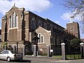
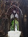
 Christ Church, Eltham - geograph.org.uk - 2861976.jpg 3,212 × 2,312; 991 KB
-

-

-

-

-
 Church of the Transfiguration, Chamberlayne Road - geograph.org.uk - 2841061.jpg 1,000 × 760; 122 KB
-

-

-
-

-
 Crocuses in Eltham Park - geograph.org.uk - 2863450.jpg 3,400 × 2,480; 1.37 MB
-
 Crossing the Road with Balloons - geograph.org.uk - 2878501.jpg 1,024 × 663; 130 KB
-
 Daldinia concentrica, King Alfred's Cakes, with rings.JPG 4,655 × 3,456; 3.33 MB
-
 Dartford Road at The Ship - geograph.org.uk - 2839471.jpg 640 × 428; 83 KB
-
 Ducks and Crows by the Long Pond - geograph.org.uk - 2863453.jpg 3,648 × 2,736; 2.16 MB
-

-
 Eltham High Street - geograph.org.uk - 2861982.jpg 3,356 × 2,596; 1.15 MB
-
 Eltham Town Sign - geograph.org.uk - 2862342.jpg 3,408 × 2,616; 1.12 MB
-
 Fitness Machines in the Park - geograph.org.uk - 2861325.jpg 3,648 × 2,736; 1.85 MB
-
 Floral display, Priory Gardens - geograph.org.uk - 2852340.jpg 640 × 425; 385 KB
-
 Formal garden, Priory Gardens - geograph.org.uk - 2852838.jpg 640 × 425; 426 KB
-
 Fountain, dried up Priory Pond - geograph.org.uk - 2851623.jpg 640 × 425; 449 KB
-
 From Inferno to Tesco - geograph.org.uk - 2860955.jpg 3,552 × 2,648; 1.16 MB
-
 Games courts, Crayford - geograph.org.uk - 6161223.jpg 1,024 × 768; 310 KB
-
-
 GreekOrthodoxCathedral GoldersGreen London.JPG 4,224 × 3,168; 4.74 MB
-
 GreekOrthodoxCathedral KentishTown London.JPG 4,224 × 3,168; 4.77 MB
-
 Green Chain Path in Jackwood - geograph.org.uk - 2862390.jpg 3,268 × 2,736; 2.16 MB
-
 Green Chain Signpost - geograph.org.uk - 2863481.jpg 3,332 × 2,736; 2.24 MB
-
 Green Chain Walk in Oxleas Wood - geograph.org.uk - 2863445.jpg 3,300 × 2,696; 2.26 MB
-
 Green Chain Walk South of Eltham Palace - geograph.org.uk - 2956168.jpg 1,600 × 1,200; 651 KB
-
 High Street - geograph.org.uk - 2855413.jpg 640 × 425; 346 KB
-

-
-
 Kent Road - geograph.org.uk - 3217588.jpg 640 × 425; 285 KB
-
 Kent Road - geograph.org.uk - 3217604.jpg 640 × 425; 306 KB
-
 London Midland Train leaving Platform 4, Berkhamsted Station - geograph.org.uk - 2839356.jpg 3,648 × 2,736; 1.17 MB
-
 Long Shadows on the Horse Field - geograph.org.uk - 2956243.jpg 1,600 × 1,170; 362 KB
-
 Lower Road - geograph.org.uk - 2857610.jpg 640 × 425; 361 KB
-
 McDonald's Corner Shop, Eltham - geograph.org.uk - 2956257.jpg 1,600 × 1,158; 458 KB
-
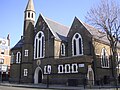
 Methodist Church - geograph.org.uk - 2841078.jpg 740 × 1,000; 161 KB
-
 MGlanville2009 00265-Edit-2.jpeg 490 × 293; 28 KB
-
 Minster Court, Mincing Lane EC3 - geograph.org.uk - 2995215.jpg 640 × 480; 89 KB
-
 No fowl today - geograph.org.uk - 2851650.jpg 640 × 425; 446 KB
-
 North of Lewisham Station - geograph.org.uk - 3027745.jpg 1,600 × 999; 397 KB
-
 Old Village Causeway - geograph.org.uk - 2853201.jpg 640 × 425; 402 KB
-
 Olympic and Paralympic Time Trial Swimming, Stratford, London (7110183737).jpg 3,767 × 2,349; 8.44 MB
-
 Playground, Crayford - geograph.org.uk - 2839482.jpg 640 × 480; 100 KB
-
 Pond, St Mary Cray - geograph.org.uk - 3217635.jpg 640 × 425; 375 KB
-
 Pond, St Mary Cray - geograph.org.uk - 3217655.jpg 640 × 425; 423 KB
-
 Priory Pond - geograph.org.uk - 2851685.jpg 640 × 425; 462 KB
-
 Raymond's Pie Mash and Eels - geograph.org.uk - 3020101.jpg 3,648 × 2,332; 756 KB
-
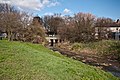 River Cray - geograph.org.uk - 3217624.jpg 640 × 425; 433 KB
-
 River Cray - geograph.org.uk - 3217684.jpg 640 × 425; 481 KB
-
 River Cray - geograph.org.uk - 3217698.jpg 640 × 425; 467 KB
-
 River Cray - geograph.org.uk - 3217703.jpg 640 × 425; 500 KB
-
 Rochester Way - geograph.org.uk - 2863442.jpg 2,908 × 2,004; 838 KB
-
-
 Sanderstead Road - geograph.org.uk - 2857613.jpg 640 × 425; 316 KB
-
 Shooters Hill - geograph.org.uk - 2862383.jpg 2,860 × 2,400; 737 KB
-
 Shops on Bellegrove Road, Welling - geograph.org.uk - 2860989.jpg 3,408 × 2,688; 1.13 MB
-
 Springfield Court - geograph.org.uk - 2839331.jpg 1,024 × 768; 827 KB
-
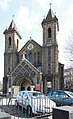
 St Andrew's Church - geograph.org.uk - 2856239.jpg 640 × 425; 422 KB
-

-

-
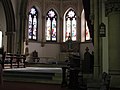 St John the Evangelist, chancel - geograph.org.uk - 2839295.jpg 1,024 × 768; 572 KB
-
 St John the Evangelist, Field of Hope - geograph.org.uk - 2839289.jpg 1,024 × 768; 1.18 MB
-
 St John the Evangelist, font - geograph.org.uk - 2839304.jpg 1,024 × 768; 625 KB
-
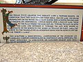
 St John the Evangelist, foundation stone - geograph.org.uk - 2839271.jpg 640 × 480; 456 KB
-
 St John the Evangelist, Kilburn Lane - East end - geograph.org.uk - 2841047.jpg 1,000 × 685; 187 KB
-
 St John the Evangelist, Kilburn Lane - East end - geograph.org.uk - 2841059.jpg 1,000 × 682; 160 KB
-
 St John the Evangelist, Kilburn Lane - Font - geograph.org.uk - 2841055.jpg 624 × 1,000; 101 KB
-
 St John the Evangelist, Kilburn Lane - geograph.org.uk - 2841042.jpg 612 × 1,000; 170 KB
-
 St John the Evangelist, Kilburn Lane - Organ - geograph.org.uk - 2841058.jpg 1,000 × 650; 113 KB
-
 St John the Evangelist, Kilburn Lane - Rood - geograph.org.uk - 2841057.jpg 1,000 × 662; 143 KB
-
 St John the Evangelist, Kilburn Lane - Sanctuary - geograph.org.uk - 2841049.jpg 1,000 × 662; 150 KB
-
 St John the Evangelist, Kilburn Lane - Shrine - geograph.org.uk - 2841053.jpg 541 × 1,000; 103 KB
-

-
-
 St John the Evangelist, Kilburn Lane - West end - geograph.org.uk - 2841050.jpg 1,000 × 660; 148 KB
-
 St John the Evangelist, Kingston - geograph.org.uk - 2839263.jpg 1,024 × 768; 773 KB
-
 St John the Evangelist, sundial - geograph.org.uk - 2839275.jpg 640 × 480; 401 KB
-
 St John the Evangelist, war memorial - geograph.org.uk - 2839302.jpg 1,024 × 768; 574 KB
-
 Statue at Liverpool Street Station - geograph.org.uk - 2873125.jpg 480 × 640; 74 KB
-
-
 Street scene, Liverpool Street EC2 - geograph.org.uk - 2995130.jpg 480 × 640; 60 KB
-
 Street sign, Leadenhall Street EC3 - geograph.org.uk - 2995171.jpg 640 × 480; 39 KB
-
 The Army at Oxleas Meadow - geograph.org.uk - 2861337.jpg 3,340 × 2,472; 814 KB
-
 The Best Kebab Ye - geograph.org.uk - 2853625.jpg 640 × 425; 357 KB
-
 The Cafe at the Top of the Hill - geograph.org.uk - 2861349.jpg 3,888 × 2,592; 1.54 MB
-
 The Eltham Centre - geograph.org.uk - 2861986.jpg 3,040 × 2,288; 718 KB
-
 The Fellowship, Crayford - geograph.org.uk - 2839926.jpg 640 × 428; 89 KB
-
-
 The new vicarage - geograph.org.uk - 2839323.jpg 1,024 × 768; 1.08 MB
-
 The old vicarage - geograph.org.uk - 2839318.jpg 1,024 × 768; 908 KB
-
 The Park Tavern - geograph.org.uk - 2862374.jpg 3,332 × 2,636; 1.11 MB
-
 Timbered House by Eltham Palace - geograph.org.uk - 2884408.jpg 3,648 × 2,736; 1.75 MB
-

-
 Travis Perkins - geograph.org.uk - 3217616.jpg 640 × 425; 346 KB
-
 Two Avenues - geograph.org.uk - 2860893.jpg 3,188 × 2,600; 1.18 MB
-

-
 Welling Bollard - geograph.org.uk - 2878496.jpg 3,556 × 2,180; 763 KB
-
 Welling Gospel Chapel - geograph.org.uk - 2860872.jpg 3,140 × 2,476; 1.09 MB


.jpg)


